Atchafalaya River Fishing Guides and Conditions, Louisiana
The largest river swamp in North America, carrying a third of the Mississippi's flow through a million acres of cypress and willow, with bass and sac-a-lait fishing driven almost entirely by stage.
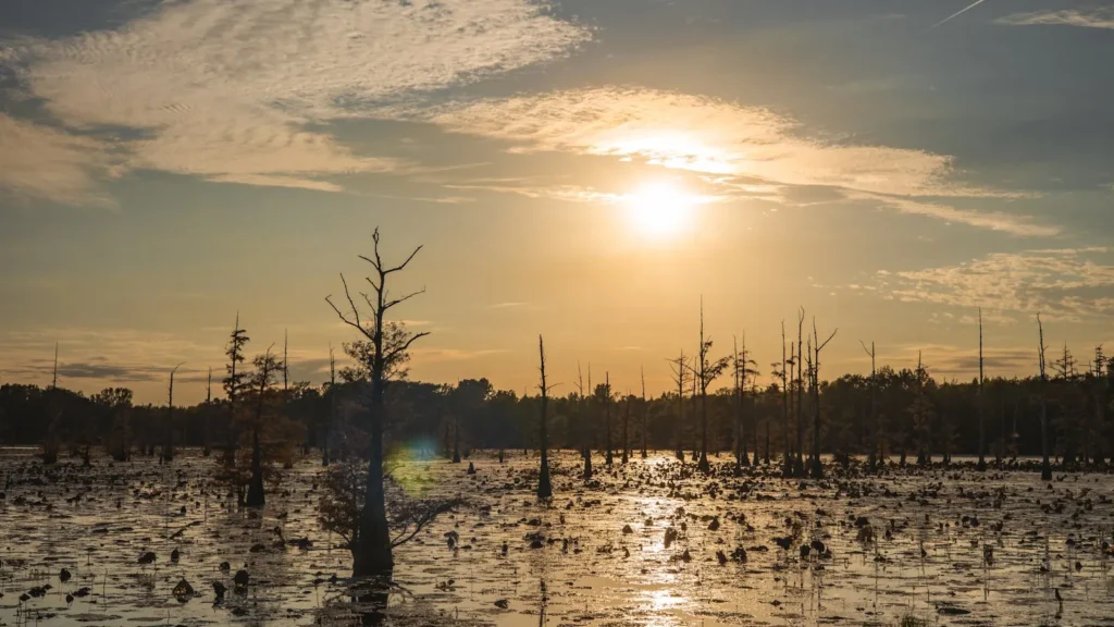
Guides on the Atchafalaya River
Claimed profiles take booking requests. Unclaimed profiles are built from public records so the river is never empty; the guide can claim or remove one any time.
No guides listed yet
Guide or outfit this water? Create your profile. Listing is free, the commission is 10% or 7% with a premium profile, and premium profiles list first on this water.
About the Atchafalaya River
The Atchafalaya is the Mississippi’s principal distributary and the spine of the largest river swamp on the continent. It leaves the Mississippi at the Old River Control Structure above Simmesport, carries roughly thirty percent of the combined Mississippi and Red River flow south through Krotz Springs and Butte La Rose, spreads through the leveed basin between Henderson and Bayou Sorrel, and reaches the Gulf below Morgan City. Between the levees sit something close to a million acres of cypress-tupelo swamp, willow flats, oilfield canals, borrow pits and connected bayous. It is one continuous fishery and it does not behave like a lake at all.
Stage runs everything here. When the river is falling, water pulls out of the flooded timber and concentrates fish along canal mouths and bayou edges, and the fishing can be extraordinary. When it is rising, fish scatter into a million acres of new cover and the same spots go dead. Local guides do not talk about seasons so much as they talk about whether the Butte La Rose stage is coming up or going down and how fast. The high water of a big spring can shut the basin down for weeks; a long slow summer fall can produce the best bass fishing in Louisiana.
Largemouth bass and sac-a-lait, which is what crappie are called here, are the two guided fisheries. Bass hold on cypress knees, in the flooded willows and along the deeper canal edges; sac-a-lait stack on brush and bridge timber from late winter into spring. Blue, channel and flathead catfish are everywhere and are targeted seriously in the main river. Bream, chinquapin and warmouth fill the shallow flats through summer, and white bass show in the current seams. The basin holds well over eighty species in total. Note that Louisiana adopted regulations specific to the Atchafalaya Basin effective 1 August, so basin limits now differ from the statewide rules and are worth reading before a trip.
Fished this water? Add a photo
Reviewed by hand before it appears. Pick the water, not the spot — we never publish exact locations.
Access
Bayou Amy launch, Henderson - free public ramp just south of the bridge, the usual way into Henderson Lake and the upper basin.
Atchafalaya Basin Landing, Henderson - three-lane ramp with parking, the busiest access on the east side.
Butte La Rose ramp, Atchafalaya River Highway at Herman Dupuis Road - main-river access about five miles from the welcome centre.
Bayou Sorrel launch, Bayou Sorrel Road off LA Highway 75 - five lanes and a floating pier, the southeastern basin.
Bayou Benoit launch, Bayou Benoit Levee Road - continuation of Catahoula Levee Road, west-side swamp access.
Morgan City waterfront ramps - lower river and delta access near the USGS gauge.
USGS 07381600 at Morgan City reports both discharge and water temperature; basin anglers also watch the Butte La Rose stage, which is what governs whether water is in or out of the timber.
Seasons
Spring: sac-a-lait first, on brush and bridge pilings from February into April, then the bass spawn in the shallow cuts. High water from the spring rise can push everything into the timber and make the basin difficult for weeks at a time.
Summer: falling water is the tell. As stage drops through June and July fish pull to canal mouths and bayou edges and concentrate hard; bream and chinquapin fill the flats, and catfish are consistent in the main river.
Fall: the most reliable stretch of the year. Low, stable water, cooling temperatures and bass feeding along the deeper edges, with far fewer boats than spring.
Winter: cold and clear in the canals, with sac-a-lait moving deep and bass holding on the outside bends. Fishable throughout; the basin never closes.
From the water
No logged trips yet. Be the first to put this water on your map.
Log this water
Fished it or cleaned it? Log in or create a free account to log a trip with photos and earn the waterway badge.
Questions
What is the current flow on the Atchafalaya River?
As of Sep 7, 4:00 am, the USGS gauge Lower Atchafalaya River at Morgan City, LA reads 46,400 cfs, with water temperature 86.7 F. Conditions update every 15 minutes.
What species can you catch on the Atchafalaya River?
Anglers target Black Crappie, Blue Catfish, Bluegill, Channel Catfish, Flathead Catfish, Largemouth Bass, Redear Sunfish, Warmouth, White Bass, White Crappie on the Atchafalaya River in Louisiana.
Where can you access the Atchafalaya River?
Bayou Amy launch, Henderson - free public ramp just south of the bridge, the usual way into Henderson Lake and the upper basin. Atchafalaya Basin Landing, Henderson - three-lane ramp with parking, the busiest access on the east side. Butte La Rose ramp, Atchafalaya River Highway at Herman Dupuis Road - main-river access about five miles from the welcome centre. Bayou Sorrel launch, Bayou Sorrel Road off LA Highway 75 - five lanes and a floating pier, the southeastern basin. Bayou Benoit launch, Bayou Benoit Levee Road - continuation of Catahoula Levee Road, west-side swamp access. Morgan City...
When is the best time to fish the Atchafalaya River?
Spring: sac-a-lait first, on brush and bridge pilings from February into April, then the bass spawn in the shallow cuts. High water from the spring rise can push everything into the timber and make the basin difficult for weeks at a time. Summer: falling water is the tell. As stage drops through June and July fish pull to canal mouths and bayou edges and concentrate hard; bream and chinquapin fill the flats, and catfish are consistent in the main river. Fall: the most reliable stretch of the year. Low, stable water, cooling temperatures and bass feeding along the deeper edges, with far fewer b...
Where are the fishing regulations for the Atchafalaya River?
Regulations change by season and section. Read the current rules on the Louisiana agency site: https://www.wlf.louisiana.gov/page/recreational-fishing