Beta

GuidedFloats is in beta. The full site launches March 1, 2027. The mobile app follows.

Guides: claim before March 1, 2027 and your first full season of Premium is free. Claim your founding spot →

Home › Waters › Virginia › South Fork Shenandoah River
River · Shenandoah Valley of northern Virginia between Massanutten Mountain and the Blue Ridge, from Port Republic down through Luray and Front Royal · Virginia

South Fork Shenandoah River Fishing Guides

Virginia's premier smallmouth float, a long, shallow, ledge-and-grassbed river running the Shenandoah Valley from Port Republic to Front Royal.
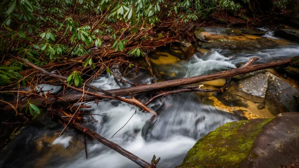
A small waterfall stepping through mossy boulders in an eastern hardwood forest

Map of the South Fork Shenandoah River

15 numbered points: 14 access points, 1 USGS gauge. Tap a marker for details. Reviewed Sep 25, 2026.

Printable version →
  • Access / boat ramp (14)
  • USGS gauge (1)
Map data © OpenStreetMap contributors. Points are curated from OpenStreetMap and state agency sources; confirm access and hours before you go.

Print it. Bag it. Bring it.Phones die, screens crack, and most of this water has no signal. Print this map, fold it into a zip-top bag or dry bag with your license, and you have a backup your electronics can’t give you. Every marker is numbered so you can say exactly where you are.

Open the printable map
All 15 points on this map
#PointTypeLat, LonNotes
1Port Republic Access
VA DWR - Rockingham Co. - hand launch
Access / boat ramp38.29583, -78.80799Head of the South Fork, at the Middle and North River confluence. Hand launch.
2Island Ford Access
VA DWR - Rockingham Co. - hand launch
Access / boat ramp38.35482, -78.69565Hand launch below Port Republic, Rockingham County.
3South Fork Shenandoah River near Lynnwood
USGS 01628500 - real-time stage and flow
USGS gauge38.32263, -78.75475Roster gauge for this water. The Page County floats read off this one; it is the gauge to check.
4Elkton Access
VA DWR - Rockingham Co. - hand launch
Access / boat ramp38.40947, -78.63497Hand launch at Elkton, at the USGS Lynnwood gauge reach.
5Shenandoah Riverside Access
VA DWR - Page Co. - 1 ramp
Access / boat ramp38.48035, -78.62373Ramp at Shenandoah, Page County.
6Grove Hill Access
VA DWR - Page Co. - hand launch
Access / boat ramp38.52734, -78.59471Hand launch, Page County.
7Newport Access
VA DWR - Page Co. - hand launch
Access / boat ramp38.58317, -78.59435Hand launch above Alma.
8Alma Access
VA DWR - Page Co. - hand launch
Access / boat ramp38.58878, -78.56577Hand launch at Alma; short float to White House.
9White House Access
VA DWR - Page Co. - 1 ramp
Access / boat ramp38.64607, -78.53448Ramp at the White House bridge - the usual top of the Page County smallmouth float.
10Massanutten Access
VA DWR - Page Co. - 1 ramp
Access / boat ramp38.67239, -78.52913Ramp below White House.
11Inskeep Access
VA DWR - Page Co. - hand launch
Access / boat ramp38.70155, -78.49173Hand launch, Page County.
12Fosters Access
VA DWR - Page Co. - 1 ramp
Access / boat ramp38.77032, -78.42249Ramp at Fosters, below Luray.
13Bentonville Access
VA DWR - Warren Co. - hand launch
Access / boat ramp38.84009, -78.33042Hand launch at Bentonville, Warren County.
14Karo Access
VA DWR - Warren Co. - hand launch
Access / boat ramp38.87151, -78.25264Hand launch above the Front Royal confluence.
15Simpson's Landing Access
VA DWR - Warren Co. - hand launch
Access / boat ramp38.87874, -78.26198Lowest South Fork access, just above the Front Royal confluence. DWR labels the waterbody Shenandoah River (South).

Guides on the South Fork Shenandoah River

Claimed profiles take booking requests. Unclaimed profiles are built from public records so the river is never empty; the guide can claim or remove one any time.

Order on this page: premium and outfitter plans first (labelled Premium placement), then claimed free profiles, then unclaimed — one published price, no bidding for position. How placement works

About the South Fork Shenandoah River

The South Fork of the Shenandoah is the river most Virginia guides mean when they say smallmouth. It forms at Port Republic where the North, Middle and South rivers come together, then runs roughly a hundred miles north between Massanutten Mountain and the Blue Ridge, past Shenandoah, Luray and Bentonville, to meet the North Fork at Front Royal. This gauge sits near Lynnwood at the top of that run and is the standard reference for the whole upper river.

It is a limestone-influenced valley river, shallow and wide, with long grass beds, gravel bars and hard ledge drops that create exactly the kind of broken structure smallmouth like. The bass fishery is the main event and it is a numbers fishery as much as a size one, with topwater fishing from late spring through early fall that is as good as any in the mid-Atlantic. Redbreast sunfish and rock bass fill the shallows, channel catfish work the deeper holes, and the river holds a genuine musky population that a small number of specialists target seriously through the colder months.

Almost all of the fishing here happens from a boat. The river is well suited to drift boats, rafts and canoes, with a long chain of public landings that makes float planning straightforward, and wading is practical in the shallow ledge sections at summer flows. Water clarity and level move with valley rainfall rather than with any dam, so the gauge trend matters. The river fished hard through a difficult period after fish kills in the early 2000s and the smallmouth population has recovered well since, though anglers should still check current state advisories and regulations, including seasonal protections on larger bass.

This water needs a real photo

The photo at the top of this page is not South Fork Shenandoah River.

It is a regional stand-in, honestly captioned but generic — we will not put a name to a river we cannot prove. Send us a photograph you took here and it replaces the stand-in, with your credit on it.

Add a photo of this water See the badges

Pioneer badgeUnclaimed

Add a photo of this water

Landscape, not fish — the water itself. Reviewed by hand before it appears. The first one published here earns the Pioneer badge.

Never published. It is how the badge is held for you until member accounts open.

Posting to South Fork Shenandoah River.

JPG, PNG or WebP, up to 12 MB. Landscape orientation looks best at the top of the page. We resize it and strip the location data out of the file.

The name printed under the photo and on your badge. Leave blank to stay anonymous.

Reader photo license v1.0 — the short version:

  • You grant Guided Floats, LLC a non-exclusive, royalty-free license to publish, resize and crop your photo on guidedfloats.com and in GuidedFloats’ own social posts and apps. You keep the copyright and can use the photo anywhere else.
  • You confirm that you took the photo yourself, that publishing it does not infringe anyone else’s rights, and that anyone recognisable in it (or a parent or guardian, if they are under 18) is happy for it to appear here.
  • Credit is printed beside the photo wherever it appears on the site, using the credit name you give us. Leave it blank and we use your name; write “Anonymous” for no name. Your email address is never published.
  • Withdrawing is one email to hello@guidedfloats.com naming the photo. It comes off the site within 7 days.
Read the full license

Version 1.0, dated 6 September 2026. Applies to every photograph submitted to GuidedFloats through the contact form, a species page, or the community board.

1. What you give us

By ticking the box on the form you grant Guided Floats, LLC (“GuidedFloats”, “we”) a non-exclusive, worldwide, royalty-free license to store, copy, resize, crop and display your photograph on guidedfloats.com, in GuidedFloats’ own social media accounts and mobile apps, and in material that promotes the site itself, in connection with the fish, water or community feature you sent it in for. The license lasts until you withdraw it (section 4).

You keep the copyright. The license is not exclusive, so you can use the photo anywhere else and license it to anyone else. We will not sell your photo, license it on to anyone else on its own, or use it in paid advertising for a third party.

2. What you confirm

You confirm that you took the photograph yourself (or otherwise own the rights to it), that you have the right to grant this license, and that publishing the photo does not infringe anyone else’s copyright, privacy or other rights.

If any person is recognisable in the photo, you confirm that they have agreed to its being published here, and that a parent or guardian has agreed on behalf of anyone under 18. Please do not send photographs of other people’s catches, screenshots, or pictures copied from other websites or social media.

3. Credit

We print the credit name you give us beside the photo wherever it appears on the site, and record it as the photo’s creator in the page’s structured data. If you leave the credit blank we use the name you gave us on the form. Write “Anonymous” if you prefer no name at all. Your email address, phone number and the exact spot the photo was taken are never published.

4. Withdrawing the license

You can withdraw the license at any time by emailing hello@guidedfloats.com, or by using the contact form, and telling us which photo you mean. We will remove the photo from guidedfloats.com within 7 days of receiving your message and stop using it in anything new. Copies that are already outside our control — search-engine caches, social posts that have already gone out, printed material already produced — may take longer to disappear or may not be recallable, and we are not responsible for those.

5. What we may do

We choose which photos to publish and may decline any submission without giving a reason. We may crop, resize, sharpen or colour-correct a photo for display, and we may remove a photo at any time. We will not alter a photo in a way that misrepresents the fish, the water or you.

6. Your details

We keep your name, email address, the credit name, the water and date you gave us, and the network address the submission came from, with the submission record, as our evidence of this license. We hold that record for as long as the photo is published and for the retention period described in our privacy policy. Location data that your camera or phone embedded in the file is removed before the photo is published.

7. Versions

The version of this license you accepted is stored with your submission and printed with the photo. A later version does not apply to a photo you have already sent unless you agree to it.

Fished this water? Add a photo

Reviewed by hand before it appears. Pick the water, not the spot — we never publish exact locations.

Never published. We use it only if we need to ask about the photo.

Posting to South Fork Shenandoah River.

JPG, PNG or WebP, up to 12 MB. We resize it and strip the location data out of the file.

The name shown under the photo. Leave blank to stay anonymous.

Reader photo license v1.0 — the short version:

  • You grant Guided Floats, LLC a non-exclusive, royalty-free license to publish, resize and crop your photo on guidedfloats.com and in GuidedFloats’ own social posts and apps. You keep the copyright and can use the photo anywhere else.
  • You confirm that you took the photo yourself, that publishing it does not infringe anyone else’s rights, and that anyone recognisable in it (or a parent or guardian, if they are under 18) is happy for it to appear here.
  • Credit is printed beside the photo wherever it appears on the site, using the credit name you give us. Leave it blank and we use your name; write “Anonymous” for no name. Your email address is never published.
  • Withdrawing is one email to hello@guidedfloats.com naming the photo. It comes off the site within 7 days.
Read the full license

Version 1.0, dated 6 September 2026. Applies to every photograph submitted to GuidedFloats through the contact form, a species page, or the community board.

1. What you give us

By ticking the box on the form you grant Guided Floats, LLC (“GuidedFloats”, “we”) a non-exclusive, worldwide, royalty-free license to store, copy, resize, crop and display your photograph on guidedfloats.com, in GuidedFloats’ own social media accounts and mobile apps, and in material that promotes the site itself, in connection with the fish, water or community feature you sent it in for. The license lasts until you withdraw it (section 4).

You keep the copyright. The license is not exclusive, so you can use the photo anywhere else and license it to anyone else. We will not sell your photo, license it on to anyone else on its own, or use it in paid advertising for a third party.

2. What you confirm

You confirm that you took the photograph yourself (or otherwise own the rights to it), that you have the right to grant this license, and that publishing the photo does not infringe anyone else’s copyright, privacy or other rights.

If any person is recognisable in the photo, you confirm that they have agreed to its being published here, and that a parent or guardian has agreed on behalf of anyone under 18. Please do not send photographs of other people’s catches, screenshots, or pictures copied from other websites or social media.

3. Credit

We print the credit name you give us beside the photo wherever it appears on the site, and record it as the photo’s creator in the page’s structured data. If you leave the credit blank we use the name you gave us on the form. Write “Anonymous” if you prefer no name at all. Your email address, phone number and the exact spot the photo was taken are never published.

4. Withdrawing the license

You can withdraw the license at any time by emailing hello@guidedfloats.com, or by using the contact form, and telling us which photo you mean. We will remove the photo from guidedfloats.com within 7 days of receiving your message and stop using it in anything new. Copies that are already outside our control — search-engine caches, social posts that have already gone out, printed material already produced — may take longer to disappear or may not be recallable, and we are not responsible for those.

5. What we may do

We choose which photos to publish and may decline any submission without giving a reason. We may crop, resize, sharpen or colour-correct a photo for display, and we may remove a photo at any time. We will not alter a photo in a way that misrepresents the fish, the water or you.

6. Your details

We keep your name, email address, the credit name, the water and date you gave us, and the network address the submission came from, with the submission record, as our evidence of this license. We hold that record for as long as the photo is published and for the retention period described in our privacy policy. Location data that your camera or phone embedded in the file is removed before the photo is published.

7. Versions

The version of this license you accepted is stored with your submission and printed with the photo. A later version does not apply to a photo you have already sent unless you agree to it.

Flow alert

Tell me when the South Fork Shenandoah River cfs

Now: 193 cfs, read 7:45 am CST, Mon Nov 2, 2026 (USGS 01628500, S F SHENANDOAH RIVER NEAR LYNNWOOD, VA).

We never use this address for anything else and never share it. See the privacy policy.

Access

Port Republic landing at the forks - the top of the South Fork and the uppermost public launch.
Lynnwood access near the gauge - convenient upper river put-in.
Shenandoah town landing - developed access with parking on the upper middle river.
Inskeep and Newport landings near Luray - the heart of the middle river float water.
Bixlers Ferry landing north of Luray - popular mid-river launch.
Bentonville landing - lower river access above the Front Royal reach.
Karo Landing and Front Royal town access - the bottom of the South Fork at the confluence.

Seasons

Spring: high and stained from valley rain, with a strong smallmouth prespawn as the river settles in May.
Summer: the classic season, low clear water, long floats and excellent topwater fishing morning and evening.
Fall: cooling water, smallmouth feeding hard on the ledges and the start of the serious musky season.
Winter: cold and often high, mainly a slow deep game for smallmouth and the best months for musky specialists.

From the water

No logged trips yet. Be the first to put this water on your map.

Log this water

Fished it or cleaned it? Log in or create a free account to log a trip with photos and earn the waterway badge.

Questions

What is the current flow on the South Fork Shenandoah River?

As of Nov 2, 7:45 am, the USGS gauge S F SHENANDOAH RIVER NEAR LYNNWOOD, VA reads 193 cfs. Conditions update every 15 minutes.

What species can you catch on the South Fork Shenandoah River?

Anglers target Bluegill, Channel Catfish, Largemouth Bass, Muskellunge, Redbreast Sunfish, Rock Bass, Smallmouth Bass on the South Fork Shenandoah River in Virginia.

Are there fishing guides on the South Fork Shenandoah River?

GuidedFloats lists 2 guides and outfitters on the South Fork Shenandoah River. Claimed profiles accept booking requests; unclaimed profiles are built from public records and link to the business.

Where can you access the South Fork Shenandoah River?

Port Republic landing at the forks - the top of the South Fork and the uppermost public launch. Lynnwood access near the gauge - convenient upper river put-in. Shenandoah town landing - developed access with parking on the upper middle river. Inskeep and Newport landings near Luray - the heart of the middle river float water. Bixlers Ferry landing north of Luray - popular mid-river launch. Bentonville landing - lower river access above the Front Royal reach. Karo Landing and Front Royal town access - the bottom of the South Fork at the confluence.

When is the best time to fish the South Fork Shenandoah River?

Spring: high and stained from valley rain, with a strong smallmouth prespawn as the river settles in May. Summer: the classic season, low clear water, long floats and excellent topwater fishing morning and evening. Fall: cooling water, smallmouth feeding hard on the ledges and the start of the serious musky season. Winter: cold and often high, mainly a slow deep game for smallmouth and the best months for musky specialists.

Where are the fishing regulations for the South Fork Shenandoah River?

Regulations change by season and section. Read the current rules on the Virginia agency site: https://dwr.virginia.gov/fishing/regulations/