Fishes James River
River · The upper James in the Virginia Blue Ridge, running northeast past Buchanan and through the Balcony Falls gorge toward Lynchburg · Virginia
James River Fishing Guides
The upper James above Lynchburg, one of the best smallmouth float rivers in the East, running clear over ledge and shoal through the Blue Ridge.
Map of the James River
30 numbered points: 28 access points, 1 regulation section limit, 1 USGS gauge. Tap a marker for details. Reviewed Sep 25, 2026.
- Access / boat ramp (28)
- Regulation section limit (1)
- USGS gauge (1)
Map data © OpenStreetMap contributors. Points are curated from OpenStreetMap and state agency sources; confirm access and hours before you go.
Print it. Bag it. Bring it.Phones die, screens crack, and most of this water has no signal. Print this map, fold it into a zip-top bag or dry bag with your license, and you have a backup your electronics can’t give you. Every marker is numbered so you can say exactly where you are.
Open the printable mapAll 30 points on this map
| # | Point | Type | Lat, Lon | Notes |
|---|---|---|---|---|
| 1 | James River bass regulation reach - upper boundary VA DWR geographic exception - upper limit | Regulation section limit | 37.78416, -79.77593 | Upstream end of DWR's named James River reach: the Jackson and Cowpasture confluence in Botetourt County, running downstream to the 14th Street Bridge in Richmond. Check the current digest for what applies. |
| 2 | Iron Gate Access VA DWR - Botetourt Co. - hand launch | Access / boat ramp | 37.77372, -79.78268 | Head of the James, at the Jackson and Cowpasture confluence. Hand launch off Rt 220; the top of the whole float river. |
| 3 | Craig Creek Access VA DWR - Botetourt Co. - hand launch | Access / boat ramp | 37.64566, -79.81440 | Hand launch under the Rt 220 bridge at Rt 683, at the Craig Creek mouth. |
| 4 | Horseshoe Bend Access VA DWR - Botetourt Co. - hand launch | Access / boat ramp | 37.58909, -79.72784 | Hand launch seven miles west of Buchanan on Rt 43. |
| 5 | Springwood Access VA DWR - Botetourt Co. - hand launch | Access / boat ramp | 37.54802, -79.74262 | Hand launch at Springwood, reached from Buchanan by Rt 43 and Rt 630. |
| 6 | Buchanan Access VA DWR - Botetourt Co. - hand launch | Access / boat ramp | 37.52999, -79.67940 | Hand launch in the town of Buchanan, at the USGS gauge. The reference point for the upper river. |
| 7 | James River at Buchanan USGS 02019500 - real-time stage and flow | USGS gauge | 37.53069, -79.67893 | Roster gauge for this water. The whole upper float river - Iron Gate down to Lynchburg - is read off this one. |
| 8 | Arcadia Access VA DWR - Botetourt Co. - hand launch | Access / boat ramp | 37.55482, -79.63704 | Hand launch at Arcadia, below Buchanan off Rt 614. |
| 9 | Glasgow Access VA DWR - Rockbridge Co. - 1 ramp | Access / boat ramp | 37.62378, -79.44542 | Ramp at Glasgow off Rt 130, just below the Maury River confluence; shared parking. |
| 10 | Snowden Access VA DWR - Amherst Co. - 1 ramp | Access / boat ramp | 37.59685, -79.38941 | Ramp at Snowden on Rt 501/130, below the Blue Ridge water gap. |
| 11 | Reed Creek Landing VA DWR - Bedford Co. - 1 ramp | Access / boat ramp | 37.52468, -79.34985 | Ramp south of Big Island on Rt 501. DWR files this one under a misspelled waterbody, 'Jame River'. |
| 12 | Joshua Falls Access VA DWR - Campbell Co. - hand launch | Access / boat ramp | 37.41931, -79.04058 | Hand launch off Rt 726 north of Rt 460, below Lynchburg. |
| 13 | Bent Creek Access VA DWR - Appomattox Co. - 1 ramp | Access / boat ramp | 37.53557, -78.82762 | Ramp at Bent Creek where Rt 60 meets Rt 26. |
| 14 | Wingina Access VA DWR - Nelson Co. - 1 ramp | Access / boat ramp | 37.63601, -78.71989 | Ramp on Rt 56 south of Wingina. |
| 15 | Midway Access VA DWR - Nelson Co. - 1 ramp | Access / boat ramp | 37.66930, -78.71469 | Ramp in the James River WMA off Rt 743, north-east of Wingina. |
| 16 | Howardsville Access VA DWR - Albemarle Co. - 1 ramp | Access / boat ramp | 37.73307, -78.64523 | Ramp at Howardsville. DWR spells the county 'Albermarle' in its own layer. |
| 17 | Scottsville Access VA DWR - Albemarle Co. - 1 ramp | Access / boat ramp | 37.79700, -78.49323 | Ramp on Ferry Street in the town of Scottsville - the busiest launch on the middle river. |
| 18 | Hardware River Access VA DWR - Fluvanna Co. - hand launch | Access / boat ramp | 37.74026, -78.40782 | Hand launch at the Hardware River mouth, reached from Scottsville by Rt 6 east then Rt 646. |
| 19 | New Canton Access VA DWR - Buckingham Co. - 1 ramp | Access / boat ramp | 37.70966, -78.29986 | Ramp at New Canton, north of Arvonia off Rt 15 and Rt 670. |
| 20 | Columbia Access VA DWR - Cumberland Co. - 1 ramp | Access / boat ramp | 37.74941, -78.16276 | Ramp south of Columbia on Rt 690, at the Rivanna River mouth. |
| 21 | Cartersville Access VA DWR - Cumberland Co. - 1 ramp | Access / boat ramp | 37.66942, -78.08684 | Ramp in Cartersville on Rt 45. |
| 22 | West View Access VA DWR - Goochland Co. - 1 ramp | Access / boat ramp | 37.64255, -78.01037 | Ramp reached from Goochland by Rt 6 west, Rt 600 and Rt 643. |
| 23 | Beaumont Access VA DWR - Powhatan Co. - hand launch | Access / boat ramp | 37.66447, -77.89042 | Hand launch a mile south of Maidens on Rt 522. |
| 24 | Watkins Landing VA DWR - Powhatan Co. - 2 ramps | Access / boat ramp | 37.58830, -77.71291 | Two ramps, reached from Bon Air by Rt 147, Rt 711 and Rt 625. |
| 25 | Robious Landing VA DWR - Chesterfield Co. - hand launch | Access / boat ramp | 37.55920, -77.64734 | Hand launch at Robious Landing Park, above the Richmond fall line. |
| 26 | Huguenot Bridge Access VA DWR - Richmond City - hand launch | Access / boat ramp | 37.56049, -77.54581 | Hand launch just west of the Huguenot Bridge off Southampton Street - the top of the Richmond whitewater reach. |
| 27 | Ancarrow's Landing VA DWR - Richmond City - 2 ramps | Access / boat ramp | 37.51986, -77.41871 | Two ramps on Maury Street, below the fall line at the head of tidewater. |
| 28 | Osborne Pike Landing VA DWR - Henrico Co. - 6 ramps | Access / boat ramp | 37.40093, -77.38585 | Six ramps at Kingsland Road and Osborne Turnpike - the largest launch on the river, on the tidal James. |
| 29 | Dutch Gap Access VA DWR - Chesterfield Co. - 2 ramps | Access / boat ramp | 37.38200, -77.37668 | Two ramps at Dutch Gap on the tidal river, reached by Rt 10, Rt 732 and Rt 615. |
| 30 | Deep Bottom Access VA DWR - Henrico Co. - 2 ramps | Access / boat ramp | 37.40716, -77.30541 | Two ramps on Deep Bottom Road, eight miles south of Seven Pines. Lowest access mapped here. |
Guides on the James River
Claimed profiles take booking requests. Unclaimed profiles are built from public records so the river is never empty; the guide can claim or remove one any time.
Order on this page: premium and outfitter plans first (labelled Premium placement), then claimed free profiles, then unclaimed — one published price, no bidding for position. How placement works
About the James River
The James is Virginia’s river in the way that few states have a single obvious candidate, and the upper reach around Buchanan is where it is best as a fishery. Above Lynchburg the river runs clear and relatively shallow over long ledge shelves and gravel shoals, dropping through the Blue Ridge with the Jefferson National Forest on both sides in places. It is broad enough to float comfortably and shallow enough to wade in summer, which is an unusual and valuable combination.
Smallmouth bass are the reason to come and the upper James is genuinely one of the better smallmouth rivers in the eastern United States. The ledge structure is exactly what they want – current breaks, depth changes and ambush points repeating for mile after mile. The river produces both numbers and size, and it fishes well on everything from a fly rod popper to a tube jig. Rock bass and redbreast sunfish are everywhere and abundant enough to keep a beginner busy all day.
Muskellunge are the other story and they are a serious fishery here rather than a curiosity. Virginia manages musky on the upper James and they reach substantial size, holding in the deeper slow water, the eddies behind ledges and the log-strewn banks. Anglers targeting them specifically fish large flies and big baits in the cooler months. Flathead catfish, an introduced species, have established themselves and get large in the deeper holes.
This is float country. The standard approach is a canoe, kayak or raft between mapped accesses, and the Upper James River Water Trail has made that straightforward with published launches and mileages. Summer low water means dragging in places and excellent wading everywhere else. Check the gauge before committing, and note that the Balcony Falls reach below Glasgow is substantially more serious water than the rest.
This water needs a real photo
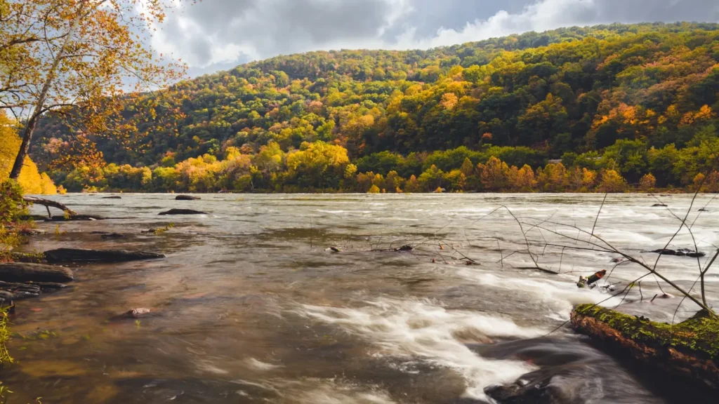
The photo at the top of this page is not James River.
It is a regional stand-in, honestly captioned but generic — we will not put a name to a river we cannot prove. Send us a photograph you took here and it replaces the stand-in, with your credit on it.
Pioneer badgeUnclaimed
Add a photo of this water
Landscape, not fish — the water itself. Reviewed by hand before it appears. The first one published here earns the Pioneer badge.
Fished this water? Add a photo
Reviewed by hand before it appears. Pick the water, not the spot — we never publish exact locations.
Access
Buchanan - the gauge reach and a developed town access on the upper river.
Arcadia - a popular launch on the upper James float water.
Springwood - access on the middle upper reach.
Glasgow - the launch above the Balcony Falls gorge.
Snowden - access below the gorge on the lower reach.
Natural Bridge Station - access on the Maury near the confluence.
Lynchburg - the bottom of the upper river reach.
Seasons
Spring: high water and the strongest musky fishing, with smallmouth turning on late.
Summer: the prime smallmouth season, with low clear water and excellent wading.
Fall: cooling water, aggressive smallmouth and the best colour in the Blue Ridge.
Winter: slow and cold, but the best big-musky period of the year.
From the water
No logged trips yet. Be the first to put this water on your map.
Log this water
Fished it or cleaned it? Log in or create a free account to log a trip with photos and earn the waterway badge.
Questions
What is the current flow on the James River?
As of Nov 2, 6:00 am, the USGS gauge JAMES RIVER AT BUCHANAN, VA reads 492 cfs. Conditions update every 15 minutes.
What species can you catch on the James River?
Anglers target Bluegill, Channel Catfish, Common Carp, Flathead Catfish, Largemouth Bass, Muskellunge, Redbreast Sunfish, Rock Bass, Smallmouth Bass on the James River in Virginia.
Are there fishing guides on the James River?
GuidedFloats lists 4 guides and outfitters on the James River. Claimed profiles accept booking requests; unclaimed profiles are built from public records and link to the business.
Where can you access the James River?
Buchanan - the gauge reach and a developed town access on the upper river. Arcadia - a popular launch on the upper James float water. Springwood - access on the middle upper reach. Glasgow - the launch above the Balcony Falls gorge. Snowden - access below the gorge on the lower reach. Natural Bridge Station - access on the Maury near the confluence. Lynchburg - the bottom of the upper river reach.
When is the best time to fish the James River?
Spring: high water and the strongest musky fishing, with smallmouth turning on late. Summer: the prime smallmouth season, with low clear water and excellent wading. Fall: cooling water, aggressive smallmouth and the best colour in the Blue Ridge. Winter: slow and cold, but the best big-musky period of the year.
Where are the fishing regulations for the James River?
Regulations change by season and section. Read the current rules on the Virginia agency site: https://dwr.virginia.gov/fishing/regulations/