Fishes Cimarron River, Rio Grande
Tailwater · Northern New Mexico, below Eagle Nest Lake in the Sangre de Cristo range, running east through Cimarron Canyon State Park toward the town of Cimarron · New Mexico
Cimarron River Fishing Guides
New Mexico's classic canyon tailwater, running cold below Eagle Nest Dam through the granite palisades of Cimarron Canyon.
Map of the Cimarron River
12 numbered points: 3 access points, 4 campsites, 1 agency office, 1 regulation section limit, 1 hazard, 2 USGS gauges. Tap a marker for details. Reviewed Sep 24, 2026.
- Access / boat ramp (3)
- Campsite (4)
- Agency / conservation office (1)
- Regulation section limit (1)
- Dam / hazard (1)
- USGS gauge (2)
Map data © OpenStreetMap contributors. Points are curated from OpenStreetMap and state agency sources; confirm access and hours before you go.
Print it. Bag it. Bring it.Phones die, screens crack, and most of this water has no signal. Print this map, fold it into a zip-top bag or dry bag with your license, and you have a backup your electronics can’t give you. Every marker is numbered so you can say exactly where you are.
Open the printable mapAll 12 points on this map
| # | Point | Type | Lat, Lon | Notes |
|---|---|---|---|---|
| 1 | Eagle Nest Dam Eagle Nest Lake outlet - head of the tailwater | Dam / hazard | 36.53177, -105.22940 | Everything on this page is below the dam. The canyon runs on releases, so the level can change between morning and afternoon; read the gauge 150 m downstream before you commit to a reach. |
| 2 | USGS 07206000 Cimarron River below Eagle Nest Dam Real-time flow and stage - the gauge this page reads | USGS gauge | 36.53213, -105.22814 | Sits immediately below the dam, so it reports the release rather than the whole canyon. USGS 07207000 near Cimarron, 33 km downstream, is the one to read for the lower river. |
| 3 | Tolby Trailhead Cimarron Canyon State Park - parking at the head of the canyon | Access / boat ramp | 36.53693, -105.22478 | First pull-off below the dam and the parking for the Tolby Creek trails. The park's Tolby free angler access area is signed near the campground entrance just downstream. |
| 4 | Tolby Campground Cimarron Canyon State Park - park office at the east end | Campsite | 36.53834, -105.22220 | Uppermost of the park's four campgrounds and where the park office sits. The state's special trout water begins at this campground's east end. |
| 5 | Special Trout Water - upper limit East end of Tolby Campground - marker on the river | Regulation section limit | 36.53794, -105.22207 | Upper boundary of the state's special trout water, which runs "from the east end of Tolby Campground downstream 1.4 miles to the first U.S. Highway 64 bridge". See NM Game and Fish for what applies inside it. |
| 6 | Blackjack Campground Cimarron Canyon State Park - tent and day-use area | Campsite | 36.52975, -105.17300 | Tent camping and a day-use area on the south side of US 64, in the narrow middle of the canyon. OSM spells it "Black Jack"; the park's own map calls it the Blackjack Tent Area. |
| 7 | Palisades Picnic Area Cimarron Canyon State Park - day use, opposite the Palisades | Access / boat ramp | 36.53682, -105.15205 | Day-use parking and picnic ground across the river from the Palisades Sill, the 120 m granite wall the canyon is known for. Short walk to the water. |
| 8 | Maverick Campground Cimarron Canyon State Park - Gravel Pit Lakes | Campsite | 36.54554, -105.13394 | The park's largest campground, beside the Gravel Pit Lakes. The lakes are stocked and are the usual fallback when the river is low or off colour. |
| 9 | Ponderosa Campground Cimarron Canyon State Park - US 64 | Campsite | 36.54745, -105.13061 | Easternmost of the park campgrounds, a few hundred metres below Maverick and close to the lower end of the park water. |
| 10 | Ute Park Trailhead Trailhead parking at Ute Park | Access / boat ramp | 36.56080, -105.08872 | Parking at the village of Ute Park, at the lower end of the canyon fishery. OSM spells it "Ute park Trailhead". |
| 11 | NM State Forestry Office (Ute Park) State agency office on US 64 at Ute Park | Agency / conservation office | 36.56482, -105.07761 | The one staffed agency office between Eagle Nest and Cimarron, on the highway a few hundred metres off the river. Useful for fire restrictions and road status in the canyon. |
| 12 | USGS 07207000 Cimarron River near Cimarron Real-time flow and stage - lower river | USGS gauge | 36.51983, -104.97861 | Second station on the river, at the mouth of the canyon above the town of Cimarron. Reads the whole canyon's accumulated flow rather than just the dam release. |
Guides on the Cimarron River
Claimed profiles take booking requests. Unclaimed profiles are built from public records so the river is never empty; the guide can claim or remove one any time.
Order on this page: premium and outfitter plans first (labelled Premium placement), then claimed free profiles, then unclaimed — one published price, no bidding for position. How placement works
About the Cimarron River
The Cimarron below Eagle Nest Dam is one of the most distinctive trout streams in the Southwest, and its character comes almost entirely from the dam above it. The release is a bottom draw out of Eagle Nest Lake, which means the river runs cold through a canyon at an elevation and latitude that would otherwise cook a trout stream by July. That single fact turns a modest high plains river into a year-round brown trout fishery with genuine wild reproduction.
The water is small. Anglers arriving with a western tailwater in mind are usually surprised by how tight and brushy the Cimarron is, threading between the road and the granite walls of the canyon with pools that a good cast can cover end to end. That scale is the appeal for people who like it. Approach matters enormously, the fish see plenty of anglers along the road corridor, and a careful angler working upstream with small flies will do far better than one crashing through the runs.
Brown trout dominate and they hold in every piece of holding water the canyon provides – undercut banks, plunge pools below the ledges, and the pocket water between boulders. Rainbows are stocked in the more accessible stretches and provide the bulk of the harvest fishery. Rio Grande cutthroat, the state fish, occupy some of the tributary water in the upper drainage. The Palisades Sill formation that walls in the middle canyon is the scenic centerpiece of the whole reach.
Cimarron Canyon State Park manages most of the corridor and access is straightforward from US 64, with parking areas and marked trails down to the water at regular intervals. Special trout water regulations apply through much of the canyon, so read the current rules rather than assuming general statewide limits. Releases from Eagle Nest are irrigation-driven and can change the river substantially, so check the gauge before committing to a day.
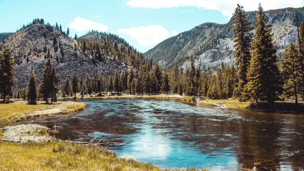
This water needs a real photo
The photo at the top of this page is not Cimarron River.
It is a regional stand-in, honestly captioned but generic — we will not put a name to a river we cannot prove. Send us a photograph you took here and it replaces the stand-in, with your credit on it.
Pioneer badgeUnclaimed
Add a photo of this water
Landscape, not fish — the water itself. Reviewed by hand before it appears. The first one published here earns the Pioneer badge.
Fished this water? Add a photo
Reviewed by hand before it appears. Pick the water, not the spot — we never publish exact locations.
Access
Below Eagle Nest Dam - the gauge reach and the top of the tailwater.
Cimarron Canyon State Park, Gravel Pit Lakes - the main developed access and campground.
Maverick Campground - midcanyon access with parking and trails to the water.
Ponderosa Campground - upper canyon access off US 64.
Blackjack Canyon trailhead - walk-in access to less pressured pocket water.
Tolby Campground - lower canyon access near the park boundary.
Town of Cimarron - the bottom of the canyon reach and the Philmont boundary water.
Seasons
Spring: runoff and irrigation releases can blow the river out, but edges fish well.
Summer: the prime season, with cold releases and strong terrestrial fishing in the canyon.
Fall: brown trout color up and move, and the canyon is at its best scenically.
Winter: limited access in heavy snow but the tailwater stays open and fishable in mild spells.
From the water
No logged trips yet. Be the first to put this water on your map.
Log this water
Fished it or cleaned it? Log in or create a free account to log a trip with photos and earn the waterway badge.
Questions
What is the current flow on the Cimarron River?
As of Nov 2, 6:15 am, the USGS gauge CIMARRON RIVER BELOW EAGLE NEST DAM, NM reads 20 cfs. Conditions update every 15 minutes.
What species can you catch on the Cimarron River?
Anglers target Brook Trout, Brown Trout, Rainbow Trout, Rio Grande Cutthroat Trout on the Cimarron River in New Mexico.
Are there fishing guides on the Cimarron River?
GuidedFloats lists 4 guides and outfitters on the Cimarron River. Claimed profiles accept booking requests; unclaimed profiles are built from public records and link to the business.
Where can you access the Cimarron River?
Below Eagle Nest Dam - the gauge reach and the top of the tailwater. Cimarron Canyon State Park, Gravel Pit Lakes - the main developed access and campground. Maverick Campground - midcanyon access with parking and trails to the water. Ponderosa Campground - upper canyon access off US 64. Blackjack Canyon trailhead - walk-in access to less pressured pocket water. Tolby Campground - lower canyon access near the park boundary. Town of Cimarron - the bottom of the canyon reach and the Philmont boundary water.
When is the best time to fish the Cimarron River?
Spring: runoff and irrigation releases can blow the river out, but edges fish well. Summer: the prime season, with cold releases and strong terrestrial fishing in the canyon. Fall: brown trout color up and move, and the canyon is at its best scenically. Winter: limited access in heavy snow but the tailwater stays open and fishable in mild spells.
Where are the fishing regulations for the Cimarron River?
Regulations change by season and section. Read the current rules on the New Mexico agency site: https://wildlife.dgf.nm.gov/fishing/