Rio Grande Fishing Guides
The Rio Grande del Norte gorge below Taos, eight hundred feet of basalt wall over big browns, wild trout water reached by trail or by raft.
Map of the Rio Grande
39 numbered points: 2 access points, 15 campsites, 10 bridges, 1 park or conservation area, 2 agency offices, 2 regulation section limits, 1 hazard, 2 springs, 4 USGS gauges. Tap a marker for details. Reviewed Sep 24, 2026.
- Access / boat ramp (2)
- Campsite (15)
- Bridge crossing (10)
- Park / conservation area (1)
- Agency / conservation office (2)
- Regulation section limit (2)
- Dam / hazard (1)
- Spring (2)
- USGS gauge (4)
Print it. Bag it. Bring it.Phones die, screens crack, and most of this water has no signal. Print this map, fold it into a zip-top bag or dry bag with your license, and you have a backup your electronics can’t give you. Every marker is numbered so you can say exactly where you are.
Open the printable mapAll 39 points on this map
| # | Point | Type | Lat, Lon | Notes |
|---|---|---|---|---|
| 1 | Special trout water - upper limit: New Mexico/Colorado state line Taos County reach - 19.31.4.11(A)(5)(a) NMAC | Regulation section limit | 36.99986, -105.71882 | Upstream end of the posted special-regulation reach, which runs from the state line down to the Taos Junction Bridge. Check the current New Mexico rules before you fish it. |
| 2 | Chiflo Campground BLM - Rio Grande del Norte | Campsite | 36.74143, -105.68037 | Rim campground above the gorge north of Cerro. |
| 3 | USGS Rio Grande near Cerro Upper gorge flows | USGS gauge | 36.73989, -105.68350 | The gauge to read for the Ute Mountain and Wild Rivers reaches. |
| 4 | Bear Crossing BLM - Rio Grande del Norte | Campsite | 36.71816, -105.69122 | |
| 5 | Big Arsenic BLM - Wild Rivers | Campsite | 36.67547, -105.68147 | Rim site; a steep trail drops about 800 ft to the river. |
| 6 | Little Arsenic BLM - Wild Rivers | Campsite | 36.66739, -105.68060 | Rim site with its own trail to the water. |
| 7 | Montoso BLM - Wild Rivers | Campsite | 36.66554, -105.68096 | |
| 8 | La Junta BLM - Wild Rivers | Campsite | 36.65713, -105.68534 | On the rim above the Red River confluence. |
| 9 | La Junta Lower BLM - Wild Rivers | Campsite | 36.65359, -105.69014 | |
| 10 | Cebolla Mesa Carson National Forest | Campsite | 36.64100, -105.68870 | Trail from the rim to the Red River confluence; a common walk-in put-in for the Taos Box. |
| 11 | John Dunn Bridge Near Arroyo Hondo | Bridge crossing | 36.53506, -105.70886 | The first road crossing below the Colorado line - there is none in the 61 km above it. Usual put-in for the Taos Box. |
| 12 | Manby Hot Springs Also known as Stagecoach Hot Springs | Spring | 36.50834, -105.72407 | Riverside hot springs reached on foot from the west rim. |
| 13 | Rio Grande Gorge Bridge US 64 west of Taos | Bridge crossing | 36.47625, -105.73308 | High steel crossing of the gorge; no river access at the bridge itself. |
| 14 | Gorge Overlook Rest Stop West rim beside the Gorge Bridge | Park / conservation area | 36.47540, -105.73673 | Parking, toilets and the rim walk. |
| 15 | Rio Pueblo Campground BLM - Orilla Verde | Campsite | 36.33768, -105.73112 | |
| 16 | Taos Junction Bridge Boat Launch BLM - Orilla Verde | Access / boat ramp | 36.33555, -105.73371 | Launch and take-out at the bridge; the head of the Orilla Verde float. |
| 17 | Special trout water - downstream limit: Taos Junction Bridge Taos County reach - 19.31.4.11(A)(5)(a) NMAC | Regulation section limit | 36.33607, -105.73377 | Downstream end of the posted reach that begins at the New Mexico/Colorado state line. The bridge is the marker. |
| 18 | Orilla Verde Campground BLM - Orilla Verde | Campsite | 36.33580, -105.73607 | |
| 19 | Rio Grande Spring | Spring | 36.33311, -105.74034 | |
| 20 | USGS Rio Grande below Taos Junction Bridge The roster gauge for this water | USGS gauge | 36.32003, -105.75444 | Read this one for the Orilla Verde and Racecourse floats. |
| 21 | Petaca Campground BLM - Orilla Verde | Campsite | 36.30760, -105.76721 | |
| 22 | Lone Juniper Campground BLM - Orilla Verde | Campsite | 36.30047, -105.77186 | |
| 23 | Lone Juniper Boat Takeout BLM - Orilla Verde | Access / boat ramp | 36.29952, -105.77251 | |
| 24 | Arroyo Hondo Campground BLM - Orilla Verde | Campsite | 36.29704, -105.77352 | |
| 25 | Rio Brave Campground BLM - Orilla Verde | Campsite | 36.29196, -105.78191 | |
| 26 | Pilar Campground BLM - Orilla Verde | Campsite | 36.28575, -105.78635 | |
| 27 | Pilar Bridge Pilar | Bridge crossing | 36.27855, -105.78945 | |
| 28 | Pilar Visitor Center BLM - Rio Grande Gorge | Agency / conservation office | 36.26802, -105.78869 | Staffed visitor centre at Pilar, at the downstream end of the Orilla Verde reach. |
| 29 | Glen Woody Bridge Below the Racecourse | Bridge crossing | 36.24599, -105.82555 | |
| 30 | Rinconada Bridge Rinconada | Bridge crossing | 36.21680, -105.88995 | |
| 31 | Embudo Bridge Embudo | Bridge crossing | 36.20670, -105.96067 | |
| 32 | USGS Rio Grande at Embudo Gauging here began in 1889 | USGS gauge | 36.20548, -105.96416 | Embudo is where the USGS started streamgaging in the United States. |
| 33 | Old Highway 582 Bridge Near Velarde | Bridge crossing | 36.14610, -105.99801 | |
| 34 | Los Luceros Diversion Dam In-river diversion structure | Dam / hazard | 36.12110, -106.04387 | Scout or portage - a diversion weir spans the river here. |
| 35 | NM 74 Bridge North of Espanola | Bridge crossing | 36.05798, -106.08211 | |
| 36 | Espanola Ranger District Headquarters US Forest Service | Agency / conservation office | 36.01755, -106.06487 | District office in Espanola. |
| 37 | Onate Street Bridge Espanola | Bridge crossing | 35.99045, -106.07360 | A second town crossing sits about 250 m downstream. |
| 38 | Otowi Bridge NM 502 | Bridge crossing | 35.87487, -106.14150 | The 1924 Otowi suspension bridge still stands beside the highway crossing. |
| 39 | USGS Rio Grande at Otowi Bridge The Otowi compact gauge | USGS gauge | 35.87458, -106.14239 | The index gauge for Rio Grande Compact accounting. |
Guides on the Rio Grande
Claimed profiles take booking requests. Unclaimed profiles are built from public records so the river is never empty; the guide can claim or remove one any time.
Order on this page: premium and outfitter plans first (labelled Premium placement), then claimed free profiles, then unclaimed — one published price, no bidding for position. How placement works
About the Rio Grande
The Rio Grande through the Taos gorge is one of the most dramatic trout fisheries in the country and one of the least crowded, because getting to it means either a steep hike down eight hundred feet of basalt or a raft trip through class III water. The Rio Grande del Norte National Monument protects the corridor, and the reaches from the Colorado line through the Ute Mountain run, the Taos Box and down to the Taos Junction Bridge and Pilar hold wild brown trout, rainbows and, in the upper reaches, cutthroat.
Brown trout are the fish, and big ones live in this canyon. The classic approach is a winter and early-spring trip when flows are low, the water is clear and the browns are concentrated, hiking down at La Junta or the Big Arsenic trail and fishing heavy nymphs and streamers through the pocket water. In summer the river is warmer and the rafting traffic is heavy through the Racecourse below Pilar, and anglers move up to the tributaries, the Red River and the Rio Pueblo de Taos.
The Taos Junction gauge is the reference for the lower gorge. Readings in the low hundreds of cfs mean clear, wadeable, excellent winter and spring fishing. Spring runoff through May and June can push it into the thousands, which is prime whitewater and poor fishing, and summer monsoon storms can turn the whole canyon the color of the cliffs within an hour. Water temperature climbs in late summer; fish early or fish higher.
Taos is the base for everything, with Pilar, Questa and the Wild Rivers Recreation Area strung along the canyon. The hike out at the end of a winter day is the part nobody mentions until you are doing it.
This water needs a real photo
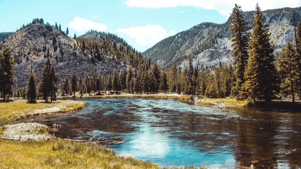
The photo at the top of this page is not Rio Grande.
It is a regional stand-in, honestly captioned but generic — we will not put a name to a river we cannot prove. Send us a photograph you took here and it replaces the stand-in, with your credit on it.
Add a photo of this water
Landscape, not fish — the water itself. Reviewed by hand before it appears. The first one published here earns the Pioneer badge.
Fished this water? Add a photo
Reviewed by hand before it appears. Pick the water, not the spot — we never publish exact locations.
Access
Wild Rivers Recreation Area, Questa: rim campgrounds and the steep La Junta and Big Arsenic trails.
Red River confluence: the classic winter walk-in fishery.
John Dunn Bridge: road access to the river above the Taos Box.
Taos Junction Bridge: access near the gauge and the standard raft takeout.
Orilla Verde Recreation Area, Pilar: the easiest river-level access, camping and ramps.
The Racecourse below Pilar: heavy summer whitewater traffic.
Trails into the gorge are steep and exposed; carry water and plan the climb out.
Seasons
December through April: the best fishing of the year, low clear water and concentrated brown trout.
May and June: runoff and whitewater season; fishing is poor and rafting is excellent.
July and August: monsoon storms, warm water and turbid conditions; fish the tributaries.
September through November: clearing water, cooling temperatures and brown trout on the move.
From the water
No logged trips yet. Be the first to put this water on your map.
Log this water
Fished it or cleaned it? Log in or create a free account to log a trip with photos and earn the waterway badge.
Questions
What is the current flow on the Rio Grande?
As of Nov 2, 6:30 am, the USGS gauge RIO GRANDE BLW TAOS JUNCTION BRIDGE NEAR TAOS, NM reads 1,270 cfs, the 84th percentile for this date. Conditions update every 15 minutes.
What species can you catch on the Rio Grande?
Anglers target Brown Trout, Cutthroat Trout, Northern Pike, Rainbow Trout on the Rio Grande in New Mexico.
Are there fishing guides on the Rio Grande?
GuidedFloats lists 4 guides and outfitters on the Rio Grande. Claimed profiles accept booking requests; unclaimed profiles are built from public records and link to the business.
Where can you access the Rio Grande?
Wild Rivers Recreation Area, Questa: rim campgrounds and the steep La Junta and Big Arsenic trails. Red River confluence: the classic winter walk-in fishery. John Dunn Bridge: road access to the river above the Taos Box. Taos Junction Bridge: access near the gauge and the standard raft takeout. Orilla Verde Recreation Area, Pilar: the easiest river-level access, camping and ramps. The Racecourse below Pilar: heavy summer whitewater traffic. Trails into the gorge are steep and exposed; carry water and plan the climb out.
When is the best time to fish the Rio Grande?
December through April: the best fishing of the year, low clear water and concentrated brown trout. May and June: runoff and whitewater season; fishing is poor and rafting is excellent. July and August: monsoon storms, warm water and turbid conditions; fish the tributaries. September through November: clearing water, cooling temperatures and brown trout on the move.
Where are the fishing regulations for the Rio Grande?
Regulations change by season and section. Read the current rules on the New Mexico agency site: https://wildlife.dgf.nm.gov/fishing/