Lamoille River Fishing Guides
A northern Vermont river with wild browns in the upper water, smallmouth below, and lake-run salmon and steelhead pushing up from Champlain in the fall.
Map of the Lamoille River
56 numbered points: 9 access points, 2 campsites, 1 bait & fly shop, 24 bridges, 9 parks and conservation areas, 4 regulation section limits, 6 hazards, 1 USGS gauge. Tap a marker for details. Reviewed Sep 26, 2026.
- Access / boat ramp (9)
- Campsite (2)
- Bait, tackle & fly shop (1)
- Bridge crossing (24)
- Park / conservation area (9)
- Regulation section limit (4)
- Dam / hazard (6)
- USGS gauge (1)
Print it. Bag it. Bring it.Phones die, screens crack, and most of this water has no signal. Print this map, fold it into a zip-top bag or dry bag with your license, and you have a backup your electronics can’t give you. Every marker is numbered so you can say exactly where you are.
Open the printable mapAll 56 points on this map
| # | Point | Type | Lat, Lon | Notes |
|---|---|---|---|---|
| 1 | Vermont Route 16 Greensboro | Bridge crossing | 44.61537, -72.20880 | |
| 2 | Gonyaw Road | Bridge crossing | 44.57023, -72.24856 | |
| 3 | Shepherds Road | Bridge crossing | 44.56416, -72.25359 | |
| 4 | Vermont Freedom Campground Hardwick | Campsite | 44.55269, -72.24807 | |
| 5 | The Bend Road | Bridge crossing | 44.54799, -72.26431 | |
| 6 | East Main Street Hardwick | Bridge crossing | 44.54182, -72.26758 | Closed to traffic in OSM. |
| 7 | Riverside Farm Lane | Bridge crossing | 44.50953, -72.31755 | |
| 8 | Pumpkin Lane | Bridge crossing | 44.50548, -72.31852 | |
| 9 | Main Street Hardwick village | Bridge crossing | 44.50489, -72.36589 | |
| 10 | Hardwick Lake Dam | Dam / hazard | 44.51687, -72.37755 | |
| 11 | Vermont Route 15 West | Bridge crossing | 44.51682, -72.37852 | |
| 12 | McAllister Farm Road | Bridge crossing | 44.51520, -72.39468 | |
| 13 | Kate Brook Road | Bridge crossing | 44.52232, -72.41567 | |
| 14 | Fisher Covered Railroad Bridge Covered railroad bridge, Wolcott | Bridge crossing | 44.53231, -72.42773 | |
| 15 | Fisher Bridge Vermont F and W, Wolcott | Access / boat ramp | 44.53260, -72.42780 | Shore-fishing access at the Fisher covered railroad bridge. |
| 16 | Wolcott Dam | Dam / hazard | 44.53735, -72.44301 | |
| 17 | Wolcott Field Wolcott | Park / conservation area | 44.54008, -72.45661 | |
| 18 | School Street Wolcott | Bridge crossing | 44.54633, -72.45797 | |
| 19 | Upper Lamoille River Vermont F and W, Wolcott | Access / boat ramp | 44.55160, -72.47870 | Steps down to the water at the Elmore Pond Road crossing. |
| 20 | Corley Road | Bridge crossing | 44.55957, -72.49717 | |
| 21 | Mountain View Campground Morristown | Campsite | 44.56828, -72.53386 | |
| 22 | Lamoille River - Rotary Vermont F and W, Morristown | Access / boat ramp | 44.56740, -72.54950 | Shore-fishing access. |
| 23 | Park Street Morrisville | Bridge crossing | 44.56435, -72.56616 | |
| 24 | Oxbow Riverfront Park Morrisville | Park / conservation area | 44.56661, -72.59868 | |
| 25 | Morrisville Dam | Dam / hazard | 44.56182, -72.60181 | |
| 26 | Bridge Street Morrisville | Bridge crossing | 44.56532, -72.60748 | |
| 27 | Cadys Falls Dam | Dam / hazard | 44.57419, -72.61120 | |
| 28 | Cadys Falls Road Trestle | Bridge crossing | 44.57771, -72.61209 | |
| 29 | USGS gauge - Lamoille River at Johnson Live flow and stage | USGS gauge | 44.62286, -72.67633 | |
| 30 | Lamoille River - Dog Head Falls Vermont F and W, Johnson | Access / boat ramp | 44.62180, -72.67860 | Steps down to the water at Dog Head Falls. |
| 31 | Railroad Street Johnson | Bridge crossing | 44.63240, -72.68493 | |
| 32 | The Old Mill Park Johnson | Park / conservation area | 44.63260, -72.69109 | |
| 33 | Cambridge Junction Road Covered bridge | Bridge crossing | 44.65110, -72.81460 | |
| 34 | Lamoille River - Dorothy Smith Vermont F and W, Cambridge | Access / boat ramp | 44.64980, -72.82980 | Boating and fishing access at the VT 108 crossing. |
| 35 | Vermont Route 15 | Bridge crossing | 44.64773, -72.87257 | |
| 36 | Cambridge State Forest | Park / conservation area | 44.65339, -72.87648 | |
| 37 | Krusch Nature Preserve | Park / conservation area | 44.65805, -72.87594 | |
| 38 | River Road Fairfax Falls | Bridge crossing | 44.65010, -72.98849 | |
| 39 | Fairfax Falls dam Two reach limits meet here | Regulation section limit | 44.65109, -72.98970 | Top of the dam is the upstream limit of the Lamoille trophy trout section in Fairfax and of the named special regulation trout stream reach running to Lake Champlain. Portage. |
| 40 | Route 104 bridge, Fairfax village Trophy trout section limit | Regulation section limit | 44.66269, -73.00834 | Downstream limit of the Lamoille River trophy trout section in Fairfax, whose upstream limit is the top of the Fairfax Falls dam. OSM names the crossing Main Street and refs it VT 104. |
| 41 | Fairfax Recreational Trail Fairfax | Park / conservation area | 44.66127, -73.01247 | |
| 42 | Arrow Head Lake Road | Bridge crossing | 44.67937, -73.08190 | |
| 43 | Boat launch on Arrowhead Mountain Lake Unnamed slipway in OSM | Access / boat ramp | 44.68214, -73.08698 | On the impoundment above Clark Falls. |
| 44 | Clark Falls Dam Milton | Dam / hazard | 44.64133, -73.11327 | |
| 45 | U.S. Route 7 North Milton | Bridge crossing | 44.64086, -73.11389 | |
| 46 | River Street Park Milton | Park / conservation area | 44.63736, -73.11412 | |
| 47 | Milton Dam | Dam / hazard | 44.63661, -73.11756 | |
| 48 | Boat launch at Milton Unnamed slipway in OSM | Access / boat ramp | 44.63553, -73.12188 | |
| 49 | Peterson Dam Lake Champlain boundary | Regulation section limit | 44.63838, -73.16274 | Top of the dam is the Lake Champlain boundary, the downstream limit of the named special regulation trout stream reach, and the upstream limit of the spring closure reach below it. Portage. |
| 50 | Bear Trap Road bridge, Milton Spring closure reach limit | Regulation section limit | 44.63178, -73.17192 | Downstream limit of the Lamoille spring closure reach whose upstream limit is the top of Peterson Dam. The regulations gloss this crossing as the West Milton bridge. |
| 51 | The Tackle Box Tackle shop, Milton | Bait, tackle & fly shop | 44.59542, -73.18748 | |
| 52 | U.S. Route 2 Milton | Bridge crossing | 44.60323, -73.20452 | |
| 53 | Lamoille River - Sears Vermont F and W, Milton | Access / boat ramp | 44.60400, -73.20520 | Shore-fishing access. |
| 54 | Lamoille River Vermont F and W, Milton | Access / boat ramp | 44.60620, -73.21840 | Concrete ramp - the main trailered launch on the lower river. |
| 55 | Beeman Preserve | Park / conservation area | 44.62353, -73.22864 | |
| 56 | Sandbar State Park Vermont State Parks | Park / conservation area | 44.62647, -73.23917 | At the mouth on Lake Champlain; car-top launch. |
Guides on the Lamoille River
Claimed profiles take booking requests. Unclaimed profiles are built from public records so the river is never empty; the guide can claim or remove one any time.
Order on this page: premium and outfitter plans first (labelled Premium placement), then claimed free profiles, then unclaimed — one published price, no bidding for position. How placement works
About the Lamoille River
The Lamoille runs west across northern Vermont from the Greensboro country to Lake Champlain, and it offers a genuinely unusual range of fishing for a river of its size. The upper and middle reaches around Johnson and Jeffersonville are classic New England freestone trout water – riffle, run and pool over cobble, with hardwood hills on both sides and the Green Mountains standing behind. The lower river below Milton is bigger, slower, warmer and an entirely different proposition.
Brown trout are the mainstay of the middle river and a meaningful number of them are wild. They hold in the deeper runs, against the ledges and under the bank cover, and they grow well in a river with this much insect life. Rainbows and brook trout share the water, brookies concentrating in the colder tributaries. Smallmouth bass move in as the river warms downstream and provide excellent summer fishing through the lower and middle reaches.
The lake-run fishery is what makes the Lamoille distinctive. Landlocked salmon and steelhead run up from Lake Champlain in the autumn, and Vermont manages the river with that migration in mind. Those fish are the reason some anglers fish the lower river in October and November in weather that would keep anyone else at home. Northern pike and walleye occupy the slow lower water and the delta near the lake.
Access is good, with Route 15 following the river for much of its length and frequent bridge crossings, town parks and informal pull-offs. The Lamoille Valley Rail Trail runs along the corridor and opens up stretches that were awkward to reach on foot. Check the current regulations, because seasons and gear rules differ between the trout water and the lake-run reaches, and check the gauge, since northern Vermont rain moves this river quickly.
This water needs a real photo
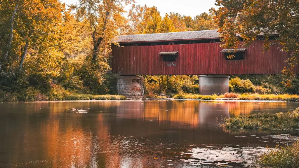
The photo at the top of this page is not Lamoille River.
It is a regional stand-in, honestly captioned but generic — we will not put a name to a river we cannot prove. Send us a photograph you took here and it replaces the stand-in, with your credit on it.
Add a photo of this water
Landscape, not fish — the water itself. Reviewed by hand before it appears. The first one published here earns the Pioneer badge.
Fished this water? Add a photo
Reviewed by hand before it appears. Pick the water, not the spot — we never publish exact locations.
Access
Johnson - the gauge reach and a convenient access on the middle river.
Jeffersonville - access on the upper middle reach.
Lamoille Valley Rail Trail - walk-in access along much of the corridor.
Route 15 crossings - roadside access at frequent intervals.
Cambridge - access on the middle river.
Fairfax falls area - access on the lower river above the impoundment.
Milton and the Champlain delta - the lake-run reach at the bottom.
Seasons
Spring: high snowmelt water, then strong trout fishing as it drops through May.
Summer: the best wading of the year, with trout above and smallmouth below.
Fall: the salmon and steelhead run from Champlain, and the river's best weeks.
Winter: cold and largely iced, with very limited access along the valley.
From the water
No logged trips yet. Be the first to put this water on your map.
Log this water
Fished it or cleaned it? Log in or create a free account to log a trip with photos and earn the waterway badge.
Questions
What is the current flow on the Lamoille River?
As of Nov 2, 7:30 am, the USGS gauge LAMOILLE RIVER AT JOHNSON, VT reads 90 cfs. Conditions update every 15 minutes.
What species can you catch on the Lamoille River?
Anglers target Brook Trout, Brown Trout, Fallfish, Landlocked Salmon, Northern Pike, Rainbow Trout, Smallmouth Bass, Steelhead, Walleye on the Lamoille River in Vermont.
Are there fishing guides on the Lamoille River?
GuidedFloats lists 1 guide and outfitters on the Lamoille River. Claimed profiles accept booking requests; unclaimed profiles are built from public records and link to the business.
Where can you access the Lamoille River?
Johnson - the gauge reach and a convenient access on the middle river. Jeffersonville - access on the upper middle reach. Lamoille Valley Rail Trail - walk-in access along much of the corridor. Route 15 crossings - roadside access at frequent intervals. Cambridge - access on the middle river. Fairfax falls area - access on the lower river above the impoundment. Milton and the Champlain delta - the lake-run reach at the bottom.
When is the best time to fish the Lamoille River?
Spring: high snowmelt water, then strong trout fishing as it drops through May. Summer: the best wading of the year, with trout above and smallmouth below. Fall: the salmon and steelhead run from Champlain, and the river's best weeks. Winter: cold and largely iced, with very limited access along the valley.
Where are the fishing regulations for the Lamoille River?
Regulations change by season and section. Read the current rules on the Vermont agency site: https://vtfishandwildlife.com/fish/fishing-regulations