Bruneau River Fishing Guides
A desert river in a two-thousand-foot rhyolite canyon in Owyhee County, holding native redband trout above and smallmouth bass below, and famous for a short and serious spring whitewater season.
Map of the Bruneau River
16 numbered points: 2 access points, 1 campsite, 3 bridges, 2 hazards, 1 USGS gauge, 7 points of interest. Tap a marker for details. Reviewed Sep 25, 2026.
- Access / boat ramp (2)
- Campsite (1)
- Bridge crossing (3)
- Dam / hazard (2)
- USGS gauge (1)
- Point of interest (7)
Print it. Bag it. Bring it.Phones die, screens crack, and most of this water has no signal. Print this map, fold it into a zip-top bag or dry bag with your license, and you have a backup your electronics can’t give you. Every marker is numbered so you can say exactly where you are.
Open the printable mapAll 16 points on this map
| # | Point | Type | Lat, Lon | Notes |
|---|---|---|---|---|
| 1 | Idaho - Nevada state line Bruneau River enters Idaho | Point of interest | 42.00011, -115.64946 | The Idaho reach runs 152 km (94 mi) from here to the Snake. Position measured where the chained OSM centreline crosses 42 deg N, not from a published coordinate. |
| 2 | Jarbidge River confluence Jarbidge joins from the east | Point of interest | 42.32957, -115.65255 | Parties who launch on the Jarbidge at Murphy Hot Springs reach the Bruneau here - BLM gives that run as 30.5 river miles. It is 1.2 km above the Bruneau launch site. |
| 3 | Indian Hot Springs Road bridge Indian Hot Springs Road - 4WD track | Bridge crossing | 42.33809, -115.64651 | BLM calls this the bridge launch: from the Wild and Scenic kiosk it is 0.2 mi left to the bridge and 0.16 mi right to the BLM launch. |
| 4 | Bruneau River Launch Site (Indian Hot Springs) BLM - self-issue permit box - no facilities | Access / boat ramp | 42.33835, -115.64727 | Four-wheel-drive, high-clearance road in. BLM publishes GPS 42.34222 / -115.64389 for the site; this is the OSM access point on the water. Free self-issue permit, box at the launch. |
| 5 | Sheep Creek confluence Wild and Scenic tributary from the east | Point of interest | 42.49830, -115.59699 | Sheep Creek carries 25.6 miles of Wild designation of its own. Position is the chained centreline point nearest the mapped creek, not a published coordinate. |
| 6 | Roberson East Trail Canyon climb-out and portage trail | Point of interest | 42.65226, -115.69725 | BLM describes Five Mile Rapids - the Class IV drop on the lower canyon - and a Roberson Trail portage around it. No published coordinate for the rapid itself was found, so none is shown. |
| 7 | Bruneau Canyon Overlook BLM viewpoint on the west rim | Point of interest | 42.69140, -115.67204 | Rim to riverbed 800 ft, opposite rim 1,300 ft away. Reached by Hot Springs Road east from Bruneau, about 15.6 mi to the signed turn then ~3 mi. BLM marker reads 42.68806 / -115.67389. |
| 8 | USGS 13168500 - Bruneau River near Hot Spring USGS streamgage | USGS gauge | 42.77111, -115.72028 | BLM guidance for this run is roughly 500-2,500 cfs here, with about 1,000 cfs the practical minimum for rafts. Short spring season. |
| 9 | Bruneau River Take-Out BLM - gravel road - no facilities | Access / boat ramp | 42.77560, -115.71890 | Nine miles south of Bruneau on good gravel; two-wheel drive is adequate. Part of the take-out is on private land. BLM marker reads 42.77306 / -115.71611. Motors are prohibited above this point. |
| 10 | Harris Dam Irrigation weir, immediately below the take-out | Dam / hazard | 42.77608, -115.71834 | The first of the valley diversion structures and the reason the float ends at the take-out above it. |
| 11 | Buckaroo Dam Irrigation weir - feeds Buckaroo Ditch | Dam / hazard | 42.78004, -115.71457 | USGS gauges Buckaroo Ditch at Hot Springs near Bruneau, which corroborates the diversion here. |
| 12 | Hot Creek Road bridge, Hot Spring Hot Creek Road at the Hot Spring locality | Bridge crossing | 42.79167, -115.71881 | First road bridge below the take-out. Hot Creek comes in about 1.5 km upstream; BLM places the take-out roughly a mile below that confluence. |
| 13 | Tumbleweed RV Park & Storage In Bruneau, about 1.3 km east of the river | Campsite | 42.88186, -115.79419 | The only mapped camping at the take-out end of the run. Not a riverside site - it is in town, off ID 51. |
| 14 | ID 51 / ID 78 bridge, Bruneau Idaho 51 / Idaho 78 highway crossing | Bridge crossing | 42.88037, -115.81787 | The only highway bridge on the Idaho Bruneau. BLM measures roughly 56 river miles from the Jarbidge confluence to south of Bruneau; the chained line gives 54.6 mi to here. |
| 15 | Bruneau Arm - head of slackwater C.J. Strike Reservoir backs up to about here | Point of interest | 42.92079, -115.88756 | Below this the Bruneau is reservoir, not river, and it belongs to the C.J. Strike sheet. Position is the centreline point nearest the OSM Bruneau Arm label. |
| 16 | Snake River confluence Mouth of the Bruneau, in C.J. Strike Reservoir | Point of interest | 42.95000, -115.97007 | End of the chained centreline: 251.7 km (156 mi) from the Nevada headwaters, 152 km (94 mi) of it in Idaho. |
Guides on the Bruneau River
Claimed profiles take booking requests. Unclaimed profiles are built from public records so the river is never empty; the guide can claim or remove one any time.
No guides listed yet
Guide or outfit this water? Create your profile. Listing is free, the commission is 10% or 7% with a premium profile, and premium profiles list first on this water.
About the Bruneau River
The Bruneau River drains roughly twenty seven hundred square miles of the high desert of southwestern Idaho and northern Nevada, and it has cut one of the most dramatic canyons in the interior West on its way north to the Snake River. The canyon walls are rhyolite, in places some two thousand feet deep and narrow enough at the bottom that the sky is a strip overhead. That remoteness is the defining quality of the river for anglers and boaters alike, and it is the reason a substantial part of the drainage now sits inside the Owyhee Canyonlands wilderness designations.
Hydrology here is desert hydrology. The river runs hard with snowmelt from the Jarbidge Mountains in spring and falls away sharply through summer, and the gauge near Hot Spring reads discharge and stage. The spring window is short. It is also when the canyon sees its whitewater traffic, and the Bruneau and Jarbidge together make up one of the more committing multi day wilderness runs in the region, not a trip to take lightly or without experience.
Native redband rainbow trout are the fish that matter most. They are a desert adapted form of rainbow trout, tolerant of water temperatures that would kill a coastal fish, and they hold through the upper canyon and the Jarbidge. Downstream, as the river warms and slows toward the Snake, smallmouth bass and channel catfish take over and provide a genuinely good warmwater fishery. Mountain whitefish are present in the cooler reaches.
Access is limited and that is the point. Bruneau Canyon Overlook, Bruneau Dunes State Park and a handful of long dirt approaches are the practical entries, and a high clearance vehicle earns its keep out here.
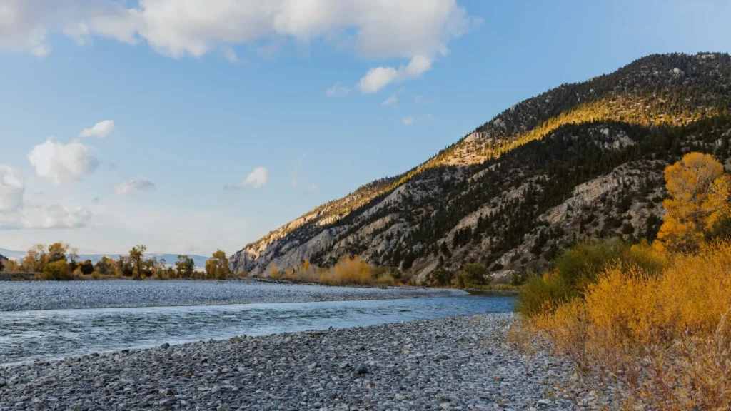
This water needs a real photo
The photo at the top of this page is not Bruneau River.
It is a regional stand-in, honestly captioned but generic — we will not put a name to a river we cannot prove. Send us a photograph you took here and it replaces the stand-in, with your credit on it.
Add a photo of this water
Landscape, not fish — the water itself. Reviewed by hand before it appears. The first one published here earns the Pioneer badge.
Fished this water? Add a photo
Reviewed by hand before it appears. Pick the water, not the spot — we never publish exact locations.
Access
Bruneau - the small town near the river's lower end, the nearest point for fuel and basic supplies.
Mountain Home - the regional town to the north, with lodging, food and full services.
Bruneau Canyon Overlook - the standard viewpoint and orientation point for the canyon.
Bruneau Dunes State Park - nearby public land with camping and a base for exploring.
Boise - the city an hour and a half north, with an airport and outfitters.
Jarbidge River - the major tributary, joining the Bruneau for the classic wilderness run.
Snake River - the large river this drainage feeds, with very different fishing at the bottom end.
Seasons
Spring: snowmelt brings the river up and this is the short window for the canyon whitewater run and the best flows of the year.
Summer: flows drop hard, the desert heat sets in, and fishing concentrates on the cooler upper reaches and early mornings.
Fall: cooling water and low clear flows make for excellent redband trout and smallmouth fishing with almost no company.
Winter: access becomes the obstacle, the roads are unreliable, and the canyon is effectively closed to most anglers.
From the water
No logged trips yet. Be the first to put this water on your map.
Log this water
Fished it or cleaned it? Log in or create a free account to log a trip with photos and earn the waterway badge.
Questions
What is the current flow on the Bruneau River?
As of Oct 18, 6:00 pm, the USGS gauge BRUNEAU RIVER NR HOT SPRING ID reads 44 cfs. Conditions update every 15 minutes.
What species can you catch on the Bruneau River?
Anglers target Channel Catfish, Common Carp, Mountain Whitefish, Rainbow Trout, Redband Rainbow Trout, Smallmouth Bass on the Bruneau River in Idaho.
Where can you access the Bruneau River?
Bruneau - the small town near the river's lower end, the nearest point for fuel and basic supplies. Mountain Home - the regional town to the north, with lodging, food and full services. Bruneau Canyon Overlook - the standard viewpoint and orientation point for the canyon. Bruneau Dunes State Park - nearby public land with camping and a base for exploring. Boise - the city an hour and a half north, with an airport and outfitters. Jarbidge River - the major tributary, joining the Bruneau for the classic wilderness run. Snake River - the large river this drainage feeds, with very different fishin...
When is the best time to fish the Bruneau River?
Spring: snowmelt brings the river up and this is the short window for the canyon whitewater run and the best flows of the year. Summer: flows drop hard, the desert heat sets in, and fishing concentrates on the cooler upper reaches and early mornings. Fall: cooling water and low clear flows make for excellent redband trout and smallmouth fishing with almost no company. Winter: access becomes the obstacle, the roads are unreliable, and the canyon is effectively closed to most anglers.
Where are the fishing regulations for the Bruneau River?
Regulations change by season and section. Read the current rules on the Idaho agency site: https://idfg.idaho.gov/rules/fish