Beta

GuidedFloats is in beta. The full site launches March 1, 2027. The mobile app follows.

Guides: claim before March 1, 2027 and your first full season of Premium is free. Claim your founding spot →

Home › Waters › Maine › East Branch Penobscot River below Grand Lake Matagamon
Tailwater · Penobscot County, the East Branch below the Matagamon dam at the northeast corner of Baxter State Park · Maine

East Branch Penobscot River below Grand Lake Matagamon Fishing Guides

The East Branch below the Matagamon dam at Baxter State Park's north gate, a cold wild brook trout tailwater with a gauge that reports water temperature.
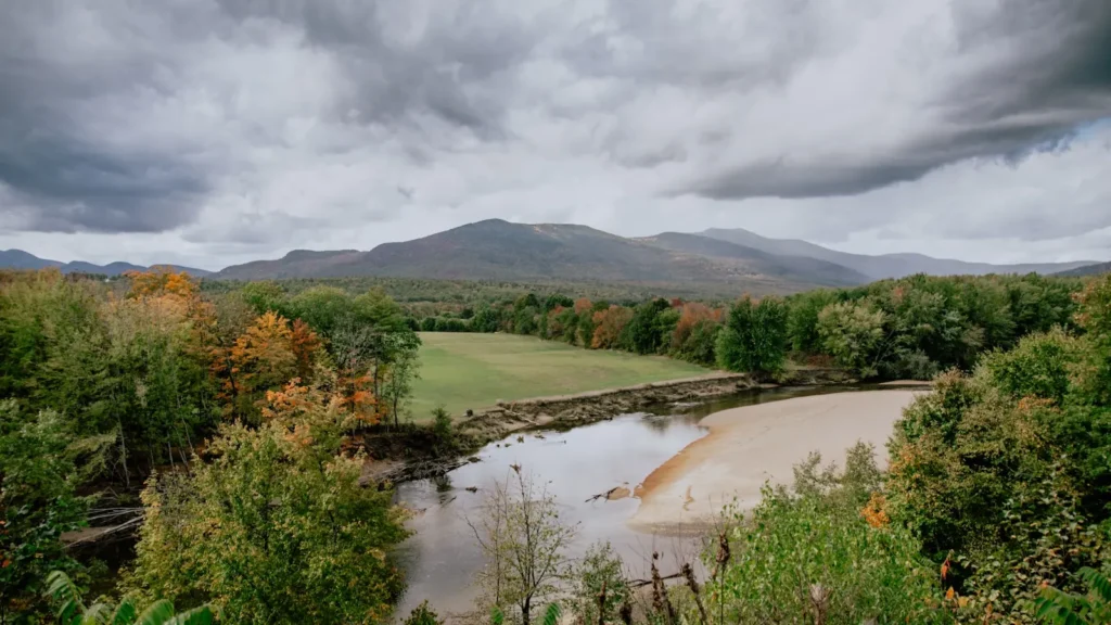
A broad river under fall colour with mountains beyond in New England

Map of the East Branch Penobscot River below Grand Lake Matagamon

18 numbered points: 1 access point, 6 campsites, 1 outfitter, 2 bridges, 1 agency office, 6 hazards, 1 USGS gauge. Tap a marker for details. Reviewed Sep 25, 2026.

Printable version →
  • Access / boat ramp (1)
  • Campsite (6)
  • Outfitter / canoe rental (1)
  • Bridge crossing (2)
  • Agency / conservation office (1)
  • Dam / hazard (6)
  • USGS gauge (1)
Map data © OpenStreetMap contributors. Points are curated from OpenStreetMap and state agency sources; confirm access and hours before you go.

Print it. Bag it. Bring it.Phones die, screens crack, and most of this water has no signal. Print this map, fold it into a zip-top bag or dry bag with your license, and you have a backup your electronics can’t give you. Every marker is numbered so you can say exactly where you are.

Open the printable map
All 18 points on this map
#PointTypeLat, LonNotes
1Grand Lake Matagamon boat launch
Launch above the dam
Access / boat ramp46.14193, -68.79035Unnamed slipway in OSM.
2Baxter State Park: Matagamon Gate
Baxter State Park north entrance
Agency / conservation office46.15493, -68.80558
3Grand Lake Matagamon Dam
Outlet dam
Dam / hazard46.14113, -68.79053The tailwater starts immediately below this dam.
4USGS gauge 01029100 - East Branch Penobscot River below Grand Lake Matagamon
Live stage and discharge
USGS gauge46.13436, -68.79391
5Grand Lake Road
First crossing below the dam
Bridge crossing46.13390, -68.79385Also the boundary of a reach in the MDIFW special fishing laws.
6Matagamon Wilderness
Private campground at the Grand Lake Road crossing
Campsite46.13362, -68.79369
7Stair Falls West
Riverside campsite above Stair Falls
Campsite46.08721, -68.77772
8Stair Falls
Ledge drops
Dam / hazard46.08706, -68.77643First of the pitches below Matagamon.
9Haskell Deadwater
Riverside campsite
Campsite46.07273, -68.76849
10Haskell Rock Pitch
Pitch - carry
Dam / hazard46.07291, -68.76433Scout and carry.
11Pond Pitch
Pitch - carry
Dam / hazard46.06390, -68.75472
12Pond Pitch Campsite
Riverside campsite at the pitch
Campsite46.06366, -68.75518
13Grand Pitch
Pitch - carry
Dam / hazard46.05775, -68.74572The biggest drop in the tailwater reach.
14Bowlin Camp Road
Woods-road crossing
Bridge crossing46.03622, -68.72704
15Bowlin Camp
Private sporting camp at the Bowlin Road crossing
Outfitter / canoe rental46.03511, -68.72513
16Spencer Rips
Rips
Dam / hazard46.01742, -68.72389
17Elbow
Riverside campsite
Campsite45.98451, -68.68443
18Fiske Brook
Riverside campsite
Campsite45.96787, -68.65419

Guides on the East Branch Penobscot River below Grand Lake Matagamon

Claimed profiles take booking requests. Unclaimed profiles are built from public records so the river is never empty; the guide can claim or remove one any time.

No guides listed yet

Guide or outfit this water? Create your profile. Listing is free, the commission is 10% or 7% with a premium profile, and premium profiles list first on this water.

About the East Branch Penobscot River below Grand Lake Matagamon

The East Branch of the Penobscot leaves Grand Lake Matagamon at the northeast corner of Baxter State Park and runs south through some of the least developed country in the eastern United States. The gauge sits immediately below the dam, and it is an unusually well-instrumented station for water this remote: it reports water temperature as well as discharge and gage height, on a fifteen-minute interval.

For a tailwater that temperature series is the single most valuable thing about the gauge. Releases out of Matagamon control both how much water is in the river and how cold it is, and the East Branch’s brook trout are sensitive to both. A reading in the high fifties in July means the fish are comfortable and spread through the river; a reading climbing through the sixties means they will be stacked at spring seeps and tributary mouths, and the honest thing to do on the hottest days is to leave them alone.

These are wild brook trout, not stocked fish, and they are the reason anglers make the long drive up from Millinocket or in from Patten. Landlocked salmon drop down out of Matagamon and are taken in the faster water, particularly in spring and fall. Further downstream, as the river warms and slows, smallmouth bass and chain pickerel become part of the picture, but the water immediately below the dam is a coldwater fishery.

Anglers should be aware that Maine applies special regulations to a great deal of water in and around Baxter State Park, including tackle restrictions and season dates that differ from the general law. These vary by reach and change, so the current law book is not optional reading here. Baxter itself also has its own park rules on access, camping and vehicles.

This water needs a real photo

The photo at the top of this page is not East Branch Penobscot River below Grand Lake Matagamon.

It is a regional stand-in, honestly captioned but generic — we will not put a name to a river we cannot prove. Send us a photograph you took here and it replaces the stand-in, with your credit on it.

Add a photo of this water See the badges

Pioneer badgeUnclaimed

Add a photo of this water

Landscape, not fish — the water itself. Reviewed by hand before it appears. The first one published here earns the Pioneer badge.

Never published. It is how the badge is held for you until member accounts open.

Posting to East Branch Penobscot River below Grand Lake Matagamon.

JPG, PNG or WebP, up to 12 MB. Landscape orientation looks best at the top of the page. We resize it and strip the location data out of the file.

The name printed under the photo and on your badge. Leave blank to stay anonymous.

Reader photo license v1.0 — the short version:

  • You grant Guided Floats, LLC a non-exclusive, royalty-free license to publish, resize and crop your photo on guidedfloats.com and in GuidedFloats’ own social posts and apps. You keep the copyright and can use the photo anywhere else.
  • You confirm that you took the photo yourself, that publishing it does not infringe anyone else’s rights, and that anyone recognisable in it (or a parent or guardian, if they are under 18) is happy for it to appear here.
  • Credit is printed beside the photo wherever it appears on the site, using the credit name you give us. Leave it blank and we use your name; write “Anonymous” for no name. Your email address is never published.
  • Withdrawing is one email to hello@guidedfloats.com naming the photo. It comes off the site within 7 days.
Read the full license

Version 1.0, dated 6 September 2026. Applies to every photograph submitted to GuidedFloats through the contact form, a species page, or the community board.

1. What you give us

By ticking the box on the form you grant Guided Floats, LLC (“GuidedFloats”, “we”) a non-exclusive, worldwide, royalty-free license to store, copy, resize, crop and display your photograph on guidedfloats.com, in GuidedFloats’ own social media accounts and mobile apps, and in material that promotes the site itself, in connection with the fish, water or community feature you sent it in for. The license lasts until you withdraw it (section 4).

You keep the copyright. The license is not exclusive, so you can use the photo anywhere else and license it to anyone else. We will not sell your photo, license it on to anyone else on its own, or use it in paid advertising for a third party.

2. What you confirm

You confirm that you took the photograph yourself (or otherwise own the rights to it), that you have the right to grant this license, and that publishing the photo does not infringe anyone else’s copyright, privacy or other rights.

If any person is recognisable in the photo, you confirm that they have agreed to its being published here, and that a parent or guardian has agreed on behalf of anyone under 18. Please do not send photographs of other people’s catches, screenshots, or pictures copied from other websites or social media.

3. Credit

We print the credit name you give us beside the photo wherever it appears on the site, and record it as the photo’s creator in the page’s structured data. If you leave the credit blank we use the name you gave us on the form. Write “Anonymous” if you prefer no name at all. Your email address, phone number and the exact spot the photo was taken are never published.

4. Withdrawing the license

You can withdraw the license at any time by emailing hello@guidedfloats.com, or by using the contact form, and telling us which photo you mean. We will remove the photo from guidedfloats.com within 7 days of receiving your message and stop using it in anything new. Copies that are already outside our control — search-engine caches, social posts that have already gone out, printed material already produced — may take longer to disappear or may not be recallable, and we are not responsible for those.

5. What we may do

We choose which photos to publish and may decline any submission without giving a reason. We may crop, resize, sharpen or colour-correct a photo for display, and we may remove a photo at any time. We will not alter a photo in a way that misrepresents the fish, the water or you.

6. Your details

We keep your name, email address, the credit name, the water and date you gave us, and the network address the submission came from, with the submission record, as our evidence of this license. We hold that record for as long as the photo is published and for the retention period described in our privacy policy. Location data that your camera or phone embedded in the file is removed before the photo is published.

7. Versions

The version of this license you accepted is stored with your submission and printed with the photo. A later version does not apply to a photo you have already sent unless you agree to it.

Fished this water? Add a photo

Reviewed by hand before it appears. Pick the water, not the spot — we never publish exact locations.

Never published. We use it only if we need to ask about the photo.

Posting to East Branch Penobscot River below Grand Lake Matagamon.

JPG, PNG or WebP, up to 12 MB. We resize it and strip the location data out of the file.

The name shown under the photo. Leave blank to stay anonymous.

Reader photo license v1.0 — the short version:

  • You grant Guided Floats, LLC a non-exclusive, royalty-free license to publish, resize and crop your photo on guidedfloats.com and in GuidedFloats’ own social posts and apps. You keep the copyright and can use the photo anywhere else.
  • You confirm that you took the photo yourself, that publishing it does not infringe anyone else’s rights, and that anyone recognisable in it (or a parent or guardian, if they are under 18) is happy for it to appear here.
  • Credit is printed beside the photo wherever it appears on the site, using the credit name you give us. Leave it blank and we use your name; write “Anonymous” for no name. Your email address is never published.
  • Withdrawing is one email to hello@guidedfloats.com naming the photo. It comes off the site within 7 days.
Read the full license

Version 1.0, dated 6 September 2026. Applies to every photograph submitted to GuidedFloats through the contact form, a species page, or the community board.

1. What you give us

By ticking the box on the form you grant Guided Floats, LLC (“GuidedFloats”, “we”) a non-exclusive, worldwide, royalty-free license to store, copy, resize, crop and display your photograph on guidedfloats.com, in GuidedFloats’ own social media accounts and mobile apps, and in material that promotes the site itself, in connection with the fish, water or community feature you sent it in for. The license lasts until you withdraw it (section 4).

You keep the copyright. The license is not exclusive, so you can use the photo anywhere else and license it to anyone else. We will not sell your photo, license it on to anyone else on its own, or use it in paid advertising for a third party.

2. What you confirm

You confirm that you took the photograph yourself (or otherwise own the rights to it), that you have the right to grant this license, and that publishing the photo does not infringe anyone else’s copyright, privacy or other rights.

If any person is recognisable in the photo, you confirm that they have agreed to its being published here, and that a parent or guardian has agreed on behalf of anyone under 18. Please do not send photographs of other people’s catches, screenshots, or pictures copied from other websites or social media.

3. Credit

We print the credit name you give us beside the photo wherever it appears on the site, and record it as the photo’s creator in the page’s structured data. If you leave the credit blank we use the name you gave us on the form. Write “Anonymous” if you prefer no name at all. Your email address, phone number and the exact spot the photo was taken are never published.

4. Withdrawing the license

You can withdraw the license at any time by emailing hello@guidedfloats.com, or by using the contact form, and telling us which photo you mean. We will remove the photo from guidedfloats.com within 7 days of receiving your message and stop using it in anything new. Copies that are already outside our control — search-engine caches, social posts that have already gone out, printed material already produced — may take longer to disappear or may not be recallable, and we are not responsible for those.

5. What we may do

We choose which photos to publish and may decline any submission without giving a reason. We may crop, resize, sharpen or colour-correct a photo for display, and we may remove a photo at any time. We will not alter a photo in a way that misrepresents the fish, the water or you.

6. Your details

We keep your name, email address, the credit name, the water and date you gave us, and the network address the submission came from, with the submission record, as our evidence of this license. We hold that record for as long as the photo is published and for the retention period described in our privacy policy. Location data that your camera or phone embedded in the file is removed before the photo is published.

7. Versions

The version of this license you accepted is stored with your submission and printed with the photo. A later version does not apply to a photo you have already sent unless you agree to it.

Flow alert

Tell me when the East Branch Penobscot River below Grand Lake Matagamon cfs

Now: 194 cfs, read 5:45 pm CDT, Sun Oct 18, 2026 (USGS 01029100, E. Br. Penobscot River below Grand Lake Matagamon).

We never use this address for anything else and never share it. See the privacy policy.

Access

Matagamon Gate - the north entrance to Baxter State Park, the main access point to the river below the dam.
Grand Lake Matagamon - the impoundment above, a fishery in its own right for salmon and brook trout.
Matagamon Wilderness - the private campground and store just outside the gate, with supplies and canoe access.
Trout Brook Farm - the Baxter campground on the park's north end, giving access to Trout Brook and the upper river.
Katahdin Woods and Waters National Monument - the federal land downstream, with access to Haskell Rock Pitch and Stair Falls.
Whetstone Falls - a notable drop further down the East Branch, reached from the monument road.
Patten - the nearest town, with fuel, food and the road in from the east.

Seasons

Spring: high cold water after ice-out, with landlocked salmon in the fast water and brook trout feeding as it drops.
Summer: the main season, with good dry-fly fishing in June and early July and the temperature record worth watching in August.
Fall: excellent fishing as brook trout colour up and move to spawn, with cold water and very few anglers on the river.
Winter: closed or effectively inaccessible, with deep snow, no plowed access and the river locked in ice.

From the water

No logged trips yet. Be the first to put this water on your map.

Log this water

Fished it or cleaned it? Log in or create a free account to log a trip with photos and earn the waterway badge.

Questions

What is the current flow on the East Branch Penobscot River below Grand Lake Matagamon?

As of Oct 18, 5:45 pm, the USGS gauge E. Br. Penobscot River below Grand Lake Matagamon reads 194 cfs, with water temperature 50 F. Conditions update every 15 minutes.

What species can you catch on the East Branch Penobscot River below Grand Lake Matagamon?

Anglers target Brook Trout, Chain Pickerel, Fallfish, Landlocked Salmon, Smallmouth Bass, White Sucker on the East Branch Penobscot River below Grand Lake Matagamon in Maine.

Where can you access the East Branch Penobscot River below Grand Lake Matagamon?

Matagamon Gate - the north entrance to Baxter State Park, the main access point to the river below the dam. Grand Lake Matagamon - the impoundment above, a fishery in its own right for salmon and brook trout. Matagamon Wilderness - the private campground and store just outside the gate, with supplies and canoe access. Trout Brook Farm - the Baxter campground on the park's north end, giving access to Trout Brook and the upper river. Katahdin Woods and Waters National Monument - the federal land downstream, with access to Haskell Rock Pitch and Stair Falls. Whetstone Falls - a notable drop furth...

When is the best time to fish the East Branch Penobscot River below Grand Lake Matagamon?

Spring: high cold water after ice-out, with landlocked salmon in the fast water and brook trout feeding as it drops. Summer: the main season, with good dry-fly fishing in June and early July and the temperature record worth watching in August. Fall: excellent fishing as brook trout colour up and move to spawn, with cold water and very few anglers on the river. Winter: closed or effectively inaccessible, with deep snow, no plowed access and the river locked in ice.

Where are the fishing regulations for the East Branch Penobscot River below Grand Lake Matagamon?

Regulations change by season and section. Read the current rules on the Maine agency site: https://www.maine.gov/ifw/fishing-boating/fishing/laws-rules/index.html