Fishes Saco River
Estuary · Southern Maine, York County, the river mouth and jetty at Camp Ellis between Saco and Biddeford · Maine
Saco River Fishing Guides
The mouth of the Saco at Camp Ellis, where southern Maine's largest river meets the Atlantic and stripers stack against one of the longest jetties on the coast.
Map of the Saco River
56 numbered points: 14 access points, 5 campsites, 1 outfitter, 14 bridges, 11 parks and conservation areas, 1 regulation section limit, 8 hazards, 1 spring, 1 USGS gauge. Tap a marker for details. Reviewed Sep 26, 2026.
- Access / boat ramp (14)
- Campsite (5)
- Outfitter / canoe rental (1)
- Bridge crossing (14)
- Park / conservation area (11)
- Regulation section limit (1)
- Dam / hazard (8)
- Spring (1)
- USGS gauge (1)
Map data © OpenStreetMap contributors. Points are curated from OpenStreetMap and state agency sources; confirm access and hours before you go.
Print it. Bag it. Bring it.Phones die, screens crack, and most of this water has no signal. Print this map, fold it into a zip-top bag or dry bag with your license, and you have a backup your electronics can’t give you. Every marker is numbered so you can say exactly where you are.
Open the printable mapAll 56 points on this map
| # | Point | Type | Lat, Lon | Notes |
|---|---|---|---|---|
| 1 | Reach limit - Maine / New Hampshire border, Fryeburg upstream end of the Maine reach | Regulation section limit | 44.00439, -70.99661 | Where the centreline crosses the state line into Fryeburg. The state’s single Saco reach runs from here down to the Cataract Dam in Saco; the New Hampshire river has its own sheet. |
| 2 | ME 113 bridge River Street, Fryeburg | Bridge crossing | 44.01689, -70.98987 | |
| 3 | Westons Beach Fryeburg | Park / conservation area | 44.01789, -70.99121 | |
| 4 | Swans Falls Dam NID ME00038 | Dam / hazard | 44.03807, -70.98276 | |
| 5 | Swan’s Falls Campground & Saco River Access Facility Fryeburg | Campsite | 44.03861, -70.97880 | The main managed put-in for the Fryeburg canoe reach. |
| 6 | Canal Bridge Campground Fryeburg | Campsite | 44.06506, -70.95058 | |
| 7 | Nathan Desjardins Memorial Bridge Fryeburg | formerly Canal Bridge | Bridge crossing | 44.06417, -70.94714 | |
| 8 | Menotomy Preserve Upper Saco Valley Land Trust | Park / conservation area | 44.06005, -70.90883 | |
| 9 | Walkers Bridge (US 302) Fryeburg | Bridge crossing | 44.02906, -70.92044 | |
| 10 | Walkers Bridge canoe access US 302 | Access / boat ramp | 44.02895, -70.92020 | |
| 11 | Pleasant Pond Floodplain Forest Upper Saco Valley Land Trust | Park / conservation area | 44.00872, -70.90356 | Three OSM polygons carry this name on the same reach; one point shipped. |
| 12 | Woodland Acres Campground Brownfield | Campsite | 43.95612, -70.88847 | OSM spells it "Woodland Acrs". |
| 13 | Brownfield Bridge canoe access Brownfield | Access / boat ramp | 43.95513, -70.88343 | Tagged leisure=park in OSM; re-typed to access on the name. |
| 14 | Charles E. Hill Bridge (ME 160) Brownfield | Bridge crossing | 43.95553, -70.88219 | |
| 15 | River Run Canoe and Campground canoe livery and campground, Brownfield | Outfitter / canoe rental | 43.95511, -70.87608 | |
| 16 | On The Saco Family Campground Brownfield | Campsite | 43.96339, -70.87194 | |
| 17 | River Run Saco canoe access Hiram | Access / boat ramp | 43.88093, -70.80391 | |
| 18 | ME 5 / ME 113 bridge Pequawket Trail, Hiram | Bridge crossing | 43.87870, -70.80432 | |
| 19 | Merrill Park Hiram | Park / conservation area | 43.87681, -70.80689 | |
| 20 | Hiram Falls Dam NID ME00037 | Dam / hazard | 43.85265, -70.79708 | |
| 21 | ME 5 / ME 117 bridge Cornish - Limington | Bridge crossing | 43.80716, -70.78119 | |
| 22 | Saco River Access, Cornish | Access / boat ramp | 43.80638, -70.78268 | Tagged leisure=nature_reserve in OSM; re-typed to access on the name. The Cornish gauge 01066000 sits at this crossing. |
| 23 | Jagolinzer Preserve Francis Small Heritage Trust | Limington | Park / conservation area | 43.78895, -70.76120 | Permissive access. |
| 24 | Goulds Island Francis Small Heritage Trust | Park / conservation area | 43.79549, -70.72144 | |
| 25 | Cold Bowling Spring Limington | Spring | 43.78238, -70.66049 | Untreated - treat before drinking. |
| 26 | ME 25 bridge Ossipee Trail, Standish - Limington | Bridge crossing | 43.73352, -70.65261 | |
| 27 | Bonny Eagle Recreation Area Standish | Park / conservation area | 43.73115, -70.65508 | |
| 28 | River Road landing, Standish unnamed in OSM | Access / boat ramp | 43.70394, -70.64067 | Named from its access road by reverse geocode. |
| 29 | New River Channel Dam Bonny Eagle | NID ME00036S001 | Dam / hazard | 43.69202, -70.60993 | |
| 30 | Bonny Eagle Road bridge Standish - Buxton | Bridge crossing | 43.69006, -70.60768 | |
| 31 | West Buxton Dam NID ME00035 | Dam / hazard | 43.66692, -70.60306 | |
| 32 | West Buxton Bridge Buxton - Hollis | Bridge crossing | 43.66629, -70.60292 | |
| 33 | Bar Mills landing Hollis | unnamed in OSM | Access / boat ramp | 43.61288, -70.55406 | Slipway above the Bar Mills Dam; reverse geocode returned only the snowmobile trail that reaches it, so it is named for the village. |
| 34 | Bar Mills Dam NID ME00034 | Dam / hazard | 43.61236, -70.55293 | |
| 35 | ME 4A bridge Bar Mills, Buxton - Hollis | Bridge crossing | 43.61276, -70.55180 | |
| 36 | US 202 / ME 4 bridge Narragansett Trail, Buxton - Hollis | Bridge crossing | 43.59647, -70.55374 | |
| 37 | Pleasant Point Park Town of Buxton | Park / conservation area | 43.59060, -70.55321 | |
| 38 | Skelton Dam boat ramp - above the dam Dayton | Access / boat ramp | 43.56927, -70.56167 | |
| 39 | Skelton Dam NID ME00033 | Dam / hazard | 43.57110, -70.55785 | |
| 40 | Skelton Dam boat ramp - below the dam Dayton | Access / boat ramp | 43.56804, -70.55318 | |
| 41 | Homestead By The River Family Campground Dayton | Campsite | 43.54272, -70.51509 | |
| 42 | ME 5 bridge New County Road, Dayton - Buxton | Bridge crossing | 43.54004, -70.51488 | |
| 43 | Maine Turnpike bridge (I-95) Biddeford - Saco | Bridge crossing | 43.49888, -70.48806 | |
| 44 | Rotary Park boat ramp Biddeford | Access / boat ramp | 43.50078, -70.47802 | |
| 45 | Irving Street boat ramp Saco | Access / boat ramp | 43.49925, -70.46014 | |
| 46 | Diamond Riverside Park City of Saco | Park / conservation area | 43.49999, -70.46043 | |
| 47 | US 1 Elm Street bridge Saco - Biddeford | Bridge crossing | 43.49862, -70.45169 | |
| 48 | Bradley-Springs Island Dam NID ME83030 | Dam / hazard | 43.49829, -70.45160 | |
| 49 | Pearl Point Park Saco | Park / conservation area | 43.49617, -70.45328 | |
| 50 | Cataract West Dam Saco - Biddeford | Dam / hazard | 43.49557, -70.45239 | The Cataract Dam is the downstream end of the state’s single Saco reach, which begins at the Maine/New Hampshire border in Fryeburg. Below here the river is tidal. |
| 51 | Mechanics Park Biddeford | Park / conservation area | 43.49243, -70.44870 | |
| 52 | Front Street boat ramp Saco | Access / boat ramp | 43.49478, -70.44288 | |
| 53 | Edgewater Lane landing, Saco unnamed in OSM | Access / boat ramp | 43.48029, -70.41282 | |
| 54 | Marblehead boat launch Maine Dept. of Agriculture, Conservation & Forestry | Access / boat ramp | 43.47421, -70.40987 | OSM spells it "Marrblehead". |
| 55 | Camp Ellis landing Bay Avenue, Saco | unnamed in OSM | Access / boat ramp | 43.46281, -70.38206 | |
| 56 | USGS gauge - Saco River at Camp Ellis site 432742070225401 | USGS gauge | 43.46163, -70.38170 | The tidal station this water page reads. The freshwater gauge upstream is 01066000 at Cornish. |
Guides on the Saco River
Claimed profiles take booking requests. Unclaimed profiles are built from public records so the river is never empty; the guide can claim or remove one any time.
Order on this page: premium and outfitter plans first (labelled Premium placement), then claimed free profiles, then unclaimed — one published price, no bidding for position. How placement works
About the Saco River
The Saco River runs about a hundred and thirty miles from the White Mountains of New Hampshire across southern Maine to the Atlantic at Camp Ellis, between the cities of Saco and Biddeford. The gauge at Camp Ellis reads tidal elevation at the river mouth. The upper Saco is a well known canoeing and trout river; this entry concerns the estuary, which is a different fishery entirely.
The mouth is dominated by the Camp Ellis jetty, a stone breakwater built by the federal government beginning in the eighteen sixties and eventually extended to roughly sixty-seven hundred feet. It is one of the longest on the New England coast and it defines the fishing. Current sweeps along it on both tides, bait piles against the rocks, and fish work the structure from the beach out to the end.
Striped bass are the main quarry from late May through October, taken from the jetty, the beach and from boats working the mouth and the tidal river above. Bluefish arrive in mid-summer and can be aggressive around the jetty tip. American shad run the river in spring, American eel are abundant, and brown trout are present in the freshwater river well above the head of tide.
Access at Camp Ellis is good, with parking, a pier and the jetty itself walkable in reasonable conditions, though the outer rocks are hazardous in swell and are not a place to take chances. There is boat access upriver in Saco and Biddeford, and the tidal reach above the mouth fishes well on a moving tide.
The jetty is the main attraction and the main danger. Waves break over the outer section without much warning in swell, the stones are uneven and slick with weed, and people have been swept off it. Fish the inner third in anything but calm conditions, wear a flotation device, and treat a rising sea as a reason to leave rather than a challenge.
This water needs a real photo
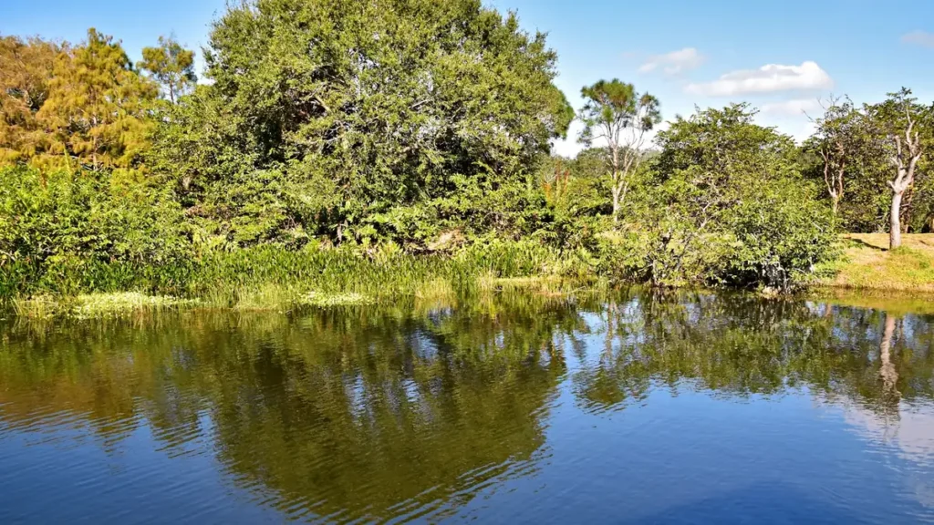
The photo at the top of this page is not Saco River.
It is a regional stand-in, honestly captioned but generic — we will not put a name to a river we cannot prove. Send us a photograph you took here and it replaces the stand-in, with your credit on it.
Pioneer badgeUnclaimed
Add a photo of this water
Landscape, not fish — the water itself. Reviewed by hand before it appears. The first one published here earns the Pioneer badge.
Fished this water? Add a photo
Reviewed by hand before it appears. Pick the water, not the spot — we never publish exact locations.
Access
Camp Ellis - the gauge site, with the jetty, pier and beach access at the river mouth.
Camp Ellis jetty - the long breakwater, the central structure of the fishery.
Saco River tidal reach - the estuary above the mouth, boat and kayak water.
Ferry Beach State Park - shoreline access north of the river mouth.
Biddeford Pool - the tidal pool and shoreline south of the river.
Hills Beach - the south side of the river mouth at Biddeford.
Cataract Falls - the head of tide at the Saco and Biddeford dams.
Seasons
Spring: American shad run the river and the first striped bass arrive in late May.
Summer: the peak, with stripers on the jetty and bluefish around the mouth.
Fall: strong fishing into October as bass stage before moving south.
Winter: the estuary is done, with no meaningful fishery until spring.
From the water
No logged trips yet. Be the first to put this water on your map.
Log this water
Fished it or cleaned it? Log in or create a free account to log a trip with photos and earn the waterway badge.
Questions
What species can you catch on the Saco River?
Anglers target American Eel, American Shad, Bluefish, Brown Trout, Striped Bass on the Saco River in Maine.
Are there fishing guides on the Saco River?
GuidedFloats lists 1 guide and outfitters on the Saco River. Claimed profiles accept booking requests; unclaimed profiles are built from public records and link to the business.
Where can you access the Saco River?
Camp Ellis - the gauge site, with the jetty, pier and beach access at the river mouth. Camp Ellis jetty - the long breakwater, the central structure of the fishery. Saco River tidal reach - the estuary above the mouth, boat and kayak water. Ferry Beach State Park - shoreline access north of the river mouth. Biddeford Pool - the tidal pool and shoreline south of the river. Hills Beach - the south side of the river mouth at Biddeford. Cataract Falls - the head of tide at the Saco and Biddeford dams.
When is the best time to fish the Saco River?
Spring: American shad run the river and the first striped bass arrive in late May. Summer: the peak, with stripers on the jetty and bluefish around the mouth. Fall: strong fishing into October as bass stage before moving south. Winter: the estuary is done, with no meaningful fishery until spring.
Where are the fishing regulations for the Saco River?
Regulations change by season and section. Read the current rules on the Maine agency site: https://www.maine.gov/dmr/fisheries/recreational