Fishes Pecos River, Rio Chama
River · Northern New Mexico · New Mexico
Rio Chama Fishing Guides
A Wild and Scenic red-rock canyon float below El Vado, plus the cold tailwater below Abiquiu Dam that fishes all winter under Georgia O'Keeffe country.
Map of the Rio Chama
52 numbered points: 6 access points, 6 campsites, 2 bait & fly shops, 10 bridges, 6 parks and conservation areas, 4 agency offices, 6 regulation section limits, 7 hazards, 1 USGS gauge, 4 points of interest. Tap a marker for details. Reviewed Sep 24, 2026.
- Access / boat ramp (6)
- Campsite (6)
- Bait, tackle & fly shop (2)
- Bridge crossing (10)
- Park / conservation area (6)
- Agency / conservation office (4)
- Regulation section limit (6)
- Dam / hazard (7)
- USGS gauge (1)
- Point of interest (4)
Map data © OpenStreetMap contributors. Points are curated from OpenStreetMap and state agency sources; confirm access and hours before you go.
Print it. Bag it. Bring it.Phones die, screens crack, and most of this water has no signal. Print this map, fold it into a zip-top bag or dry bag with your license, and you have a backup your electronics can’t give you. Every marker is numbered so you can say exactly where you are.
Open the printable mapAll 52 points on this map
| # | Point | Type | Lat, Lon | Notes |
|---|---|---|---|---|
| 1 | USGS 08281400 Rio Chama above Chama USGS gauge · uppermost NM station | Point of interest | 36.93496, -106.55521 | Not the gauge this page reads; it sits about 5 mi above the village of Chama and is the first station below the Colorado line. |
| 2 | Edward Sargent Wildlife Management Area NMDGF · trailhead off NM 29, north of Chama | Park / conservation area | 36.91954, -106.58051 | NMDGF area on the Rio Chamita and upper Chama. State special-regulation tackle rules apply to all waters within or adjacent to the WMA; check the current rule book before fishing it. |
| 3 | NM 17 crossing, Chama NM 17 | Bridge crossing | 36.91253, -106.57380 | First mapped road crossing below the state line, at the north end of the village. |
| 4 | Rio Chama RV Park Chama · riverside RV park | Campsite | 36.90889, -106.57688 | Sits on the left bank in the village; mapped twice in OSM as a way and a node, shipped once. |
| 5 | Cumbres & Toltec Scenic Railroad bridge narrow-gauge railroad · Chama yard | Bridge crossing | 36.90882, -106.57518 | The C&T steam railroad crosses here beside its Chama yard. OSM maps the span twice (way 287982505 and way 1426337393); one point. |
| 6 | Camo-Up Sporting Goods 669 Terrace Ave, Chama · NM licence vendor | Bait, tackle & fly shop | 36.90101, -106.58038 | Hunting and fishing supplies and a current NMDGF fishing-licence vendor. Placed on its street address (Nominatim house-number match, 0.30 km off the river); it has no website. |
| 7 | Diversion dam at Chama (unnamed in OSM) low structure · scout before running | Dam / hazard | 36.89345, -106.57493 | Tagged waterway=dam with no name or operator. Position is OSM's; nothing else is known about it, so treat it as an unscouted obstruction. |
| 8 | Northern New Mexico Welcome Center Chama Valley Chamber of Commerce | Agency / conservation office | 36.88342, -106.58496 | Visitor centre on US 64/84 in Chama; local information rather than a licence or permit office. |
| 9 | US 64 / US 84 crossing, Chama US 64 · US 84 | Bridge crossing | 36.87810, -106.58362 | The main highway crossing in Chama, just above the Rio Chamita confluence. |
| 10 | Little Creel RV Park Chama · riverside RV park | Campsite | 36.87202, -106.58404 | |
| 11 | Sky Mountain RV Resort Chama · riverside RV park | Campsite | 36.86459, -106.58387 | |
| 12 | Co Road 343A crossing Rio Arriba CR 343A | Bridge crossing | 36.85211, -106.58774 | Last mapped crossing before the river leaves the Chama valley for the Tierra Amarilla reach. |
| 13 | New Mexico State Forestry — Chama District Office NM State Forestry | Agency / conservation office | 36.75654, -106.55924 | District office for the Chama valley; fire and forest-road information. |
| 14 | NM 95 crossing NM 95 | Bridge crossing | 36.73777, -106.57652 | Crossing near Los Ojos, above the Laguna del Campo turn-off. |
| 15 | Laguna del Campo Wildlife Management Area NMDGF · stocked lake beside the river | Park / conservation area | 36.71972, -106.57419 | NMDGF water open to the public a short way off the river; the Laguna del Campo fish hatchery (way 1124307453) sits on the same ground. |
| 16 | USGS 08284100 Rio Chama near La Puente USGS gauge · upper river | Point of interest | 36.66266, -106.63337 | Not the gauge this page reads. It is the flow reference for the reach above Heron and El Vado. |
| 17 | Cottonwood Flats — upper limit of the Wildlife & Fishing Area reach placed by the published 2.9-mile walk | Regulation section limit | 36.66667, -106.67036 | Upstream end of the state's named reach inside the Rio Chama Wildlife and Fishing Area. Walked 2.9 mi (4.67 km) upstream from the Heron Reservoir outlet along the chained centreline; no OSM feature carries the name. |
| 18 | Rio Chama Wildlife & Fishing Area NMDGF · public access, both banks | Park / conservation area | 36.66164, -106.67601 | NMDGF relation 19715012, three parcels straddling the river between Cottonwood Flats and the Heron Reservoir outlet. The state's special tackle reach lies inside it. |
| 19 | Heron Reservoir outlet — lower limit of the Wildlife & Fishing Area reach Willow Creek confluence | Regulation section limit | 36.66236, -106.70590 | Downstream end of the named reach. Heron Dam releases down Willow Creek, and the confluence sits exactly on the centreline (0.000 km). |
| 20 | Heron Lake State Park campground NM State Parks · nearest camping to the reach | Campsite | 36.66826, -106.71012 | On the Heron Lake side of the divide, about half a kilometre off the river; the closest developed camping to the Wildlife and Fishing Area water. |
| 21 | El Vado Lake State Park NM State Parks | Park / conservation area | 36.60001, -106.74226 | Park on the reservoir the river enters here; the state-park boundary relation (way 579777787) covers the wider shoreline. |
| 22 | El Vado Dam NID NM10008 · portage, no through route | Dam / hazard | 36.59474, -106.73282 | Hard stop for anything floating. Releases from here set the flow for the canyon run below. |
| 23 | El Vado Ranch Access put-in for the Wild & Scenic canyon · BLM permit | Access / boat ramp | 36.58271, -106.72861 | The standard launch for the El Vado-to-Big Eddy float. OSM records that a BLM permit is required and that the access crosses private property; Cooper's El Vado Ranch on NM 112 sells fishing supplies and NM licences. |
| 24 | USGS gauge below Cooper's Landing — upper limit of the special trout water USGS 08285500 · Rio Chama below El Vado Dam | Regulation section limit | 36.58046, -106.72480 | The state names this gauging station as the upstream boundary of a special-regulation reach. The marker and its anchor gauge are one point. |
| 25 | Rio Nutrias confluence — lower limit of the special trout water tributary mouth on the left bank | Regulation section limit | 36.55249, -106.71626 | Downstream boundary of the same reach. The Rio Nutrias channel meets the centreline at 0.005 km; the reach measures 2.86 mi against the two published anchors. |
| 26 | Rio Chama Wilderness Study Area BLM · wild & scenic corridor | Park / conservation area | 36.50956, -106.72418 | BLM-managed study area along the canyon; the river through here is the permitted Wild and Scenic reach. |
| 27 | Dark Canyon Rapid named rapid · canyon reach | Dam / hazard | 36.46633, -106.70541 | One of two named rapids OSM carries on the canyon run. Scout at the flow you get. |
| 28 | Christ in the Desert Monastery Forest Road 151 · canyon landmark | Point of interest | 36.37803, -106.68077 | Benedictine monastery on the right bank, the main landmark on the upper canyon float and the end of the maintained stretch of FR 151. Abbey Brewing Company is on the same ground. |
| 29 | Chavez Canyon Access FR 151U, 4wd · permit to go upstream | Access / boat ramp | 36.36426, -106.68105 | OSM records that a BLM permit is needed to boat upstream from here and that downstream trips do not need one. The access road is signed Chavez Rafting Access Road. |
| 30 | Rio Chama Campground USFS · FR 151SA | Campsite | 36.35513, -106.67273 | Forest Service campground at the river; not to be confused with Riana Campground above Abiquiu Dam, which OSM still carries the old name 'Rio Chama Campground' for. |
| 31 | Screaming Left Hand Turn named rapid · canyon reach | Dam / hazard | 36.35081, -106.67381 | Sits immediately above the Rio Chama Campground launch. |
| 32 | Rio Chama Campground launch boat ramp at the USFS campground | Access / boat ramp | 36.35100, -106.67240 | Mapped three times in OSM (access point, slipway node, slipway way) at one spot; shipped once. |
| 33 | Chama River Canyon Wilderness USFS · designated wilderness | Park / conservation area | 36.34372, -106.66197 | Wilderness on both sides of the canyon below the monastery, administered by the Espanola Ranger District. |
| 34 | Skull Bridge FR 474 · canyon crossing | Bridge crossing | 36.32991, -106.62519 | The only road crossing inside the canyon and the standard halfway landmark. OSM spells the way 'Skull Bridge(Elizabeth'S) Road'. |
| 35 | USGS 08286500 Rio Chama above Abiquiu Reservoir USGS gauge · canyon flow reference | Point of interest | 36.31876, -106.59792 | Not the gauge this page reads. This is the station canyon floaters watch for the El Vado-to-Big Eddy run. |
| 36 | Big Eddy Access take-out for the canyon float · FR 151G | Access / boat ramp | 36.31151, -106.58297 | The standard take-out above Abiquiu Reservoir. The approach road is signed Big Eddy Take Out Road and is 4wd. |
| 37 | Abiquiu Reservoir ramp (unnamed in OSM) ramp below Riana Campground | Access / boat ramp | 36.25549, -106.43467 | A slipway node with no name or operator, 0.48 km off the through-line on the reservoir. Identified by position between Riana Campground and the dam; no agency source names it. |
| 38 | Riana Campground US Army Corps of Engineers · fee | Campsite | 36.24617, -106.43010 | On the bluff above Abiquiu Reservoir. OSM carries 'Rio Chama Campground' as its old name, which is the USFS campground 32 km upstream. |
| 39 | Abiquiu Dam Visitor Center US Army Corps of Engineers | Agency / conservation office | 36.24014, -106.42825 | Corps office at the dam; releases from here set the flow for the tailwater below. |
| 40 | Abiquiu Dam NID NM00001 · no through route | Dam / hazard | 36.23809, -106.42584 | Corps of Engineers flood-control dam. Everything below it is the separate Rio Chama below Abiquiu Dam page on this site. |
| 41 | Abiquiu Wave access upstream and downstream put-ins at the wave | Access / boat ramp | 36.23927, -106.41791 | OSM carries two access points 30 m apart either side of the wave; shipped as one. |
| 42 | Abiquiu Wave engineered play wave below the dam | Dam / hazard | 36.23932, -106.41769 | A whitewater feature in the tailrace with its own small accesses just above and below it. |
| 43 | Base of Abiquiu Dam — upper limit of the Abiquiu special water USGS 08287000 · Rio Chama below Abiquiu Dam | Regulation section limit | 36.23722, -106.41742 | Upstream boundary of the state's named reach below the dam, anchored on the station named for it. The reach measures 7.30 mi to the US 84 bridge against a published 7.0 mi. |
| 44 | US 84 bridge at Abiquiu — lower limit of the Abiquiu special water US 84 · bridge and section limit in one point | Regulation section limit | 36.20939, -106.32533 | The state names this river crossing as the downstream boundary of the reach below Abiquiu Dam. Bridge and marker are one point. |
| 45 | Bode's General Store 21196 US-84, Abiquiu · flies, bait, tackle | Bait, tackle & fly shop | 36.20975, -106.32018 | Its own 2026 site lists flies, minnows in season, worms year round, rods, lures and line. It is not on the NMDGF licence-vendor list, so buy the licence elsewhere. |
| 46 | NM 554 crossing, El Rito road NM 554 | Bridge crossing | 36.21621, -106.24792 | |
| 47 | Medanales Bridge NM 233 | Bridge crossing | 36.16862, -106.18349 | |
| 48 | Pablo Maestas Bridge US 285 | Bridge crossing | 36.09438, -106.13175 | |
| 49 | El Duende Dam diversion structure · lower river | Dam / hazard | 36.08426, -106.12605 | The only named structure on the lower river. Three further unnamed weirs and one unnamed dam sit between Abiquiu and here; see the notes. |
| 50 | NM 74 crossing, Chamita NM 74 | Bridge crossing | 36.07358, -106.11193 | Last crossing above the Rio Grande confluence, beside the gauge this page reads. |
| 51 | USGS 08290000 Rio Chama near Chamita the gauge this page reads · near the mouth | USGS gauge | 36.07356, -106.11169 | Shipped on the roster coordinate, which scores 0.022 km off the chained centreline. Five other USGS stations on this river are marked as points of interest or carry section limits. |
| 52 | Espanola Ranger District Headquarters USFS · Carson National Forest | Agency / conservation office | 36.01755, -106.06487 | The district that administers the Chama River Canyon Wilderness and the FR 151 accesses. In Espanola, 3.4 km off the river. |
Guides on the Rio Chama
Claimed profiles take booking requests. Unclaimed profiles are built from public records so the river is never empty; the guide can claim or remove one any time.
Order on this page: premium and outfitter plans first (labelled Premium placement), then claimed free profiles, then unclaimed — one published price, no bidding for position. How placement works
About the Rio Chama
The Chama gives northern New Mexico two very different trips. The Wild and Scenic section from El Vado Dam down to the Chama Canyon and the Christ in the Desert Monastery is a thirty-mile red-rock float, usually run over two or three days on scheduled releases, with brown and rainbow trout, sandstone walls and some of the quietest camping in the state. The tailwater below Abiquiu Dam is a shorter, road-accessible fishery that stays cold and fishable year-round.
The canyon float is the signature trip and it is release-dependent: the Bureau of Reclamation runs water through in early summer, and the float community plans around those releases. Fishing in the canyon is best on the shoulders, before the water comes up and after it drops. The Abiquiu tailwater is the reliable option the rest of the year, fished with nymphs and streamers, and it holds larger browns than most people expect. Pike and walleye live in the reservoirs and occasionally show up in the river.
The Chamita gauge sits low on the river above the Rio Grande confluence and reflects the sum of the releases and tributaries. Several hundred cfs is normal working water; release periods push it much higher, which is when the canyon floats run, and low-flow periods make the tailwater technical and clear. Because so much of this river is managed, checking the current release schedule matters more than any long-term average.
Abiquiu, Chama and Espanola are the towns, with Santa Fe an hour away. The canyon has no services, permits are required for the Wild and Scenic float in season, and the monastery asks that visitors respect the quiet.
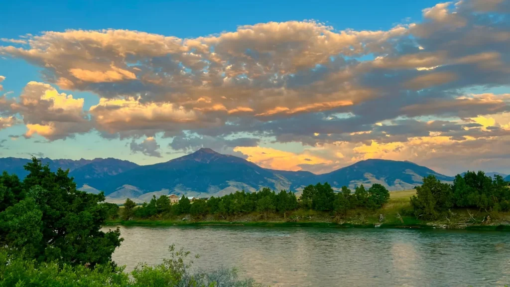
This water needs a real photo
The photo at the top of this page is not Rio Chama.
It is a regional stand-in, honestly captioned but generic — we will not put a name to a river we cannot prove. Send us a photograph you took here and it replaces the stand-in, with your credit on it.
Pioneer badgeUnclaimed
Add a photo of this water
Landscape, not fish — the water itself. Reviewed by hand before it appears. The first one published here earns the Pioneer badge.
Fished this water? Add a photo
Reviewed by hand before it appears. Pick the water, not the spot — we never publish exact locations.
Access
El Vado Dam: the top of the Wild and Scenic float.
Cooper El Vado Ranch: the standard permit launch for the canyon.
Chama Canyon and the Christ in the Desert Monastery: mid-canyon river access on a rough road.
Big Eddy and Chavez Canyon: canyon takeouts above Abiquiu Reservoir.
Abiquiu Dam tailwater: the year-round road-accessible trout water.
Chamita and the Rio Grande confluence: the bottom of the river near the gauge.
The Wild and Scenic section requires a permit during the season and has no services.
Seasons
Year-round on the Abiquiu tailwater.
April and May: pre-release fishing in the canyon, cool water and few people.
June and July: scheduled releases, the main canyon float season.
September through March: the tailwater at its best, browns in the fall and midges through winter.
From the water
No logged trips yet. Be the first to put this water on your map.
Log this water
Fished it or cleaned it? Log in or create a free account to log a trip with photos and earn the waterway badge.
Questions
What is the current flow on the Rio Chama?
As of Nov 2, 7:00 am, the USGS gauge RIO CHAMA NEAR CHAMITA, NM reads 441 cfs, the 78th percentile for this date, with water temperature 51.4 F. Conditions update every 15 minutes.
What species can you catch on the Rio Chama?
Anglers target Brown Trout, Northern Pike, Rainbow Trout, Walleye on the Rio Chama in New Mexico.
Are there fishing guides on the Rio Chama?
GuidedFloats lists 2 guides and outfitters on the Rio Chama. Claimed profiles accept booking requests; unclaimed profiles are built from public records and link to the business.
Where can you access the Rio Chama?
El Vado Dam: the top of the Wild and Scenic float. Cooper El Vado Ranch: the standard permit launch for the canyon. Chama Canyon and the Christ in the Desert Monastery: mid-canyon river access on a rough road. Big Eddy and Chavez Canyon: canyon takeouts above Abiquiu Reservoir. Abiquiu Dam tailwater: the year-round road-accessible trout water. Chamita and the Rio Grande confluence: the bottom of the river near the gauge. The Wild and Scenic section requires a permit during the season and has no services.
When is the best time to fish the Rio Chama?
Year-round on the Abiquiu tailwater. April and May: pre-release fishing in the canyon, cool water and few people. June and July: scheduled releases, the main canyon float season. September through March: the tailwater at its best, browns in the fall and midges through winter.
Where are the fishing regulations for the Rio Chama?
Regulations change by season and section. Read the current rules on the New Mexico agency site: https://wildlife.dgf.nm.gov/fishing/