Fishes Pecos River, Rio Chama
River · Sangre de Cristo Mountains · New Mexico
Pecos River Fishing Guides
The mountain headwaters of the Pecos above the village of Pecos, a small, cold Sangre de Cristo trout stream gauged near Pecos and fished on foot.
Map of the Pecos River
31 numbered points: 5 access points, 9 campsites, 8 bridges, 2 agency offices, 2 regulation section limits, 1 hazard, 1 USGS gauge, 3 points of interest. Tap a marker for details. Reviewed Sep 24, 2026.
- Access / boat ramp (5)
- Campsite (9)
- Bridge crossing (8)
- Agency / conservation office (2)
- Regulation section limit (2)
- Dam / hazard (1)
- USGS gauge (1)
- Point of interest (3)
Map data © OpenStreetMap contributors. Points are curated from OpenStreetMap and state agency sources; confirm access and hours before you go.
Print it. Bag it. Bring it.Phones die, screens crack, and most of this water has no signal. Print this map, fold it into a zip-top bag or dry bag with your license, and you have a backup your electronics can’t give you. Every marker is numbered so you can say exactly where you are.
Open the printable mapAll 31 points on this map
| # | Point | Type | Lat, Lon | Notes |
|---|---|---|---|---|
| 1 | Pecos Falls 25 m waterfall - Pecos Wilderness | Dam / hazard | 35.93677, -105.55805 | The state's wilderness special trout water runs from this waterfall upstream to the headwaters; see NMDGF for what applies there. Trail access only - the nearest road is about 8 km downstream. |
| 2 | Pecos Trail footbridge (Trail 24) Santa Fe NF - foot, horse and dog; no vehicles | Bridge crossing | 35.90861, -105.59762 | One of only three crossings on the wilderness reach. Timber deck on the Pecos Trail, the main valley-bottom route in from Iron Gate. |
| 3 | Larkspur Trail footbridge (Trail 260) Santa Fe NF - foot and horse | Bridge crossing | 35.90514, -105.59882 | Second of the three wilderness crossings, about 400 m below the Pecos Trail bridge. |
| 4 | Beatty's Cabin Historic site - Pecos Wilderness | Point of interest | 35.90384, -105.60498 | The best-known landmark on the upper river and the usual turnaround for a long day in from Iron Gate; the cabin site sits a short way back from the water. |
| 5 | Iron Gate Campground Santa Fe NF - end of Forest Road 223 | Campsite | 35.83995, -105.62032 | The highest road-accessible camp on this side of the river and the trailhead most anglers use to walk into the wilderness reach. Rough access road; no water on site. |
| 6 | Hamilton Mesa Trail footbridge (Trail 249) Santa Fe NF - foot and horse | Bridge crossing | 35.83463, -105.64059 | The lowest of the three wilderness crossings, where the Hamilton Mesa trail leaves the valley. |
| 7 | Jacks Creek Campground (horse camp) Santa Fe NF - Jacks Creek trailhead | Campsite | 35.83428, -105.65544 | Sits about a kilometre up Jacks Creek from the Pecos rather than on the main river. Jacks Creek itself carries its own NMDGF reach rule above the Highway 63 crossing waterfalls. |
| 8 | Cowles Campground Santa Fe NF - Winsor Creek Road, Cowles | Campsite | 35.81268, -105.66435 | At the top of the road-accessible river, beside the Cowles day-use recreation site. The paved road ends here; everything upstream is trail. |
| 9 | Forest Road 121 bridge at Cowles Winsor Road - paved | Bridge crossing | 35.81219, -105.65931 | The bridge crossing at Cowles that NMDGF uses as the upper anchor for the box-canyon special trout water downstream. |
| 10 | Cowles Ponds Two small stocked ponds beside the river | Point of interest | 35.81115, -105.65926 | Family water at the head of the canyon, a few metres off the Pecos and easier than the river itself when the main channel is high. |
| 11 | Box canyon special trout water - upper limit 0.2 mi below the Cowles bridge | Regulation section limit | 35.80967, -105.65942 | Upper boundary of the NMDGF box-canyon reach, measured 0.2 miles downstream of the Forest Road 121 bridge at Cowles. The reach runs about 2.1 miles from here down to the marker above the Rio Mora. See NMDGF for what applies inside it. |
| 12 | Box canyon special trout water - lower limit 0.5 mi above the Rio Mora confluence | Regulation section limit | 35.78281, -105.65978 | Lower boundary of the NMDGF box-canyon reach, measured 0.5 miles upstream of the Rio Mora confluence. See NMDGF for what applies inside it. |
| 13 | North Rio Mora Day-Use Area Pecos Canyon State Park - free angler access | Access / boat ramp | 35.77989, -105.66024 | Northernmost unit of Pecos Canyon State Park and the top of the state-park water. Day use and picnicking only; the campground is a short way downstream. |
| 14 | Rio Mora Campground Pecos Canyon State Park - formerly Central Mora | Campsite | 35.77690, -105.65942 | The park's northern campground, on the Rio Mora just above its confluence with the Pecos. |
| 15 | South Rio Mora Day-Use Area Pecos Canyon State Park - free angler access | Access / boat ramp | 35.77181, -105.66249 | Day-use and picnic unit on the east side of NM 63, immediately below the Rio Mora confluence. |
| 16 | Willow Creek Recreation Area Pecos Canyon State Park - free angler access | Access / boat ramp | 35.76184, -105.67121 | The park's largest day-use unit, in the old Terrero townsite floodplain; the Jamie Koch pavilion here can be reserved. The Pecos Wilderness boundary is about 1 km to the north-west. |
| 17 | Links Tract Campground Santa Fe NF - NM 63 | Campsite | 35.75670, -105.66135 | Small forest campground on the bench above the river between Willow Creek and Terrero. |
| 18 | Davis Willow Dispersed Camping Area Santa Fe NF - dispersed, no facilities | Campsite | 35.75023, -105.67189 | Signed dispersed camping on the Davis and Willow Creek benches; no water, no toilets, pack it out. |
| 19 | Terrero Recreation Area Pecos Canyon State Park - camping and day use | Campsite | 35.74397, -105.67658 | The park's Terrero unit, across the river from the old general store. Campground plus day-use parking; the store itself is closed, so buy tackle before Pecos. |
| 20 | Forest 122 Road bridge (Holy Ghost Road) Single lane - 15 mph | Bridge crossing | 35.74130, -105.67958 | Crossing at Terrero for Holy Ghost Canyon, one of the better-known side creeks on this stretch. |
| 21 | Rio Pecos Campground (formerly Bert Clancy) Pecos Canyon State Park - free angler access | Campsite | 35.73523, -105.67815 | Southernmost unit of Pecos Canyon State Park, renamed from Bert Clancy. Camping, day use and a signed free angler-access stretch along the river. |
| 22 | USGS 08378500 Pecos River near Pecos Real-time flow and stage | USGS gauge | 35.70835, -105.68270 | The gauge this page reads, at Brush Ranch between Terrero and Tres Lagunas. A second station, Rio Mora near Terrero, is on the tributary rather than on the Pecos and is not shown. |
| 23 | Windy Bridge (NM 63) State highway crossing - two lanes | Bridge crossing | 35.69647, -105.68858 | The landmark highway bridge in the middle canyon; the Santa Fe NF picnic ground of the same name sits on the bank immediately downstream and is the parking for this reach. |
| 24 | Field Tract Campground Santa Fe NF - NM 63 | Campsite | 35.68670, -105.69307 | Riverside forest campground on the west bank, one of the easiest walk-in stretches in the canyon. |
| 25 | Rainy Day Picnic Ground Santa Fe NF - day use | Access / boat ramp | 35.65971, -105.68912 | Small day-use site and pull-off on NM 63 with a short path to the water. |
| 26 | Dalton Fishing Area NM Game & Fish - Pecos Complex wildlife area | Access / boat ramp | 35.65498, -105.68272 | Game and Fish angler access at the mouth of Dalton Canyon, with the Forest Service's Dalton picnic area about 300 m downstream. |
| 27 | Lisboa Springs Fish Hatchery NM Game & Fish - Fish Hatchery Road, Pecos | Agency / conservation office | 35.61003, -105.67724 | The state's oldest hatchery and the source of much of the trout stocked in this canyon. Visitor parking off NM 63 just north of the village. |
| 28 | Monastery Lake Stocked lake beside the river | Point of interest | 35.59863, -105.68193 | Small lake on the edge of Pecos village, stocked through the season and the usual fallback when the river is off colour. |
| 29 | Pecos River North Bridge (NM 63) State highway crossing - two lanes | Bridge crossing | 35.58691, -105.67551 | The upper of the two village bridges, where NM 63 crosses back over the river. |
| 30 | Pecos River Bridge (NM 223) Village of Pecos - two lanes | Bridge crossing | 35.57644, -105.66958 | The bridge in the village of Pecos. This page covers the river above here; below it the Pecos leaves the mountains. |
| 31 | Santa Fe National Forest - Pecos Ranger Station Pecos/Las Vegas Ranger District - 32 NM 63 | Agency / conservation office | 35.57198, -105.67589 | District office in the village. Road, fire and campground status for the whole canyon, and the place to ask before driving Forest Road 223 to Iron Gate. |
Guides on the Pecos River
Claimed profiles take booking requests. Unclaimed profiles are built from public records so the river is never empty; the guide can claim or remove one any time.
Order on this page: premium and outfitter plans first (labelled Premium placement), then claimed free profiles, then unclaimed — one published price, no bidding for position. How placement works
About the Pecos River
The Pecos River is best known for the long desert reach that runs down through eastern New Mexico into Texas, but the water anglers fish is the top forty miles of it, in the Sangre de Cristo Mountains above the village of Pecos. The USGS gauge near Pecos sits at the bottom of that mountain section and reports discharge and stage with no water temperature series. Above the gauge the river runs through the Pecos Wilderness and the Santa Fe National Forest as a small, cold, boulder-and-pocket stream, dropping fast out of country that tops thirteen thousand feet.
This is a wade fishery and a small-water one. Rainbow and brown trout are the common catch through the accessible canyon above the village, supported by stocking in the heavily used stretches and by natural reproduction further up. Brook trout appear in the higher tributaries, and native Rio Grande cutthroat trout hold in several headwater streams inside the wilderness, where restoration work has protected them. Fish are modest in size and the reward is the setting and the density of water, not trophy dimensions.
Guided trips here run out of Santa Fe and Pecos and are almost entirely walk-and-wade days, often paired with the nearby Rio Grande or the San Juan for clients wanting variety. The canyon road above Pecos gives easy roadside entry to miles of stream, with campgrounds strung along it, while the wilderness water above requires a hike and rewards it with far less pressure. There is no float fishing on this section; the river is too small and too steep.
Snowmelt and monsoon set the calendar. High runoff through May makes the canyon hard to fish, July and August bring afternoon thunderstorms that can color the water in an hour, and the most dependable conditions are usually late June and then September into October. New Mexico licenses are required, several reaches carry special tackle or bag rules, and the state regulations linked below list them by section.
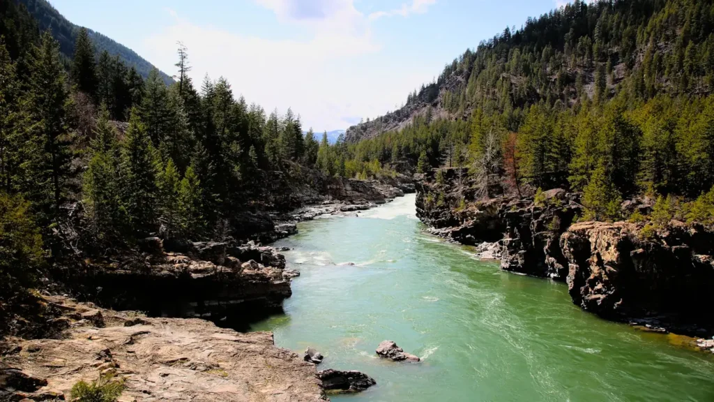
This water needs a real photo
The photo at the top of this page is not Pecos River.
It is a regional stand-in, honestly captioned but generic — we will not put a name to a river we cannot prove. Send us a photograph you took here and it replaces the stand-in, with your credit on it.
Pioneer badgeUnclaimed
Add a photo of this water
Landscape, not fish — the water itself. Reviewed by hand before it appears. The first one published here earns the Pioneer badge.
Fished this water? Add a photo
Reviewed by hand before it appears. Pick the water, not the spot — we never publish exact locations.
Access
Pecos village access at the USGS gauge - the bottom of the mountain section and the flow reference.
Canyon road pullouts above Pecos - the main roadside wade access corridor.
Field Tract and Dalton campground accesses - developed entry points with parking.
Cowles area access - upper canyon entry near the wilderness boundary.
Jacks Creek trailhead - hiking access to the upper Pecos and its tributaries.
Monastery Lake area access - stocked still water alongside the river.
Tererro area crossings - midpoint wade access on the canyon water.
Seasons
Spring: snowmelt runs the canyon high and off-color through May; fishing improves as flows drop in June.
Summer: good early and late, with afternoon monsoon storms coloring the water on short notice.
Fall: the most dependable window, with clear low flows and strong fishing through September and October.
Winter: cold and often snowbound above the village, with limited access on the lower canyon water.
From the water
No logged trips yet. Be the first to put this water on your map.
Log this water
Fished it or cleaned it? Log in or create a free account to log a trip with photos and earn the waterway badge.
Questions
What is the current flow on the Pecos River?
As of Nov 2, 6:00 am, the USGS gauge PECOS RIVER NEAR PECOS, NM reads 818 cfs. Conditions update every 15 minutes.
What species can you catch on the Pecos River?
Anglers target Brook Trout, Brown Trout, Rainbow Trout, Rio Grande Cutthroat Trout on the Pecos River in New Mexico.
Are there fishing guides on the Pecos River?
GuidedFloats lists 2 guides and outfitters on the Pecos River. Claimed profiles accept booking requests; unclaimed profiles are built from public records and link to the business.
Where can you access the Pecos River?
Pecos village access at the USGS gauge - the bottom of the mountain section and the flow reference. Canyon road pullouts above Pecos - the main roadside wade access corridor. Field Tract and Dalton campground accesses - developed entry points with parking. Cowles area access - upper canyon entry near the wilderness boundary. Jacks Creek trailhead - hiking access to the upper Pecos and its tributaries. Monastery Lake area access - stocked still water alongside the river. Tererro area crossings - midpoint wade access on the canyon water.
When is the best time to fish the Pecos River?
Spring: snowmelt runs the canyon high and off-color through May; fishing improves as flows drop in June. Summer: good early and late, with afternoon monsoon storms coloring the water on short notice. Fall: the most dependable window, with clear low flows and strong fishing through September and October. Winter: cold and often snowbound above the village, with limited access on the lower canyon water.
Where are the fishing regulations for the Pecos River?
Regulations change by season and section. Read the current rules on the New Mexico agency site: https://wildlife.dgf.nm.gov/fishing/