Fishes Huzzah Creek, Meramec River
River · Ozarks · Missouri
Meramec River Fishing Guides
Clear Ozark river with stocked rainbow and brown trout in the Maramec Spring reach near St. James and strong smallmouth bass floating from Steelville downstream to Meramec State Park.
Map of the Meramec River
38 numbered points: 10 access points, 7 campsites, 2 outfitters, 7 bridges, 7 parks and conservation areas, 2 regulation section limits, 2 springs, 1 USGS gauge. Tap a marker for details. Reviewed Sep 7, 2026.
- Access / boat ramp (10)
- Campsite (7)
- Outfitter / canoe rental (2)
- Bridge crossing (7)
- Park / conservation area (7)
- Regulation section limit (2)
- Spring (2)
- USGS gauge (1)
Map data © OpenStreetMap contributors. Points are curated from OpenStreetMap and state agency sources; confirm access and hours before you go.
Print it. Bag it. Bring it.Phones die, screens crack, and most of this water has no signal. Print this map, fold it into a zip-top bag or dry bag with your license, and you have a backup your electronics can’t give you. Every marker is numbered so you can say exactly where you are.
Open the printable mapAll 38 points on this map
| # | Point | Type | Lat, Lon | Notes |
|---|---|---|---|---|
| 1 | Highway 19 bridge (upper) MO 19 | Bridge crossing | 37.74998, -91.42334 | Crossing on the small upper river south of Steelville; floatable only in high water. |
| 2 | Highway M bridge MO M | Bridge crossing | 37.82896, -91.43751 | Crossing above Steelville. |
| 3 | Gibbs State Wildlife Area Missouri Department of Conservation | Park / conservation area | 37.88032, -91.42459 | Conservation land on the upper river near Steelville. |
| 4 | Woodson K. Woods Memorial Conservation Area Missouri Department of Conservation | Park / conservation area | 37.95289, -91.51699 | MDC area at Highway 8; wade access to the trout water below Maramec Spring. |
| 5 | Highway 8 bridge MO 8 | Bridge crossing | 37.95036, -91.51140 | Crossing between St. James and Steelville, just below Maramec Spring. |
| 6 | Red Ribbon Trout Area — upper limit Highway 8 access | Regulation section limit | 37.95110, -91.50858 | MDC's Red Ribbon Trout Area runs from the Highway 8 access down to Scotts Ford Access. Check the MDC regulations for methods and limits. |
| 7 | Woodson Woods Access MDC · Highway 8 | Access / boat ramp | 37.95110, -91.50858 | Put-in for the Red Ribbon float; trout numbers are highest in the first three miles below the spring. |
| 8 | Maramec Spring Park James Foundation · trout park | Park / conservation area | 37.95447, -91.52938 | Private trout park on the spring branch (daily tag); campgrounds, store and museum. |
| 9 | Maramec Spring Park Campground James Foundation · east and west campgrounds | Campsite | 37.95815, -91.52815 | Camping inside the park. |
| 10 | Scotts Ford Access MDC | Access / boat ramp | 37.97802, -91.45658 | Take-out for the Red Ribbon float and the lower limit of the trout area. |
| 11 | Red Ribbon Trout Area — lower limit Scotts Ford Access | Regulation section limit | 37.97802, -91.45658 | Trout management ends here; smallmouth water from Scotts Ford down. |
| 12 | Adventure Outdoors Campground Private · camping and floats | Campsite | 37.97782, -91.45830 | Campground and landing at Scotts Ford. |
| 13 | Canoe Shack (Indian Springs) Canoe and raft rental | Outfitter / canoe rental | 37.97842, -91.43107 | Outfitter at Indian Springs Resort. |
| 14 | Indian Springs Campground Private · camping | Campsite | 37.97818, -91.43097 | Riverside camping with its own access. |
| 15 | Riverview Access MDC | Access / boat ramp | 37.99235, -91.42539 | Public access above Steelville. |
| 16 | Lucky Clover Lakeside River Resort Private · camping | Campsite | 37.99223, -91.38405 | Campground west of the Highway 19 bridge. |
| 17 | Highway 19 bridge at Steelville MO 19 | Bridge crossing | 37.98902, -91.37621 | The Steelville crossing; town is just south. |
| 18 | The Rafting Co. Private · rafts, canoes and camping | Campsite | 37.98579, -91.37606 | Outfitter and campground at the Steelville bridge. |
| 19 | USGS 07013000 Meramec River near Steelville | USGS gauge | 37.99847, -91.36094 | The gauge behind the live flow on this page. |
| 20 | Bird's Nest Access Public · Birds Nest Beach Park | Access / boat ramp | 37.99668, -91.36064 | Landing at the Birds Nest railroad bridge. |
| 21 | Garrison's River Resort Landing Private · camping and floats | Access / boat ramp | 38.01492, -91.32098 | Resort landing below Steelville. |
| 22 | Saranac Spring | Spring | 38.04468, -91.29151 | Spring on the reach above Onondaga. |
| 23 | Cathedral Spring | Spring | 38.05378, -91.23371 | Spring inside Onondaga Cave State Park. |
| 24 | Onondaga Cave State Park Missouri State Parks | Park / conservation area | 38.06048, -91.23268 | Cave tours, campground and a boat ramp on the river. |
| 25 | Onondaga Cave State Park Campground Missouri State Parks | Campsite | 38.05840, -91.23716 | Campground in the state park. |
| 26 | Onondaga Cave boat ramp Missouri State Parks · ramp | Access / boat ramp | 38.05774, -91.22529 | Concrete ramp at the park. |
| 27 | Ozark Outdoors Riverfront Resort Canoe, raft and kayak rental · camping | Outfitter / canoe rental | 38.05833, -91.22276 | Large outfitter at Onondaga with its own landings and camp store. |
| 28 | Campbell Bridge (Highway N) MO N | Bridge crossing | 38.08132, -91.14983 | Crossing at Campbell Bridge Access. |
| 29 | Campbell Bridge Access MDC · concrete ramp | Access / boat ramp | 38.08187, -91.15001 | Public ramp and canoe launch at the Highway N bridge. |
| 30 | Onondaga Cave State Park — Vilander Bluff Unit Missouri State Parks | Park / conservation area | 38.09828, -91.13992 | The big bluff below Campbell Bridge. |
| 31 | Blue Springs Ranch Landing Private · camping and floats | Access / boat ramp | 38.11207, -91.15675 | Resort landing with a public canoe launch beside it. |
| 32 | Sappington Bridge County road | Bridge crossing | 38.15847, -91.10892 | Crossing at Sappington Bridge Access. |
| 33 | Sappington Bridge Access MDC · concrete ramp | Access / boat ramp | 38.15807, -91.10880 | Public ramp and canoe launch. |
| 34 | Meramec State Park boat ramp Missouri State Parks · ramp | Access / boat ramp | 38.20313, -91.09844 | Ramp and camp store (RiverStop) inside the park. |
| 35 | Meramec State Park Missouri State Parks | Park / conservation area | 38.20723, -91.09628 | Lodging, campground sections 1–3, cave tours and river access at Sullivan. |
| 36 | Highway 185 bridge MO 185 | Bridge crossing | 38.20773, -91.09393 | The park crossing at Sullivan. |
| 37 | Meramec State Park Campground Missouri State Parks · sections 1–3 | Campsite | 38.22519, -91.08164 | Campground along the river below the bridge. |
| 38 | Meramec Conservation Area Missouri Department of Conservation | Park / conservation area | 38.22974, -91.06087 | MDC area on the east bank below the state park. |
Guides on the Meramec River
Claimed profiles take booking requests. Unclaimed profiles are built from public records so the river is never empty; the guide can claim or remove one any time.
About the Meramec River
The Meramec is the closest big Ozark river to St. Louis, and the upper river from Maramec Spring Park down past Steelville is the part that matters for guided float trips. Maramec Spring adds roughly 100 million gallons a day of cold water just above the confluence with the Meramec proper, and the river below it holds stocked rainbows and a solid population of wild-spawning browns for about ten miles before warming into smallmouth water.
Maramec Spring Park to Scotts Ford is the trout float, and Scotts Ford to Woodson K. Woods or Birds Nest continues through transitional water where a single day can produce browns, smallmouth, and goggle-eye. Below Steelville the Meramec is a warm-water river with long gravel pools, smallmouth bass, and the occasional big walleye, running past Onondaga Cave State Park and Meramec State Park before slowing toward the Missouri River.
The Steelville gauge sits at the bottom of the trout reach. Around 300 to 600 cfs is ideal for floating; under 250 the river is low but wades beautifully; above 1,200 it is high and stained and most guides wait a day or two. The Meramec responds quickly to rain and drops quickly too, which makes it forgiving for anglers who can move a trip by a day.
Steelville and Cuba have lodging and supplies, and the James Foundation park at Maramec Spring has camping, a hatchery, and a daily trout tag system that is separate from the state parks. Steelville calls itself the floating capital of Missouri, and the liveries there run shuttles for the Meramec, the Huzzah, and the Courtois, so booking a guide and a shuttle on the same day is easy in season.
This water needs a real photo
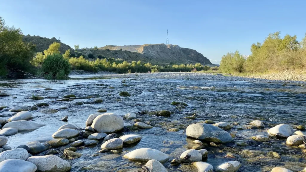
The photo at the top of this page is not Meramec River.
It is a regional stand-in, honestly captioned but generic — we will not put a name to a river we cannot prove. Send us a photograph you took here and it replaces the stand-in, with your credit on it.
Pioneer badgeUnclaimed
Add a photo of this water
Landscape, not fish — the water itself. Reviewed by hand before it appears. The first one published here earns the Pioneer badge.
Fished this water? Add a photo
Reviewed by hand before it appears. Pick the water, not the spot — we never publish exact locations.
Access
Maramec Spring Park (James Foundation): park access at the top of the trout water, day-use fee.
Scotts Ford Access: MDC gravel bar access, 4 miles below the park, common trout takeout.
Woodson K. Woods Conservation Area: MDC access below Scotts Ford.
Birds Nest Access and Riverview near Steelville: ramps for the transition water and smallmouth floats.
Sappington Bridge, Onondaga Cave State Park, and Meramec State Park serve the middle river.
Seasons
March through May: best brown trout months, good flows, fewer floaters.
June through August: stocked rainbows near the park, smallmouth below Steelville, heavy canoe traffic on weekends.
September through November: low clear water, sight fishing for browns, fall colors through the bluffs.
Winter: catch-and-release trout fishing in the park on set days, quiet river below it.
From the water
No logged trips yet. Be the first to put this water on your map.
Log this water
Fished it or cleaned it? Log in or create a free account to log a trip with photos and earn the waterway badge.
Questions
What is the current flow on the Meramec River?
As of Oct 18, 6:15 pm, the USGS gauge Meramec River near Steelville, MO reads 174 cfs, the 47th percentile for this date. Conditions update every 15 minutes.
What species can you catch on the Meramec River?
Anglers target Brown Trout, Largemouth Bass, Rainbow Trout, Rock Bass, Smallmouth Bass on the Meramec River in Missouri.
Are there fishing guides on the Meramec River?
GuidedFloats lists 2 guides and outfitters on the Meramec River. Claimed profiles accept booking requests; unclaimed profiles are built from public records and link to the business.
Where can you access the Meramec River?
Maramec Spring Park (James Foundation): park access at the top of the trout water, day-use fee. Scotts Ford Access: MDC gravel bar access, 4 miles below the park, common trout takeout. Woodson K. Woods Conservation Area: MDC access below Scotts Ford. Birds Nest Access and Riverview near Steelville: ramps for the transition water and smallmouth floats. Sappington Bridge, Onondaga Cave State Park, and Meramec State Park serve the middle river.
When is the best time to fish the Meramec River?
March through May: best brown trout months, good flows, fewer floaters. June through August: stocked rainbows near the park, smallmouth below Steelville, heavy canoe traffic on weekends. September through November: low clear water, sight fishing for browns, fall colors through the bluffs. Winter: catch-and-release trout fishing in the park on set days, quiet river below it.
Where are the fishing regulations for the Meramec River?
Regulations change by season and section. Read the current rules on the Missouri agency site: https://mdc.mo.gov/fishing/regulations