Fishes Boardman River
River · Grand Traverse County in northwest Lower Michigan, running north from the Mayfield and Brown Bridge country into Traverse City and Grand Traverse Bay · Michigan
Boardman River Fishing Guides
A cold, sand-and-gravel northern Michigan trout river running into Traverse City, transformed by one of the largest dam removal projects in the Midwest.
Map of the Boardman River
23 numbered points: 3 access points, 2 campsites, 2 bait & fly shops, 4 bridges, 9 parks and conservation areas, 1 agency office, 1 hazard, 1 USGS gauge. Tap a marker for details. Reviewed Sep 25, 2026.
- Access / boat ramp (3)
- Campsite (2)
- Bait, tackle & fly shop (2)
- Bridge crossing (4)
- Park / conservation area (9)
- Agency / conservation office (1)
- Dam / hazard (1)
- USGS gauge (1)
Map data © OpenStreetMap contributors. Points are curated from OpenStreetMap and state agency sources; confirm access and hours before you go.
Print it. Bag it. Bring it.Phones die, screens crack, and most of this water has no signal. Print this map, fold it into a zip-top bag or dry bag with your license, and you have a backup your electronics can’t give you. Every marker is numbered so you can say exactly where you are.
Open the printable mapAll 23 points on this map
| # | Point | Type | Lat, Lon | Notes |
|---|---|---|---|---|
| 1 | Forks Canoe Launch Michigan DNR launch | Access / boat ramp | 44.67325, -85.40096 | Uppermost access on the mapped main stem, at the forks above Scheck's Place. |
| 2 | Forks State Forest Campground Michigan DNR state forest campground | Campsite | 44.67338, -85.40218 | Small state forest campground at the Forks launch, 100 m from the water. |
| 3 | USGS 04126970 - Boardman River near Mayfield Real-time stage and discharge | USGS gauge | 44.65667, -85.43673 | The gauge float levels on this river are read from, at the Brown Bridge Road crossing. |
| 4 | Brown Bridge Road Upper river crossing | Bridge crossing | 44.65678, -85.43850 | Road crossing at the gauge; the usual upper reference point for float lengths on the state forest water. |
| 5 | Scheck's Place River Access Launch beside the Scheck's Place trail camp | Access / boat ramp | 44.65129, -85.44653 | Unnamed slipway in OSM; it is the launch serving the Scheck's Place trail camp 160 m away, which OSM spells 'Sheck's'. |
| 6 | Scheck's Place State Forest Campground Michigan DNR state forest campground | Campsite | 44.65258, -85.45589 | State forest campground on the middle river, with a separate walk-in trail camp just upstream. |
| 7 | Brown Bridge Quiet Area City of Traverse City nature reserve | Park / conservation area | 44.65328, -85.49235 | Large riverside nature reserve on the reach restored after the Brown Bridge Dam was removed; foot access only. |
| 8 | Howard and Mary Dunn Edwards Nature Sanctuary Grand Traverse Regional Land Conservancy | Park / conservation area | 44.64789, -85.52611 | Conservancy preserve on the south bank below the Quiet Area. |
| 9 | Shumsky Road Shumsky Road crossing | Bridge crossing | 44.64825, -85.58771 | Named crossing on the lower state forest reach and a standard take-out reference. |
| 10 | Michigan DNR Traverse City Customer Service Center Michigan Department of Natural Resources | Agency / conservation office | 44.65521, -85.65693 | DNR customer service centre for this river, about 3 km south of the water; the place to ask about access and campground status. |
| 11 | Beitner Park Grand Traverse County | Park / conservation area | 44.67456, -85.62975 | County park at the Beitner Road crossing, on the last free-flowing reach above the city. |
| 12 | Beitner Park Kayak/Canoe Launch Launch inside Beitner Park | Access / boat ramp | 44.67478, -85.63020 | The park's own launch. The Beitner Road bridge sits about 45 m away and is not shown separately. |
| 13 | Cass Road Cass Road crossing | Bridge crossing | 44.69869, -85.62332 | Crossing on the reach between Beitner Park and the Sabin and Boardman impoundments. |
| 14 | River East Recreation Area Garfield Charter Township | Park / conservation area | 44.71914, -85.61670 | Township recreation area on the river just above Boardman Lake. |
| 15 | Medalie Park Grand Traverse County Parks & Recreation | Park / conservation area | 44.73462, -85.61496 | County park at the south end of Boardman Lake, where the river enters the lake. |
| 16 | Kayak Launch Park City of Traverse City | Park / conservation area | 44.75639, -85.61574 | City park and launch on the north-west shore of Boardman Lake. |
| 17 | Hull Park City of Traverse City | Park / conservation area | 44.75673, -85.60977 | City park on the north-east shore of Boardman Lake, with the library and the lake loop trail. |
| 18 | American Legion Park City of Traverse City | Park / conservation area | 44.76165, -85.62056 | Riverside park on the short city reach between Boardman Lake and the bay. |
| 19 | South Union Street City crossing at the dam site | Bridge crossing | 44.76204, -85.62382 | Downtown crossing. Unnamed dam and weir structures sit on the centreline just upstream, at the Union Street Dam and FishPass site; OSM names none, so none is pinned. Treat the water above as impounded and portage. |
| 20 | The Northern Angler Fly shop · Traverse City | Bait, tackle & fly shop | 44.76437, -85.62955 | Full fly shop a short walk from the lower river in Traverse City. |
| 21 | Boardman Weir Weir on the lower city reach | Dam / hazard | 44.76448, -85.62694 | The one named in-stream structure on the city reach; sits on the centreline. |
| 22 | Open Space Park City of Traverse City | Park / conservation area | 44.76665, -85.62436 | The waterfront Open Space at the river's mouth on West Grand Traverse Bay. |
| 23 | Streamside Orvis Fly shop · Traverse City | Bait, tackle & fly shop | 44.76399, -85.61775 | Orvis fly shop on the lower river. OSM records the name as 'Orivis Streamside'; the shop's own site spells it Streamside Orvis. |
Guides on the Boardman River
Claimed profiles take booking requests. Unclaimed profiles are built from public records so the river is never empty; the guide can claim or remove one any time.
Order on this page: premium and outfitter plans first (labelled Premium placement), then claimed free profiles, then unclaimed — one published price, no bidding for position. How placement works
About the Boardman River
The Boardman is the river that made Traverse City a fishing town. It runs about thirty miles north through Grand Traverse County, spring-fed and cold, over the sand and gravel typical of northwest Lower Michigan, and empties into the west arm of Grand Traverse Bay in the middle of the city. Above town it is classic northern Michigan trout water: cedar-lined, tannin-tinted, with sweeping bends, deep outside corners and long shallow gravel runs. The reach above Brown Bridge Road where this gauge sits is among the most attractive water on the river.
What sets the last fifteen years apart is restoration. A sequence of dam removals through the 2010s, among the largest such projects in the region, reopened long stretches of the river to natural flow and to fish movement, and the sediment and temperature regime has been settling ever since. Resident brown trout are the primary fishery and hold through the upper and middle river. Brook trout persist in the colder feeder water. In the lower river below town, steelhead and salmon run up from the bay, giving the system a second and completely different seasonal fishery. Note that the river was officially renamed the Ottaway River in 2023 in recognition of Anishinaabe history, though the USGS station and most local usage still say Boardman.
Guides fish it by wading and by small drift boat depending on the reach, and access along the upper river is good through state and county land. It is a river worth reading carefully rather than covering fast. The gauge here reports discharge and stage but not water temperature, which matters in a system this dependent on cold water, so anglers working the marginal summer stretches should carry a thermometer and fish the shaded upper water when the days get hot.
This water needs a real photo
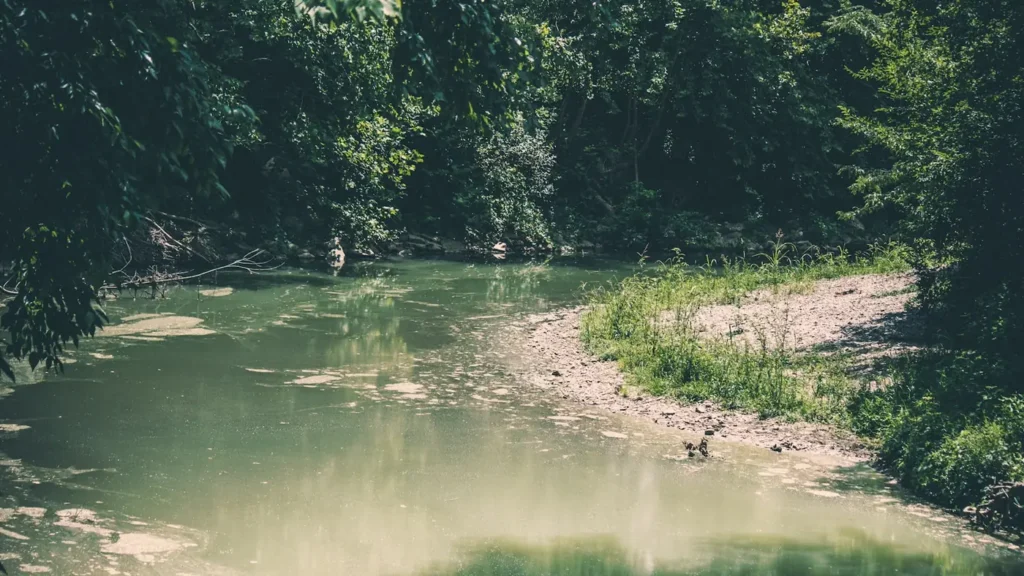
The photo at the top of this page is not Boardman River.
It is a regional stand-in, honestly captioned but generic — we will not put a name to a river we cannot prove. Send us a photograph you took here and it replaces the stand-in, with your credit on it.
Pioneer badgeUnclaimed
Add a photo of this water
Landscape, not fish — the water itself. Reviewed by hand before it appears. The first one published here earns the Pioneer badge.
Fished this water? Add a photo
Reviewed by hand before it appears. Pick the water, not the spot — we never publish exact locations.
Access
Brown Bridge Quiet Area near Mayfield - trail and bank access on the upper river at the former impoundment.
Forks Campground at the confluence of the branches - developed access at the top of the mainstem.
Scheck's Place State Forest Campground - riverside camping and wading access on the upper river.
Shumsky access site off Supply Road - established launch and parking on the middle river.
Beitner Park in Traverse City - lower river access with parking and a canoe launch.
Sabin and Boardman dam sites - restoration-area access below the former impoundments.
Union Street dam area in Traverse City - lower river access for steelhead and salmon runs.
Seasons
Spring: high water and the steelhead run in the lower river, with the upper river settling into good trout fishing by May.
Summer: prime wading months on the upper river, with strong evening hatches and best fishing in the shaded cedar reaches.
Fall: brown trout turn aggressive before the spawn and salmon push up from the bay into the lower river.
Winter: cold and quiet, with limited trout fishing and steelhead holding in the lower river between thaws.
From the water
No logged trips yet. Be the first to put this water on your map.
Log this water
Fished it or cleaned it? Log in or create a free account to log a trip with photos and earn the waterway badge.
Questions
What is the current flow on the Boardman River?
As of Nov 2, 6:15 am, the USGS gauge BOARDMAN R ABOVE BROWN BRIDGE ROAD NR MAYFIELD, MI reads 98 cfs. Conditions update every 15 minutes.
What species can you catch on the Boardman River?
Anglers target Brook Trout, Brown Trout, Rainbow Trout, Steelhead on the Boardman River in Michigan.
Are there fishing guides on the Boardman River?
GuidedFloats lists 2 guides and outfitters on the Boardman River. Claimed profiles accept booking requests; unclaimed profiles are built from public records and link to the business.
Where can you access the Boardman River?
Brown Bridge Quiet Area near Mayfield - trail and bank access on the upper river at the former impoundment. Forks Campground at the confluence of the branches - developed access at the top of the mainstem. Scheck's Place State Forest Campground - riverside camping and wading access on the upper river. Shumsky access site off Supply Road - established launch and parking on the middle river. Beitner Park in Traverse City - lower river access with parking and a canoe launch. Sabin and Boardman dam sites - restoration-area access below the former impoundments. Union Street dam area in Traverse Cit...
When is the best time to fish the Boardman River?
Spring: high water and the steelhead run in the lower river, with the upper river settling into good trout fishing by May. Summer: prime wading months on the upper river, with strong evening hatches and best fishing in the shaded cedar reaches. Fall: brown trout turn aggressive before the spawn and salmon push up from the bay into the lower river. Winter: cold and quiet, with limited trout fishing and steelhead holding in the lower river between thaws.
Where are the fishing regulations for the Boardman River?
Regulations change by season and section. Read the current rules on the Michigan agency site: https://www.michigan.gov/dnr/things-to-do/fishing/fishing-regulations