Fishes Current River, Jacks Fork
River · Ozarks · Missouri
Current River Fishing Guides
Spring-fed Ozark river with stocked rainbows and wild browns from Montauk down through the Akers and Pulltite reaches, floated by canoe and drift boat, with smallmouth bass taking over on the lower river.
Map of the Current River
61 numbered points: 20 access points, 15 campsites, 3 outfitters, 5 bridges, 5 parks and conservation areas, 3 agency offices, 2 regulation section limits, 7 springs, 1 USGS gauge. Tap a marker for details. Reviewed Sep 7, 2026.
- Access / boat ramp (20)
- Campsite (15)
- Outfitter / canoe rental (3)
- Bridge crossing (5)
- Park / conservation area (5)
- Agency / conservation office (3)
- Regulation section limit (2)
- Spring (7)
- USGS gauge (1)
Map data © OpenStreetMap contributors. Points are curated from OpenStreetMap and state agency sources; confirm access and hours before you go.
Print it. Bag it. Bring it.Phones die, screens crack, and most of this water has no signal. Print this map, fold it into a zip-top bag or dry bag with your license, and you have a backup your electronics can’t give you. Every marker is numbered so you can say exactly where you are.
Open the printable mapAll 61 points on this map
| # | Point | Type | Lat, Lon | Notes |
|---|---|---|---|---|
| 1 | Montauk State Park Missouri State Parks · trout park | Park / conservation area | 37.45294, -91.68276 | Headwaters of the Current. Daily trout tag required inside the park; lodge, store and campground loops 1–4. |
| 2 | Montauk Springs | Spring | 37.46054, -91.68336 | The springs that make the Current a year-round trout river. |
| 3 | Montauk Hatchery Missouri Department of Conservation | Agency / conservation office | 37.45488, -91.68545 | MDC hatchery that stocks the park water daily in season. |
| 4 | Montauk State Park Campground Loops 1–4 · reservations | Campsite | 37.45478, -91.67798 | Riverside loops; book through Missouri State Parks. |
| 5 | Blue Ribbon Trout Area — upper limit Lower boundary of Montauk State Park | Regulation section limit | 37.45053, -91.66134 | The Blue Ribbon Trout Area runs 9 miles from here to Cedar Grove Bridge. Special gear and limits apply — check the MDC regulations before you fish. |
| 6 | Tan Vat Access MDC · gravel launch | Access / boat ramp | 37.45053, -91.66134 | First public access below the park; classic put-in for the Blue Ribbon wade and float water. |
| 7 | Baptist Camp Access MDC · gravel launch | Access / boat ramp | 37.43513, -91.65725 | Mid-point of the Blue Ribbon reach; low-water crossing upstream of the ramp. |
| 8 | Cedar Grove Bridge (County Road 651) Low-water bridge | Bridge crossing | 37.42286, -91.60891 | The Blue Ribbon Trout Area ends here and the White Ribbon Trout Area begins, running 7.7 miles downstream to Akers. |
| 9 | Cedar Grove Access NPS · Ozark National Scenic Riverways | Access / boat ramp | 37.42238, -91.60830 | Launch, primitive camping and a spring branch; the usual take-out for the Tan Vat float. |
| 10 | Cedar Grove Conservation Area Missouri Department of Conservation | Park / conservation area | 37.42886, -91.58713 | MDC land on the north bank below Cedar Grove. |
| 11 | Welch Spring | Spring | 37.39413, -91.57390 | Big spring on river left with the ruins of the old Welch hospital; short walk from Welch Landing. |
| 12 | Welch Landing NPS · gravel launch | Access / boat ramp | 37.38543, -91.57334 | Access just below Welch Spring; the spring roughly doubles the flow from here down. |
| 13 | Akers Group Campground NPS · group sites | Campsite | 37.37608, -91.56129 | Group camping on the bluff above Akers. |
| 14 | USGS 07064533 Current River above Akers | USGS gauge | 37.37569, -91.55281 | The gauge behind the live flow on this page. |
| 15 | White Ribbon Trout Area — lower limit Akers Ferry | Regulation section limit | 37.37591, -91.55147 | Trout management ends here; smallmouth and goggle-eye water from Akers down. Check MDC regulations for the reach above. |
| 16 | Akers Ferry Landing NPS · ferry crossing | Access / boat ramp | 37.37447, -91.55489 | Upper and lower landings either side of the cable ferry on Route K/KK. |
| 17 | Akers Ferry Canoe Rental Canoe, kayak and raft rental · store | Outfitter / canoe rental | 37.37574, -91.55300 | Rentals, shuttles, camp store and cabins at the ferry. |
| 18 | Akers Ranger Station National Park Service | Agency / conservation office | 37.37656, -91.55282 | Ozark National Scenic Riverways ranger station at Akers. |
| 19 | Cave Spring | Spring | 37.36348, -91.49588 | Spring that flows out of a cave mouth at river level; paddle in on a calm day. |
| 20 | Pulltite Spring | Spring | 37.33491, -91.49023 | Short trail from Pulltite to the spring and the old cabin. |
| 21 | Pulltite Campground NPS · campground | Campsite | 37.33421, -91.47677 | Drive-in campground with river frontage and group sites. |
| 22 | Pulltite Landing NPS · gravel launch | Access / boat ramp | 37.33424, -91.47612 | Take-out for the Akers–Pulltite float (about 10 miles). |
| 23 | Current River State Park Missouri State Parks | Park / conservation area | 37.32435, -91.42969 | Day-use park on the former Alton Club grounds; river frontage and trails. |
| 24 | Current River State Park Launch Missouri State Parks | Access / boat ramp | 37.32020, -91.43750 | Launch inside the state park. |
| 25 | Echo Bluff State Park Missouri State Parks · lodge | Park / conservation area | 37.30961, -91.40527 | Lodge, cabins and camping on Sinking Creek just above the Current. |
| 26 | Sinking Creek Campground NPS | Campsite | 37.30358, -91.41451 | Campground where Sinking Creek meets the Current. |
| 27 | Round Spring Upper Landing NPS | Access / boat ramp | 37.28704, -91.40987 | Landing above the Highway 19 bridge. |
| 28 | Carr's Canoe Rental Canoe and kayak rental | Outfitter / canoe rental | 37.28759, -91.40911 | Rentals and shuttles at Round Spring. |
| 29 | Highway 19 bridge at Round Spring MO 19 | Bridge crossing | 37.28627, -91.40915 | The main north–south crossing between Salem and Eminence. |
| 30 | Round Spring | Spring | 37.28270, -91.40770 | Deep blue spring in a collapsed cavern; cave tours in season. |
| 31 | Round Spring Ranger Station National Park Service | Agency / conservation office | 37.28032, -91.40971 | Information and permits at Round Spring. |
| 32 | Round Spring Campground NPS · campground | Campsite | 37.27996, -91.40792 | Large drive-in campground with river access. |
| 33 | Round Spring Lower Landing NPS | Access / boat ramp | 37.27993, -91.40437 | Put-in for the Round Spring–Two Rivers float. |
| 34 | Jerktail Landing NPS · gravel road access | Access / boat ramp | 37.22867, -91.30851 | Remote landing about halfway to Two Rivers; primitive camping. |
| 35 | Jerktail Landing Primitive Camping NPS · primitive | Campsite | 37.23045, -91.30976 | No water or hookups. |
| 36 | Broadfoot Campground NPS | Campsite | 37.19638, -91.29559 | Small campground above the Jacks Fork confluence. |
| 37 | Two Rivers Canoe Rental Canoe, kayak and raft rental | Outfitter / canoe rental | 37.18956, -91.27673 | Rentals, shuttles and camping at the Jacks Fork confluence. |
| 38 | Two Rivers Upper Landing NPS | Access / boat ramp | 37.19051, -91.27479 | Just above where the Jacks Fork comes in on river right. |
| 39 | Two Rivers Campground NPS · campground | Campsite | 37.18948, -91.27559 | Campground at the confluence. |
| 40 | Two Rivers Lower Landing NPS | Access / boat ramp | 37.18919, -91.26859 | Below the confluence; the river is noticeably bigger from here. |
| 41 | Highway 106 bridge at Powder Mill MO 106 | Bridge crossing | 37.18553, -91.17863 | Crossing between Eminence and Ellington. |
| 42 | Powder Mill Landing NPS | Access / boat ramp | 37.18175, -91.17527 | Access beside the campground; trailhead for Blue Spring. |
| 43 | Powder Mill Campground NPS | Campsite | 37.18214, -91.17462 | Campground at the Highway 106 crossing. |
| 44 | Blue Spring | Spring | 37.16607, -91.16220 | Missouri's deepest spring, about 300 feet, a short walk from the river. |
| 45 | Roberts Field NPS · primitive | Access / boat ramp | 37.12725, -91.17292 | Gravel-bar access and primitive campsite. |
| 46 | Logyard Campsite NPS · primitive | Campsite | 37.11448, -91.13017 | Primitive camping at Logyard. |
| 47 | Logyard Landing NPS | Access / boat ramp | 37.10842, -91.12124 | Access on the long, quiet reach above Van Buren. |
| 48 | Paint Rock Bluff Access MDC · Current River Conservation Area | Access / boat ramp | 37.12968, -91.06883 | Access below the painted bluff; conservation-area land on the north bank. |
| 49 | Waymer Access NPS | Access / boat ramp | 37.06604, -91.04419 | Access a few miles above Van Buren. |
| 50 | Chilton Creek Campsite NPS · primitive | Campsite | 37.06283, -91.04846 | Primitive site at the Chilton Creek mouth. |
| 51 | Watercress Spring Campground NPS · Van Buren | Campsite | 37.00033, -91.01957 | In-town campground and picnic grounds at Watercress Spring. |
| 52 | Van Buren Landing Public access · Van Buren | Access / boat ramp | 36.99241, -91.01492 | Town access beside the Highway 60 bridge; outfitters, fuel and groceries in town. |
| 53 | Highway 60 bridge at Van Buren US 60 | Bridge crossing | 36.99225, -91.01314 | The four-lane crossing at Van Buren. |
| 54 | Big Spring Campground NPS · campground | Campsite | 36.96321, -90.98112 | Large campground at Big Spring with cabins and picnic areas. |
| 55 | Big Spring Landing NPS | Access / boat ramp | 36.95303, -90.99021 | Landing at the mouth of the spring branch. |
| 56 | Big Spring | Spring | 36.95219, -90.99432 | One of the largest springs in the United States; the river nearly doubles below it. |
| 57 | Gooseneck Campground NPS · primitive | Campsite | 36.81998, -90.94767 | Remote campground on the lower riverways reach. |
| 58 | Bay Nothing Recreation Area Mark Twain National Forest | Access / boat ramp | 36.79561, -90.95549 | Forest Service access below the national riverways boundary. |
| 59 | Deer Leap Recreation Area Mark Twain National Forest | Park / conservation area | 36.67284, -90.88762 | Forest Service campground and river access above Doniphan. |
| 60 | Float Camp Campground Mark Twain National Forest | Campsite | 36.66537, -90.87156 | Forest Service campground with a launch, just above Doniphan. |
| 61 | Highway 160 bridge at Doniphan US 160 / MO 21 / MO 142 | Bridge crossing | 36.61827, -90.83898 | The Doniphan crossing; the river runs on into Arkansas below town. |
Guides on the Current River
Claimed profiles take booking requests. Unclaimed profiles are built from public records so the river is never empty; the guide can claim or remove one any time.
About the Current River
The Current River rises at Montauk Spring in Dent County and runs southeast through the Ozark National Scenic Riverways, gathering Welch, Cave, Pulltite, Round, Blue, and Big Springs along the way. That spring flow is what makes it fishable almost every day of the year: even in late summer the upper river holds steady, cold, and clear, and it rarely blows out for more than a day or two after a storm.
The character changes as you go downstream. From Montauk State Park down through Cedargrove, Akers Ferry, and Pulltite the river is a trout stream, narrow enough to cover from a canoe or a small drift boat, with stocked rainbows near the park and wild browns holding under the root wads and bluff pools farther down. Below Round Spring the water warms and widens and smallmouth bass, goggle-eye, and the occasional walleye take over. Most guided trips run one of the classic day floats: Baptist Camp to Cedargrove, Cedargrove to Akers, Akers to Pulltite, or Pulltite to Round Spring.
Flow matters here more than on most Ozark rivers because the trout water is small. Guides watch the Akers gauge. Under about 200 cfs the upper river is low, slow, and technical, which favors wade anglers and dry flies. From 250 to 500 cfs is the sweet spot for floating with a rod in hand. Above 800 cfs the river is pushy, the color turns, and most guides move clients to the springs or reschedule. The lower river near Van Buren and Big Spring runs several times higher and fishes fine at flows that would be too much up top.
Expect company on summer weekends between Akers and Round Spring. Weekday trips, shoulder-season trips, and early launches get you the river to yourself.
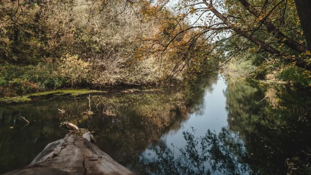
This water needs a real photo
The photo at the top of this page is not Current River.
It is a regional stand-in, honestly captioned but generic — we will not put a name to a river we cannot prove. Send us a photograph you took here and it replaces the stand-in, with your credit on it.
Pioneer badgeUnclaimed
Add a photo of this water
Landscape, not fish — the water itself. Reviewed by hand before it appears. The first one published here earns the Pioneer badge.
Fished this water? Add a photo
Reviewed by hand before it appears. Pick the water, not the spot — we never publish exact locations.
Access
Baptist Camp Access (Dent County): gravel bar launch at the top of the trout water, 7.6 miles above Cedargrove.
Cedargrove Access: concrete ramp and parking, the most common takeout for the upper trout float.
Akers Ferry: NPS access with a ramp, campground, and outfitters; 8 miles below Cedargrove.
Pulltite: NPS access and campground, 10 miles below Akers.
Round Spring: NPS access, 9 miles below Pulltite, where the trout water gives way to smallmouth.
Two Rivers (Jacks Fork confluence), Powder Mill, Log Yard, Van Buren, and Big Spring serve the lower river.
Drift boats launch at Cedargrove, Akers, and Pulltite; canoes and kayaks anywhere.
Seasons
March through May: highest, coolest flows and the best brown trout fishing of the year on the upper river.
June through August: stable spring flow, heavy canoe traffic below Akers, best trips launch early or go midweek.
September and October: low clear water, wade fishing, hopper and terrestrial season, fall colors on the bluffs.
November through February: catch-and-release winter trout season near Montauk, empty river, dress for it.
From the water
No logged trips yet. Be the first to put this water on your map.
Log this water
Fished it or cleaned it? Log in or create a free account to log a trip with photos and earn the waterway badge.
Questions
What is the current flow on the Current River?
As of Oct 18, 5:30 pm, the USGS gauge Current River above Akers, MO reads 143 cfs, the 10th percentile for this date. Conditions update every 15 minutes.
What species can you catch on the Current River?
Anglers target Brown Trout, Rainbow Trout, Shadow Bass, Smallmouth Bass on the Current River in Missouri.
Are there fishing guides on the Current River?
GuidedFloats lists 3 guides and outfitters on the Current River. Claimed profiles accept booking requests; unclaimed profiles are built from public records and link to the business.
Where can you access the Current River?
Baptist Camp Access (Dent County): gravel bar launch at the top of the trout water, 7.6 miles above Cedargrove. Cedargrove Access: concrete ramp and parking, the most common takeout for the upper trout float. Akers Ferry: NPS access with a ramp, campground, and outfitters; 8 miles below Cedargrove. Pulltite: NPS access and campground, 10 miles below Akers. Round Spring: NPS access, 9 miles below Pulltite, where the trout water gives way to smallmouth. Two Rivers (Jacks Fork confluence), Powder Mill, Log Yard, Van Buren, and Big Spring serve the lower river. Drift boats launch at Cedargrove, Ak...
When is the best time to fish the Current River?
March through May: highest, coolest flows and the best brown trout fishing of the year on the upper river. June through August: stable spring flow, heavy canoe traffic below Akers, best trips launch early or go midweek. September and October: low clear water, wade fishing, hopper and terrestrial season, fall colors on the bluffs. November through February: catch-and-release winter trout season near Montauk, empty river, dress for it.
Where are the fishing regulations for the Current River?
Regulations change by season and section. Read the current rules on the Missouri agency site: https://mdc.mo.gov/fishing/regulations