Fishes Gasconade River
River · Ozarks · Missouri
Gasconade River Fishing Guides
Longest river entirely in Missouri, winding through bluff country with smallmouth bass, goggle-eye, catfish and walleye, fished from jon boats and canoes on multi-day floats between Hazelgreen and Jerome.
Map of the Gasconade River
36 numbered points: 10 access points, 2 campsites, 17 bridges, 2 parks and conservation areas, 4 springs, 1 USGS gauge. Tap a marker for details. Reviewed Sep 7, 2026.
- Access / boat ramp (10)
- Campsite (2)
- Bridge crossing (17)
- Park / conservation area (2)
- Spring (4)
- USGS gauge (1)
Map data © OpenStreetMap contributors. Points are curated from OpenStreetMap and state agency sources; confirm access and hours before you go.
Print it. Bag it. Bring it.Phones die, screens crack, and most of this water has no signal. Print this map, fold it into a zip-top bag or dry bag with your license, and you have a backup your electronics can’t give you. Every marker is numbered so you can say exactly where you are.
Open the printable mapAll 36 points on this map
| # | Point | Type | Lat, Lon | Notes |
|---|---|---|---|---|
| 1 | Highway 5 bridge MO 5 | Bridge crossing | 37.20391, -92.53281 | Upper crossing near Hartville; small, seasonal water above here. |
| 2 | Highway 38 bridge MO 38 | Bridge crossing | 37.25623, -92.49441 | Crossing east of Hartville. |
| 3 | Highway E bridge MO E | Bridge crossing | 37.31342, -92.39881 | Crossing above Buzzard Bluff. |
| 4 | Buzzard Bluff Fishing Access Public · no fee | Access / boat ramp | 37.33201, -92.39495 | Bank and wade access on the upper river. |
| 5 | Highway H bridge MO H | Bridge crossing | 37.37140, -92.39204 | Crossing at Competition. |
| 6 | Wilber Allen Memorial State Wildlife Area Missouri Department of Conservation | Park / conservation area | 37.39838, -92.40128 | MDC land on the upper river near Competition. |
| 7 | Highway O bridge MO O | Bridge crossing | 37.48750, -92.40526 | Crossing on the reach toward Falcon. |
| 8 | Highway 32 bridge MO 32 | Bridge crossing | 37.59262, -92.35755 | Crossing between Lebanon and Plato. |
| 9 | Barlow Ford Access County road | Access / boat ramp | 37.72021, -92.36171 | Landing beside Froggy's River Resort. |
| 10 | Gasconade Hills Resort Private · camping and floats | Campsite | 37.75132, -92.39712 | Campground, cabins and canoe rental on the Hazelgreen reach. |
| 11 | Hazelgreen Access MDC · canoe ramp | Access / boat ramp | 37.75938, -92.45251 | Public access at the old Route 66 bridge below I-44. |
| 12 | Interstate 44 bridge at Hazelgreen I-44 / Historic US 66 | Bridge crossing | 37.76009, -92.45267 | The interstate crossing; Historic 66 bridge beside it. |
| 13 | Highway 133 bridge MO 133 | Bridge crossing | 37.79800, -92.40590 | Crossing south of Richland. |
| 14 | Highway 7 bridge MO 7 | Bridge crossing | 37.80067, -92.34151 | Crossing between Richland and Waynesville, with a landing beside it. |
| 15 | Highway 7 Access Public | Access / boat ramp | 37.80088, -92.34091 | Landing at the Highway 7 bridge. |
| 16 | Highway T bridge MO T | Bridge crossing | 37.86715, -92.29165 | Crossing west of Waynesville. |
| 17 | Ruby's Landing Private · fee ramps | Access / boat ramp | 37.86853, -92.26107 | Resort ramps near Waynesville; fee to launch. |
| 18 | Creasy Spring | Spring | 37.84567, -92.25125 | Spring on the Waynesville reach. |
| 19 | Highway 17 bridge at Waynesville MO 17 | Bridge crossing | 37.85099, -92.21430 | The Waynesville crossing; Roubidoux Creek enters just below town. |
| 20 | Riddle Bridge Access MDC | Access / boat ramp | 37.90952, -92.13250 | Public access below Waynesville on the Logan Road bridge. |
| 21 | Mossy Spring | Spring | 37.86749, -92.12469 | Spring below Riddle Bridge. |
| 22 | Veterans Bridge (Highway 28) MO 28 | Bridge crossing | 37.89161, -92.08106 | Crossing north of Fort Leonard Wood with a landing beside it. |
| 23 | Veterans Bridge Access Public | Access / boat ramp | 37.89260, -92.08128 | Landing at the Highway 28 bridge. |
| 24 | Boiling Spring | Spring | 37.88965, -92.03512 | Big spring that wells up beside the river; landing and resort at the spring. |
| 25 | Boiling Spring Access Private resort landing | Access / boat ramp | 37.88816, -92.03683 | Landing at Boiling Spring. |
| 26 | Jerome Access MDC · concrete ramp | Access / boat ramp | 37.92004, -91.97496 | Public ramp at Jerome, the usual take-out for the Waynesville floats. |
| 27 | USGS 06933500 Gasconade River at Jerome | USGS gauge | 37.92992, -91.97733 | The gauge behind the live flow on this page. |
| 28 | Highway D bridge at Jerome MO D | Bridge crossing | 37.91967, -91.97623 | Crossing at Jerome; the BNSF railroad bridge is just below. |
| 29 | Clifty Creek Conservation Area Missouri Department of Conservation | Park / conservation area | 38.03306, -91.97996 | MDC area with the Clifty Creek natural bridge, above the river's east bank. |
| 30 | Highway 63 bridge US 63 / MO 28 | Bridge crossing | 38.14603, -91.88158 | Crossing south of Vienna. |
| 31 | Highway 42 bridge MO 42 | Bridge crossing | 38.18877, -91.90802 | Crossing east of Vienna. |
| 32 | Meyers Spring | Spring | 38.33443, -91.83745 | Spring on the lower river above Mount Sterling. |
| 33 | Highway 89 bridge at Mount Sterling MO 89 | Bridge crossing | 38.38884, -91.82030 | The Mount Sterling crossing. |
| 34 | Belle River Retreat Private · RV and tent camping | Campsite | 38.42151, -91.73722 | Campground with a fee ramp on the lower river. |
| 35 | Highway 50 bridge US 50 | Bridge crossing | 38.46679, -91.62890 | Crossing between Linn and Rosebud. |
| 36 | Fredericksburg Ferry Access MDC · concrete ramp | Access / boat ramp | 38.60282, -91.63354 | Public ramp on the lower river a few miles above the Missouri; primitive camping. |
Guides on the Gasconade River
Claimed profiles take booking requests. Unclaimed profiles are built from public records so the river is never empty; the guide can claim or remove one any time.
About the Gasconade River
The Gasconade is the long one. It starts near Hartville in Wright County and wanders roughly 280 miles to the Missouri River near Hermann, one of the most crooked rivers in the country, and it is a warm-water fishery the entire way. Smallmouth bass are the headline species, with largemouth, goggle-eye, walleye, and flathead and channel catfish sharing the water.
The upper river above the Big Piney confluence at Jerome is the most floated for smallmouth: Hazelgreen, Riddle Bridge, Schlicht Springs, and Jerome frame a series of one-day and two-day floats with gravel bars for camping and enough current to make a drift boat or raft the right tool. Below Jerome the river grows with the Big Piney and Roubidoux Creek and becomes bigger water where jet boats and bass boats appear, and the walleye and catfish fishing picks up toward Mount Sterling and Gasconade.
The Jerome gauge sits just above the Big Piney mouth. Around 400 to 900 cfs is a good floating flow on the upper river; under 300 the riffles get shallow for a loaded drift boat; above 2,000 the river is high and off-color and the smallmouth bite generally shuts down until it starts to fall. The Gasconade takes longer to clear than the Big Piney and the Niangua after a big rain.
Waynesville, St. Robert, and Richland are the supply towns for the upper river. Because the river winds so much, driving between accesses often takes longer than the map suggests, and a two-day float with a gravel bar camp is often easier to plan than two separate one-day trips. Guides who fish the Gasconade tend to specialize in either the upper smallmouth water or the lower walleye and catfish water, so ask which one before you book.
This water needs a real photo
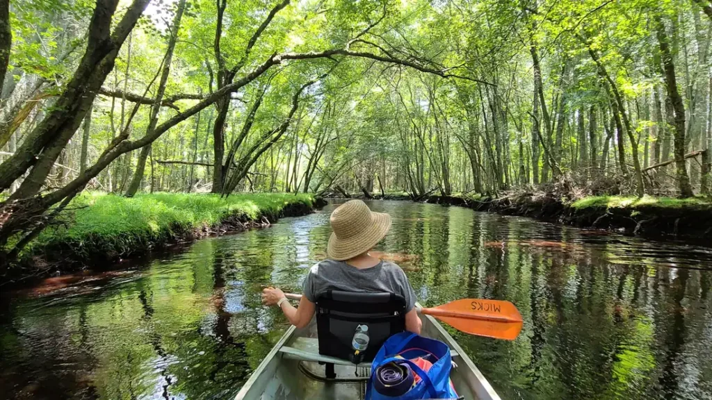
The photo at the top of this page is not Gasconade River.
It is a regional stand-in, honestly captioned but generic — we will not put a name to a river we cannot prove. Send us a photograph you took here and it replaces the stand-in, with your credit on it.
Pioneer badgeUnclaimed
Add a photo of this water
Landscape, not fish — the water itself. Reviewed by hand before it appears. The first one published here earns the Pioneer badge.
Fished this water? Add a photo
Reviewed by hand before it appears. Pick the water, not the spot — we never publish exact locations.
Access
Hazelgreen Access (Interstate 44): MDC ramp at the top of the popular smallmouth floats.
Riddle Bridge and Schlicht Springs: MDC accesses on the upper river.
Jerome Access: MDC ramp near the gauge and the Big Piney confluence, the usual end of the upper floats.
Boiling Springs Access (below Jerome), Rollins Ferry, and Mount Sterling: middle river ramps used by drift and jet boats.
Gasconade and Fredericksburg Ferry: lower river ramps near the Missouri River.
Seasons
April through June: peak smallmouth fishing with good flows, plus walleye on the lower river in early spring.
July and August: warm water, topwater at dawn and dusk, gravel bar camping floats.
September and October: falling flows, clear water, smallmouth bunching in the deeper pools.
Winter: catfish and walleye on the lower river; smallmouth are slow and deep.
From the water
No logged trips yet. Be the first to put this water on your map.
Log this water
Fished it or cleaned it? Log in or create a free account to log a trip with photos and earn the waterway badge.
Questions
What is the current flow on the Gasconade River?
As of Oct 18, 4:45 pm, the USGS gauge Gasconade River at Jerome, MO reads 479 cfs, the 14th percentile for this date. Conditions update every 15 minutes.
What species can you catch on the Gasconade River?
Anglers target Channel Catfish, Largemouth Bass, Rock Bass, Smallmouth Bass, Walleye on the Gasconade River in Missouri.
Are there fishing guides on the Gasconade River?
GuidedFloats lists 1 guide and outfitters on the Gasconade River. Claimed profiles accept booking requests; unclaimed profiles are built from public records and link to the business.
Where can you access the Gasconade River?
Hazelgreen Access (Interstate 44): MDC ramp at the top of the popular smallmouth floats. Riddle Bridge and Schlicht Springs: MDC accesses on the upper river. Jerome Access: MDC ramp near the gauge and the Big Piney confluence, the usual end of the upper floats. Boiling Springs Access (below Jerome), Rollins Ferry, and Mount Sterling: middle river ramps used by drift and jet boats. Gasconade and Fredericksburg Ferry: lower river ramps near the Missouri River.
When is the best time to fish the Gasconade River?
April through June: peak smallmouth fishing with good flows, plus walleye on the lower river in early spring. July and August: warm water, topwater at dawn and dusk, gravel bar camping floats. September and October: falling flows, clear water, smallmouth bunching in the deeper pools. Winter: catfish and walleye on the lower river; smallmouth are slow and deep.
Where are the fishing regulations for the Gasconade River?
Regulations change by season and section. Read the current rules on the Missouri agency site: https://mdc.mo.gov/fishing/regulations