Adamsville Brook Fishing Guides
A small brook in the stone wall farm country of Little Compton, running a few miles to the Westport River estuary in the quietest corner of Rhode Island.
Guides on the Adamsville Brook
Claimed profiles take booking requests. Unclaimed profiles are built from public records so the river is never empty; the guide can claim or remove one any time.
No guides listed yet
Guide or outfit this water? Create your profile. Listing is free, the commission is 10% or 7% with a premium profile, and premium profiles list first on this water.
About the Adamsville Brook
Adamsville Brook drains a few square miles of the farm country in Little Compton, the peninsula at the southeastern corner of Rhode Island that sits apart from the rest of the state and reaches the mainland only through Massachusetts. The brook is small, running through pasture, stone wall and patches of woodland before crossing into Massachusetts at the village of Adamsville and reaching the east branch of the Westport River a short distance below. It is the kind of stream that most anglers drive past without noticing, and it is worth noticing chiefly because of where it is and what it connects to.
Little Compton has escaped the development that reshaped most of coastal southern New England, and the watershed remains largely agricultural with intact riparian woodland along much of the channel. The brook carries brook trout in the cooler upper reaches, along with the usual small stream community of creek chub, blacknose dace and white sucker. The slower lower water and the small ponds on the system hold chain pickerel, largemouth bass and bluegill. American eel are common and have good access from the estuary below, which is the most significant thing about the brook biologically.
That connection to the Westport River is what gives the stream more importance than its size suggests. The Westport estuary is a productive system with a serious striped bass fishery and an active shellfishery, and the small tributaries feeding it carry a disproportionate share of the responsibility for its water quality. The gauge reports discharge and stage, and it has one of the longer continuous records of any small coastal stream in Rhode Island, which makes it a reference point for the whole southeastern corner of the state. For an angler the practical value is the summer baseline: when it falls away the trout have withdrawn to a handful of shaded pools and the brook is best left alone until the autumn rain returns.
This water needs a real photo
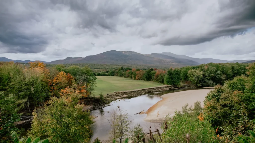
The photo at the top of this page is not Adamsville Brook.
It is a regional stand-in, honestly captioned but generic — we will not put a name to a river we cannot prove. Send us a photograph you took here and it replaces the stand-in, with your credit on it.
Add a photo of this water
Landscape, not fish — the water itself. Reviewed by hand before it appears. The first one published here earns the Pioneer badge.
Fished this water? Add a photo
Reviewed by hand before it appears. Pick the water, not the spot — we never publish exact locations.
Access
Adamsville - the village at the state line, the gauge reference point and the nearest settlement.
Little Compton - the town covering the watershed, with quiet roads and limited services.
Westport River - the estuary downstream in Massachusetts, with striped bass and boat access.
Tiverton - the town north, with the nearest tackle and the route back toward Newport.
Sakonnet Point - the southern tip of the peninsula, with saltwater fishing and harbour access.
Newport - half an hour west across the bridges, with the fullest range of services in the area.
Fall River - the city north in Massachusetts, the nearest larger centre for supplies.
Seasons
Spring: the highest flows of the year and the best distribution of trout through the accessible reaches.
Summer: the brook drops low and warm, and the fishing retreats to the shaded upper water and the ponds.
Fall: rain restores the flow and the brook trout become active again ahead of spawning.
Winter: cold and quiet, with the stream largely unfished and ice forming in the slower reaches.
From the water
No logged trips yet. Be the first to put this water on your map.
Log this water
Fished it or cleaned it? Log in or create a free account to log a trip with photos and earn the waterway badge.
Questions
What is the current flow on the Adamsville Brook?
As of Oct 18, 4:30 pm, the USGS gauge ADAMSVILLE BROOK AT ADAMSVILLE, RI reads 28 cfs. Conditions update every 15 minutes.
What species can you catch on the Adamsville Brook?
Anglers target American Eel, Blacknose Dace, Bluegill, Brook Trout, Chain Pickerel, Creek Chub, Largemouth Bass, White Sucker on the Adamsville Brook in Rhode Island.
Where can you access the Adamsville Brook?
Adamsville - the village at the state line, the gauge reference point and the nearest settlement. Little Compton - the town covering the watershed, with quiet roads and limited services. Westport River - the estuary downstream in Massachusetts, with striped bass and boat access. Tiverton - the town north, with the nearest tackle and the route back toward Newport. Sakonnet Point - the southern tip of the peninsula, with saltwater fishing and harbour access. Newport - half an hour west across the bridges, with the fullest range of services in the area. Fall River - the city north in Massachusett...
When is the best time to fish the Adamsville Brook?
Spring: the highest flows of the year and the best distribution of trout through the accessible reaches. Summer: the brook drops low and warm, and the fishing retreats to the shaded upper water and the ponds. Fall: rain restores the flow and the brook trout become active again ahead of spawning. Winter: cold and quiet, with the stream largely unfished and ice forming in the slower reaches.
Where are the fishing regulations for the Adamsville Brook?
Regulations change by season and section. Read the current rules on the Rhode Island agency site: https://dem.ri.gov/natural-resources-bureau/fish-wildlife/freshwater-fishing/rules-regulations