Usquepaug River Fishing Guides
The lower name of Rhode Island's Queen River, a thirty-six square mile coastal-plain stream carrying wild brook trout above and a mixed warmwater fishery below.
Guides on the Usquepaug River
Claimed profiles take booking requests. Unclaimed profiles are built from public records so the river is never empty; the guide can claim or remove one any time.
No guides listed yet
Guide or outfit this water? Create your profile. Listing is free, the commission is 10% or 7% with a premium profile, and premium profiles list first on this water.
About the Usquepaug River
The Usquepaug River is what the Queen River becomes below the village of Usquepaug, and the two names describe one continuous stream draining about thirty-six square miles of southern Rhode Island before it joins the Pawcatuck system above Worden Pond. The name change confuses visitors regularly, and it is worth knowing that guidance written about the Queen River applies to the same water. The gauge near Usquepaug reads discharge and stage, and on a stream this small the flow number is the difference between a good day and a wasted drive.
The character is coastal plain rather than upland. Gradient is gentle, the bottom is sand and gravel with stretches of soft organic material, and the stream runs through a mixture of swamp maple, alder and second-growth woodland with sections of open meadow. Groundwater input keeps the upper water notably cool for southern New England, which is why trout persist here at all in a state where most streams warm past their tolerance by July. Cover is undercut bank, fallen timber and overhanging brush, and the casting room reflects that.
Wild brook trout hold in the coolest upper reaches and are the reason serious anglers come. Brown and rainbow trout are stocked and carry over in places. Lower down the water warms and chain pickerel, largemouth bass, fallfish and white sucker take over, with American eel throughout the system. The stream is small enough that a careful angler can fish a productive mile in an afternoon, and heavy-handed wading will spoil a pool for the rest of the day. Approaching from downstream and keeping low is the difference between fish and none.
Rhode Island manages parts of this drainage under special regulations that differ from the statewide rules, and checking them before fishing is not optional.
This water needs a real photo
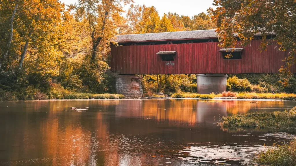
The photo at the top of this page is not Usquepaug River.
It is a regional stand-in, honestly captioned but generic — we will not put a name to a river we cannot prove. Send us a photograph you took here and it replaces the stand-in, with your credit on it.
Add a photo of this water
Landscape, not fish — the water itself. Reviewed by hand before it appears. The first one published here earns the Pioneer badge.
Fished this water? Add a photo
Reviewed by hand before it appears. Pick the water, not the spot — we never publish exact locations.
Access
Usquepaug - the village at the gauge, the usual reference point for access.
Queen River - the same stream above the village, where the wild brook trout water lies.
Richmond and South Kingstown - the towns the river runs through, with road crossings and local access.
Great Swamp Management Area - a large state property nearby with public access and parking.
Worden Pond - the large shallow pond the system drains into, with a warmwater fishery and a ramp.
Wood River - the better-known neighbouring Rhode Island trout water a short drive west.
Wakefield - the nearest town of size, with tackle, food and lodging.
Seasons
Spring: the best of the year, with high cool flows, stocked fish spread through the system and wild trout feeding freely.
Summer: the upper spring-influenced water holds trout while the lower river warms and turns to pickerel and bass.
Fall: cooling water brings trout back into play and brook trout colour up for spawning.
Winter: flows run high and cold, fishing is slow, and the lower warmwater reaches are the more realistic option.
From the water
No logged trips yet. Be the first to put this water on your map.
Log this water
Fished it or cleaned it? Log in or create a free account to log a trip with photos and earn the waterway badge.
Questions
What is the current flow on the Usquepaug River?
As of Oct 18, 4:45 pm, the USGS gauge Usquepaug River Near Usquepaug, RI reads 98 cfs. Conditions update every 15 minutes.
What species can you catch on the Usquepaug River?
Anglers target American Eel, Brook Trout, Brown Trout, Chain Pickerel, Fallfish, Largemouth Bass, Rainbow Trout, White Sucker on the Usquepaug River in Rhode Island.
Where can you access the Usquepaug River?
Usquepaug - the village at the gauge, the usual reference point for access. Queen River - the same stream above the village, where the wild brook trout water lies. Richmond and South Kingstown - the towns the river runs through, with road crossings and local access. Great Swamp Management Area - a large state property nearby with public access and parking. Worden Pond - the large shallow pond the system drains into, with a warmwater fishery and a ramp. Wood River - the better-known neighbouring Rhode Island trout water a short drive west. Wakefield - the nearest town of size, with tackle, food...
When is the best time to fish the Usquepaug River?
Spring: the best of the year, with high cool flows, stocked fish spread through the system and wild trout feeding freely. Summer: the upper spring-influenced water holds trout while the lower river warms and turns to pickerel and bass. Fall: cooling water brings trout back into play and brook trout colour up for spawning. Winter: flows run high and cold, fishing is slow, and the lower warmwater reaches are the more realistic option.
Where are the fishing regulations for the Usquepaug River?
Regulations change by season and section. Read the current rules on the Rhode Island agency site: https://dem.ri.gov/natural-resources-bureau/fish-wildlife/freshwater-fishing/rules-regulations