Pawcatuck River Fishing Guides
The river that drains Rhode Island south country to the sea at Westerly, a mixed trout and warmwater float with sea-run fish and river herring in the lower reaches.
Map of the Pawcatuck River
33 numbered points: 2 access points, 1 bait & fly shop, 13 bridges, 13 parks and conservation areas, 3 hazards, 1 USGS gauge. Tap a marker for details. Reviewed Sep 26, 2026.
- Access / boat ramp (2)
- Bait, tackle & fly shop (1)
- Bridge crossing (13)
- Park / conservation area (13)
- Dam / hazard (3)
- USGS gauge (1)
Print it. Bag it. Bring it.Phones die, screens crack, and most of this water has no signal. Print this map, fold it into a zip-top bag or dry bag with your license, and you have a backup your electronics can’t give you. Every marker is numbered so you can say exactly where you are.
Open the printable mapAll 33 points on this map
| # | Point | Type | Lat, Lon | Notes |
|---|---|---|---|---|
| 1 | Biscuit City Road Richmond | Bridge crossing | 41.44968, -71.61573 | Crossing near the head of the mapped reach. RI DEM lists Biscuit City Landing on the Pawcatuck at this road, but the launch point itself is not mapped in OSM and is not placed here. |
| 2 | South County Trail RI 2, Richmond | Bridge crossing | 41.44602, -71.62127 | Route 2 crossing above Shannock. |
| 3 | Sherman Avenue Shannock, Richmond | Bridge crossing | 41.44520, -71.62691 | Village crossing above Horseshoe Falls. |
| 4 | Horseshoe Falls Dam Shannock, Richmond | Dam / hazard | 41.44766, -71.63635 | Horseshoe-shaped dam and fishway at Shannock village. Two road crossings, Shannock Road and Shannock Village Road, stand within 40 m and are folded into this point. |
| 5 | Old Shannock Road Richmond | Bridge crossing | 41.44816, -71.64471 | Crossing below Shannock village. |
| 6 | Carolina Pond Dam Carolina, Richmond | Dam / hazard | 41.45883, -71.66344 | Dam at Carolina village, with the Route 112 crossing 6 m away and folded into this point. |
| 7 | Carolina Management Area RI DEM state management area | Park / conservation area | 41.46506, -71.68480 | State land north of the river at Carolina, about 1.1 km back from the bank. |
| 8 | Alton Carolina Road RI 91, Richmond | Bridge crossing | 41.44555, -71.68118 | Route 91 crossing just below the Wood River confluence. |
| 9 | Francis C. Carter Preserve The Nature Conservancy, Charlestown | Park / conservation area | 41.43656, -71.67482 | Large preserve on the south side, about 0.8 km off the river, with trails running toward the bank. |
| 10 | Kings Factory Road Charlestown and Hopkinton line | Bridge crossing | 41.43287, -71.69411 | Quiet crossing on the middle river. |
| 11 | Burdickville Road Charlestown | Bridge crossing | 41.41623, -71.72895 | Crossing at Burdickville. |
| 12 | How Davey Preserve The Nature Conservancy, Charlestown | Park / conservation area | 41.41188, -71.73143 | Riverside preserve on the south bank at Burdickville. |
| 13 | Bradford Boat Launch and Fishing Area Bradford, Westerly | Access / boat ramp | 41.40519, -71.74754 | The main public launch on the lower river, listed by RI DEM as Bradford Landing; car-top and trailer use, with bank fishing alongside. |
| 14 | Alton Bradford Road RI 91 and RI 216, Bradford | Bridge crossing | 41.40748, -71.74834 | The crossing at the Bradford launch. |
| 15 | Grills Preserve Hopkinton and Westerly land trusts | Park / conservation area | 41.40218, -71.76942 | Two adjoining parcels of the same name, one held by the Hopkinton Land Trust and one by the Westerly Land Trust, running along the north bank; mapped here as one point. |
| 16 | Newton Swamp Management Area RI DEM state management area | Park / conservation area | 41.38176, -71.77466 | State land south of the river between Bradford and Ashaway. |
| 17 | Route 3 bridge at Ashaway Main Street, Hopkinton | Bridge crossing | 41.39930, -71.79984 | The Ashaway crossing, mapped in OSM as two adjoining ways and shown here once. |
| 18 | Potter Hill Dam Potter Hill, Westerly | Dam / hazard | 41.41343, -71.79785 | Mill dam on the lower river; the Potter Hill Road crossing stands 60 m away and is folded into this point. State rules use this dam as a reference feature for the reach below it. |
| 19 | Westerly Town Forest Town of Westerly | Park / conservation area | 41.41322, -71.81237 | Town woodland on the north side above Boom Bridge. |
| 20 | Boom Bridge Road Westerly | Bridge crossing | 41.41757, -71.82350 | Crossing at the old log boom site; OSM carries two spellings of the road name for one bridge. |
| 21 | Bridge Road Westerly and North Stonington | Bridge crossing | 41.39754, -71.84201 | Crossing on the Rhode Island and Connecticut state line reach. |
| 22 | Bushel Sposato Park Town of Westerly | Park / conservation area | 41.38596, -71.82976 | Riverside town park above Westerly centre. |
| 23 | Stillman Avenue Westerly | Bridge crossing | 41.38528, -71.83300 | Crossing into downtown Westerly. |
| 24 | Wilcox Park Town of Westerly | Park / conservation area | 41.37836, -71.82839 | Westerly's main public park, a short walk from the downtown crossings. |
| 25 | Main Street bridge, Westerly US 1, Westerly and Pawcatuck | Bridge crossing | 41.37770, -71.83130 | The US 1 crossing between Westerly and Pawcatuck. Rhode Island's rules place the freshwater and saltwater jurisdiction line on the downstream side of this bridge. OSM maps the crossing as three ways; it is shown here once. |
| 26 | Donahue Park Town of Westerly | Park / conservation area | 41.37709, -71.83248 | Riverside park immediately below the Main Street bridge. |
| 27 | Boat ramp, Main Street, Westerly Concrete slab ramp | Access / boat ramp | 41.37514, -71.83178 | Mapped in OSM only as Boat Launch. RI DEM lists a concrete slab ramp on Main Street in Westerly, and this is the ramp the Main Street tackle shop describes as sitting behind it. |
| 28 | Watch Hill Outfitters 157 Main Street, Westerly | Bait, tackle & fly shop | 41.37215, -71.83112 | Bait and tackle shop that also rents kayaks and sells licences, by the Main Street ramp. Placed on its mapped street address. Trading hours could not be confirmed for 2026, so ring ahead. |
| 29 | Margin Street Knoll Town of Westerly | Park / conservation area | 41.36888, -71.83266 | Small open space on the west bank below downtown. |
| 30 | Kimball Park Town of Westerly | Park / conservation area | 41.36603, -71.83493 | Town park on the tidal reach below Westerly. |
| 31 | Pawcatuck River State Wildlife Management Area Connecticut bank, Stonington | Park / conservation area | 41.34912, -71.83435 | State wildlife land on the Connecticut side of the lower river. |
| 32 | Parker Brothers Preserve Avalonia Land Conservancy, Connecticut bank | Park / conservation area | 41.33833, -71.83854 | Land trust preserve on the Connecticut side of the tidal reach. |
| 33 | USGS gauge 01118500, Pawcatuck River at Westerly Real-time stage and discharge | USGS gauge | 41.38528, -71.83306 | The gauge this water page links to; coordinates taken from the site roster rather than typed by hand. |
Guides on the Pawcatuck River
Claimed profiles take booking requests. Unclaimed profiles are built from public records so the river is never empty; the guide can claim or remove one any time.
No guides listed yet
Guide or outfit this water? Create your profile. Listing is free, the commission is 10% or 7% with a premium profile, and premium profiles list first on this water.
About the Pawcatuck River
The Pawcatuck runs from Worden Pond in the Great Swamp down through Kenyon, Shannock, Bradford and Westerly to Little Narragansett Bay, forming part of the Rhode Island and Connecticut border along the way. It is the main stem of the whole South County drainage, taking in the Wood, the Usquepaug and the Beaver, and it changes character completely from top to bottom: slow swamp water at the head, a set of dam pools and rocky drops in the middle, and a tidal river at Westerly.
The fishing changes with it. The middle reaches around Shannock and Bradford hold stocked and holdover trout in the cooler water, along with a solid smallmouth population on the rock. The slower upper river and pond outlets are largemouth and chain pickerel water, and the whole river carries river herring in spring. Substantial dam removals and fishways over the last decade reopened the river to migratory fish, and American shad and herring runs have returned, with striped bass following them into the lower river. It is a good paddling river, easy to float with several short trips between dams.
The Westerly gauge reads the whole basin at the bottom, so it responds to rain across all of South County. Moderate readings are comfortable paddling and wading; high spring water makes the dam drops pushy and colors the river; late-summer lows warm the middle reaches and push trout into the cold spring seeps and the mouths of tributaries like the Wood. Tide matters below Westerly, not flow.
Westerly, Bradford, Shannock and Wood River Junction give access, and the whole corridor is within a short drive of the Rhode Island beaches.
This water needs a real photo
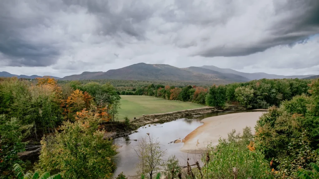
The photo at the top of this page is not Pawcatuck River.
It is a regional stand-in, honestly captioned but generic — we will not put a name to a river we cannot prove. Send us a photograph you took here and it replaces the stand-in, with your credit on it.
Add a photo of this water
Landscape, not fish — the water itself. Reviewed by hand before it appears. The first one published here earns the Pioneer badge.
Fished this water? Add a photo
Reviewed by hand before it appears. Pick the water, not the spot — we never publish exact locations.
Access
Westerly: town access at the gauge and the head of tide.
Bradford: dam pool and put-in for the lower float.
Shannock and the Horseshoe Falls fishway: middle river access.
Kenyon: quiet middle-river paddling access.
Wood River Junction: the Wood River confluence.
Carolina and the Great Swamp: upper river and Worden Pond.
Little Narragansett Bay: the tidal mouth and striped bass water.
Seasons
March and April: herring and shad enter the river; high water and stocked trout.
May and June: the best all-around month, trout in the cool water and smallmouth waking up.
July and August: warm middle river, smallmouth and bass fishing, trout only in the cold seams.
September through November: striped bass in the lower river and good smallmouth fishing above.
From the water
No logged trips yet. Be the first to put this water on your map.
Log this water
Fished it or cleaned it? Log in or create a free account to log a trip with photos and earn the waterway badge.
Questions
What is the current flow on the Pawcatuck River?
As of Oct 19, 3:00 am, the USGS gauge PAWCATUCK RIVER AT WESTERLY, RI reads 579 cfs, the 82nd percentile for this date. Conditions update every 15 minutes.
What species can you catch on the Pawcatuck River?
Anglers target American Shad, Brown Trout, Chain Pickerel, Largemouth Bass, Rainbow Trout, Smallmouth Bass, Striped Bass on the Pawcatuck River in Rhode Island.
Where can you access the Pawcatuck River?
Westerly: town access at the gauge and the head of tide. Bradford: dam pool and put-in for the lower float. Shannock and the Horseshoe Falls fishway: middle river access. Kenyon: quiet middle-river paddling access. Wood River Junction: the Wood River confluence. Carolina and the Great Swamp: upper river and Worden Pond. Little Narragansett Bay: the tidal mouth and striped bass water.
When is the best time to fish the Pawcatuck River?
March and April: herring and shad enter the river; high water and stocked trout. May and June: the best all-around month, trout in the cool water and smallmouth waking up. July and August: warm middle river, smallmouth and bass fishing, trout only in the cold seams. September through November: striped bass in the lower river and good smallmouth fishing above.
Where are the fishing regulations for the Pawcatuck River?
Regulations change by season and section. Read the current rules on the Rhode Island agency site: https://dem.ri.gov/natural-resources-bureau/fish-wildlife/freshwater-fishing/rules-regulations