Fishes Wood River
River · South County · Rhode Island
Wood River Fishing Guides
Rhode Island best trout stream, a small cedar-lined river through the Arcadia Management Area with wild brook trout and thousands of acres of public land around it.
Map of the Wood River
26 numbered points: 1 access point, 12 bridges, 6 parks and conservation areas, 1 regulation section limit, 5 hazards, 1 USGS gauge. Tap a marker for details. Reviewed Sep 26, 2026.
- Access / boat ramp (1)
- Bridge crossing (12)
- Park / conservation area (6)
- Regulation section limit (1)
- Dam / hazard (5)
- USGS gauge (1)
Map data © OpenStreetMap contributors. Points are curated from OpenStreetMap and state agency sources; confirm access and hours before you go.
Print it. Bag it. Bring it.Phones die, screens crack, and most of this water has no signal. Print this map, fold it into a zip-top bag or dry bag with your license, and you have a backup your electronics can’t give you. Every marker is numbered so you can say exactly where you are.
Open the printable mapAll 26 points on this map
| # | Point | Type | Lat, Lon | Notes |
|---|---|---|---|---|
| 1 | Pharisee Rock Trail footbridge Exeter, upper Wood River | Bridge crossing | 41.65386, -71.83334 | Trail footbridge near the head of the mapped reach, where the river is a small brook. |
| 2 | Cedar Swamp Road Exeter | Bridge crossing | 41.65207, -71.82907 | First road crossing on the upper river. |
| 3 | Bailey Pond Road Exeter, unpaved track crossing | Bridge crossing | 41.63123, -71.79703 | Track crossing inside the Arcadia block; passable on foot, not a place to leave a vehicle. |
| 4 | Wood River Barrens The Nature Conservancy preserve | Park / conservation area | 41.61344, -71.78752 | Pitch pine and scrub oak barrens preserve on the west side of the river, about 1 km back from the bank. |
| 5 | Falls River Road Exeter, Arcadia Management Area | Bridge crossing | 41.61267, -71.76051 | Crossing at Stepstone Falls; the parking pull-off here is the usual walk-in for the falls. |
| 6 | Stepstone Falls Arcadia Management Area, Exeter | Dam / hazard | 41.61222, -71.76018 | Ledge falls and stair-step drops, the best known feature on the upper river. A trail footbridge crosses within 25 m of the falls and is folded into this point rather than mapped separately. |
| 7 | Tanner Washout footbridge Ben Utter Trail, Arcadia Management Area | Bridge crossing | 41.59934, -71.74782 | Foot crossing on the trail along the west bank; a second span of the same name sits 40 m downstream and is not repeated. |
| 8 | Plain Road Exeter, unpaved track crossing | Bridge crossing | 41.59818, -71.74588 | Track crossing in Arcadia, useful as a landmark rather than as an access. |
| 9 | North South Trail crossing Arcadia Management Area | Bridge crossing | 41.58008, -71.72101 | Where the state long-distance North South Trail crosses the river; a second span of the same name lies 140 m away. |
| 10 | Arcadia Management Area RI DEM state management area | Park / conservation area | 41.57824, -71.72105 | The largest block of state land in Rhode Island and the reason most of the upper Wood is walkable; it wraps both banks through Exeter, Richmond and Hopkinton. |
| 11 | Special regulation reach, upper limit at Route 165 Ten Rod Road, RI 165 bridge, Exeter | Regulation section limit | 41.57410, -71.72062 | Upstream boundary of the reach the state regulates separately; the downstream boundary is Barberville Dam at Arcadia Road. Check the current Rhode Island freshwater rules for what applies inside it. |
| 12 | Audubon Society of Rhode Island land Riverside parcels, Hopkinton | Park / conservation area | 41.53614, -71.69536 | Three adjoining Audubon Society of Rhode Island parcels line this stretch. OSM carries all three under one misspelled name and does not name the individual preserve, so they ship as a single point. |
| 13 | Barberville Pond Dam Arcadia Road, Barberville, Hopkinton | Dam / hazard | 41.54064, -71.69606 | Dam at the Arcadia Road bridge, which stands 12 m away and is folded into this point. It is also the downstream boundary of the separately regulated reach whose upper limit is the Route 165 bridge. |
| 14 | Skunk Hill Road Richmond | Bridge crossing | 41.52245, -71.69177 | Road crossing just above Hope Valley village. |
| 15 | Nooseneck Hill Road RI 3, Hope Valley | Bridge crossing | 41.52112, -71.69156 | Route 3 crossing 140 m below the Skunk Hill Road bridge. |
| 16 | Wyoming Pond Upper Dam Richmond and Hopkinton town line | Dam / hazard | 41.51595, -71.70322 | Dam at the head of Wyoming Pond; the Bridge Street crossing sits 25 m away and is folded into this point. |
| 17 | Main Street bridge, Wyoming RI 3 and RI 138, Richmond | Bridge crossing | 41.51427, -71.70503 | The village crossing at Wyoming, and the nearest bridge to the USGS gauge. |
| 18 | Joseph Langworthy Memorial Park Hopkinton village park | Park / conservation area | 41.51001, -71.71501 | Small riverside park at Wyoming, about 0.3 km off the bank. |
| 19 | Depot Square Park Hope Valley | Park / conservation area | 41.50695, -71.71651 | Village green at Hope Valley, the nearest public ground to the Hope Valley Road access. |
| 20 | North Switch Road Hopkinton | Bridge crossing | 41.50281, -71.71623 | Crossing below Hope Valley. |
| 21 | Switch Road Hopkinton | Bridge crossing | 41.49136, -71.71536 | Crossing about 1.3 km below North Switch Road, close to the gauge reach. |
| 22 | Black Farm Management Area RI DEM state management area | Park / conservation area | 41.47808, -71.72171 | State land on the west bank through Hopkinton, with foot trails down to the river. |
| 23 | Woodville Pond Dam Woodville Road, Hopkinton | Dam / hazard | 41.46010, -71.71951 | Dam at the Woodville Road bridge, which stands 7 m away and is folded into this point. |
| 24 | Alton Pond Dam Alton, Hopkinton | Dam / hazard | 41.43780, -71.72173 | The last dam on the Wood, immediately above the Pawcatuck confluence. |
| 25 | N.S. Lewis Canoe Launch Alton, Hopkinton | Access / boat ramp | 41.43804, -71.72236 | Car-top launch at Alton beside the Church Street crossing, which sits 6 m away. RI DEM lists Alton Landing here, serving both the Wood River and Alton Pond, with no motors. |
| 26 | USGS gauge 01118000, Wood River at Hope Valley Real-time stage and discharge | USGS gauge | 41.49816, -71.71646 | The gauge this water page links to; coordinates taken from the site roster rather than typed by hand. |
Guides on the Wood River
Claimed profiles take booking requests. Unclaimed profiles are built from public records so the river is never empty; the guide can claim or remove one any time.
About the Wood River
The Wood River runs about twenty-five miles through southwestern Rhode Island, from the headwaters near Sterling down through the Arcadia Management Area and Hope Valley to its junction with the Pawcatuck at Alton. Almost all of the upper and middle river runs through state land, which is remarkable in a state this small, and it means an angler can fish for miles without leaving public ground.
It is a small, cold, tea-stained stream running over sand and gravel between white cedar and hemlock, and it holds wild brook trout, which is the reason it matters. Stocked brown and rainbow trout are added and hold over well in the deeper reaches, and the lower river toward the Pawcatuck warms and picks up largemouth bass and chain pickerel. There are fly-fishing-only and catch-and-release areas on the river; check the current regulations because these designations are specific and change.
The Hope Valley gauge is the reference for the middle river. This is a small stream and the readings are correspondingly small, but the trend matters: spring water is high and pushy enough to make the brushy reaches hard to fish, early summer is ideal, and by August the river is low and warm enough that trout stack in the coldest spring-fed pockets and ethical anglers fish early or move on. Wading is easy, but casting room is not, and short rods earn their keep here.
Hope Valley, Wyoming and Arcadia are the access points, and Providence is under an hour away. The Falls River and Roaring Brook tributaries hold wild fish and are worth exploring.
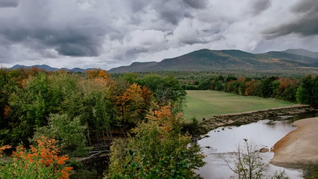
This water needs a real photo
The photo at the top of this page is not Wood River.
It is a regional stand-in, honestly captioned but generic — we will not put a name to a river we cannot prove. Send us a photograph you took here and it replaces the stand-in, with your credit on it.
Pioneer badgeUnclaimed
Add a photo of this water
Landscape, not fish — the water itself. Reviewed by hand before it appears. The first one published here earns the Pioneer badge.
Fished this water? Add a photo
Reviewed by hand before it appears. Pick the water, not the spot — we never publish exact locations.
Access
Arcadia Management Area: thousands of acres of public land along the upper and middle river.
Barberville Dam and the fish ladder: a classic access point with parking.
Wyoming and the Route 138 area: middle river access.
Hope Valley: access at the gauge reach.
Woodville and Alton: lower river and the Pawcatuck junction.
Frying Pan Pond and Wood River Junction: quiet lower reaches.
Falls River and Roaring Brook: cold tributaries with wild brook trout.
Seasons
April and May: stocking, high water and the busiest weeks of the year.
June: the best month, warm air, cool water and manageable flows.
July and August: low and warm; fish early, seek out spring-fed pockets or fish the tributaries.
September through November: cooling water, wild brook trout in spawning color and very little pressure.
From the water
No logged trips yet. Be the first to put this water on your map.
Log this water
Fished it or cleaned it? Log in or create a free account to log a trip with photos and earn the waterway badge.
Questions
What is the current flow on the Wood River?
As of Oct 19, 2:15 am, the USGS gauge WOOD RIVER AT HOPE VALLEY, RI reads 144 cfs, the 80th percentile for this date. Conditions update every 15 minutes.
What species can you catch on the Wood River?
Anglers target Brook Trout, Brown Trout, Chain Pickerel, Largemouth Bass, Rainbow Trout on the Wood River in Rhode Island.
Are there fishing guides on the Wood River?
GuidedFloats lists 1 guide and outfitters on the Wood River. Claimed profiles accept booking requests; unclaimed profiles are built from public records and link to the business.
Where can you access the Wood River?
Arcadia Management Area: thousands of acres of public land along the upper and middle river. Barberville Dam and the fish ladder: a classic access point with parking. Wyoming and the Route 138 area: middle river access. Hope Valley: access at the gauge reach. Woodville and Alton: lower river and the Pawcatuck junction. Frying Pan Pond and Wood River Junction: quiet lower reaches. Falls River and Roaring Brook: cold tributaries with wild brook trout.
When is the best time to fish the Wood River?
April and May: stocking, high water and the busiest weeks of the year. June: the best month, warm air, cool water and manageable flows. July and August: low and warm; fish early, seek out spring-fed pockets or fish the tributaries. September through November: cooling water, wild brook trout in spawning color and very little pressure.
Where are the fishing regulations for the Wood River?
Regulations change by season and section. Read the current rules on the Rhode Island agency site: https://dem.ri.gov/natural-resources-bureau/fish-wildlife/freshwater-fishing/rules-regulations