Fishes Otter Creek, White River (Vermont)
Creek · Champlain Valley · Vermont
Otter Creek Fishing Guides
The longest river in Vermont, a slow Champlain Valley waterway that fishes for big northern pike and smallmouth far more than it does for trout.
Map of the Otter Creek
53 numbered points: 10 access points, 2 campsites, 2 bait & fly shops, 23 bridges, 6 parks and conservation areas, 3 regulation section limits, 6 hazards, 1 USGS gauge. Tap a marker for details. Reviewed Sep 26, 2026.
- Access / boat ramp (10)
- Campsite (2)
- Bait, tackle & fly shop (2)
- Bridge crossing (23)
- Park / conservation area (6)
- Regulation section limit (3)
- Dam / hazard (6)
- USGS gauge (1)
Map data © OpenStreetMap contributors. Points are curated from OpenStreetMap and state agency sources; confirm access and hours before you go.
Print it. Bag it. Bring it.Phones die, screens crack, and most of this water has no signal. Print this map, fold it into a zip-top bag or dry bag with your license, and you have a backup your electronics can’t give you. Every marker is numbered so you can say exactly where you are.
Open the printable mapAll 53 points on this map
| # | Point | Type | Lat, Lon | Notes |
|---|---|---|---|---|
| 1 | Emerald Lake State Park Vermont State Parks | Campsite | 43.28117, -73.00486 | Campground at the headwater lake. |
| 2 | Otter Creek - Neilson Parcel Vermont F and W, Mount Tabor | Access / boat ramp | 43.32690, -72.99120 | Steps down to the water. |
| 3 | Brooklyn Road | Bridge crossing | 43.34910, -72.98684 | |
| 4 | Otter Creek WMA Vermont F and W, Mount Tabor | Access / boat ramp | 43.36200, -72.99180 | Steps down to the water. |
| 5 | Vermont Railway bridge, Mount Tabor Trophy trout section limit | Regulation section limit | 43.36798, -72.99359 | Downstream limit of the Otter Creek trophy trout section in Danby and Mount Tabor. Its upstream limit, the Danby to Mount Tabor Forest Road 10 bridge, is not in OSM and is unmarked. |
| 6 | Otter Creek Wildlife Management Area | Park / conservation area | 43.37535, -72.98705 | |
| 7 | Hartsboro Road | Bridge crossing | 43.44827, -72.98684 | |
| 8 | Florence Avenue Wallingford | Bridge crossing | 43.47166, -72.98120 | |
| 9 | Elm Street Wallingford | Bridge crossing | 43.47428, -72.98144 | |
| 10 | Creek Road | Bridge crossing | 43.47835, -72.97882 | |
| 11 | Otter Creek - Clarendon Vermont F and W, Clarendon | Access / boat ramp | 43.51100, -72.98340 | Boating and fishing access. |
| 12 | Lower Clarendon Gorge State Park Vermont River Conservancy | Park / conservation area | 43.51655, -72.96608 | |
| 13 | Walker Mountain Road | Bridge crossing | 43.52313, -72.97306 | |
| 14 | Alfrecha Road | Bridge crossing | 43.56295, -72.98815 | |
| 15 | U.S. Route 4 Rutland | Bridge crossing | 43.58386, -72.98500 | |
| 16 | River Street Rutland | Bridge crossing | 43.60110, -72.99244 | |
| 17 | Ripley Mills Dam Weir, Rutland | Dam / hazard | 43.60294, -72.99769 | |
| 18 | Center Rutland Falls Special regulation reach limit | Regulation section limit | 43.60297, -73.01220 | Top of the falls is the upstream limit of the named Otter Creek special regulation trout stream reach, which runs down to the Lake Champlain boundary. The Center Rutland dam sits here - portage. |
| 19 | Proctor Dam Proctor | Dam / hazard | 43.66248, -73.03367 | |
| 20 | Gorham Covered Bridge Covered bridge, Pittsford | Bridge crossing | 43.68006, -73.03753 | |
| 21 | Otter Creek - Kingsley Vermont F and W, Pittsford | Access / boat ramp | 43.68030, -73.03800 | Steps down to the water, at the Gorham covered bridge. |
| 22 | Depot Hill Road | Bridge crossing | 43.70948, -73.04274 | |
| 23 | Kendall Hill Road | Bridge crossing | 43.72009, -73.05312 | |
| 24 | Union Street Brandon | Bridge crossing | 43.77892, -73.09716 | |
| 25 | Pearl Street Covered bridge | Bridge crossing | 43.78958, -73.11172 | |
| 26 | Otter Creek - Sudbury Vermont F and W, Sudbury | Access / boat ramp | 43.80990, -73.15520 | Gravel ramp. |
| 27 | Vermont Route 73 East | Bridge crossing | 43.81089, -73.15406 | |
| 28 | Brandon Swamp Wildlife Management Area | Park / conservation area | 43.83284, -73.15095 | |
| 29 | Leicester-Whiting Road | Bridge crossing | 43.85541, -73.14817 | |
| 30 | Old Jerusalem Road | Bridge crossing | 43.86612, -73.14784 | |
| 31 | Otter Creek - Cornwall Swamp Vermont F and W, Cornwall | Access / boat ramp | 43.91800, -73.17450 | Gravel ramp at the Swamp Road crossing. |
| 32 | Vermont Field Sports Tackle and hunting shop, Middlebury | Bait, tackle & fly shop | 43.99005, -73.13898 | |
| 33 | Otter Creek - Middlebury Vermont F and W, Middlebury | Access / boat ramp | 44.00050, -73.16100 | Steps down to the water. |
| 34 | Boathouse Bridge Middlebury | Bridge crossing | 44.00331, -73.16417 | |
| 35 | USGS gauge - Otter Creek at Middlebury Live flow and stage | USGS gauge | 44.01314, -73.16802 | |
| 36 | Middlebury Mountaineer Outdoor shop on the creek, Middlebury | Bait, tackle & fly shop | 44.01326, -73.16887 | |
| 37 | Battell Bridge Main Street, Middlebury | Bridge crossing | 44.01333, -73.16870 | |
| 38 | Cannon Park Middlebury | Park / conservation area | 44.01266, -73.16937 | |
| 39 | Pulp Mill Covered Bridge Covered bridge, Middlebury | Bridge crossing | 44.02465, -73.17742 | |
| 40 | Middlebury Lower Dam Weir | Dam / hazard | 44.02575, -73.17777 | |
| 41 | Beldens Dam Weybridge | Dam / hazard | 44.05209, -73.17721 | OSM carries an east and a west structure about 30 m apart; this is the east one. |
| 42 | Horse Farm Road | Bridge crossing | 44.07113, -73.19421 | |
| 43 | Huntington Falls Dam Weybridge | Dam / hazard | 44.07066, -73.19538 | |
| 44 | Weybridge Cave State Park Vermont Agency of Natural Resources | Park / conservation area | 44.05999, -73.20351 | |
| 45 | Weybridge Dam | Dam / hazard | 44.06658, -73.21663 | |
| 46 | Quaker Village Road Weybridge | Bridge crossing | 44.06621, -73.21610 | |
| 47 | Otter Creek - Kwonumosk Vermont F and W, Weybridge | Access / boat ramp | 44.08600, -73.24720 | Steps down to the water at the VT 17 crossing. |
| 48 | Vergennes dam Lake Champlain boundary | Regulation section limit | 44.16617, -73.25645 | Top of the dam is the Lake Champlain boundary and the downstream limit of the named Otter Creek special regulation trout stream reach. The falls and dam are a hard portage. |
| 49 | Boat launch below Vergennes Falls Unnamed slipway in OSM | Access / boat ramp | 44.16786, -73.25794 | |
| 50 | MacDonough Park Vergennes | Park / conservation area | 44.16968, -73.25827 | |
| 51 | Whispering Pines Campground Ferrisburgh | Campsite | 44.16064, -73.27962 | |
| 52 | Basin Harbor Road | Bridge crossing | 44.18517, -73.31102 | |
| 53 | Fort Cassin Vermont F and W, Ferrisburgh | Access / boat ramp | 44.22173, -73.31587 | Concrete ramp at the mouth; the Fishing Access Areas layer files it under Lake Champlain. |
Guides on the Otter Creek
Claimed profiles take booking requests. Unclaimed profiles are built from public records so the river is never empty; the guide can claim or remove one any time.
About the Otter Creek
Otter Creek is the longest river in Vermont, running about a hundred miles north from the Green Mountain National Forest near Dorset through Rutland, Proctor, Middlebury and Vergennes to Lake Champlain. Despite the name it is a river, and through the Champlain Valley it is a wide, slow, deep, weedy waterway winding through farmland and the largest swamp in the state. It is one of the more overlooked fisheries in New England.
Northern pike are the headline. The slow weedy reaches from Middlebury down to Vergennes grow big pike, and the lower river below Vergennes Falls is essentially an arm of Lake Champlain, with pike, smallmouth, largemouth, walleye and even bowfin using it. Smallmouth fishing on the rockier reaches is excellent and underfished. Up above Rutland and in the tributaries the creek is smaller and colder and holds brown and rainbow trout, which gives the system a trout personality that most anglers never see. The falls at Middlebury, Proctor and Vergennes split the river into distinct sections that fish differently.
The Middlebury gauge reads the middle river. Because the valley is flat and the channel is deep and slow, this river responds to rain more slowly than a mountain stream and stays fishable longer. High spring water floods the swamp and scatters fish into the flooded timber, which is a pike pattern in itself; summer low water concentrates them on the weed edges and the deeper bends. Wind on the lower river matters as much as flow.
Middlebury, Vergennes, Proctor and Rutland are the access towns, and Lake Champlain is a short run from the mouth.
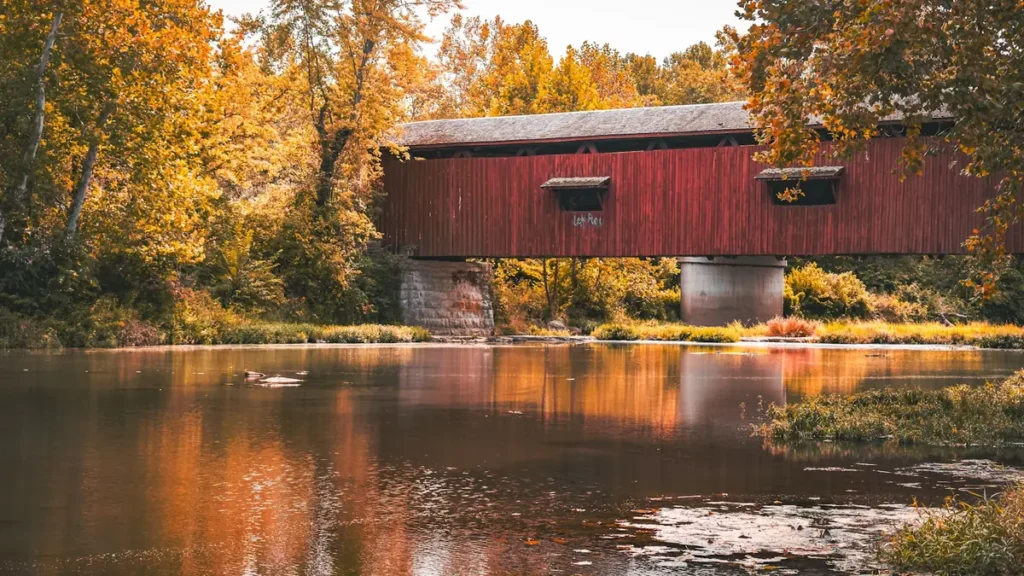
This water needs a real photo
The photo at the top of this page is not Otter Creek.
It is a regional stand-in, honestly captioned but generic — we will not put a name to a river we cannot prove. Send us a photograph you took here and it replaces the stand-in, with your credit on it.
Pioneer badgeUnclaimed
Add a photo of this water
Landscape, not fish — the water itself. Reviewed by hand before it appears. The first one published here earns the Pioneer badge.
Fished this water? Add a photo
Reviewed by hand before it appears. Pick the water, not the spot — we never publish exact locations.
Access
Middlebury: town access at the falls and the gauge.
Vergennes: the falls, the city ramp and the deep lower river.
Otter Creek Wildlife Management Area: swamp and backwater access.
Weybridge and New Haven: quiet middle-river paddling access.
Proctor and Pittsford: upper river below Rutland.
Rutland and Center Rutland: the upper reaches and trout water.
Lake Champlain at the mouth: big-water access below Vergennes.
Seasons
April and May: high water in the swamp, pike spawning and the best big-pike window.
June and July: smallmouth on the rock reaches and pike on the weed edges.
August and September: low clear water, weed growth at its peak, early and late fishing.
October and November: pike feeding hard before ice and very few boats on the water.
From the water
No logged trips yet. Be the first to put this water on your map.
Log this water
Fished it or cleaned it? Log in or create a free account to log a trip with photos and earn the waterway badge.
Questions
What is the current flow on the Otter Creek?
As of Oct 19, 3:30 am, the USGS gauge OTTER CREEK AT MIDDLEBURY, VT reads 646 cfs, the 61st percentile for this date. Conditions update every 15 minutes.
What species can you catch on the Otter Creek?
Anglers target Bowfin, Brown Trout, Largemouth Bass, Northern Pike, Rainbow Trout, Smallmouth Bass, Walleye on the Otter Creek in Vermont.
Are there fishing guides on the Otter Creek?
GuidedFloats lists 2 guides and outfitters on the Otter Creek. Claimed profiles accept booking requests; unclaimed profiles are built from public records and link to the business.
Where can you access the Otter Creek?
Middlebury: town access at the falls and the gauge. Vergennes: the falls, the city ramp and the deep lower river. Otter Creek Wildlife Management Area: swamp and backwater access. Weybridge and New Haven: quiet middle-river paddling access. Proctor and Pittsford: upper river below Rutland. Rutland and Center Rutland: the upper reaches and trout water. Lake Champlain at the mouth: big-water access below Vergennes.
When is the best time to fish the Otter Creek?
April and May: high water in the swamp, pike spawning and the best big-pike window. June and July: smallmouth on the rock reaches and pike on the weed edges. August and September: low clear water, weed growth at its peak, early and late fishing. October and November: pike feeding hard before ice and very few boats on the water.
Where are the fishing regulations for the Otter Creek?
Regulations change by season and section. Read the current rules on the Vermont agency site: https://vtfishandwildlife.com/fish/fishing-regulations