Fishes Buffalo Bayou
Bayou · Upper Texas Coast · Texas
Buffalo Bayou Fishing Guides
Houston's urban bayou, gauged in the city below the Addicks and Barker releases, paddled and fished for alligator gar, catfish and bass inside the loop.
Map of the Buffalo Bayou
12 numbered points: 3 access points, 2 bridges, 5 parks and conservation areas, 1 hazard, 1 USGS gauge. Tap a marker for details. Reviewed Oct 22, 2026.
- Access / boat ramp (3)
- Bridge crossing (2)
- Park / conservation area (5)
- Dam / hazard (1)
- USGS gauge (1)
Map data © OpenStreetMap contributors. Points are curated from OpenStreetMap and state agency sources; confirm access and hours before you go.
Print it. Bag it. Bring it.Phones die, screens crack, and most of this water has no signal. Print this map, fold it into a zip-top bag or dry bag with your license, and you have a backup your electronics can’t give you. Every marker is numbered so you can say exactly where you are.
Open the printable mapAll 12 points on this map
| # | Point | Type | Lat, Lon | Notes |
|---|---|---|---|---|
| 1 | Barker Dam USACE flood-control dam; top of this sheet | Dam / hazard | 29.76969, -95.64655 | km 0 and the top of this sheet. The Corps dam at the head of the reach, 109 m off the centreline measured to its own geometry. Above it is the Barker Reservoir flood pool, dry most of the year and not a float. Put in below the outlet. |
| 2 | TX 6 crossing State Highway 6, west Houston | Bridge crossing | 29.76943, -95.64327 | km 0.5. The first crossing below Barker Dam, 6 m off the centreline, and the usual top of the Buffalo Bayou paddle. A river-km landmark; OSM carries no ramp at the bridge itself. |
| 3 | Terry Hershey Park Harris County; linear park along the bayou | Park / conservation area | 29.76119, -95.56012 | km 10.2. A linear county park following the bayou from TX 6 down to Beltway 8, touching the centreline here. Hike-and-bike trail on both banks and several footbridges; the park itself, not a single pin, is the access for this reach. |
| 4 | Beltway 8 crossing Sam Houston Parkway / Beltway 8 | Bridge crossing | 29.76240, -95.55773 | km 10.7. The Beltway 8 crossing, 1 m off the centreline, at the downstream end of Terry Hershey Park. A river-km landmark. |
| 5 | Briarbend Park launch Unnamed slipway in OSM, inside Briarbend Park | Access / boat ramp | 29.74601, -95.50760 | km 18.9. A slipway on the centreline inside Briarbend Park, a City of Houston park whose boundary sits 39 m away - the named anchor that makes this unnamed feature placeable. A bank launch for canoes and kayaks, not a ramp. |
| 6 | Houston Arboretum and Nature Center Nature sanctuary on the Memorial Park edge | Park / conservation area | 29.75653, -95.44941 | km 30.6. Nature sanctuary on the south bank, 35 m off the centreline at its nearest point. OSM names it Houston Arboretum Park; the site's own name is the Houston Arboretum and Nature Center. Trails and a visitor centre, no launch. |
| 7 | Memorial Park City of Houston; the city's largest park | Park / conservation area | 29.75673, -95.44006 | km 31.8. Houston's largest park, touching the centreline here at 3 m, with trails along the south bank through this whole reach. OSM maps no launch inside the park. |
| 8 | USGS streamgage - Buffalo Bayou at Houston USGS streamgage 08074000 | USGS gauge | 29.76023, -95.40855 | km 36.8. Real-time flow and the reference gauge for this reach, the one the water page links. USGS names the site Buffalo Bayou at Houston, TX. Coordinate from the site roster; 33 m off the centreline. |
| 9 | Buffalo Bayou Park Buffalo Bayou Partnership; Shepherd to Sabine | Park / conservation area | 29.76176, -95.39198 | km 38.5. The restored park carrying the bayou from Shepherd Drive down to Sabine Street, 88 m off the centreline. OSM maps three unnamed slipways inside it; one of them ships below at km 40.1. |
| 10 | Eleanor Tinsley Park launch Unnamed slipway in OSM, at Eleanor Tinsley Park | Access / boat ramp | 29.76207, -95.37829 | km 40.1. A slipway on the centreline with the Eleanor Tinsley Park boundary 90 m away - the anchor that places it. Two further unnamed slipways sit 0.4 and 0.5 km downstream; this ships as one point, not three. |
| 11 | Sesquicentennial Park City of Houston; downtown theater district | Park / conservation area | 29.76417, -95.36513 | km 41.6. Downtown park on both banks below Bagby Street, 62 m off the centreline, with steps down to the water. The last green space above Allen's Landing. |
| 12 | Allen's Landing Historic head of navigation; bottom of this sheet | Access / boat ramp | 29.76389, -95.35875 | km 42.3 and the bottom of this sheet. Houston's original port at the White Oak Bayou confluence, 54 m off the centreline, and the usual take-out. Below here the bayou is bulkheaded and becomes the Ship Channel. |
Guides on the Buffalo Bayou
Claimed profiles take booking requests. Unclaimed profiles are built from public records so the river is never empty; the guide can claim or remove one any time.
Order on this page: premium and outfitter plans first (labelled Premium placement), then claimed free profiles, then unclaimed — one published price, no bidding for position. How placement works
About the Buffalo Bayou
Buffalo Bayou runs about fifty miles from the prairie west of Katy through the Addicks and Barker flood-control reservoirs and straight into downtown Houston, where it becomes the head of the Houston Ship Channel. The USGS gauge at Houston sits on the urban reach and reports discharge and stage without a water temperature series. Because Addicks and Barker release on a flood-control schedule rather than a natural one, the flow this gauge reads is often a direct product of a management decision made hours earlier, which makes it worth checking before any trip.
The bayou is a genuinely productive warmwater fishery hiding in plain sight. Alligator gar are the marquee species and reach large sizes in the deeper city bends; longnose gar are common. Blue, channel and flathead catfish are abundant, largemouth and spotted bass hold along the bank structure and outfalls, and bluegill and carp fill in. It is a fishery of hard structure, shade lines and current seams rather than of natural habitat, and it fishes best where bridges, riprap and storm outfalls concentrate bait.
Access is what makes this water unusual. Buffalo Bayou Park, the surrounding greenways and a chain of public paddle launches give a large city continuous access to a fishable stream, and Houston-area guides run kayak and light-skiff trips through the urban reach year-round. Fly anglers work it for gar and bass, and the alligator gar fishery has developed a specialist following. The upper reach above the reservoirs is smaller, quieter and more natural, and is paddled more than it is fished.
The main hazards are flow and water quality. After heavy rain the bayou rises fast and stays high and dirty while the reservoirs release, and it is not a place to be on the water during those periods. In dry stretches it runs low, clear enough to sight-fish, and very fishable. Texas licenses are required, alligator gar are managed under their own rules including harvest reporting, and the state regulations linked below carry current provisions.
This water needs a real photo
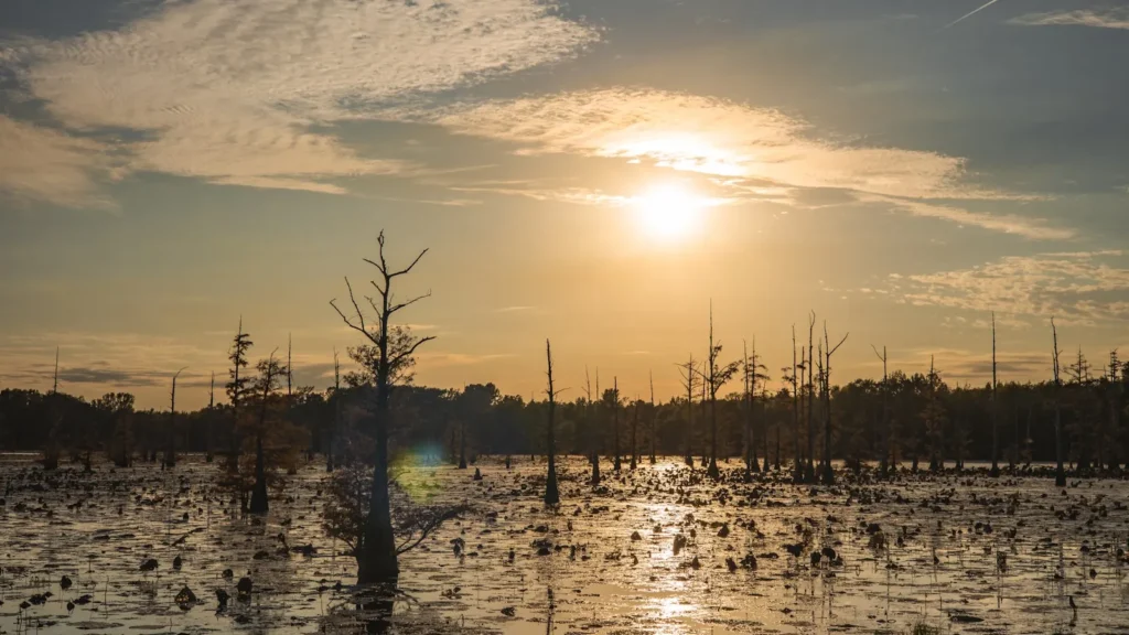
The photo at the top of this page is not Buffalo Bayou.
It is a regional stand-in, honestly captioned but generic — we will not put a name to a river we cannot prove. Send us a photograph you took here and it replaces the stand-in, with your credit on it.
Pioneer badgeUnclaimed
Add a photo of this water
Landscape, not fish — the water itself. Reviewed by hand before it appears. The first one published here earns the Pioneer badge.
Fished this water? Add a photo
Reviewed by hand before it appears. Pick the water, not the spot — we never publish exact locations.
Access
Houston gauge reach access in Buffalo Bayou Park - the urban flow reference and multiple bank points.
Buffalo Bayou Park paddle launch near Sabine Street - the main kayak put-in inside the loop.
Allen's Landing downtown - historic launch at the head of the ship channel.
Memorial Park and Woodway area accesses - upstream bank fishing and hand launch.
Briar Bend and Piney Point accesses - upper urban reach paddle points.
Highway 6 crossing near Addicks - access to the reach below the reservoir releases.
Katy area upper bayou crossings - small-water paddling above the reservoirs.
Seasons
Spring: frequent high releases after rain; fish the falling water for gar and catfish once flow steadies.
Summer: the main season, with alligator gar active in the deeper bends and good early-morning bass fishing.
Fall: settled flows and the clearest water of the year, best for sight-fishing gar and working structure.
Winter: slower but fishable, with catfish holding in deep bends and fewer paddlers on the water.
From the water
No logged trips yet. Be the first to put this water on your map.
Log this water
Fished it or cleaned it? Log in or create a free account to log a trip with photos and earn the waterway badge.
Questions
What is the current flow on the Buffalo Bayou?
As of Nov 2, 7:15 am, the USGS gauge Buffalo Bayou at Houston, TX reads 169 cfs. Conditions update every 15 minutes.
What species can you catch on the Buffalo Bayou?
Anglers target Alligator Gar, Blue Catfish, Bluegill, Channel Catfish, Common Carp, Flathead Catfish, Largemouth Bass, Longnose Gar, Spotted Bass on the Buffalo Bayou in Texas.
Are there fishing guides on the Buffalo Bayou?
GuidedFloats lists 1 guide and outfitters on the Buffalo Bayou. Claimed profiles accept booking requests; unclaimed profiles are built from public records and link to the business.
Where can you access the Buffalo Bayou?
Houston gauge reach access in Buffalo Bayou Park - the urban flow reference and multiple bank points. Buffalo Bayou Park paddle launch near Sabine Street - the main kayak put-in inside the loop. Allen's Landing downtown - historic launch at the head of the ship channel. Memorial Park and Woodway area accesses - upstream bank fishing and hand launch. Briar Bend and Piney Point accesses - upper urban reach paddle points. Highway 6 crossing near Addicks - access to the reach below the reservoir releases. Katy area upper bayou crossings - small-water paddling above the reservoirs.
When is the best time to fish the Buffalo Bayou?
Spring: frequent high releases after rain; fish the falling water for gar and catfish once flow steadies. Summer: the main season, with alligator gar active in the deeper bends and good early-morning bass fishing. Fall: settled flows and the clearest water of the year, best for sight-fishing gar and working structure. Winter: slower but fishable, with catfish holding in deep bends and fewer paddlers on the water.
Where are the fishing regulations for the Buffalo Bayou?
Regulations change by season and section. Read the current rules on the Texas agency site: https://tpwd.texas.gov/regulations/outdoor-annual/fishing/