Wabash River Fishing Guides
The longest free-flowing river east of the Mississippi - a big, undammed border river at Mt. Carmel with a deep, varied fishery and a genuine sauger run.
Guides on the Wabash River
Claimed profiles take booking requests. Unclaimed profiles are built from public records so the river is never empty; the guide can claim or remove one any time.
No guides listed yet
Guide or outfit this water? Create your profile. Listing is free, the commission is 10% or 7% with a premium profile, and premium profiles list first on this water.
About the Wabash River
The Wabash forms the Illinois-Indiana border along its lower course and reaches the Ohio River below Mount Carmel. The USGS gauge at Mount Carmel watches about twenty-eight thousand six hundred square miles and reports discharge and stage without a temperature series. The river’s distinction is that it runs free: the lower Wabash is the longest undammed river east of the Mississippi, and that single fact shapes everything about how it fishes.
Without dams, the river keeps a natural sand-and-gravel bar structure, a functioning floodplain and a fish community that reflects a large, connected midwestern river rather than a chain of pools. Sauger are the signature run, moving up in cold water and drawing anglers to the tailwater-like conditions below wing dams and at tributary mouths. Walleye are present in smaller numbers. Catfish are the volume fishery – channel, flathead and blue – and the big flatheads here reach serious size. White bass run in spring, freshwater drum are everywhere, smallmouth hold on the rock and bar edges, and shovelnose sturgeon and longnose gar round out a genuinely diverse assemblage.
Because it is undammed and drains a very large agricultural basin, the Wabash rises hard and fast after regional rain and carries a heavy sediment load when it does. It can be an entirely different river week to week. The gauge is the essential planning tool: at moderate and falling stage the bars are exposed and the river is workable from a boat, and at high stage it is a wide brown flood not worth launching into.
Access is by boat ramp and bar, and the fishery is shared with Indiana across the channel, so anglers should confirm which state’s license and regulations apply to where they intend to fish.
This water needs a real photo
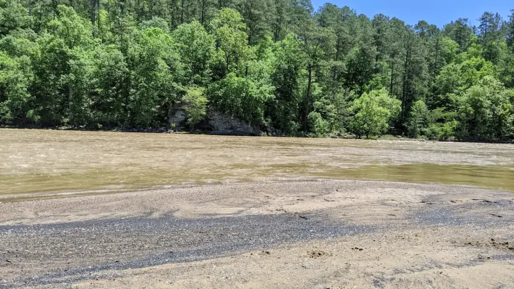
The photo at the top of this page is not Wabash River.
It is a regional stand-in, honestly captioned but generic — we will not put a name to a river we cannot prove. Send us a photograph you took here and it replaces the stand-in, with your credit on it.
Add a photo of this water
Landscape, not fish — the water itself. Reviewed by hand before it appears. The first one published here earns the Pioneer badge.
Fished this water? Add a photo
Reviewed by hand before it appears. Pick the water, not the spot — we never publish exact locations.
Access
Mt. Carmel riverfront and gauge - the flow reference and the main access on the reach.
Beall Woods State Park - protected bottomland forest with river frontage upstream.
Grayville area ramp - downstream trailer access toward the Ohio confluence.
White River confluence, Indiana side - a major tributary junction concentrating fish.
New Harmony area crossing - access to the middle of the lower river.
Sand and gravel bars below Mt. Carmel - exposed at moderate and falling stage.
Ohio River confluence near New Haven - the bottom of the Wabash.
Seasons
Spring: high, fast and muddy; white bass run and the river is often too big to fish well.
Summer: falls and clears somewhat; catfish and smallmouth on the bars carry the season.
Fall: the best combination of low clear water and active fish across most species.
Winter: cold with the sauger run concentrating fish below wing dams and tributary mouths.
From the water
No logged trips yet. Be the first to put this water on your map.
Log this water
Fished it or cleaned it? Log in or create a free account to log a trip with photos and earn the waterway badge.
Questions
What is the current flow on the Wabash River?
As of Oct 21, 11:45 pm, the USGS gauge WABASH RIVER AT MT. CARMEL, IL reads 8,900 cfs. Conditions update every 15 minutes.
What species can you catch on the Wabash River?
Anglers target Blue Catfish, Channel Catfish, Flathead Catfish, Freshwater Drum, Largemouth Bass, Longnose Gar, Sauger, Shovelnose Sturgeon, Smallmouth Bass, Walleye, White Bass on the Wabash River in Illinois.
Where can you access the Wabash River?
Mt. Carmel riverfront and gauge - the flow reference and the main access on the reach. Beall Woods State Park - protected bottomland forest with river frontage upstream. Grayville area ramp - downstream trailer access toward the Ohio confluence. White River confluence, Indiana side - a major tributary junction concentrating fish. New Harmony area crossing - access to the middle of the lower river. Sand and gravel bars below Mt. Carmel - exposed at moderate and falling stage. Ohio River confluence near New Haven - the bottom of the Wabash.
When is the best time to fish the Wabash River?
Spring: high, fast and muddy; white bass run and the river is often too big to fish well. Summer: falls and clears somewhat; catfish and smallmouth on the bars carry the season. Fall: the best combination of low clear water and active fish across most species. Winter: cold with the sauger run concentrating fish below wing dams and tributary mouths.
Where are the fishing regulations for the Wabash River?
Regulations change by season and section. Read the current rules on the Illinois agency site: https://www.ifishillinois.org/site-documents/FishingDigest.pdf