South Toe River Fishing Guides
A cold Black Mountain freestone under Mount Mitchell, with wild trout in the upper forest water and a stocked, wadable middle reach through Celo.
Guides on the South Toe River
Claimed profiles take booking requests. Unclaimed profiles are built from public records so the river is never empty; the guide can claim or remove one any time.
No guides listed yet
Guide or outfit this water? Create your profile. Listing is free, the commission is 10% or 7% with a premium profile, and premium profiles list first on this water.
About the South Toe River
The South Toe drains the west side of the Black Mountains, the highest ground in the eastern United States, and that headwater elevation is what keeps it cold when other western North Carolina streams are struggling. It starts in the Pisgah National Forest below Mount Mitchell, runs north through the Carolina Hemlocks corridor and the Celo valley, and eventually joins the North Toe to form the Nolichucky. The gauge sits on the middle river near Celo, where the stream has grown to comfortable wading size but is still unmistakably a mountain freestone.
The fishery changes as you move down it. High in the national forest the South Toe and its feeders hold wild rainbows and some native brook trout in small, steep, brushy water that rewards short casts and a willingness to bushwhack. Through the Carolina Hemlocks Recreation Area and down past Celo the river is stocked and considerably more accessible, with the kind of pools and pocket water that make it a good place to learn. Farther down toward the North Toe confluence the water warms, gradient eases, and rock bass and smallmouth begin to appear alongside the trout.
Access is unusually good for a mountain stream because Forest Service roads and the Blue Ridge parkway country feed the whole upper valley, and there is a lot of public frontage. That also means summer weekends are busy with swimmers and campers in the popular stretches, so trout anglers do better early, late, or upstream of the recreation areas. This gauge reports discharge only and no water temperature, so late-summer thermal conditions have to be judged from air temperature, recent rain and the tributaries rather than read off the station. As a freestone it rises and clears quickly after storms, and the days immediately after a summer thunderstorm are often the best of the month.
This water needs a real photo
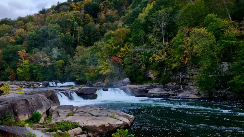
The photo at the top of this page is not South Toe River.
It is a regional stand-in, honestly captioned but generic — we will not put a name to a river we cannot prove. Send us a photograph you took here and it replaces the stand-in, with your credit on it.
Add a photo of this water
Landscape, not fish — the water itself. Reviewed by hand before it appears. The first one published here earns the Pioneer badge.
Fished this water? Add a photo
Reviewed by hand before it appears. Pick the water, not the spot — we never publish exact locations.
Access
Carolina Hemlocks Recreation Area on Highway 80 - the main developed access with parking, camping and river frontage.
Black Mountain Campground on Forest Service Road 472 - upper river access at the base of Mount Mitchell.
South Toe River Road pull-offs - numerous informal parking spots along the middle river.
Celo community access at the Highway 80 crossing - central wading access on the stocked water.
Briar Bottom group camp area - upper forest access to smaller wild trout water.
Newdale and the lower Highway 80 bridges - lower river access where warmwater species mix in.
Forest Service Road 472 upper pull-offs - headwater access for wild rainbow and brook trout fishing.
Seasons
Spring: stocking begins, snow and rain keep the river full, and hatches build through April and May.
Summer: low and clear by August with heavy recreational use in the swimming holes, so fish high or fish early.
Fall: cool nights sharpen the fishing, crowds thin sharply, and the wild upper water is at its best.
Winter: cold and quiet, with delayed harvest style angling and very little competition on the river.
From the water
No logged trips yet. Be the first to put this water on your map.
Log this water
Fished it or cleaned it? Log in or create a free account to log a trip with photos and earn the waterway badge.
Questions
What is the current flow on the South Toe River?
As of Sep 17, 6:30 am, the USGS gauge SOUTH TOE RIVER NEAR CELO, NC reads 30 cfs. Conditions update every 15 minutes.
What species can you catch on the South Toe River?
Anglers target Brook Trout, Brown Trout, Rainbow Trout, Rock Bass, Smallmouth Bass on the South Toe River in North Carolina.
Where can you access the South Toe River?
Carolina Hemlocks Recreation Area on Highway 80 - the main developed access with parking, camping and river frontage. Black Mountain Campground on Forest Service Road 472 - upper river access at the base of Mount Mitchell. South Toe River Road pull-offs - numerous informal parking spots along the middle river. Celo community access at the Highway 80 crossing - central wading access on the stocked water. Briar Bottom group camp area - upper forest access to smaller wild trout water. Newdale and the lower Highway 80 bridges - lower river access where warmwater species mix in. Forest Service Road...
When is the best time to fish the South Toe River?
Spring: stocking begins, snow and rain keep the river full, and hatches build through April and May. Summer: low and clear by August with heavy recreational use in the swimming holes, so fish high or fish early. Fall: cool nights sharpen the fishing, crowds thin sharply, and the wild upper water is at its best. Winter: cold and quiet, with delayed harvest style angling and very little competition on the river.
Where are the fishing regulations for the South Toe River?
Regulations change by season and section. Read the current rules on the North Carolina agency site: https://www.ncwildlife.gov/fishing/regulations