Eagle River Fishing Guides
A free-flowing Colorado freestone through the Vail valley with a genuine runoff cycle, dense brown trout numbers and a well-developed float fishery below Edwards.
Map of the Eagle River
30 numbered points: 3 campsites, 2 bait & fly shops, 21 bridges, 3 parks and conservation areas, 1 USGS gauge. Tap a marker for details. Reviewed Sep 16, 2026.
- Campsite (3)
- Bait, tackle & fly shop (2)
- Bridge crossing (21)
- Park / conservation area (3)
- USGS gauge (1)
Print it. Bag it. Bring it.Phones die, screens crack, and most of this water has no signal. Print this map, fold it into a zip-top bag or dry bag with your license, and you have a backup your electronics can’t give you. Every marker is numbered so you can say exactly where you are.
Open the printable mapAll 30 points on this map
| # | Point | Type | Lat, Lon | Notes |
|---|---|---|---|---|
| 1 | Camp Hale Memorial Campground USFS · White River National Forest | Campsite | 39.41973, -106.31418 | Top of the sheet, on the headwater flats at Camp Hale. |
| 2 | Camp Hale National Historic Site USFS · White River National Forest | Park / conservation area | 39.43620, -106.32544 | The 10th Mountain Division site the upper river runs through. |
| 3 | Hornsilver Campground USFS · White River National Forest | Campsite | 39.48915, -106.36685 | Forest Service campground above Red Cliff. |
| 4 | USGS 09063000 — Eagle River at Red Cliff At Red Cliff | USGS gauge | 39.50832, -106.36669 | The gauge the water page reads for flow. |
| 5 | Eagle Street bridge Red Cliff | Bridge crossing | 39.50951, -106.36687 | In-town crossing at the gauge. |
| 6 | Pine Street bridge Red Cliff | Bridge crossing | 39.51173, -106.36908 | Second Red Cliff crossing. |
| 7 | Water Street bridge Red Cliff | Bridge crossing | 39.50793, -106.37646 | Bottom-of-town crossing below Red Cliff. |
| 8 | Cemetery Road bridge Minturn | Bridge crossing | 39.58191, -106.42351 | Crossing at the top of Minturn. |
| 9 | Minturn Anglers Fly shop on Main Street, Minturn | Bait, tackle & fly shop | 39.58928, -106.43157 | On the bank in Minturn; the shop closest to the upper river. |
| 10 | Main Street bridge Minturn | Bridge crossing | 39.58938, -106.43141 | In-town crossing beside the fly shop. |
| 11 | County Road bridge Eagle County · below Minturn | Bridge crossing | 39.60557, -106.44221 | Crossing between Minturn and the Gore Creek confluence. |
| 12 | Post Boulevard bridge Avon | Bridge crossing | 39.62486, -106.50437 | Crossing at the top of Avon. |
| 13 | Stone Bridge Road bridge Avon | Bridge crossing | 39.62795, -106.51264 | Second Avon crossing. |
| 14 | Avon Whitewater Park Town of Avon | Park / conservation area | 39.63208, -106.52205 | Engineered play features on the river through Avon; scout at high water. |
| 15 | Avon Road bridge Avon | Bridge crossing | 39.63201, -106.52247 | Crossing at the whitewater park. |
| 16 | Fly Fishing Outfitters Fly shop, Avon | Bait, tackle & fly shop | 39.63557, -106.53755 | On the bank at the west end of Avon. |
| 17 | Miller Ranch Road bridge Edwards | Bridge crossing | 39.63949, -106.57185 | Crossing at Miller Ranch. |
| 18 | Reserve Road bridge Edwards | Bridge crossing | 39.63952, -106.58138 | Crossing below Miller Ranch. |
| 19 | Edwards Access Road bridge Edwards | Bridge crossing | 39.64588, -106.59244 | The main Edwards river crossing. |
| 20 | Hillcrest Drive bridge Eagle County | Bridge crossing | 39.65454, -106.62887 | Crossing below Edwards. |
| 21 | Aspen Meadows Road bridge Wolcott | Bridge crossing | 39.70335, -106.72745 | Crossing at Wolcott. |
| 22 | Diamond Star Road bridge Eagle County · below Wolcott | Bridge crossing | 39.67559, -106.77459 | Crossing in the canyon reach below Wolcott. |
| 23 | Eagle River Bridge Town of Eagle | Bridge crossing | 39.66029, -106.81569 | Crossing at the top of the town of Eagle. |
| 24 | Eby Creek Road bridge Town of Eagle | Bridge crossing | 39.65682, -106.82530 | Main Eagle crossing. |
| 25 | Eagle Town Park Town of Eagle | Park / conservation area | 39.65161, -106.82915 | Town park a few hundred metres off the river in Eagle. |
| 26 | Eagle River Road bridge Eagle County · below Eagle | Bridge crossing | 39.64783, -106.87511 | Crossing between Eagle and Gypsum. |
| 27 | Trail Gulch Road bridge Gypsum | Bridge crossing | 39.65009, -106.95228 | Crossing at Gypsum. |
| 28 | River View Road bridge Gypsum | Bridge crossing | 39.65010, -106.95776 | Second Gypsum crossing. |
| 29 | Price Lane bridge Eagle County · below Gypsum | Bridge crossing | 39.65224, -106.96562 | Crossing below Gypsum, at the USGS Price Lane station. |
| 30 | Aunt Sara's Riverdance RV Resort Private · on the river below Gypsum | Campsite | 39.64762, -107.00136 | Riverside RV park on the lower river. |
Guides on the Eagle River
Claimed profiles take booking requests. Unclaimed profiles are built from public records so the river is never empty; the guide can claim or remove one any time.
No guides listed yet
Guide or outfit this water? Create your profile. Listing is free, the commission is 10% or 7% with a premium profile, and premium profiles list first on this water.
About the Eagle River
The Eagle is one of the few significant rivers in central Colorado that is not controlled by a dam, and everything about how it fishes follows from that. It begins high near Tennessee Pass, runs past Red Cliff where this gauge sits, gathers Gore Creek at Minturn and then flows west down the length of the Vail valley through Avon, Edwards, Eagle and Gypsum before joining the Colorado at Dotsero. Because it is a true freestone it has a hard runoff season, a low clear autumn and a genuine seasonal rhythm rather than a managed one.
Brown trout dominate, and they dominate in numbers rather than just in size. The middle river below Edwards holds a dense population that supports both wading and a well-established drift boat fishery, with rainbows mixed in throughout and increasing after years of recovery work following historic mine drainage problems near Gilman. Higher up around Red Cliff and Minturn the river is smaller, steeper and pocket-water in character, with brook trout and cutthroat in the tributaries. Mountain whitefish are common and are a useful indicator of a healthy system rather than a nuisance.
Timing is the whole game on the Eagle. From late May into early July, snowmelt makes most of the river unfishable and unfloatable for anglers, though it makes the commercial rafting season. As runoff drops through July the river comes into shape and stays excellent into October, with a strong caddis emergence in early summer and good terrestrial fishing in late summer. Because this station reports water temperature as well as discharge, it is worth checking both in a hot, dry August when voluntary fishing closures on Colorado freestones have become a regular feature.
This water needs a real photo
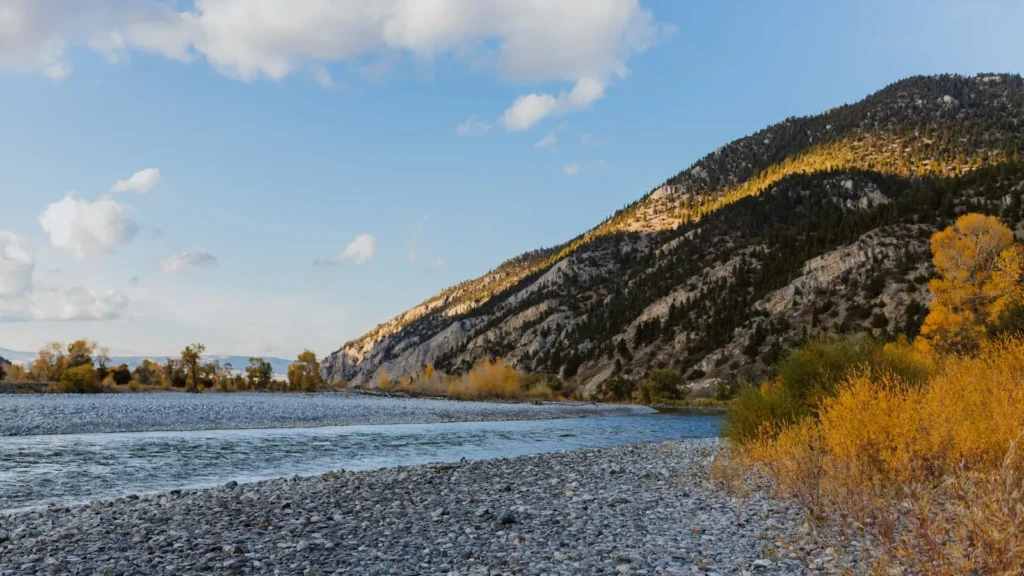
The photo at the top of this page is not Eagle River.
It is a regional stand-in, honestly captioned but generic — we will not put a name to a river we cannot prove. Send us a photograph you took here and it replaces the stand-in, with your credit on it.
Add a photo of this water
Landscape, not fish — the water itself. Reviewed by hand before it appears. The first one published here earns the Pioneer badge.
Fished this water? Add a photo
Reviewed by hand before it appears. Pick the water, not the spot — we never publish exact locations.
Access
Red Cliff access near the gauge on US 24 - upper river pocket water with roadside parking.
Minturn town access below the Gore Creek confluence - upper river wading.
Edwards Boat Ramp on US 6 - the standard upper float launch for the middle river.
Wolcott river access - popular mid-river put-in and take-out for full and half-day floats.
Eagle town whitewater park access - convenient developed access with parking and ramps.
Gypsum ponds state wildlife area - lower river public frontage near town.
Horn Ranch and Duck Pond public access sites on US 6 - Colorado Parks and Wildlife walk-in water.
Seasons
Spring: pre-runoff fishing is excellent in April and early May before snowmelt shuts the river down.
Summer: runoff clears in July and the river fishes hard through August on caddis, stoneflies and terrestrials.
Fall: the best float weeks of the year, low clear water, aggressive browns and thin crowds through October.
Winter: cold and low, with midge and small nymph fishing in the deeper middle-river runs on mild days.
From the water
No logged trips yet. Be the first to put this water on your map.
Log this water
Fished it or cleaned it? Log in or create a free account to log a trip with photos and earn the waterway badge.
Questions
What is the current flow on the Eagle River?
As of Sep 17, 6:45 am, the USGS gauge EAGLE RIVER AT RED CLIFF, CO. reads 8 cfs, with water temperature 53.1 F. Conditions update every 15 minutes.
What species can you catch on the Eagle River?
Anglers target Brook Trout, Brown Trout, Cutthroat Trout, Mountain Whitefish, Rainbow Trout on the Eagle River in Colorado.
Where can you access the Eagle River?
Red Cliff access near the gauge on US 24 - upper river pocket water with roadside parking. Minturn town access below the Gore Creek confluence - upper river wading. Edwards Boat Ramp on US 6 - the standard upper float launch for the middle river. Wolcott river access - popular mid-river put-in and take-out for full and half-day floats. Eagle town whitewater park access - convenient developed access with parking and ramps. Gypsum ponds state wildlife area - lower river public frontage near town. Horn Ranch and Duck Pond public access sites on US 6 - Colorado Parks and Wildlife walk-in water.
When is the best time to fish the Eagle River?
Spring: pre-runoff fishing is excellent in April and early May before snowmelt shuts the river down. Summer: runoff clears in July and the river fishes hard through August on caddis, stoneflies and terrestrials. Fall: the best float weeks of the year, low clear water, aggressive browns and thin crowds through October. Winter: cold and low, with midge and small nymph fishing in the deeper middle-river runs on mild days.
Where are the fishing regulations for the Eagle River?
Regulations change by season and section. Read the current rules on the Colorado agency site: https://cpw.state.co.us/rules-and-regulations