Pine Island Bayou Fishing Guides
A slow, cypress-lined Big Thicket bayou inside a national preserve, paddled for bass, bream and gar through some of the most biologically rich country in Texas.
Guides on the Pine Island Bayou
Claimed profiles take booking requests. Unclaimed profiles are built from public records so the river is never empty; the guide can claim or remove one any time.
No guides listed yet
Guide or outfit this water? Create your profile. Listing is free, the commission is 10% or 7% with a premium profile, and premium profiles list first on this water.
About the Pine Island Bayou
Pine Island Bayou runs through the heart of the Big Thicket, and a good part of its length sits inside the Big Thicket National Preserve. It is slow, dark and heavily wooded, a bayou in the fullest sense: cypress and tupelo standing in the water, sloughs peeling off into the swamp on both sides, and almost no gradient to speak of between Sour Lake and the Neches River above Beaumont. The preserve designation means the corridor is protected, undeveloped and genuinely wild in a way that very little Texas water still is.
Fishing it is a paddling proposition. Canoes and kayaks handle the deadfall and the tight bends that a motorboat cannot, and the preserve maintains a marked paddling trail along the lower bayou. Largemouth bass hold in the cypress and against every log jam, warmouth and bluegill fill the shaded pockets, and the bayou carries a serious catfish population including flatheads in the deeper bends. Bowfin and gar are abundant, alligator gar included in the lower reaches near the Neches, and both are increasingly fished for on purpose rather than cursed as bycatch. Alligators are present and are simply part of the trip here.
The gauge near Sour Lake is the go or no-go reading. This is a flat drainage with a huge rainfall budget, so the bayou responds to Southeast Texas storms by spilling into the surrounding swamp rather than rising in a defined channel, and a high stage means the fish scatter into thousands of acres of flooded timber. Low water is the opposite problem, concentrating fish but leaving logjams that must be portaged. No temperature sensor is published here. Local outfitters in the Beaumont and Kountze area run guided paddle trips through the preserve, and going with one the first time is the fastest way to learn which sloughs stay navigable at a given stage.
This water needs a real photo
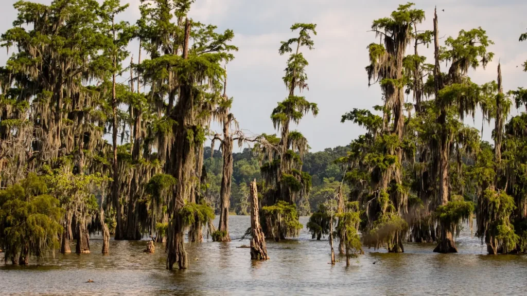
The photo at the top of this page is not Pine Island Bayou.
It is a regional stand-in, honestly captioned but generic — we will not put a name to a river we cannot prove. Send us a photograph you took here and it replaces the stand-in, with your credit on it.
Add a photo of this water
Landscape, not fish — the water itself. Reviewed by hand before it appears. The first one published here earns the Pioneer badge.
Fished this water? Add a photo
Reviewed by hand before it appears. Pick the water, not the spot — we never publish exact locations.
Access
Big Thicket National Preserve Lance Rosier Unit - the main protected access on the middle bayou.
Highway 105 crossing near Sour Lake - the closest public bridge to the gauge.
FM 770 crossing north of Sour Lake - a common upper-bayou kayak put-in.
Cook's Lake to Scatterman paddling trail - the preserve's marked lower-bayou route.
Highway 96 crossing near Lumberton - bank access and a rough launch.
Collier's Ferry Park in Beaumont - a paved ramp on the Neches near the confluence.
FM 1122 crossing - a mid-bayou access point with roadside parking only.
Seasons
Spring: high, dirty and often out of its banks, but the best bass fishing when it drops into shape between fronts.
Summer: warm and low with heavy insect pressure, catfish and bream on the shaded banks, and alligators very active.
Fall: the prime paddling season, with clearing water, comfortable temperatures and bass tight to the cypress.
Winter: cool and quiet, slow fishing, and the easiest time of year to see the bottomland without the undergrowth.
From the water
No logged trips yet. Be the first to put this water on your map.
Log this water
Fished it or cleaned it? Log in or create a free account to log a trip with photos and earn the waterway badge.
Questions
What is the current flow on the Pine Island Bayou?
As of Sep 17, 6:45 am, the USGS gauge Pine Island Bayou nr Sour Lake, TX reads 41 cfs. Conditions update every 15 minutes.
What species can you catch on the Pine Island Bayou?
Anglers target Alligator Gar, Black Crappie, Blue Catfish, Bluegill, Bowfin, Channel Catfish, Flathead Catfish, Largemouth Bass, Longnose Gar, Redear Sunfish, Spotted Bass, Warmouth, White Crappie on the Pine Island Bayou in Texas.
Where can you access the Pine Island Bayou?
Big Thicket National Preserve Lance Rosier Unit - the main protected access on the middle bayou. Highway 105 crossing near Sour Lake - the closest public bridge to the gauge. FM 770 crossing north of Sour Lake - a common upper-bayou kayak put-in. Cook's Lake to Scatterman paddling trail - the preserve's marked lower-bayou route. Highway 96 crossing near Lumberton - bank access and a rough launch. Collier's Ferry Park in Beaumont - a paved ramp on the Neches near the confluence. FM 1122 crossing - a mid-bayou access point with roadside parking only.
When is the best time to fish the Pine Island Bayou?
Spring: high, dirty and often out of its banks, but the best bass fishing when it drops into shape between fronts. Summer: warm and low with heavy insect pressure, catfish and bream on the shaded banks, and alligators very active. Fall: the prime paddling season, with clearing water, comfortable temperatures and bass tight to the cypress. Winter: cool and quiet, slow fishing, and the easiest time of year to see the bottomland without the undergrowth.
Where are the fishing regulations for the Pine Island Bayou?
Regulations change by season and section. Read the current rules on the Texas agency site: https://tpwd.texas.gov/regulations/outdoor-annual/fishing