Fishes Lake Catherine, Ouachita River
River · West central Arkansas, in the Ouachita Mountains above Lake Ouachita, running east past Mount Ida through Montgomery County · Arkansas
Ouachita River Fishing Guides
The upper Ouachita above the lake, a mountain float stream running clear over gravel with smallmouth holding in every shoal.
Map of the Ouachita River
19 numbered points: 7 access points, 1 campsite, 1 outfitter, 3 parks and conservation areas, 6 hazards, 1 USGS gauge. Tap a marker for details. Reviewed Oct 22, 2026.
- Access / boat ramp (7)
- Campsite (1)
- Outfitter / canoe rental (1)
- Park / conservation area (3)
- Dam / hazard (6)
- USGS gauge (1)
Map data © OpenStreetMap contributors. Points are curated from OpenStreetMap and state agency sources; confirm access and hours before you go.
Print it. Bag it. Bring it.Phones die, screens crack, and most of this water has no signal. Print this map, fold it into a zip-top bag or dry bag with your license, and you have a backup your electronics can’t give you. Every marker is numbered so you can say exactly where you are.
Open the printable mapAll 19 points on this map
| # | Point | Type | Lat, Lon | Notes |
|---|---|---|---|---|
| 1 | RiverView Cabins & Canoes Canoe rental and cabins, upper Ouachita | Outfitter / canoe rental | 34.60869, -93.77419 | Canoe rental on the forest reach, 0.21 km off the centreline. OSM tags it tourism=chalet; re-typed to outfitter because the rental, not the lodging, is what a floater needs. The usual source of a boat for the Oden-to-Rocky Shoals run. |
| 2 | USGS streamgage - Ouachita River, upper forest reach Reference gauge for this water page | USGS gauge | 34.61000, -93.69750 | Real-time flow and the gauge the water page links. Coordinate taken from the site roster, not typed by hand; it sits on the centreline in the forest reach above Lake Ouachita. The USGS station name was not confirmed this run. |
| 3 | Fulton Branch Recreation Area Ouachita National Forest; canoe launch | Access / boat ramp | 34.62595, -93.65935 | Forest Service recreation area on the float trail, 0.11 km off the centreline by its own polygon. The access road beside it is named Fulton Branch Canoe Launch Rd in OSM, which is what confirms the launch. |
| 4 | Dragover Recreation Area Ouachita National Forest; float trail access | Access / boat ramp | 34.64260, -93.63075 | Forest Service access on the Ouachita River float trail, 0.19 km off the centreline. One of the standard put-ins and take-outs on the free-flowing reach above Lake Ouachita. |
| 5 | River Bluff Recreation Area Ouachita National Forest; riverside camping | Campsite | 34.63982, -93.62603 | Forest Service camping area on the bank, 0.08 km off the centreline, immediately downstream of Dragover. The usual first-night camp on an overnight float trail trip. |
| 6 | Buddy's Landing River access and campground near Oden | Access / boat ramp | 34.62619, -93.54238 | An unnamed slipway on the centreline, 0.32 km out, with an unnamed campsite 0.2 km away and the OSM place node Buddys Landing between them - the three together place and name it. The only X Landing node that ships. |
| 7 | Blakely Mountain Dam U.S. Army Corps of Engineers; forms Lake Ouachita | Dam / hazard | 34.57251, -93.19480 | The Corps dam that ends the free-flowing reach and forms Lake Ouachita, 0.09 km off the centreline. Hard take-out: the float trail stops in the lake above. AGFC manages the cold tailwater below as trout water. |
| 8 | Carpenter Dam Forms Lake Hamilton | Dam / hazard | 34.44277, -93.02637 | Second dam of the Hot Springs chain, 0.10 km off the centreline, forming Lake Hamilton above and releasing into Lake Catherine below. The lake is a separate water page; nothing on its arms is on this sheet. |
| 9 | Remmel Dam Forms Lake Catherine | Dam / hazard | 34.42695, -92.89433 | Third dam of the chain, 0.09 km off the centreline. Below it the river is free-flowing again and the gentle float to Interstate 30 begins; scheduled release weekends raise it to whitewater at Rockport Ledge. |
| 10 | Ouachita River Whitewater Park Rockport Ledge, northwest of Malvern | Access / boat ramp | 34.39427, -92.84158 | The Rockport Ledge play reach a few hundred yards above Interstate 30, 0.15 km off the centreline. A boulder drop-off paddlers use on release weekends, a gentle float otherwise. Scout it before running it high. |
| 11 | Ouachita River Park Arkadelphia, on the river | Park / conservation area | 34.11986, -93.04646 | City park on the bank at Arkadelphia, 0.11 km off the centreline - the one Arkadelphia green space that is actually on the water. Three other city parks and two campus lawns nearby passed the distance gate and were dropped. |
| 12 | Sandy Beach Park Camden; park with boat ramp | Access / boat ramp | 33.59382, -92.82016 | Riverside park at Camden, 0.21 km off the centreline, with an unnamed slipway 0.17 km away that the park names and places. Ships as one point, not two. The last developed access above the lock-and-dam reach. |
| 13 | Calion Lock and Dam Lock and Dam No. 8, Ouachita-Black navigation project | Dam / hazard | 33.30734, -92.48181 | First of the navigation structures on this sheet, 0.07 km off the centreline. Commercial lock chamber - a paddler needs to portage or arrange passage, not drift into the gates. An unnamed duplicate polygon 0.98 km away was dropped. |
| 14 | Moro Bay State Park Arkansas State Parks; Ouachita and Moro Bay confluence | Park / conservation area | 33.30123, -92.34625 | State park at the Moro Bay confluence, 0.46 km off the centreline, with two unnamed slipways within 0.13 km of the water that it names. Camping, a ramp and the ferry crossing; the main access on the middle navigation reach. |
| 15 | Felsenthal National Wildlife Refuge U.S. Fish and Wildlife Service | Park / conservation area | 33.16426, -92.16488 | Refuge covering the lower Ouachita bottoms, 0.30 km off the centreline by its own geometry. OSM types it leisure=nature_reserve; re-typed to park. Flooded timber and backwater sloughs - navigation here is by the refuge's own marked routes. |
| 16 | Crossett Harbor Recreation Site Boat harbour inside Felsenthal refuge | Access / boat ramp | 33.14929, -92.10430 | Harbour and ramp on the refuge reach, 0.40 km off the centreline, with an unnamed slipway 0.12 km from the water beside it. The practical launch for the refuge pool. |
| 17 | Felsenthal Boat Ramp At Felsenthal Lock and Dam | Access / boat ramp | 33.06693, -92.12967 | Named ramp 0.34 km off the centreline, just above the lock and dam. The last ramp on this sheet with a name in OSM; a second unnamed slipway 1 km away was dropped as a near-duplicate. |
| 18 | Felsenthal Lock and Dam Ouachita-Black navigation project | Dam / hazard | 33.06096, -92.11375 | Navigation lock and dam 0.85 km off the centreline by centre point, controlling the refuge pool above. Portage or arrange passage; do not approach the gates. |
| 19 | Lock and Dam Number 6 Last structure above the Louisiana line | Dam / hazard | 33.03263, -92.08902 | The lowest navigation structure on the Arkansas Ouachita, 0.05 km off the centreline and roughly 4 km above the state line. Below here the river is Louisiana's and off this sheet. |
Guides on the Ouachita River
Claimed profiles take booking requests. Unclaimed profiles are built from public records so the river is never empty; the guide can claim or remove one any time.
Order on this page: premium and outfitter plans first (labelled Premium placement), then claimed free profiles, then unclaimed — one published price, no bidding for position. How placement works
About the Ouachita River
The Ouachita is best known for the huge impoundments on its middle course, but the river above Lake Ouachita is a mountain stream with an entirely separate character and a devoted following among Arkansas float fishermen. It rises in the Ouachita National Forest west of Mount Ida and runs east through a valley of pine ridges and hardwood bottoms, clear and gravel-bottomed, with the moderate gradient that makes for good smallmouth habitat and easy paddling.
Smallmouth bass are the headline fish and the upper Ouachita has a reputation for producing them in both numbers and quality. They hold on the shoals, at the heads of pools and around the rock structure that the mountain geology provides throughout the reach. Spotted bass are common, largemouth occupy the slower deep pools, and the sunfish population is excellent – longear are everywhere and Ozark bass, the regional rock bass relative, hold in the faster water and take a fly readily.
This is float fishing country in the traditional sense. A canoe or kayak covers the water properly, and outfitters around Mount Ida and Norman run shuttles for the popular reaches. The classic trips are day floats between bridge accesses, with plenty of wadeable shoal water to get out and fish along the way. Above the lake the river runs through national forest for much of its length, which keeps the corridor undeveloped and the water clean.
Water level is the practical constraint. The upper Ouachita is unregulated and rain-fed, so it runs well in spring and after summer storms and can get scratchy in a dry August. The gauge near Mount Ida is the number to watch. Arkansas Game and Fish manages the river under statewide black bass regulations in most reaches, but special smallmouth regulations apply on some Ouachita streams, so confirm the current rules.
This water needs a real photo
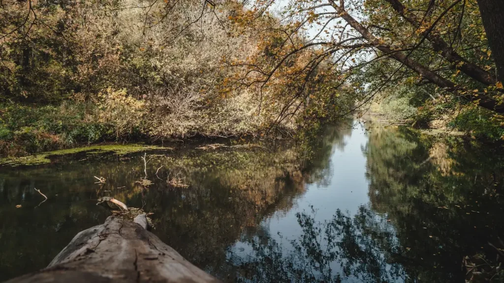
The photo at the top of this page is not Ouachita River.
It is a regional stand-in, honestly captioned but generic — we will not put a name to a river we cannot prove. Send us a photograph you took here and it replaces the stand-in, with your credit on it.
Pioneer badgeUnclaimed
Add a photo of this water
Landscape, not fish — the water itself. Reviewed by hand before it appears. The first one published here earns the Pioneer badge.
Fished this water? Add a photo
Reviewed by hand before it appears. Pick the water, not the spot — we never publish exact locations.
Access
Mount Ida - the gauge reach and the main access point on the upper river.
Rocky Shoals - Ouachita National Forest access and a popular float launch.
Highway 27 crossing near Norman - bridge access on the upper reach.
Dragover - a classic float access in the national forest corridor.
Pine Ridge area - upper river access above the main float water.
Highway 270 crossings - access at several points along the valley.
Upper end of Lake Ouachita - the bottom of the free-flowing reach.
Seasons
Spring: the best flows of the year and the strongest smallmouth fishing of the season.
Summer: low clear water, wading and sight fishing, with floats needing some dragging.
Fall: cooling water, active smallmouth and excellent color through the Ouachita valley.
Winter: slow and cold, with fish stacked in the deepest pools.
From the water
No logged trips yet. Be the first to put this water on your map.
Log this water
Fished it or cleaned it? Log in or create a free account to log a trip with photos and earn the waterway badge.
Questions
What is the current flow on the Ouachita River?
As of Nov 2, 7:30 am, the USGS gauge Ouachita River near Mount Ida, AR reads 15 cfs. Conditions update every 15 minutes.
What species can you catch on the Ouachita River?
Anglers target Bluegill, Channel Catfish, Largemouth Bass, Longear Sunfish, Ozark Bass, Rock Bass, Shadow Bass, Smallmouth Bass, Spotted Bass on the Ouachita River in Arkansas.
Are there fishing guides on the Ouachita River?
GuidedFloats lists 3 guides and outfitters on the Ouachita River. Claimed profiles accept booking requests; unclaimed profiles are built from public records and link to the business.
Where can you access the Ouachita River?
Mount Ida - the gauge reach and the main access point on the upper river. Rocky Shoals - Ouachita National Forest access and a popular float launch. Highway 27 crossing near Norman - bridge access on the upper reach. Dragover - a classic float access in the national forest corridor. Pine Ridge area - upper river access above the main float water. Highway 270 crossings - access at several points along the valley. Upper end of Lake Ouachita - the bottom of the free-flowing reach.
When is the best time to fish the Ouachita River?
Spring: the best flows of the year and the strongest smallmouth fishing of the season. Summer: low clear water, wading and sight fishing, with floats needing some dragging. Fall: cooling water, active smallmouth and excellent color through the Ouachita valley. Winter: slow and cold, with fish stacked in the deepest pools.
Where are the fishing regulations for the Ouachita River?
Regulations change by season and section. Read the current rules on the Arkansas agency site: https://www.agfc.com/regulations/general-fishing-regulations/