Fishes Kennebec River
River · Western Maine · Maine
Kennebec River Fishing Guides
Maine's classic salmon river, running from Moosehead Lake through the Kennebec Gorge to Bingham, Solon and Skowhegan, with landlocked salmon, brook trout and a fall run of big browns.
Map of the Kennebec River
88 numbered points: 28 access points, 4 campsites, 2 bait & fly shops, 16 bridges, 17 parks and conservation areas, 3 agency offices, 4 regulation section limits, 12 hazards, 1 spring, 1 USGS gauge. Tap a marker for details. Reviewed Sep 26, 2026.
- Access / boat ramp (28)
- Campsite (4)
- Bait, tackle & fly shop (2)
- Bridge crossing (16)
- Park / conservation area (17)
- Agency / conservation office (3)
- Regulation section limit (4)
- Dam / hazard (12)
- Spring (1)
- USGS gauge (1)
Map data © OpenStreetMap contributors. Points are curated from OpenStreetMap and state agency sources; confirm access and hours before you go.
Print it. Bag it. Bring it.Phones die, screens crack, and most of this water has no signal. Print this map, fold it into a zip-top bag or dry bag with your license, and you have a backup your electronics can’t give you. Every marker is numbered so you can say exactly where you are.
Open the printable mapAll 88 points on this map
| # | Point | Type | Lat, Lon | Notes |
|---|---|---|---|---|
| 1 | East Outlet Dam (Moosehead Lake) Brookfield Renewable | NID ME00091 | Dam / hazard | 45.58573, -69.71486 | Head of the Kennebec: the East Outlet leaves Moosehead here. Flow through the reach below is release-driven, so read the gauge before you commit. |
| 2 | Rockwood Road bridge (ME 6 / ME 15) East Outlet, Big Moose Twp | Bridge crossing | 45.58365, -69.71949 | |
| 3 | Burnham Pond Road landing Big Moose Twp | unnamed in OSM | Access / boat ramp | 45.54590, -69.77018 | Slipway named from its access road by reverse geocode; no agency sign recorded. |
| 4 | Harris Dam (Indian Pond) Brookfield Renewable | NID ME00090 | Dam / hazard | 45.46032, -69.86571 | Controls the releases through the Kennebec Gorge. Also the upstream limit the state names as Indian Pond Dam for the reach running down to the Abenaki (lower) Dam in Madison. |
| 5 | Harris Station put-in below Harris Dam | Access / boat ramp | 45.45835, -69.86602 | Standard put-in for the gorge. |
| 6 | Indian Pond Family Campground Indian Stream Twp | Campsite | 45.45543, -69.85549 | |
| 7 | Kids fishing area limit - US 201 bridge, The Forks downstream end | Regulation section limit | 45.33674, -69.96828 | The state names a kids fishing area from the Moxie Stream confluence in Moxie Gore down to this bridge. Only this end is mapped - the Moxie mouth is not in OSM here. |
| 8 | Ballfield Road landing West Forks Plt | unnamed in OSM | Access / boat ramp | 45.33814, -69.96661 | Named from its access road by reverse geocode. |
| 9 | Riverdrivers West Forks | open year round | Campsite | 45.33924, -69.97121 | |
| 10 | Crusher Pool access The Forks | unnamed in OSM | Access / boat ramp | 45.31932, -69.98198 | Named for the pool it serves, from a reverse geocode. |
| 11 | Maine Forest Service station ranger station | US 201 corridor | Agency / conservation office | 45.23744, -69.99578 | |
| 12 | Caratunk Country Store general store | US 201, Caratunk | Bait, tackle & fly shop | 45.21908, -69.98756 | The only retailer on the US 201 corridor above Bingham. Tagged as an outdoor shop in OSM; tackle stock not verified. |
| 13 | US 201 landing, Caratunk unnamed in OSM | Access / boat ramp | 45.21063, -69.98910 | Named from the road it leaves, by reverse geocode. |
| 14 | Canada Road landing, Moscow unnamed in OSM | Access / boat ramp | 45.13400, -69.94827 | |
| 15 | Pleasant Ridge Road landing (upper) Pleasant Ridge Plt | unnamed in OSM | Access / boat ramp | 45.07416, -69.92132 | One of two slipways on this road; this is the upstream one. |
| 16 | Station Road landing, Moscow unnamed in OSM | Access / boat ramp | 45.06806, -69.90356 | |
| 17 | Pleasant Ridge Road landing (lower) Pleasant Ridge Plt | unnamed in OSM | Access / boat ramp | 45.06523, -69.90007 | |
| 18 | Roadside spring Moscow | Spring | 45.06317, -69.90260 | Tagged natural=spring in OSM. Untreated and untested - treat before drinking. |
| 19 | Bingham boat launch Lander Avenue, Bingham | Access / boat ramp | 45.05309, -69.88614 | The red markers the state uses as the upstream end of the Bingham kids fishing area sit by this launch. |
| 20 | USGS gauge - Kennebec River at Bingham site 01046500 | USGS gauge | 45.05194, -69.88556 | The gauge this water page reads. A second streamflow gauge, 01042500 at The Forks, covers the gorge reach upstream. |
| 21 | Kids fishing area limit - ME 16 bridge, Bingham downstream end | Regulation section limit | 45.05230, -69.88577 | Downstream boundary of the Bingham kids fishing area; the upstream end is the red markers by the Bingham boat launch. |
| 22 | Solon rail-trail landing Kennebec Valley Rail Trail | unnamed in OSM | Access / boat ramp | 44.96353, -69.86576 | |
| 23 | Williams Dam NID ME00088 | Dam / hazard | 44.95935, -69.86992 | |
| 24 | Ferry Street bridge (US 201A / ME 8) Solon - Embden | Bridge crossing | 44.93776, -69.86962 | |
| 25 | Thompson & Dinsmore Islands nature reserve in the river | Park / conservation area | 44.87169, -69.86275 | |
| 26 | Madison Street landing, Anson unnamed in OSM | Access / boat ramp | 44.85815, -69.87279 | |
| 27 | Nathan Street Boat Landing Anson | Access / boat ramp | 44.80450, -69.88656 | |
| 28 | Main Street bridge (US 201A) Anson - Madison | Bridge crossing | 44.79890, -69.88823 | |
| 29 | Anson Station Dam NID ME00087 | Dam / hazard | 44.79814, -69.88832 | |
| 30 | Abenaquis Dam NID ME00086 | Dam / hazard | 44.79144, -69.88727 | The state calls this the Abenaki (lower) Dam in Madison and uses it as a reach boundary: the reach above runs up to Indian Pond Dam, the reach below down to the red markers at the Skowhegan rest area. |
| 31 | Madison Paper Corporation log dam weir | NID ME00736 | Dam / hazard | 44.79017, -69.88950 | |
| 32 | Madison rail-trail landing Madison Branch Rail Trail | unnamed in OSM | Access / boat ramp | 44.78645, -69.88873 | |
| 33 | Madison rail-trail landing (lower) Madison Branch Rail Trail | unnamed in OSM | Access / boat ramp | 44.78111, -69.88800 | |
| 34 | Corporal Eugene Cole Memorial Bridge (US 201A) Norridgewock | Bridge crossing | 44.71702, -69.79739 | |
| 35 | Oosoola Park Norridgewock | Park / conservation area | 44.71585, -69.79148 | |
| 36 | Kennebec River boat launch Oosoola Park, Norridgewock | Access / boat ramp | 44.71621, -69.78985 | |
| 37 | Yankee Woodlot Maine Bureau of Parks and Lands | Park / conservation area | 44.75847, -69.73651 | Demonstration woodlot; OHV use is signed here. |
| 38 | Weston Dam NID ME00085 | Dam / hazard | 44.76477, -69.72102 | OSM records this dam as planned for demolition some time in the 2030s. |
| 39 | Swinging Bridge footbridge, Skowhegan gorge | Bridge crossing | 44.76248, -69.72062 | |
| 40 | US 2 / US 201 bridge, Skowhegan Island Avenue | Bridge crossing | 44.76316, -69.71815 | |
| 41 | Weston south channel dam NID ME00085S001 | Dam / hazard | 44.76361, -69.71792 | |
| 42 | Riverside Park Skowhegan | Park / conservation area | 44.76526, -69.71722 | |
| 43 | Gorge Overlook Skowhegan | Park / conservation area | 44.76747, -69.71187 | |
| 44 | Coburn Park Skowhegan | Park / conservation area | 44.77106, -69.70988 | |
| 45 | Great Eddy Island nature reserve | Park / conservation area | 44.77010, -69.70360 | |
| 46 | Reach limit - red markers at the Skowhegan rest area Kennebec Banks Rest Area, US 2 | Regulation section limit | 44.76854, -69.68380 | Placed at the rest area the rule names, east of Skowhegan on US 2 - the red markers themselves are not mapped. Bounds the Abenaki Dam reach above and the Lockwood Dam reach below. |
| 47 | Cleaver Landing Skowhegan | Access / boat ramp | 44.76840, -69.68157 | |
| 48 | Two Rivers Campground Skowhegan | Campsite | 44.77024, -69.67609 | |
| 49 | Somerset Woods preserve Somerset Woods Trustees | Park / conservation area | 44.73737, -69.64276 | |
| 50 | Canaan Road landing, Fairfield unnamed in OSM | Access / boat ramp | 44.68503, -69.63109 | |
| 51 | ME 23 bridge (Canaan Road) Fairfield - Canaan | Bridge crossing | 44.68575, -69.63031 | |
| 52 | Shawmut Dam NID ME00084 | Dam / hazard | 44.63097, -69.58303 | The upstream side of this dam is the downstream end of the Skowhegan rest area kids fishing area. OSM records the dam as planned for demolition in the 2030s. |
| 53 | Mill Island Park Fairfield | Park / conservation area | 44.59165, -69.59352 | |
| 54 | ME 11 / ME 100 / ME 139 bridge Fairfield - Benton | Bridge crossing | 44.58710, -69.58984 | |
| 55 | Water Street landing, Fairfield unnamed in OSM | Access / boat ramp | 44.58544, -69.59369 | |
| 56 | Hydro-Kennebec Dam Waterville - Winslow | Dam / hazard | 44.56334, -69.61876 | |
| 57 | Head of Falls Park Waterville | Park / conservation area | 44.55139, -69.62765 | |
| 58 | Two Cent Bridge footbridge, Waterville - Winslow | Bridge crossing | 44.55084, -69.62622 | |
| 59 | Ticonic Falls weir | Dam / hazard | 44.54785, -69.62676 | |
| 60 | Ticonic Bridge (US 201 / ME 100) Waterville - Winslow | Bridge crossing | 44.54739, -69.62718 | |
| 61 | Lockwood Dam NID ME00082 | Dam / hazard | 44.54620, -69.62836 | The state uses the upstream side of this dam as a reach boundary and its downstream side as the head of the next reach, which runs to the head of tidewater above the Calumet Bridge. |
| 62 | Waterville boat launch | Access / boat ramp | 44.53311, -69.64398 | |
| 63 | Carter Memorial Bridge (ME 137) Waterville - Winslow | Bridge crossing | 44.53033, -69.64567 | |
| 64 | Maine Dept. of Inland Fisheries & Wildlife - Sidney regional office | Agency / conservation office | 44.45150, -69.72767 | |
| 65 | Sidney recreation area landing Recreation Drive | unnamed in OSM | Access / boat ramp | 44.42880, -69.70190 | |
| 66 | Dick’s Sporting Goods, Augusta big-box sporting goods | Bait, tackle & fly shop | 44.34895, -69.78507 | Fishing department and licence sales; 2.1 km off the river. |
| 67 | Cushnoc Crossing Bridge (ME 3) Augusta | Bridge crossing | 44.33551, -69.76451 | |
| 68 | Mill Park Augusta | Park / conservation area | 44.32429, -69.77187 | |
| 69 | Head of tidewater - Calumet Bridge, Augusta downstream end of the inland reach | Regulation section limit | 44.31679, -69.77223 | The inland reach ends at the power lines about 4,200 ft above this bridge; the bridge is the placeable anchor. Below here the river is tidal. |
| 70 | Augusta Waterfront Park Augusta | Park / conservation area | 44.31454, -69.77366 | |
| 71 | East Side Boat Landing Augusta | Access / boat ramp | 44.31388, -69.77196 | |
| 72 | Memorial Bridge (US 201 / US 202) Augusta | Bridge crossing | 44.31249, -69.77275 | |
| 73 | Maine Dept. of Inland Fisheries & Wildlife - Augusta state headquarters | Agency / conservation office | 44.30112, -69.78298 | |
| 74 | Kennebec River Rail Trail Park Augusta - Hallowell | Park / conservation area | 44.29908, -69.77952 | |
| 75 | Ferry Road landing, Chelsea unnamed in OSM | Access / boat ramp | 44.28613, -69.78734 | |
| 76 | Hallowell waterfront landing Water Street | unnamed in OSM | Access / boat ramp | 44.28286, -69.79049 | |
| 77 | ME 9 / ME 27 bridge Gardiner - Randolph | Bridge crossing | 44.23328, -69.76984 | |
| 78 | Gardiner Launch | Access / boat ramp | 44.22956, -69.76994 | |
| 79 | Waterfront Park Gardiner | Park / conservation area | 44.22859, -69.76911 | |
| 80 | Colburn House State Historic Site Pittston | Park / conservation area | 44.19812, -69.75557 | |
| 81 | ME 197 bridge Richmond - Dresden | Bridge crossing | 44.09143, -69.78360 | |
| 82 | Swan Island campsite Steve Powell WMA, Perkins Twp | Campsite | 44.07279, -69.79163 | On Swan Island inside MDIFW’s Steve Powell Wildlife Management Area. Unnamed in OSM; located by reverse geocode. |
| 83 | North End Boat Launch Bath | Access / boat ramp | 43.92908, -69.81137 | |
| 84 | US 1 Leeman Highway bridge Bath - Woolwich | Bridge crossing | 43.91175, -69.80939 | |
| 85 | South End Boat Launch Bath | Access / boat ramp | 43.88908, -69.81555 | |
| 86 | Blaisdell Drive landing, Phippsburg unnamed in OSM | Access / boat ramp | 43.87223, -69.80038 | |
| 87 | Wilbur Preserve at Cox’s Head Phippsburg Land Trust | Park / conservation area | 43.76647, -69.78835 | |
| 88 | Fort Popham State Historic Site Phippsburg | river mouth | Park / conservation area | 43.75431, -69.78404 |
Guides on the Kennebec River
Claimed profiles take booking requests. Unclaimed profiles are built from public records so the river is never empty; the guide can claim or remove one any time.
About the Kennebec River
The Kennebec leaves Moosehead Lake at the Indian Pond outlet, drops through the Kennebec Gorge, and runs south past The Forks, Bingham, Solon, Madison and Skowhegan on its way to the sea at Bath. It is Maine’s most complete river: whitewater rafting at the top, landlocked salmon and brook trout through the middle, brown trout in the towns, smallmouth in the warm reaches and striped bass in the tidal water.
The reach anglers travel for is the East Outlet and the upper river from Indian Pond down through the gorge and Wyman Lake to Bingham and Solon. Landlocked salmon are the marquee fish, chasing smelt in spring and taking dry flies in the summer riffles, and they are joined by brook trout that in this system reach sizes rare anywhere else in the East. Below Wyman Dam the tailwater from Bingham to Solon and Madison is cold, big and productive, and it holds brown and rainbow trout as well as salmon.
The Bingham gauge sits below Wyman Dam and reads the release. Generation drives it, and the river changes level during the day. Guides fish the low-flow windows and time wading around the release; check the schedule as well as the gauge. Spring flows are high and cold, summer releases are more predictable, and fall brings the best fishing of the year as the salmon and browns move.
The Forks, Bingham and Skowhegan cover lodging and outfitters, and the rafting economy at The Forks means there is more infrastructure here than in most of northern Maine.
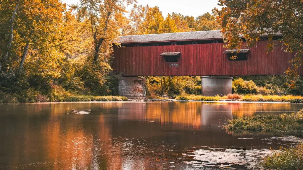
This water needs a real photo
The photo at the top of this page is not Kennebec River.
It is a regional stand-in, honestly captioned but generic — we will not put a name to a river we cannot prove. Send us a photograph you took here and it replaces the stand-in, with your credit on it.
Pioneer badgeUnclaimed
Add a photo of this water
Landscape, not fish — the water itself. Reviewed by hand before it appears. The first one published here earns the Pioneer badge.
Fished this water? Add a photo
Reviewed by hand before it appears. Pick the water, not the spot — we never publish exact locations.
Access
East Outlet, Moosehead Lake: the top of the river, walk-in and boat access, the best-known salmon water.
Indian Pond and the Kennebec Gorge: raft launch and remote access.
The Forks: confluence with the Dead River, outfitters and lodging.
Wyman Lake and Wyman Dam: impoundment and the top of the Bingham tailwater.
Bingham and Solon: tailwater accesses near the gauge.
Madison, Skowhegan and Waterville: lower river access in warmer water.
Seasons
April through June: high cold water, smelt runs, the best landlocked salmon fishing of the spring.
July and August: summer flows, dry fly fishing in the riffles, rafting traffic in the gorge.
September and October: fall salmon and brown trout, the strongest month of the year.
Winter: most of the river closes; check current Maine open water and ice fishing rules.
From the water
No logged trips yet. Be the first to put this water on your map.
Log this water
Fished it or cleaned it? Log in or create a free account to log a trip with photos and earn the waterway badge.
Questions
What is the current flow on the Kennebec River?
As of Oct 19, 3:15 am, the USGS gauge Kennebec River at Bingham, Maine reads 1,680 cfs, the 8th percentile for this date. Conditions update every 15 minutes.
What species can you catch on the Kennebec River?
Anglers target Brook Trout, Brown Trout, Landlocked Atlantic Salmon, Rainbow Trout, Smallmouth Bass, Striped Bass on the Kennebec River in Maine.
Are there fishing guides on the Kennebec River?
GuidedFloats lists 2 guides and outfitters on the Kennebec River. Claimed profiles accept booking requests; unclaimed profiles are built from public records and link to the business.
Where can you access the Kennebec River?
East Outlet, Moosehead Lake: the top of the river, walk-in and boat access, the best-known salmon water. Indian Pond and the Kennebec Gorge: raft launch and remote access. The Forks: confluence with the Dead River, outfitters and lodging. Wyman Lake and Wyman Dam: impoundment and the top of the Bingham tailwater. Bingham and Solon: tailwater accesses near the gauge. Madison, Skowhegan and Waterville: lower river access in warmer water.
When is the best time to fish the Kennebec River?
April through June: high cold water, smelt runs, the best landlocked salmon fishing of the spring. July and August: summer flows, dry fly fishing in the riffles, rafting traffic in the gorge. September and October: fall salmon and brown trout, the strongest month of the year. Winter: most of the river closes; check current Maine open water and ice fishing rules.
Where are the fishing regulations for the Kennebec River?
Regulations change by season and section. Read the current rules on the Maine agency site: https://www.maine.gov/ifw/fishing-boating/fishing/laws-rules/index.html