Fishes Androscoggin River, Kennebec River
River · Western Maine · Maine
Androscoggin River Fishing Guides
A recovered industrial river running from Errol through Bethel, Rumford and Lewiston, with a strong brown trout fishery in the upper reaches and smallmouth through the valley.
Map of the Androscoggin River
72 numbered points: 14 access points, 3 bait & fly shops, 1 outfitter, 20 bridges, 18 parks and conservation areas, 1 agency office, 3 regulation section limits, 11 hazards, 1 USGS gauge. Tap a marker for details. Reviewed Sep 26, 2026.
- Access / boat ramp (14)
- Bait, tackle & fly shop (3)
- Outfitter / canoe rental (1)
- Bridge crossing (20)
- Park / conservation area (18)
- Agency / conservation office (1)
- Regulation section limit (3)
- Dam / hazard (11)
- USGS gauge (1)
Map data © OpenStreetMap contributors. Points are curated from OpenStreetMap and state agency sources; confirm access and hours before you go.
Print it. Bag it. Bring it.Phones die, screens crack, and most of this water has no signal. Print this map, fold it into a zip-top bag or dry bag with your license, and you have a backup your electronics can’t give you. Every marker is numbered so you can say exactly where you are.
Open the printable mapAll 72 points on this map
| # | Point | Type | Lat, Lon | Notes |
|---|---|---|---|---|
| 1 | Reach limit - Maine / New Hampshire border upstream end of the Maine reach | Regulation section limit | 44.38754, -71.01547 | Where the centreline crosses the state line at Shelburne - Gilead. The state reach above the Gilead bridge starts here; New Hampshire’s Androscoggin has its own sheet. |
| 2 | Reach limit - bridge crossing in Gilead Bridge Street, Gilead | Regulation section limit | 44.39834, -70.97161 | Bounds the border reach above and the Rumford Point reach below. |
| 3 | Gilead Bridge Street landing no fee | unnamed in OSM | Access / boat ramp | 44.39740, -70.97326 | Named from the road by reverse geocode. |
| 4 | US 2 bridge, Bethel Mayville Road | US 2 / ME 5 / ME 26 | Bridge crossing | 44.41653, -70.79723 | |
| 5 | Bethel Outdoor Adventures campground and canoe rental | Outfitter / canoe rental | 44.41834, -70.79691 | The only paddling outfitter mapped on the Maine Androscoggin. |
| 6 | Davis Park Bethel | Park / conservation area | 44.41442, -70.79118 | |
| 7 | Moran’s Landing Hanover | Access / boat ramp | 44.48729, -70.78329 | Slipway and town landing at one site. |
| 8 | Ferry Road landing, Hanover unnamed in OSM | Access / boat ramp | 44.49365, -70.69438 | |
| 9 | Reach limit - Route 232 bridge, Rumford Point | Regulation section limit | 44.50086, -70.67359 | Bounds the Gilead reach above and the Livermore Falls Dam reach below. |
| 10 | Hastings Landing Rumford | Park / conservation area | 44.51242, -70.61262 | |
| 11 | Rumford public boat access Town of Rumford | Access / boat ramp | 44.51554, -70.55872 | |
| 12 | South Rumford Road bridge Rumford | Bridge crossing | 44.53619, -70.54279 | |
| 13 | Upper Dam Rumford Falls | NID ME00013 | Dam / hazard | 44.53859, -70.54480 | |
| 14 | Middle Dam Rumford Falls | NID ME00012 | Dam / hazard | 44.54286, -70.54519 | |
| 15 | Morse Bridge (ME 108) Rumford | Bridge crossing | 44.54348, -70.54662 | |
| 16 | Veterans Memorial Park Town of Rumford | Park / conservation area | 44.54361, -70.54542 | |
| 17 | Old Rumford Dam Rumford Falls | Dam / hazard | 44.54673, -70.54784 | |
| 18 | Chisholm Park Town of Rumford | Park / conservation area | 44.54711, -70.54736 | |
| 19 | Chisholm Park Bridge Rumford | Bridge crossing | 44.54775, -70.54783 | |
| 20 | Riverside Avenue landing, Mexico unnamed in OSM | Access / boat ramp | 44.55529, -70.54256 | |
| 21 | Veterans Street bridge Rumford - Mexico | Bridge crossing | 44.54966, -70.53395 | |
| 22 | Buddy Wendall McLain Memorial Bridge Dixfield | Bridge crossing | 44.53002, -70.46381 | |
| 23 | LeBlanc Rivershore Preserve Androscoggin Land Trust | Park / conservation area | 44.46903, -70.31608 | |
| 24 | School Street bridge Canton | Bridge crossing | 44.46087, -70.30428 | |
| 25 | Dorey Drive landing, Canton unnamed in OSM | Access / boat ramp | 44.48042, -70.27561 | |
| 26 | Canton Rivershore Conservation Area Androscoggin Land Trust | Park / conservation area | 44.50502, -70.25247 | Two OSM polygons carry this name on the same reach; one point shipped. |
| 27 | Riley Dam NID ME00011 | Dam / hazard | 44.50278, -70.24982 | |
| 28 | Pine Island Park Jay | Park / conservation area | 44.50171, -70.22104 | |
| 29 | Riley Road bridge Jay | Bridge crossing | 44.50020, -70.21822 | |
| 30 | French Falls Recreation Area Jay | Park / conservation area | 44.49396, -70.20560 | |
| 31 | Otis Dam NID ME00009 | Dam / hazard | 44.47846, -70.20062 | |
| 32 | ME 4 bridge Jay - Livermore Falls | Bridge crossing | 44.47258, -70.19192 | |
| 33 | Livermore Falls Dam NID ME00008 | Dam / hazard | 44.47093, -70.18954 | The state uses this dam as a reach boundary: the reach above runs up to the Route 232 bridge at Rumford Point, the reach below runs to tidewater. |
| 34 | Livermore Falls Recreation Park | Park / conservation area | 44.47036, -70.18768 | |
| 35 | Howes Corner Road bridge Turner | Bridge crossing | 44.34242, -70.18866 | |
| 36 | Center Bridge Road bridge Turner - Leeds | Bridge crossing | 44.25623, -70.17964 | |
| 37 | Center Bridge boat launch Turner | Access / boat ramp | 44.25722, -70.18324 | |
| 38 | Cherry Pond boat launch Leeds | Access / boat ramp | 44.19011, -70.20230 | |
| 39 | Gulf Island Dam NID ME00007 | Dam / hazard | 44.15316, -70.20986 | |
| 40 | Deer Rips Dam NID ME00006 | Dam / hazard | 44.13563, -70.20231 | |
| 41 | David Rancourt River Preserve Auburn | Park / conservation area | 44.12753, -70.20517 | |
| 42 | Mount Auburn Avenue bridge Auburn - Lewiston | Bridge crossing | 44.11704, -70.21676 | |
| 43 | Auburn boat access North River Road | Access / boat ramp | 44.10798, -70.22330 | |
| 44 | West Pitch Park Auburn | Great Falls overlook | Park / conservation area | 44.10073, -70.22404 | |
| 45 | Lewiston Falls project dam NID ME00005 | Dam / hazard | 44.10151, -70.22235 | |
| 46 | James B. Longley Memorial Bridge Lewiston - Auburn | Bridge crossing | 44.09720, -70.22294 | |
| 47 | Dag’s Bait and Tackle Auburn | Bait, tackle & fly shop | 44.08272, -70.24867 | The one dedicated bait and tackle shop mapped on this river; 2.2 km off the water. |
| 48 | Bernard Lown Peace Bridge Lewiston - Auburn | Bridge crossing | 44.08947, -70.22130 | |
| 49 | Canal Street Dam Lewiston | Dam / hazard | 44.08642, -70.21293 | |
| 50 | Lincoln Street boat launch Lewiston | Access / boat ramp | 44.07708, -70.20503 | |
| 51 | USGS gauge - Androscoggin River near Auburn site 01059000 | USGS gauge | 44.07222, -70.20806 | The gauge this water page reads. A second streamflow gauge, 01054500 at Rumford, covers the upper Maine reach. |
| 52 | Maine Turnpike bridge (I-95) Auburn | Bridge crossing | 44.06450, -70.20719 | |
| 53 | Durham boat launch Durham | Access / boat ramp | 44.01397, -70.16791 | |
| 54 | Durham River Park Durham | Park / conservation area | 43.98604, -70.13451 | |
| 55 | Miller Park boat launch Town of Lisbon | Access / boat ramp | 44.01197, -70.08671 | |
| 56 | ME 9 bridge Lisbon Falls - Durham | Bridge crossing | 43.99313, -70.05842 | |
| 57 | Pejepscot boat ramp Topsham | Access / boat ramp | 43.99033, -70.04792 | |
| 58 | Pejepscot Dam NID ME00003 | Dam / hazard | 43.95672, -70.02501 | |
| 59 | Dick’s Sporting Goods, Topsham big-box sporting goods | Bait, tackle & fly shop | 43.93245, -69.98481 | Fishing department and licence sales, 0.6 km off the river. |
| 60 | Coombs Property Brunswick-Topsham Land Trust | Park / conservation area | 43.92693, -69.99153 | |
| 61 | Mill Street canoe portage Brunswick | Park / conservation area | 43.91398, -69.97698 | |
| 62 | Black Bridge Brunswick - Topsham | Bridge crossing | 43.91613, -69.97513 | |
| 63 | Androscoggin Swinging Bridge footbridge, Brunswick - Topsham | Bridge crossing | 43.91778, -69.97281 | |
| 64 | Woods + Waters Gear Exchange used outdoor gear, Brunswick | Bait, tackle & fly shop | 43.91452, -69.96628 | Outdoor gear exchange rather than a tackle dealer; listed because Brunswick has nothing closer. |
| 65 | Brunswick Visitor Center town information office | Agency / conservation office | 43.91149, -69.96556 | |
| 66 | Androscoggin Riverwalk Park Brunswick | Park / conservation area | 43.92029, -69.97066 | |
| 67 | Maine Street bridge (US 201) Brunswick - Topsham | Bridge crossing | 43.92038, -69.96637 | |
| 68 | Pinette’s Landing Brunswick | Park / conservation area | 43.92189, -69.95914 | |
| 69 | Water Street boat landing Brunswick | Access / boat ramp | 43.92223, -69.95527 | |
| 70 | Merrymeeting Bridge (ME 196 / ME 24) Brunswick - Topsham | Bridge crossing | 43.92238, -69.95273 | |
| 71 | Cow Island Brunswick-Topsham Land Trust | Park / conservation area | 43.91622, -69.93717 | |
| 72 | Merrymeeting Park Town of Brunswick | tidewater | Park / conservation area | 43.91205, -69.92532 |
Guides on the Androscoggin River
Claimed profiles take booking requests. Unclaimed profiles are built from public records so the river is never empty; the guide can claim or remove one any time.
About the Androscoggin River
The Androscoggin runs from Umbagog Lake on the New Hampshire line east and south through Bethel, Rumford, Livermore Falls, Lewiston and Auburn to Merrymeeting Bay. Its history is the story of the Clean Water Act: this was one of the most polluted rivers in the country in the 1960s and the conditions here helped drive the law itself. The recovery is real, and today the upper river is a legitimate trout fishery and the lower valley a productive warm-water one.
The best trout water is up top, from Errol and the New Hampshire border down through Bethel. Brown trout dominate, with rainbows, brook trout and landlocked salmon mixed in, and the reach around Pontook and the Bethel valley fishes well from a drift boat or on foot. Hatches are strong and the river has enough riffle and pocket water to hold fish through the summer. Farther down, past the paper mill towns, the river warms and smallmouth bass, pike and pickerel take over, with excellent bass floating around Turner and Leeds.
The Auburn gauge sits low in the basin and reads the whole drainage, so it is best used as a general indicator of whether the river is up or down rather than as a precise guide to the trout water two hours north. Dams and generation affect levels through the middle river. Spring flows are heavy and cold; summer is the practical guided season.
Bethel is the base for the upper river, with lodging, a ski economy and outfitters. Lewiston and Auburn cover the lower valley.
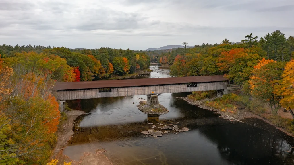
This water needs a real photo
The photo at the top of this page is not Androscoggin River.
It is a regional stand-in, honestly captioned but generic — we will not put a name to a river we cannot prove. Send us a photograph you took here and it replaces the stand-in, with your credit on it.
Pioneer badgeUnclaimed
Add a photo of this water
Landscape, not fish — the water itself. Reviewed by hand before it appears. The first one published here earns the Pioneer badge.
Fished this water? Add a photo
Reviewed by hand before it appears. Pick the water, not the spot — we never publish exact locations.
Access
Errol, New Hampshire and Umbagog Lake: the head of the river and the top of the trout water.
Pontook Reservoir and the Thirteen Mile Woods: upper river access along Route 16.
Bethel and Gilead: Maine accesses in the best brown trout water.
Rumford and Dixfield: middle river accesses.
Turner and Leeds: valley ramps in the smallmouth reach.
Lewiston and Auburn: lower river access near the gauge.
Seasons
April through June: high water, then the best brown trout fishing as it drops; smelt and salmon up top.
July and August: summer flows, evening hatches on the upper river, prime smallmouth in the valley.
September and October: fall browns and the best water clarity of the year.
Winter: limited; check current Maine open water rules by section.
From the water
No logged trips yet. Be the first to put this water on your map.
Log this water
Fished it or cleaned it? Log in or create a free account to log a trip with photos and earn the waterway badge.
Questions
What is the current flow on the Androscoggin River?
As of Oct 19, 2:15 am, the USGS gauge Androscoggin River near Auburn, Maine reads 2,160 cfs, the 22nd percentile for this date. Conditions update every 15 minutes.
What species can you catch on the Androscoggin River?
Anglers target Brook Trout, Brown Trout, Landlocked Atlantic Salmon, Northern Pike, Rainbow Trout, Smallmouth Bass on the Androscoggin River in Maine.
Are there fishing guides on the Androscoggin River?
GuidedFloats lists 1 guide and outfitters on the Androscoggin River. Claimed profiles accept booking requests; unclaimed profiles are built from public records and link to the business.
Where can you access the Androscoggin River?
Errol, New Hampshire and Umbagog Lake: the head of the river and the top of the trout water. Pontook Reservoir and the Thirteen Mile Woods: upper river access along Route 16. Bethel and Gilead: Maine accesses in the best brown trout water. Rumford and Dixfield: middle river accesses. Turner and Leeds: valley ramps in the smallmouth reach. Lewiston and Auburn: lower river access near the gauge.
When is the best time to fish the Androscoggin River?
April through June: high water, then the best brown trout fishing as it drops; smelt and salmon up top. July and August: summer flows, evening hatches on the upper river, prime smallmouth in the valley. September and October: fall browns and the best water clarity of the year. Winter: limited; check current Maine open water rules by section.
Where are the fishing regulations for the Androscoggin River?
Regulations change by season and section. Read the current rules on the Maine agency site: https://www.maine.gov/ifw/fishing-boating/fishing/laws-rules/index.html