Logan River Fishing Guides
A cold canyon river dropping out of the Bear River Range through Logan Canyon, native Bonneville cutthroat up high and heavy browns down low.
Map of the Logan River
37 numbered points: 2 access points, 8 campsites, 3 bait & fly shops, 3 bridges, 10 parks and conservation areas, 1 agency office, 4 regulation section limits, 3 hazards, 2 springs, 1 USGS gauge. Tap a marker for details. Reviewed Sep 24, 2026.
- Access / boat ramp (2)
- Campsite (8)
- Bait, tackle & fly shop (3)
- Bridge crossing (3)
- Park / conservation area (10)
- Agency / conservation office (1)
- Regulation section limit (4)
- Dam / hazard (3)
- Spring (2)
- USGS gauge (1)
Print it. Bag it. Bring it.Phones die, screens crack, and most of this water has no signal. Print this map, fold it into a zip-top bag or dry bag with your license, and you have a backup your electronics can’t give you. Every marker is numbered so you can say exactly where you are.
Open the printable mapAll 37 points on this map
| # | Point | Type | Lat, Lon | Notes |
|---|---|---|---|---|
| 1 | Idaho state line - top of the upper Logan River section Utah upper limit | Regulation section limit | 42.00000, -111.59792 | Utah's upper reach runs from the highway bridge at Red Banks Campground upstream to here. Above this point the Franklin Basin headwaters are in Idaho. Placed where the chained channel crosses 42 deg N. |
| 2 | Franklin Basin Road bridge (upper crossing) FR 006 - Uinta-Wasatch-Cache NF | Bridge crossing | 41.98160, -111.59999 | The uppermost mapped road crossing on the Utah side; the gravel Franklin Basin Road follows the river from here to the state line. |
| 3 | Franklin Basin Horse Camp US Forest Service | Campsite | 41.93719, -111.57242 | About 280 m off the channel on Franklin Basin Road; the only campground OpenStreetMap carries on the uppermost reach. |
| 4 | Franklin Basin Road bridge (lower crossing) FR 006 - Uinta-Wasatch-Cache NF | Bridge crossing | 41.93316, -111.56641 | Second Franklin Basin Road crossing, at the foot of the basin. |
| 5 | Red Banks Campground US Forest Service - US 89 | Campsite | 41.89879, -111.56477 | Sits on the regulation boundary: the highway bridge here divides Utah's two published Logan River reaches. |
| 6 | Highway bridge at Red Banks Campground US 89 - boundary between the two reaches | Regulation section limit | 41.89685, -111.56472 | The published boundary between the lower reach (Card Canyon Bridge upstream to here) and the upper reach (here upstream to the Idaho state line). |
| 7 | Lewis M. Turner Campground US Forest Service - US 89 | Campsite | 41.88523, -111.57228 | Ships knowingly wide: the campground polygon centre is about 690 m from the channel, on the bench above the river. |
| 8 | Ricks Spring Logan Canyon - US 89 pullout | Spring | 41.84014, -111.58873 | A roadside karst spring in the canyon wall; the flow is Logan River water re-emerging and is not treated drinking water. |
| 9 | Temple Fork Road bridge FR 007 | Bridge crossing | 41.83522, -111.59286 | Temple Fork is one of the tributaries the state's Logan River entry pulls in by reference. |
| 10 | Logan Cave Spring Logan Canyon | Spring | 41.81418, -111.62403 | Spring at the Logan Cave entrance; the cave itself is gated for bat protection. |
| 11 | Wood Camp Campground US Forest Service | Campsite | 41.79736, -111.64472 | Small canyon campground at the Wood Camp Hollow bridge; trailhead for the Jardine Juniper. |
| 12 | Preston Valley Campground US Forest Service - US 89 | Campsite | 41.77357, -111.65416 | Streamside sites tight against the highway and the river. |
| 13 | Chokecherry Picnic Area US Forest Service day use | Park / conservation area | 41.77003, -111.65860 | Day-use picnic ground on the river bank; four numbered sites mapped. |
| 14 | Card Canyon Bridge - foot of the lower Logan River section FR 20024 - Utah lower limit | Regulation section limit | 41.76586, -111.66688 | Utah's lower special-regulation reach runs from this bridge upstream to the highway bridge at Red Banks Campground, tributaries in between included but Tony Grove Lake excluded. |
| 15 | Card Picnic Area US Forest Service day use | Park / conservation area | 41.76433, -111.66881 | Day use immediately below Card Canyon Bridge, on the same side road. |
| 16 | Guinavah-Malibu Campground US Forest Service | Campsite | 41.76168, -111.69954 | The largest canyon campground, on the river below the Wind Caves trailhead. |
| 17 | Dewitt Picnic Area US Forest Service day use | Park / conservation area | 41.75721, -111.70943 | Riverside day use between Guinavah and Spring Hollow. |
| 18 | Spring Hollow Campground US Forest Service | Campsite | 41.75123, -111.71686 | At the mouth of Spring Hollow, just above Third Dam. |
| 19 | Third Dam Logan City hydro diversion | Dam / hazard | 41.75314, -111.72332 | The uppermost of the three canyon dams; slack water above it, a drop at the structure. |
| 20 | Bridger Campground US Forest Service | Campsite | 41.74778, -111.73499 | First campground inside the canyon mouth, between Second and Third Dam. |
| 21 | Second Dam Picnic Area US Forest Service day use | Park / conservation area | 41.74647, -111.74757 | Day use on the impoundment above Second Dam. |
| 22 | Second Dam Logan City hydro diversion | Dam / hazard | 41.74498, -111.74910 | Middle of the three canyon dams. |
| 23 | USGS 10109000 - Logan River above State Dam near Logan USGS streamgauge | USGS gauge | 41.74355, -111.78398 | The gauge this water page reads. Three other USGS stations stand within 2 km and were dropped by reading their site numbers: 10109001 and 10108400 are the Cache Highline Canal, not the river. |
| 24 | Ray Hugie Hydro Park Logan City | Park / conservation area | 41.74368, -111.78466 | Riverside park at the gauge and the old hydro plant, on the Logan River Trail. |
| 25 | Canyon Entrance Park (First Dam) Logan City | Park / conservation area | 41.74261, -111.78846 | The First Dam pond at the canyon mouth - the most used bank access on the whole river. |
| 26 | State Dam Diversion below First Dam | Dam / hazard | 41.74092, -111.79140 | The diversion the USGS station is named above; the Cache Highline Canal leaves the river here. |
| 27 | Logan Ranger District, Uinta-Wasatch-Cache National Forest 1500 East Highway 89, Logan | Agency / conservation office | 41.74335, -111.79633 | The office for every campground and day-use site in Logan Canyon. |
| 28 | Sportsman's Warehouse 99 E 1400 N, Logan | Bait, tackle & fly shop | 41.75889, -111.83217 | Big-box outdoor store with a full tackle and fly wall; about 3.1 km from the river. |
| 29 | Al's Sporting Goods 1075 N Main St, Logan | Bait, tackle & fly shop | 41.75155, -111.83614 | Cache Valley's long-standing sporting goods store, with a fly and tackle department. Tagged shop=sports in OpenStreetMap, confirmed trading in 2026. |
| 30 | Denzil Stewart Nature Park Logan City - Logan River Trail | Park / conservation area | 41.72825, -111.81744 | Bank access and interpretive trail where the river runs through town. |
| 31 | The Sportsman Logan | Bait, tackle & fly shop | 41.73389, -111.83521 | Independent Logan sporting goods store carrying tackle; about 1.1 km from the river. |
| 32 | Rendezvous Park Logan City | Park / conservation area | 41.70554, -111.85092 | Large riverside park on the lower Logan River Trail. |
| 33 | Trapper Park Logan City | Park / conservation area | 41.70644, -111.87396 | Westernmost city park on the river, below the SR-252 crossing. |
| 34 | Mendon Road (600 South) bridge - Cutler Reservoir tributaries limit Upper limit of the Cutler tributaries entry | Regulation section limit | 41.72058, -111.88634 | Utah's Cutler Reservoir tributaries entry covers the Logan River and its tributaries upstream to Mendon Road (600 South); this bridge is that limit. |
| 35 | Bud Phelps Wildlife Management Area Utah Division of Wildlife Resources | Park / conservation area | 41.72867, -111.93214 | The one state wildlife property near the lower river; the boundary sits about 1.1 km off the channel across the valley floor. |
| 36 | Boat ramp at Valley View Highway (SR-30) Unnamed in OpenStreetMap | Access / boat ramp | 41.74503, -111.95659 | One of only two mapped launches on the whole river, both down in the Cutler backwater. Named from its road by reverse geocode, not from a signed facility name. |
| 37 | Boat ramp at 3000 North, Benson Unnamed in OpenStreetMap | Access / boat ramp | 41.78783, -111.95294 | The lower of the two Cutler-backwater launches, reached from 3000 North at Benson. Named from its road by reverse geocode. |
Guides on the Logan River
Claimed profiles take booking requests. Unclaimed profiles are built from public records so the river is never empty; the guide can claim or remove one any time.
No guides listed yet
Guide or outfit this water? Create your profile. Listing is free, the commission is 10% or 7% with a premium profile, and premium profiles list first on this water.
About the Logan River
The Logan River runs down Logan Canyon from the Bear River Range through some of the prettiest limestone country in northern Utah, and it fishes far better than its size suggests. The upper river above Red Banks holds native Bonneville cutthroat and brook trout in small, clear pocket water. The middle canyon has a mix of cutthroat, browns and rainbows in classic riffle and pool water along the highway. The lower river through Logan itself holds big, hard-to-catch brown trout in water most drivers pass without a glance.
This is a wading river, small enough to cross in most places and technical enough to keep you honest. Early-summer stoneflies, midsummer caddis and terrestrials, and blue-winged olives in fall carry the hatch calendar, and the cutthroat up high are the most willing fish on the river. Special regulations apply on parts of the canyon, including cutthroat protections, so read the current guidebook before keeping anything.
The gauge above State Dam reads the river as it leaves the canyon. Readings in the tens to low hundreds of cfs are normal and wadeable; spring runoff in May and June pushes it up, colors it, and makes the canyon reaches genuinely dangerous to cross. It settles quickly by mid-summer, and irrigation diversion affects the lowest reaches through the valley.
Logan is the base and Utah State University is right there, which gives the town more fly shops and more twenty-two-year-olds who fish than a valley this size would otherwise have. The canyon road makes access easy, with campgrounds and pullouts along the whole run.
This water needs a real photo
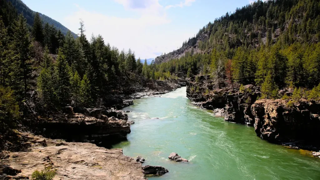
The photo at the top of this page is not Logan River.
It is a regional stand-in, honestly captioned but generic — we will not put a name to a river we cannot prove. Send us a photograph you took here and it replaces the stand-in, with your credit on it.
Add a photo of this water
Landscape, not fish — the water itself. Reviewed by hand before it appears. The first one published here earns the Pioneer badge.
Fished this water? Add a photo
Reviewed by hand before it appears. Pick the water, not the spot — we never publish exact locations.
Access
Franklin Basin and the upper canyon: headwater access and small-stream cutthroat.
Red Banks and Tony Grove Road: upper canyon campgrounds and pullouts.
Guinavah-Malibu and Spring Hollow: mid-canyon campgrounds with river frontage.
Third Dam and Second Dam: popular canyon access points near town.
First Dam and the Logan city reaches: lower river access near the gauge.
Logan Canyon Scenic Byway pullouts: roadside access along most of the river.
Cutthroat regulations vary by reach; check the current guidebook.
Seasons
April and May: pre-runoff fishing, then high, cold and pushy water.
June: runoff tapering; the lower river clears first.
July through September: the main season, easy wading, terrestrials and caddis.
October through March: browns in the fall, then winter fishing on the lower river when the canyon road is clear.
From the water
No logged trips yet. Be the first to put this water on your map.
Log this water
Fished it or cleaned it? Log in or create a free account to log a trip with photos and earn the waterway badge.
Questions
What is the current flow on the Logan River?
As of Nov 2, 7:00 am, the USGS gauge LOGAN RIVER ABOVE STATE DAM, NEAR LOGAN, UT reads 103 cfs, the 30th percentile for this date. Conditions update every 15 minutes.
What species can you catch on the Logan River?
Anglers target Brook Trout, Brown Trout, Cutthroat Trout, Mountain Whitefish, Rainbow Trout on the Logan River in Utah.
Where can you access the Logan River?
Franklin Basin and the upper canyon: headwater access and small-stream cutthroat. Red Banks and Tony Grove Road: upper canyon campgrounds and pullouts. Guinavah-Malibu and Spring Hollow: mid-canyon campgrounds with river frontage. Third Dam and Second Dam: popular canyon access points near town. First Dam and the Logan city reaches: lower river access near the gauge. Logan Canyon Scenic Byway pullouts: roadside access along most of the river. Cutthroat regulations vary by reach; check the current guidebook.
When is the best time to fish the Logan River?
April and May: pre-runoff fishing, then high, cold and pushy water. June: runoff tapering; the lower river clears first. July through September: the main season, easy wading, terrestrials and caddis. October through March: browns in the fall, then winter fishing on the lower river when the canyon road is clear.
Where are the fishing regulations for the Logan River?
Regulations change by season and section. Read the current rules on the Utah agency site: https://wildlife.utah.gov/guidebooks.html