Fishes Weber River
River · Northern Utah · Utah
Weber River Fishing Guides
A Wasatch Front freestone and tailwater running from the Uintas through Oakley and Morgan into Weber Canyon, big browns forty-five minutes from Salt Lake City.
Map of the Weber River
33 numbered points: 3 access points, 4 campsites, 2 bait & fly shops, 2 outfitters, 5 bridges, 7 parks and conservation areas, 2 regulation section limits, 6 hazards, 1 USGS gauge, 1 point of interest. Tap a marker for details. Reviewed Sep 24, 2026.
- Access / boat ramp (3)
- Campsite (4)
- Bait, tackle & fly shop (2)
- Outfitter / canoe rental (2)
- Bridge crossing (5)
- Park / conservation area (7)
- Regulation section limit (2)
- Dam / hazard (6)
- USGS gauge (1)
- Point of interest (1)
Map data © OpenStreetMap contributors. Points are curated from OpenStreetMap and state agency sources; confirm access and hours before you go.
Print it. Bag it. Bring it.Phones die, screens crack, and most of this water has no signal. Print this map, fold it into a zip-top bag or dry bag with your license, and you have a backup your electronics can’t give you. Every marker is numbered so you can say exactly where you are.
Open the printable mapAll 33 points on this map
| # | Point | Type | Lat, Lon | Notes |
|---|---|---|---|---|
| 1 | Weber Canyon Road bridge Upper Weber Canyon, Summit County | Bridge crossing | 40.77274, -111.19644 | One of the few public crossings on the upper river; the reach above Oakley is largely private ranch land. |
| 2 | Weber Cottonwood Recreation Site Weber Canyon Road, Summit County | Park / conservation area | 40.73912, -111.24185 | Riverside recreation site on the upper canyon road, 2,041 m elevation. |
| 3 | River Road bridge Oakley | Bridge crossing | 40.70871, -111.29341 | |
| 4 | Stevens Grove Millrace Road, Oakley | Access / boat ramp | 40.70845, -111.30040 | Riverside parking in Oakley; mapped in OSM as the Stevens Grove parking area. |
| 5 | Rockport State Park Utah State Parks · boat ramp | Park / conservation area | 40.77479, -111.39023 | State park on the Weber arm of Rockport Reservoir. Ramp coordinate from the UGRC statewide boat-ramp layer. |
| 6 | Wanship Dam Rockport Reservoir · 1,842 m | Dam / hazard | 40.78816, -111.40554 | Dam impounding Rockport Reservoir. The river below it is the Wanship tailwater. |
| 7 | Old Church Campground Rockport State Park | Campsite | 40.79013, -111.40678 | Campground at the head of Rockport Reservoir where the Weber comes in. |
| 8 | Riverside Campground Rockport State Park | Campsite | 40.79133, -111.40515 | Riverside loop at the Weber inlet to Rockport Reservoir. |
| 9 | Special-regulation section — upstream limit I-80 bridge at Wanship | Regulation section limit | 40.81612, -111.39898 | Upper end of the Weber River, Summit County section (a) in the Utah Fishing Guidebook, which runs from here downstream to the first I-80 bridge above Echo Reservoir. See the guidebook for the rules that apply. |
| 10 | Special-regulation section — downstream limit First I-80 bridge above Echo Reservoir | Regulation section limit | 40.91806, -111.40736 | Lower end of the Weber River, Summit County section (a). The guidebook words this limit "near Exit 164"; the interchange OSM tags beside it is 162. See the guidebook for the rules that apply. |
| 11 | Dry Hollow Campground Echo State Park · Utah State Parks | Campsite | 40.93757, -111.39817 | |
| 12 | Echo State Park Utah State Parks | Park / conservation area | 40.94135, -111.41614 | Day use, camping and the ramp on Echo Reservoir. |
| 13 | Echo Dam Echo Reservoir · 1,703 m | Dam / hazard | 40.96571, -111.43108 | Dam at the foot of Echo Reservoir. It is also the upstream limit of the guidebook’s Weber River section (b), which runs from here down to the Great Salt Lake. |
| 14 | Weber Crossing Campground Frontage Road, Henefer | Campsite | 41.00949, -111.48513 | |
| 15 | Main Street bridge (SR 65) Henefer | Bridge crossing | 41.01527, -111.49171 | |
| 16 | Destination Sports — Weber River base camp North Henefer Frontage Road, Henefer | Outfitter / canoe rental | 41.02843, -111.50122 | River trips meet here; the operator publishes these coordinates because the site has no street address. Rafting, kayaking, tube and paddleboard rentals. |
| 17 | Devil's Slide Weber Canyon landmark | Point of interest | 41.06385, -111.54759 | Twin limestone ledges above the river, visible from the canyon road and the railway. |
| 18 | Taggart Lane bridge Taggart | Bridge crossing | 41.06191, -111.57280 | |
| 19 | Como Diversion Morgan County · 1,549 m | Dam / hazard | 41.04380, -111.65254 | |
| 20 | Destination Sports & Adventures 103 N Commercial Street, Morgan | Outfitter / canoe rental | 41.04360, -111.67124 | Rentals and guided river trips on the Henefer–Taggart–Morgan water. Not a tackle shop. |
| 21 | Riverside Park Morgan City | Park / conservation area | 41.04078, -111.67686 | City park on the river in Morgan. |
| 22 | West Stoddard Lane bridge Stoddard | Bridge crossing | 41.06198, -111.72860 | |
| 23 | Stoddard Diversion Dam Morgan County · 1,519 m | Dam / hazard | 41.06998, -111.72828 | |
| 24 | USGS 10136500 — Weber River at Gateway The gauge this page reads | USGS gauge | 41.13689, -111.83244 | Discharge gauge at Gateway, in the lower canyon. Coordinates as USGS publishes them. |
| 25 | Weber Dam Lower Weber Canyon | Dam / hazard | 41.13875, -111.85228 | |
| 26 | Anglers Den 5348 S 1900 W, Roy | Bait, tackle & fly shop | 41.16749, -112.02372 | Fly and conventional tackle under one roof, trading in Roy since 2004. The only shop tagged shop=fishing anywhere on the river. |
| 27 | Sportsman's Warehouse 1137 W Riverdale Road, Riverdale | Bait, tackle & fly shop | 41.17416, -112.00719 | Chain outdoor store with a tackle counter; the nearest gear to the lower river. |
| 28 | Kayak Park Riverwalk Drive, Riverdale | Access / boat ramp | 41.18533, -111.99217 | |
| 29 | Fort Buenaventura Park Weber County · 1,317 m | Park / conservation area | 41.21456, -111.98898 | County park on the river in Ogden, with the canoe pond and river frontage. |
| 30 | Kayak Park hand launch Exchange Road, Ogden | Access / boat ramp | 41.22441, -111.98814 | Slipway at Ogden’s kayak park; the park node 90 m away is the same site. |
| 31 | River Cove Trail Head Ogden | Park / conservation area | 41.23615, -112.00116 | |
| 32 | Slaterville Diversion Dam Weber County · 1,299 m | Dam / hazard | 41.23685, -112.00961 | |
| 33 | Ogden Bay Wildlife Management Area UDWR · river mouth | Park / conservation area | 41.21829, -112.11711 | State wildlife management area on the delta where the Weber reaches the Great Salt Lake. |
Guides on the Weber River
Claimed profiles take booking requests. Unclaimed profiles are built from public records so the river is never empty; the guide can claim or remove one any time.
Order on this page: premium and outfitter plans first (labelled Premium placement), then claimed free profiles, then unclaimed — one published price, no bidding for position. How placement works
About the Weber River
The Weber is the river most Salt Lake anglers actually fish, because it is close, it is productive, and it offers several distinct fisheries within an hour of each other. The upper river above Rockport Reservoir near Oakley and Peoa is a classic freestone with wild browns and cutthroat. Below Echo Reservoir the river runs as a tailwater through Henefer and Morgan with larger browns and a longer season, and the lowest reach drops through Weber Canyon toward Ogden alongside the interstate.
Brown trout dominate and they are wild fish. The Weber fishes on stoneflies in early summer, caddis and terrestrials through the warm months, and streamers in the fall when the browns get aggressive before spawning. Whitefish are abundant and provide winter sport. Access is a patchwork of public easements, bridge crossings and private ranch water, and Utah’s stream access law makes knowing the difference important; local guides earn their fee here partly by knowing where the public water is.
The Gateway gauge reads the lower river above Ogden and reflects the whole system, including reservoir releases and irrigation diversion. Readings around 100 to 500 cfs are typical working conditions; spring runoff and irrigation releases can push it far higher and off-color, and late-summer diversion can leave some reaches thin. The tailwater sections below the reservoirs are the most stable water in any month.
Ogden, Morgan, Oakley and Park City are all on or near the river, and Salt Lake City is under an hour from most of it. This is the Wasatch Front’s everyday trout river, which means weekends are busy and weekday mornings are excellent.
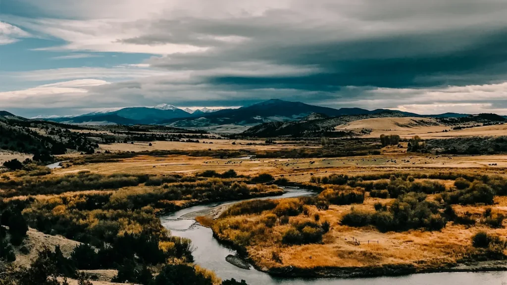
This water needs a real photo
The photo at the top of this page is not Weber River.
It is a regional stand-in, honestly captioned but generic — we will not put a name to a river we cannot prove. Send us a photograph you took here and it replaces the stand-in, with your credit on it.
Pioneer badgeUnclaimed
Add a photo of this water
Landscape, not fish — the water itself. Reviewed by hand before it appears. The first one published here earns the Pioneer badge.
Fished this water? Add a photo
Reviewed by hand before it appears. Pick the water, not the spot — we never publish exact locations.
Access
Oakley and Peoa: upper river access above Rockport Reservoir.
Rockport State Park: reservoir access and the reach below it.
Echo Reservoir tailwater: the top of the middle river tailwater section.
Henefer and Taggart: middle river public accesses and easements.
Morgan area bridges: the most consistent public access on the lower middle river.
Weber Canyon and Gateway: lower river access near the gauge, alongside I-84.
Utah stream access rules are strict; use public easements and bridge crossings.
Seasons
Year-round on the tailwater reaches below the reservoirs.
March through May: pre-runoff streamer fishing, then high water.
June: runoff on the freestone; the tailwater keeps fishing.
July through October: the main season, stoneflies into caddis into hoppers, then brown trout on streamers.
From the water
No logged trips yet. Be the first to put this water on your map.
Log this water
Fished it or cleaned it? Log in or create a free account to log a trip with photos and earn the waterway badge.
Questions
What is the current flow on the Weber River?
As of Nov 2, 6:30 am, the USGS gauge WEBER RIVER AT GATEWAY, UT reads 110 cfs, the 35th percentile for this date. Conditions update every 15 minutes.
What species can you catch on the Weber River?
Anglers target Brown Trout, Cutthroat Trout, Mountain Whitefish, Rainbow Trout on the Weber River in Utah.
Are there fishing guides on the Weber River?
GuidedFloats lists 2 guides and outfitters on the Weber River. Claimed profiles accept booking requests; unclaimed profiles are built from public records and link to the business.
Where can you access the Weber River?
Oakley and Peoa: upper river access above Rockport Reservoir. Rockport State Park: reservoir access and the reach below it. Echo Reservoir tailwater: the top of the middle river tailwater section. Henefer and Taggart: middle river public accesses and easements. Morgan area bridges: the most consistent public access on the lower middle river. Weber Canyon and Gateway: lower river access near the gauge, alongside I-84. Utah stream access rules are strict; use public easements and bridge crossings.
When is the best time to fish the Weber River?
Year-round on the tailwater reaches below the reservoirs. March through May: pre-runoff streamer fishing, then high water. June: runoff on the freestone; the tailwater keeps fishing. July through October: the main season, stoneflies into caddis into hoppers, then brown trout on streamers.
Where are the fishing regulations for the Weber River?
Regulations change by season and section. Read the current rules on the Utah agency site: https://wildlife.utah.gov/guidebooks.html