Beta

GuidedFloats is in beta. The full site launches March 1, 2027. The mobile app follows.

Guides: claim before March 1, 2027 and your first full season of Premium is free. Claim your founding spot →

Home › Waters › Arkansas › Little Red River
Tailwater · Ozarks · Arkansas

Little Red River Fishing Guides

Greers Ferry tailwater famous for a former world-record brown trout, floated by drift boat and jon boat from the dam through Pangburn, with this gauge near the lower end of the trout water.
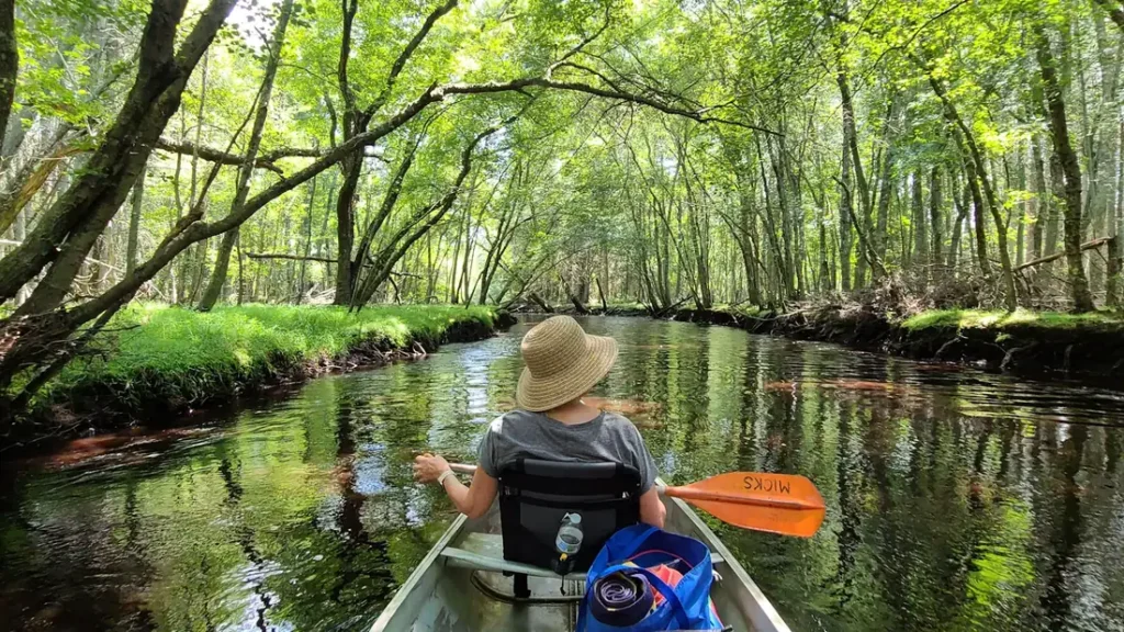
A paddler working a canoe down a green tunnel of overhanging hardwoods

Map of the Little Red River

21 numbered points: 5 access points, 1 campsite, 1 bait & fly shop, 3 bridges, 2 parks and conservation areas, 1 agency office, 4 regulation section limits, 1 hazard, 1 USGS gauge, 2 points of interest. Tap a marker for details. Reviewed Sep 7, 2026.

Printable version →
  • Access / boat ramp (5)
  • Campsite (1)
  • Bait, tackle & fly shop (1)
  • Bridge crossing (3)
  • Park / conservation area (2)
  • Agency / conservation office (1)
  • Regulation section limit (4)
  • Dam / hazard (1)
  • USGS gauge (1)
  • Point of interest (2)
Map data © OpenStreetMap contributors. Points are curated from OpenStreetMap and state agency sources; confirm access and hours before you go.

Print it. Bag it. Bring it.Phones die, screens crack, and most of this water has no signal. Print this map, fold it into a zip-top bag or dry bag with your license, and you have a backup your electronics can’t give you. Every marker is numbered so you can say exactly where you are.

Open the printable map
All 21 points on this map
#PointTypeLat, LonNotes
1Greers Ferry Dam
USACE · hydroelectric station
Dam / hazard35.52101, -91.99460Flows change fast when the generators come on. The special-regulation reach starts 100 yards below the dam. Check the generation schedule before wading anywhere below.
2Dam Site Recreation Area
USACE · lake side of the dam, campground and ramp on Greers Ferry Lake
Park / conservation area35.52168, -92.00328
3JFK Catch-and-Release Area (upper limit)
100 yards below Greers Ferry Dam
Regulation section limit35.51488, -91.99799Special-regulation reach runs about half a mile to the last hatchery outfall in JFK Park. Rules on the AGFC site — approximate marker on the centerline.
4Greers Ferry National Fish Hatchery
US Fish & Wildlife Service · visitor area, raceways
Agency / conservation office35.51415, -91.99583Raises the rainbow and brook trout stocked in the river. Hatchery effluent outfalls mark the bottom of the JFK special-regulation reach.
5John F. Kennedy Park
USACE · campground (loops A–D), picnic area, trout dock
Park / conservation area35.51336, -91.99232The tailwater's hub: campground, walk-in wading on the shoals below the dam and the uppermost boat ramp.
6JFK Park boat ramp
USACE · concrete ramp
Access / boat ramp35.51105, -91.99590Put-in for floats to Cow Shoals (about 5 mi) or Barnett (about 10 mi).
7JFK Park Campground
USACE · loops A–D, electric sites, showers
Campsite35.51092, -91.99409Reserve on recreation.gov in season; walk-in access to the river below the hatchery.
8JFK Catch-and-Release Area (lower limit)
Last hatchery effluent outfall in JFK Park
Regulation section limit35.50935, -91.99384Approximate marker placed on the centerline.
9Collins Creek
Restored spawning tributary, river left
Point of interest35.50907, -91.98974Brook trout and browns run up Collins Creek to spawn in fall; the AGFC guidebook covers the creek's own rules.
10Cow Shoals Catch-and-Release Area
Head of Cow Shoals to the mouth of Canoe Creek
Regulation section limit35.50516, -91.92959About 5.5 river miles below the dam. Walk-in access from the Cow Shoals parking area off Wilburn Road when turbines are off. Marker approximate, placed by river mile.
11Cow Shoals walk-in access
AGFC · walk-in only, no ramp
Access / boat ramp35.49675, -91.93499Long gravel shoal that fishes best at minimum flow. Approximate location (river mile 5.5).
12Little Red Fly Shop
35 Swinging Bridge Dr, Heber Springs · flies, tackle, guides
Bait, tackle & fly shop35.49244, -91.97071Beside the Barnett Access road. Placed at the Swinging Bridge Drive road — confirm hours before driving out.
13Barnett Access
AGFC · paved lot, concrete ramp on a deep pool
Access / boat ramp35.48979, -91.97200About 10 miles below the dam at the AR 110 (Wilburn Road) bridge. Winkley Shoals is downstream; Sugarloaf Mountain rises behind.
14Wilburn Road bridge (AR 110)
Arkansas Highway 110 at Barnett
Bridge crossing35.48975, -91.97386
15Libby Bluff
Bluff and shoal, river right
Point of interest35.45591, -91.94376Libby Shoal below is a walk-in wading spot at low water.
16Lobo Access
AGFC · concrete ramp, off Lobo Lane
Access / boat ramp35.45812, -91.92492About 17 miles below the dam. Barnett–Lobo is a popular 6–7 mile drift; cabins at Lobo Landing beside the ramp.
17Mossy Shoals Catch-and-Release Area
Upstream end of Dunham Shoals to downstream end of Mossy Shoals
Regulation section limit35.45293, -91.89714Roughly river miles 18–20 below the dam. Marker approximate, placed at the Dunham Shoals end.
18AR 110 bridge at Pangburn
Arkansas Highway 110
Bridge crossing35.43787, -91.84521Pangburn Shoals below the bridge is a walk-in wading area at minimum flow.
19Ramsey Access
AGFC · concrete ramp
Access / boat ramp35.45129, -91.77788About 29 miles below the dam; lower end of the classic trout floats. Approximate location, placed by river mile.
20USGS gauge — Little Red River (lower tailwater)
Gauge used for this water's flow reading
USGS gauge35.43806, -91.74583Lower end of the trout water near the AR 124 bridge. Wading conditions depend on generation at the dam upstream, not just the gauge reading.
21AR 124 bridge (Monaghan-Womack Access)
Arkansas Highway 124
Bridge crossing35.43804, -91.74593Lowest access in the trout-managed water.

Guides on the Little Red River

Claimed profiles take booking requests. Unclaimed profiles are built from public records so the river is never empty; the guide can claim or remove one any time.

About the Little Red River

Greers Ferry tailwater famous for a former world-record brown trout, floated by drift boat and jon boat from the dam through Pangburn, with this gauge near the lower end of the trout water.

This water needs a real photo

The photo at the top of this page is not Little Red River.

It is a regional stand-in, honestly captioned but generic — we will not put a name to a river we cannot prove. Send us a photograph you took here and it replaces the stand-in, with your credit on it.

Add a photo of this water See the badges

Pioneer badgeUnclaimed

Add a photo of this water

Landscape, not fish — the water itself. Reviewed by hand before it appears. The first one published here earns the Pioneer badge.

Never published. It is how the badge is held for you until member accounts open.

Posting to Little Red River.

JPG, PNG or WebP, up to 12 MB. Landscape orientation looks best at the top of the page. We resize it and strip the location data out of the file.

The name printed under the photo and on your badge. Leave blank to stay anonymous.

Reader photo license v1.0 — the short version:

  • You grant Guided Floats, LLC a non-exclusive, royalty-free license to publish, resize and crop your photo on guidedfloats.com and in GuidedFloats’ own social posts and apps. You keep the copyright and can use the photo anywhere else.
  • You confirm that you took the photo yourself, that publishing it does not infringe anyone else’s rights, and that anyone recognisable in it (or a parent or guardian, if they are under 18) is happy for it to appear here.
  • Credit is printed beside the photo wherever it appears on the site, using the credit name you give us. Leave it blank and we use your name; write “Anonymous” for no name. Your email address is never published.
  • Withdrawing is one email to hello@guidedfloats.com naming the photo. It comes off the site within 7 days.
Read the full license

Version 1.0, dated 6 September 2026. Applies to every photograph submitted to GuidedFloats through the contact form, a species page, or the community board.

1. What you give us

By ticking the box on the form you grant Guided Floats, LLC (“GuidedFloats”, “we”) a non-exclusive, worldwide, royalty-free license to store, copy, resize, crop and display your photograph on guidedfloats.com, in GuidedFloats’ own social media accounts and mobile apps, and in material that promotes the site itself, in connection with the fish, water or community feature you sent it in for. The license lasts until you withdraw it (section 4).

You keep the copyright. The license is not exclusive, so you can use the photo anywhere else and license it to anyone else. We will not sell your photo, license it on to anyone else on its own, or use it in paid advertising for a third party.

2. What you confirm

You confirm that you took the photograph yourself (or otherwise own the rights to it), that you have the right to grant this license, and that publishing the photo does not infringe anyone else’s copyright, privacy or other rights.

If any person is recognisable in the photo, you confirm that they have agreed to its being published here, and that a parent or guardian has agreed on behalf of anyone under 18. Please do not send photographs of other people’s catches, screenshots, or pictures copied from other websites or social media.

3. Credit

We print the credit name you give us beside the photo wherever it appears on the site, and record it as the photo’s creator in the page’s structured data. If you leave the credit blank we use the name you gave us on the form. Write “Anonymous” if you prefer no name at all. Your email address, phone number and the exact spot the photo was taken are never published.

4. Withdrawing the license

You can withdraw the license at any time by emailing hello@guidedfloats.com, or by using the contact form, and telling us which photo you mean. We will remove the photo from guidedfloats.com within 7 days of receiving your message and stop using it in anything new. Copies that are already outside our control — search-engine caches, social posts that have already gone out, printed material already produced — may take longer to disappear or may not be recallable, and we are not responsible for those.

5. What we may do

We choose which photos to publish and may decline any submission without giving a reason. We may crop, resize, sharpen or colour-correct a photo for display, and we may remove a photo at any time. We will not alter a photo in a way that misrepresents the fish, the water or you.

6. Your details

We keep your name, email address, the credit name, the water and date you gave us, and the network address the submission came from, with the submission record, as our evidence of this license. We hold that record for as long as the photo is published and for the retention period described in our privacy policy. Location data that your camera or phone embedded in the file is removed before the photo is published.

7. Versions

The version of this license you accepted is stored with your submission and printed with the photo. A later version does not apply to a photo you have already sent unless you agree to it.

Fished this water? Add a photo

Reviewed by hand before it appears. Pick the water, not the spot — we never publish exact locations.

Never published. We use it only if we need to ask about the photo.

Posting to Little Red River.

JPG, PNG or WebP, up to 12 MB. We resize it and strip the location data out of the file.

The name shown under the photo. Leave blank to stay anonymous.

Reader photo license v1.0 — the short version:

  • You grant Guided Floats, LLC a non-exclusive, royalty-free license to publish, resize and crop your photo on guidedfloats.com and in GuidedFloats’ own social posts and apps. You keep the copyright and can use the photo anywhere else.
  • You confirm that you took the photo yourself, that publishing it does not infringe anyone else’s rights, and that anyone recognisable in it (or a parent or guardian, if they are under 18) is happy for it to appear here.
  • Credit is printed beside the photo wherever it appears on the site, using the credit name you give us. Leave it blank and we use your name; write “Anonymous” for no name. Your email address is never published.
  • Withdrawing is one email to hello@guidedfloats.com naming the photo. It comes off the site within 7 days.
Read the full license

Version 1.0, dated 6 September 2026. Applies to every photograph submitted to GuidedFloats through the contact form, a species page, or the community board.

1. What you give us

By ticking the box on the form you grant Guided Floats, LLC (“GuidedFloats”, “we”) a non-exclusive, worldwide, royalty-free license to store, copy, resize, crop and display your photograph on guidedfloats.com, in GuidedFloats’ own social media accounts and mobile apps, and in material that promotes the site itself, in connection with the fish, water or community feature you sent it in for. The license lasts until you withdraw it (section 4).

You keep the copyright. The license is not exclusive, so you can use the photo anywhere else and license it to anyone else. We will not sell your photo, license it on to anyone else on its own, or use it in paid advertising for a third party.

2. What you confirm

You confirm that you took the photograph yourself (or otherwise own the rights to it), that you have the right to grant this license, and that publishing the photo does not infringe anyone else’s copyright, privacy or other rights.

If any person is recognisable in the photo, you confirm that they have agreed to its being published here, and that a parent or guardian has agreed on behalf of anyone under 18. Please do not send photographs of other people’s catches, screenshots, or pictures copied from other websites or social media.

3. Credit

We print the credit name you give us beside the photo wherever it appears on the site, and record it as the photo’s creator in the page’s structured data. If you leave the credit blank we use the name you gave us on the form. Write “Anonymous” if you prefer no name at all. Your email address, phone number and the exact spot the photo was taken are never published.

4. Withdrawing the license

You can withdraw the license at any time by emailing hello@guidedfloats.com, or by using the contact form, and telling us which photo you mean. We will remove the photo from guidedfloats.com within 7 days of receiving your message and stop using it in anything new. Copies that are already outside our control — search-engine caches, social posts that have already gone out, printed material already produced — may take longer to disappear or may not be recallable, and we are not responsible for those.

5. What we may do

We choose which photos to publish and may decline any submission without giving a reason. We may crop, resize, sharpen or colour-correct a photo for display, and we may remove a photo at any time. We will not alter a photo in a way that misrepresents the fish, the water or you.

6. Your details

We keep your name, email address, the credit name, the water and date you gave us, and the network address the submission came from, with the submission record, as our evidence of this license. We hold that record for as long as the photo is published and for the retention period described in our privacy policy. Location data that your camera or phone embedded in the file is removed before the photo is published.

7. Versions

The version of this license you accepted is stored with your submission and printed with the photo. A later version does not apply to a photo you have already sent unless you agree to it.

Flow alert

Tell me when the Little Red River cfs

Now: 226 cfs, read 5:45 pm CDT, Sun Oct 18, 2026 (USGS 07076517, Little Red River near Dewey, AR).

We never use this address for anything else and never share it. See the privacy policy.

From the water

No logged trips yet. Be the first to put this water on your map.

Log this water

Fished it or cleaned it? Log in or create a free account to log a trip with photos and earn the waterway badge.

Questions

What is the current flow on the Little Red River?

As of Oct 18, 5:45 pm, the USGS gauge Little Red River near Dewey, AR reads 226 cfs, the 51st percentile for this date, with water temperature 56.7 F. Conditions update every 15 minutes.

What species can you catch on the Little Red River?

Anglers target Brook Trout, Brown Trout, Cutthroat Trout, Rainbow Trout on the Little Red River in Arkansas.

Are there fishing guides on the Little Red River?

GuidedFloats lists 5 guides and outfitters on the Little Red River. Claimed profiles accept booking requests; unclaimed profiles are built from public records and link to the business.

Where are the fishing regulations for the Little Red River?

Regulations change by season and section. Read the current rules on the Arkansas agency site: https://www.agfc.com/regulations/general-fishing-regulations/