Fishes Colorado River (Lees Ferry)
Tailwater · Northern Arizona · Arizona
Colorado River (Lees Ferry) Fishing Guides
Fifteen miles of clear tailwater between Glen Canyon Dam and Lees Ferry, wild rainbows under red canyon walls and the launch point for the Grand Canyon.
Map of the Colorado River (Lees Ferry)
24 numbered points: 2 access points, 6 campsites, 1 outfitter, 1 bridge, 1 park or conservation area, 2 agency offices, 3 regulation section limits, 2 hazards, 1 USGS gauge, 5 points of interest. Tap a marker for details. Reviewed Sep 25, 2026.
- Access / boat ramp (2)
- Campsite (6)
- Outfitter / canoe rental (1)
- Bridge crossing (1)
- Park / conservation area (1)
- Agency / conservation office (2)
- Regulation section limit (3)
- Dam / hazard (2)
- USGS gauge (1)
- Point of interest (5)
Map data © OpenStreetMap contributors. Points are curated from OpenStreetMap and state agency sources; confirm access and hours before you go.
Print it. Bag it. Bring it.Phones die, screens crack, and most of this water has no signal. Print this map, fold it into a zip-top bag or dry bag with your license, and you have a backup your electronics can’t give you. Every marker is numbered so you can say exactly where you are.
Open the printable mapAll 24 points on this map
| # | Point | Type | Lat, Lon | Notes |
|---|---|---|---|---|
| 1 | Glen Canyon Dam Bureau of Reclamation - head of the reach | Dam / hazard | 36.93713, -111.48399 | Releases from the dam set the flow and the water temperature for the whole 15.5-mile tailwater. No boat access at the dam face. |
| 2 | Glen Canyon Dam Bridge US 89 - the only road bridge on the reach | Bridge crossing | 36.93556, -111.48328 | Carries US 89 across the gorge just below the dam; the next crossing downstream is Navajo Bridge, below Lees Ferry. |
| 3 | Glen Canyon Dam Visitor Center National Park Service - US 89 at the dam | Agency / conservation office | 36.93570, -111.48574 | Park information, exhibits and dam tours on the rim above the head of the reach. |
| 4 | Upstream boat closure - the three buoys About 1/4 mile below the dam | Regulation section limit | 36.93427, -111.48297 | River travel above the three closure buoys is prohibited without a Bureau of Reclamation permit; signs are posted on both banks. Position measured 0.25 mi down the channel from the dam, not from a published coordinate. |
| 5 | Kayak Beach seasonal closure River mile -15.1, river right | Regulation section limit | 36.92630, -111.48129 | Closed to all recreational use from 15 March to 1 September for osprey nesting. Coordinate converted from the NAD83 UTM reference NPS publishes in its Superintendent's Compendium. |
| 6 | Glen Canyon National Recreation Area Headquarters National Park Service - Page, AZ | Agency / conservation office | 36.91932, -111.47550 | Park headquarters for the recreation area that manages the whole dam-to-Lees-Ferry reach. |
| 7 | Wilderness River Adventures Page, AZ - river outfitter | Outfitter / canoe rental | 36.90248, -111.47477 | Guide office in Page, tagged in OSM as a river outfitter for the Glen Canyon reach. Confirm trip offerings direct before travelling. |
| 8 | Ropes Trail Glen Canyon NRA - boat-in only | Campsite | 36.91827, -111.49138 | One of the five designated primitive camping areas between Glen Canyon Dam and Lees Ferry. Signed, first-come, no fee; toilet and fire pit, and a short walk up from the boat. Boat-in only. |
| 9 | Ferry Swale Glen Canyon NRA - boat-in only | Campsite | 36.89818, -111.52293 | One of the five designated primitive camping areas between Glen Canyon Dam and Lees Ferry. Signed, first-come, no fee; toilet and fire pit, and a short walk up from the boat. Boat-in only. |
| 10 | Navajo Petroglyphs River-level rock art panel | Point of interest | 36.88685, -111.52589 | Archaeological site recorded on the bank about nine miles below the dam. Look, photograph, touch nothing. |
| 11 | Horseshoe Bend The 270-degree meander | Point of interest | 36.88045, -111.51613 | The rim overlook above this bend is the famous one; from the water it is a long slow curve under sheer Navajo sandstone. |
| 12 | 9 Mile Glen Canyon NRA - boat-in only | Campsite | 36.87953, -111.51497 | One of the five designated primitive camping areas between Glen Canyon Dam and Lees Ferry. Signed, first-come, no fee; toilet and fire pit, and a short walk up from the boat. Boat-in only. |
| 13 | 8 Mile Glen Canyon NRA - boat-in only | Campsite | 36.87824, -111.52426 | One of the five designated primitive camping areas between Glen Canyon Dam and Lees Ferry. Signed, first-come, no fee; toilet and fire pit, and a short walk up from the boat. Boat-in only. |
| 14 | Lunch Beach NPS picnic site - boat-in | Point of interest | 36.87481, -111.54822 | Named day-use beach on the reach; the usual stop on the half-day float down from the dam. |
| 15 | 6 Mile Glen Canyon NRA - boat-in only | Campsite | 36.87531, -111.56215 | One of the five designated primitive camping areas between Glen Canyon Dam and Lees Ferry. Signed, first-come, no fee; toilet and fire pit, and a short walk up from the boat. Boat-in only. |
| 16 | Water Holes Canyon Slot canyon at river level | Point of interest | 36.85032, -111.54337 | Side-canyon access point on the bank, tagged in OSM as a waterway access point. Foot access from the river only. |
| 17 | Spencer Trail Lookout Above the river, upstream of Lees Ferry | Point of interest | 36.86872, -111.57532 | Viewpoint on the Spencer Trail, the switchback climb out of the canyon that starts from the Lees Ferry historic area. |
| 18 | Lees Ferry Boat Launch - paved section NPS - upstream use, the only road access | Access / boat ramp | 36.86576, -111.58646 | The paved upstream half of the split ramp, for boats running up into the tailwater. Lees Ferry is the only place a road reaches the Colorado in over 700 miles of canyon. A 30-minute limit applies at the ramp and courtesy docks. |
| 19 | Lees Ferry launch ramp - downriver section NPS - gravel section, permit launches | Access / boat ramp | 36.86566, -111.58696 | The gravel downstream half of the ramp, used for loading and launching Grand Canyon river trips. OSM records it as access=permit; NPS describes it as the downriver section of the same ramp. |
| 20 | USGS 09380000 - Colorado River at Lees Ferry Flow and temperature for the whole reach | USGS gauge | 36.86433, -111.58787 | The reference gauge for Glen Canyon Dam releases; read it before you plan a run upriver. |
| 21 | The cable below the launch ramp Downstream limit for Lees Ferry boats | Dam / hazard | 36.86485, -111.58774 | NPS: do not boat below the cable downstream of the launch ramp. Dangerous rapids start below it and a Grand Canyon National Park permit is required to float on. OSM records an unnamed weir structure at this point. |
| 22 | Lonely Dell Ranch Historic Site Glen Canyon NRA - mouth of the Paria | Park / conservation area | 36.86897, -111.59510 | Pioneer ranch, orchard, log cabins and cemetery; self-guided walking loop of about a mile round trip. Picnic tables and shade, no water. |
| 23 | Lees Ferry Campground NPS - drive-in, dump station | Campsite | 36.85934, -111.60630 | The drive-in campground above the ferry site. NPS reports the upper loop closed for renovation with the lower loop open; check before you arrive. |
| 24 | Paria riffle - regulation boundary Foot of the Lees Ferry reach | Regulation section limit | 36.85739, -111.60159 | Arizona lists 'Lees Ferry on Colorado River' as its own water, and lists the Colorado River reach below it as running from the Paria riffle to Navajo Bridge. Read the current regulations before you fish. |
Guides on the Colorado River (Lees Ferry)
Claimed profiles take booking requests. Unclaimed profiles are built from public records so the river is never empty; the guide can claim or remove one any time.
About the Colorado River (Lees Ferry)
Lees Ferry is where two famous rivers meet in one place: the fifteen-mile trout tailwater below Glen Canyon Dam, and the launch ramp where every Grand Canyon raft trip begins. The tailwater is clear, cold and startlingly beautiful, running between vertical Navajo sandstone walls with gravel bars and grassy shelves where wild rainbow trout hold in numbers that make this one of the most productive trout fisheries in the Southwest.
Fishing is done two ways. The walk-in water at the Lees Ferry ramp is public, easy to reach and fishes well on foot. The upper fifteen miles to the dam is boat-only, reached by motoring up from the ferry, and guides run that water daily, anchoring on the gravel bars and fishing small nymphs and midges to sighted fish. The rainbows are wild and self-sustaining, and management here also balances the needs of the endangered humpback chub, which shapes the regulations.
Flows come out of Glen Canyon Dam on a hydropower schedule and change through the day, often between roughly 8,000 and 15,000 cfs, with occasional experimental high-flow releases much larger. Anglers plan around the daily fluctuation: a dropping tide concentrates fish on the bars, and a rising one moves them. Water temperature stays cold and stable year-round, so this river fishes in every month.
Marble Canyon and Page are the base, with Flagstaff about two hours away. Boat rentals, guides and lodging are all clustered at Marble Canyon, and a walk-in day at the ferry costs nothing but a fishing license.
This water needs a real photo
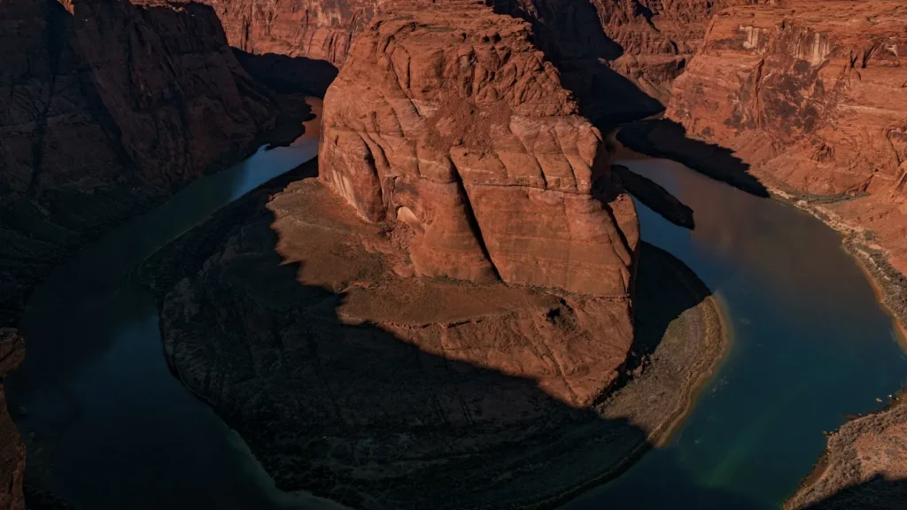
The photo at the top of this page is not Colorado River (Lees Ferry).
It is a regional stand-in, honestly captioned but generic — we will not put a name to a river we cannot prove. Send us a photograph you took here and it replaces the stand-in, with your credit on it.
Pioneer badgeUnclaimed
Add a photo of this water
Landscape, not fish — the water itself. Reviewed by hand before it appears. The first one published here earns the Pioneer badge.
Fished this water? Add a photo
Reviewed by hand before it appears. Pick the water, not the spot — we never publish exact locations.
Access
Lees Ferry boat ramp: the main access, the walk-in fishery and the Grand Canyon launch point.
The walk-in reach: public bank access downstream of the ramp, no boat needed.
Upper fifteen miles to Glen Canyon Dam: boat-only access, guided or by rental.
Marble Canyon: lodging, guides and supplies at the highway junction.
Navajo Bridge: the overlook just downstream of the ferry.
Glen Canyon National Recreation Area: the administering agency; entrance fees apply.
Seasons
Year-round; the tailwater temperature barely changes.
March through May: comfortable weather, strong midge fishing and light crowds.
June through August: hot air, cold water, early starts and afternoon shade under the walls.
September through February: the best months for many guides, stable flows and very few boats.
From the water
No logged trips yet. Be the first to put this water on your map.
Log this water
Fished it or cleaned it? Log in or create a free account to log a trip with photos and earn the waterway badge.
Questions
What is the current flow on the Colorado River (Lees Ferry)?
As of Oct 19, 3:00 am, the USGS gauge COLORADO RIVER AT LEES FERRY, AZ reads 5,670 cfs, the 19th percentile for this date, with water temperature 66.7 F. Conditions update every 15 minutes.
What species can you catch on the Colorado River (Lees Ferry)?
Anglers target Brown Trout, Humpback Chub, Rainbow Trout on the Colorado River (Lees Ferry) in Arizona.
Are there fishing guides on the Colorado River (Lees Ferry)?
GuidedFloats lists 2 guides and outfitters on the Colorado River (Lees Ferry). Claimed profiles accept booking requests; unclaimed profiles are built from public records and link to the business.
Where can you access the Colorado River (Lees Ferry)?
Lees Ferry boat ramp: the main access, the walk-in fishery and the Grand Canyon launch point. The walk-in reach: public bank access downstream of the ramp, no boat needed. Upper fifteen miles to Glen Canyon Dam: boat-only access, guided or by rental. Marble Canyon: lodging, guides and supplies at the highway junction. Navajo Bridge: the overlook just downstream of the ferry. Glen Canyon National Recreation Area: the administering agency; entrance fees apply.
When is the best time to fish the Colorado River (Lees Ferry)?
Year-round; the tailwater temperature barely changes. March through May: comfortable weather, strong midge fishing and light crowds. June through August: hot air, cold water, early starts and afternoon shade under the walls. September through February: the best months for many guides, stable flows and very few boats.
Where are the fishing regulations for the Colorado River (Lees Ferry)?
Regulations change by season and section. Read the current rules on the Arizona agency site: https://www.azgfd.com/fishing-2/licenses-and-regulations/