Fishes Clear Creek
Creek · Jefferson and Clear Creek counties, Colorado, the Front Range canyon running down from the Continental Divide to Golden · Colorado
Clear Creek Fishing Guides
A steep Front Range creek dropping from the Divide through a mining canyon to Golden, and the closest genuine trout water to Denver.
Map of the Clear Creek
32 numbered points: 11 access points, 2 campsites, 2 bait & fly shops, 3 outfitters, 11 parks and conservation areas, 1 agency office, 1 hazard, 1 USGS gauge. Tap a marker for details. Reviewed Sep 24, 2026.
- Access / boat ramp (11)
- Campsite (2)
- Bait, tackle & fly shop (2)
- Outfitter / canoe rental (3)
- Park / conservation area (11)
- Agency / conservation office (1)
- Dam / hazard (1)
- USGS gauge (1)
Map data © OpenStreetMap contributors. Points are curated from OpenStreetMap and state agency sources; confirm access and hours before you go.
Print it. Bag it. Bring it.Phones die, screens crack, and most of this water has no signal. Print this map, fold it into a zip-top bag or dry bag with your license, and you have a backup your electronics can’t give you. Every marker is numbered so you can say exactly where you are.
Open the printable mapAll 32 points on this map
| # | Point | Type | Lat, Lon | Notes |
|---|---|---|---|---|
| 1 | Georgetown Gateway Visitor Center Town of Georgetown - I-70 exit 228 | Agency / conservation office | 39.71475, -105.69578 | The mapped point is the visitor-centre car park at the Georgetown end of the greenway. |
| 2 | Georgetown Greenway Park Town of Georgetown - creekside path | Park / conservation area | 39.71982, -105.69350 | Walk-in water through Georgetown; the greenway follows the creek from the visitor centre to the lake. |
| 3 | Georgetown Lake Park Town of Georgetown | Park / conservation area | 39.72950, -105.69157 | Shoreline park on the impoundment immediately above Georgetown Dam. |
| 4 | Georgetown Watchable Wildlife Area Colorado Parks and Wildlife | Park / conservation area | 39.73128, -105.69162 | CPW property at the lake; the mapped point is its car park. |
| 5 | Georgetown Dam Impounds Georgetown Lake | Dam / hazard | 39.73323, -105.68922 | Creek-wide structure at the foot of Georgetown Lake. |
| 6 | Alvarado Open Space Park Clear Creek County Open Space | Park / conservation area | 39.74306, -105.68073 | Creekside open space between Georgetown and Empire Junction. |
| 7 | Downstream Adventures Rafting Empire - raft and tube rental | Outfitter / canoe rental | 39.76031, -105.67772 | |
| 8 | Philadelphia Mill Site Open Space Park Clear Creek County Open Space | Park / conservation area | 39.76151, -105.57681 | Mapped twice in OpenStreetMap, as a park and as a fishing site; shown once here. |
| 9 | Fishing is Fun #4 Signed angler access on the creek | Access / boat ramp | 39.75688, -105.56645 | One of seven numbered Fishing is Fun access points OpenStreetMap carries on Clear Creek; the numbering is not continuous. |
| 10 | Charlie Taylor Water Wheel Park City of Idaho Springs | Park / conservation area | 39.74056, -105.51604 | Creekside park at the west end of Idaho Springs. |
| 11 | Clear Creek Outdoors 1524 Miner Street, Idaho Springs | Bait, tackle & fly shop | 39.74202, -105.51643 | The creek's only mapped tackle and fly retailer between Georgetown and Golden. |
| 12 | Indian Springs Campsites Idaho Springs | Campsite | 39.74066, -105.51203 | |
| 13 | Montgomery Park City of Idaho Springs | Park / conservation area | 39.74294, -105.50961 | Mapped in OpenStreetMap both as a park and as a fishing site; shown once here. |
| 14 | Courtney/Riley/Cooper Park City of Idaho Springs | Park / conservation area | 39.74239, -105.50868 | |
| 15 | Clear Creek Rafting Dumont / Idaho Springs | Outfitter / canoe rental | 39.74342, -105.47933 | |
| 16 | Game Check Station Trailhead Clear Creek County Open Space | Access / boat ramp | 39.74307, -105.47525 | Mapped twice in OpenStreetMap, as a trailhead and as a park 80 m away; shown once here. |
| 17 | Fishing is Fun #6 Signed angler access on the creek | Access / boat ramp | 39.74195, -105.43078 | |
| 18 | Fishing is Fun #7 Signed angler access on the creek | Access / boat ramp | 39.73664, -105.41840 | |
| 19 | Fishing is Fun #8 Signed angler access on the creek | Access / boat ramp | 39.73723, -105.41714 | |
| 20 | Peaks to Plains Trailhead Clear Creek County Open Space | Access / boat ramp | 39.74313, -105.40637 | Trail parking on the Peaks to Plains corridor through the upper canyon. |
| 21 | Fishing is Fun #10 Signed angler access on the creek | Access / boat ramp | 39.74306, -105.40148 | |
| 22 | Fishing is Fun #11 Signed angler access on the creek | Access / boat ramp | 39.74352, -105.40150 | |
| 23 | Fishing is Fun #12 Signed angler access on the creek | Access / boat ramp | 39.74433, -105.40426 | Sits upstream of #10 and #11 by longitude but downstream by the chained centreline, where the creek doubles back. |
| 24 | Mayhem Gulch Trailhead Jefferson County Open Space - Clear Creek Canyon Park | Access / boat ramp | 39.73710, -105.37119 | OpenStreetMap spells it “Mayham”; corrected here. |
| 25 | Clear Creek Canyon Park Jefferson County Open Space | Park / conservation area | 39.73958, -105.31651 | The canyon park runs most of US 6 between Golden and the Highway 119 junction. |
| 26 | USGS 06719505 - Clear Creek at Golden US Geological Survey | USGS gauge | 39.75306, -105.23472 | Live flow and water temperature for the creek at the canyon mouth. |
| 27 | Gateway Trailhead Jefferson County Open Space | Access / boat ramp | 39.75360, -105.23880 | Canyon-mouth trailhead at the top of Golden. |
| 28 | Golden Clear Creek RV Park Golden | Campsite | 39.75344, -105.23097 | |
| 29 | Golden River Sports Golden - paddle shop and boat rental | Outfitter / canoe rental | 39.75863, -105.22486 | |
| 30 | Golden Fly Shop Golden - 3.3 km off the creek | Bait, tackle & fly shop | 39.72834, -105.20805 | |
| 31 | Lewis Ralston Gold Site Park City of Arvada | Park / conservation area | 39.79804, -105.05668 | Small creekside park on the lower creek, on the Clear Creek Trail. |
| 32 | Lowell Ponds State Wildlife Area Colorado Parks and Wildlife | Park / conservation area | 39.79826, -105.03950 | CPW's fishing point on the lower creek; the only CPW-owned water on Clear Creek. |
Guides on the Clear Creek
Claimed profiles take booking requests. Unclaimed profiles are built from public records so the river is never empty; the guide can claim or remove one any time.
Order on this page: premium and outfitter plans first (labelled Premium placement), then claimed free profiles, then unclaimed — one published price, no bidding for position. How placement works
About the Clear Creek
Clear Creek falls from the Continental Divide above Georgetown down a tight canyon to Golden, where it emerges from the mountains and runs out onto the plains. It is the most accessible trout stream on Colorado’s Front Range by a wide margin, close enough to Denver that people fish it after work, and that proximity defines both its value and its problems.
The creek is steep, which is the first thing to understand about fishing it. The gradient is high through the canyon, so the water is fast, broken and full of pocket water rather than the long pools and riffles of a valley stream. Trout hold in small pockets behind boulders, in the seams beside the main current and in the plunge pools below the drops, and reading that water accurately matters more than fly selection.
Brown trout are the backbone of the fishery and many are wild, holding in the canyon through their whole lives. Rainbows are stocked in the more accessible stretches and hold over well in the better habitat. Brook trout occupy the upper drainage and the small tributaries, and cutthroat turn up in the highest water near the Divide. The creek supports more fish per mile than its appearance suggests.
History has left a mark on the water. This canyon was the heart of Colorado’s gold rush, and a century and a half of mining left tailings, acid drainage and metal loading in parts of the drainage. Long-running cleanup work has improved conditions substantially and the fishery has responded, but the upper tributaries still vary in quality and the creek is a genuine restoration story rather than a pristine one.
Access is excellent and almost entirely public through the canyon, with a highway, a bike path along the lower creek and a long series of pull-offs. Golden has a whitewater park in town that draws paddlers and tubers through the summer, so the lower creek gets crowded and noisy in warm weather. Runoff blows the creek out from late spring into early summer; the best fishing runs from midsummer through autumn, and winter fishes surprisingly well on sunny days in the lower canyon.
This water needs a real photo
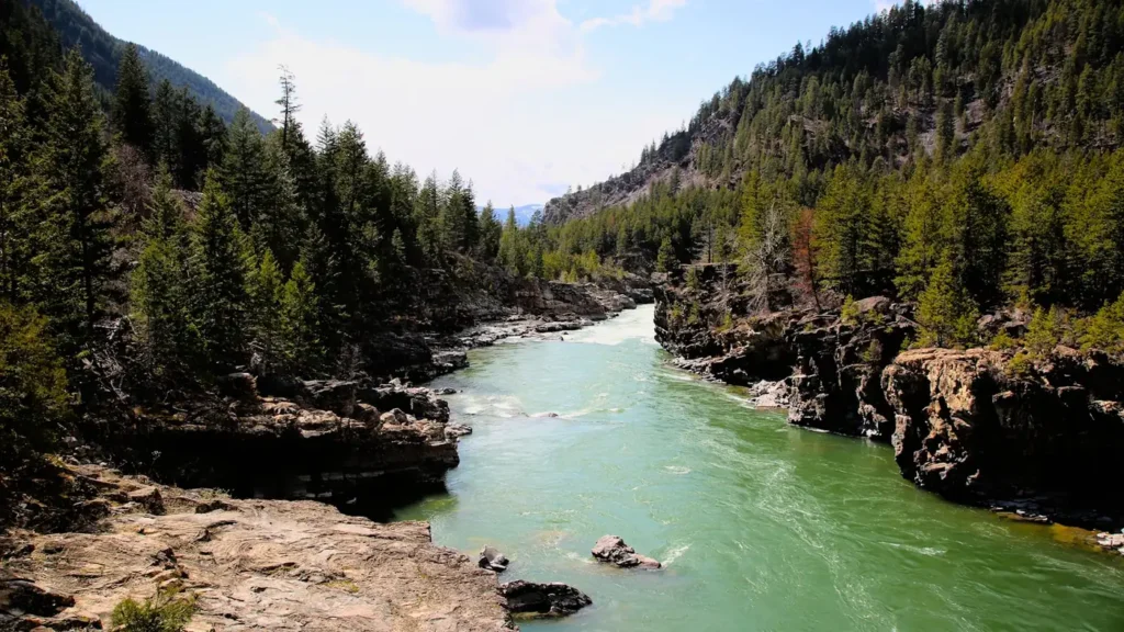
The photo at the top of this page is not Clear Creek.
It is a regional stand-in, honestly captioned but generic — we will not put a name to a river we cannot prove. Send us a photograph you took here and it replaces the stand-in, with your credit on it.
Pioneer badgeUnclaimed
Add a photo of this water
Landscape, not fish — the water itself. Reviewed by hand before it appears. The first one published here earns the Pioneer badge.
Fished this water? Add a photo
Reviewed by hand before it appears. Pick the water, not the spot — we never publish exact locations.
Access
Golden - the town at the canyon mouth where the gauge sits, with full services.
Clear Creek Canyon Park - the county open space with pull-offs and trails along the canyon.
U.S. Highway 6 - the highway running the length of the canyon beside the creek.
Idaho Springs - the old mining town on the upper creek.
Georgetown - the town high in the drainage near the headwaters.
Clear Creek Whitewater Park - the in-town paddling feature on the lower creek in Golden.
Denver - the metropolitan area just east, the source of most of the creek's traffic.
Seasons
Spring: runoff swells the creek and pushes it out of shape from late spring onward.
Summer: clearing flows and good pocket water fishing, with heavy recreation traffic in the lower canyon.
Fall: the best stretch of the year, with settled water, active brown trout and thin crowds.
Winter: cold and low, fishing well on sunny afternoons in the sheltered lower canyon.
From the water
No logged trips yet. Be the first to put this water on your map.
Log this water
Fished it or cleaned it? Log in or create a free account to log a trip with photos and earn the waterway badge.
Questions
What is the current flow on the Clear Creek?
As of Nov 2, 5:45 am, the USGS gauge CLEAR CREEK AT GOLDEN, CO reads 47 cfs. Conditions update every 15 minutes.
What species can you catch on the Clear Creek?
Anglers target Brook Trout, Brown Trout, Cutthroat Trout, Mountain Whitefish, Rainbow Trout on the Clear Creek in Colorado.
Are there fishing guides on the Clear Creek?
GuidedFloats lists 2 guides and outfitters on the Clear Creek. Claimed profiles accept booking requests; unclaimed profiles are built from public records and link to the business.
Where can you access the Clear Creek?
Golden - the town at the canyon mouth where the gauge sits, with full services. Clear Creek Canyon Park - the county open space with pull-offs and trails along the canyon. U.S. Highway 6 - the highway running the length of the canyon beside the creek. Idaho Springs - the old mining town on the upper creek. Georgetown - the town high in the drainage near the headwaters. Clear Creek Whitewater Park - the in-town paddling feature on the lower creek in Golden. Denver - the metropolitan area just east, the source of most of the creek's traffic.
When is the best time to fish the Clear Creek?
Spring: runoff swells the creek and pushes it out of shape from late spring onward. Summer: clearing flows and good pocket water fishing, with heavy recreation traffic in the lower canyon. Fall: the best stretch of the year, with settled water, active brown trout and thin crowds. Winter: cold and low, fishing well on sunny afternoons in the sheltered lower canyon.
Where are the fishing regulations for the Clear Creek?
Regulations change by season and section. Read the current rules on the Colorado agency site: https://cpw.state.co.us/rules-and-regulations