Fishes Lake Lanier
Reservoir · North Georgia · Georgia
Lake Lanier Fishing Guides
Atlanta lake, serious fishery: one of the best striped bass waters in the South and the place that made the blueback-herring spotted bass what it is.
Map of the Lake Lanier
60 numbered points: 47 access points, 11 outfitters, 1 hazard, 1 USGS gauge. Tap a marker for details. Reviewed Sep 26, 2026.
- Access / boat ramp (47)
- Outfitter / canoe rental (11)
- Dam / hazard (1)
- USGS gauge (1)
Map data © OpenStreetMap contributors. Points are curated from OpenStreetMap and state agency sources; confirm access and hours before you go.
Print it. Bag it. Bring it.Phones die, screens crack, and most of this water has no signal. Print this map, fold it into a zip-top bag or dry bag with your license, and you have a backup your electronics can’t give you. Every marker is numbered so you can say exactly where you are.
Open the printable mapAll 60 points on this map
| # | Point | Type | Lat, Lon | Notes |
|---|---|---|---|---|
| 1 | Buford Dam Corps of Engineers, Gwinnett/Forsyth County | Dam / hazard | 34.16014, -84.07425 | The dam at the lake's south end. Restricted areas above and below; the horn and siren mean generation is starting in the tailwater. |
| 2 | USGS gauge - Lake Lanier at Buford Dam Roster gauge coordinate | USGS gauge | 34.16272, -84.07553 | Lake elevation and Buford Dam outflow. The same release drives the Chattahoochee tailwater sheet downstream. |
| 3 | Lanier Harbor City of Buford - paved ramp | Access / boat ramp | 34.15212, -84.02539 | Ramp on the lake's south-east corner near Buford Dam. |
| 4 | Lanier Park COE, Gwinnett County - paved ramp, fee | Access / boat ramp | 34.15197, -84.05960 | Corps ramp just above the dam on the east side. |
| 5 | Shoal Creek Park COE, Hall County - paved ramp, fee | Access / boat ramp | 34.15940, -84.00768 | Ramp and campground on the Shoal Creek arm. |
| 6 | Big Creek COE, Hall County - paved ramp, fee | Access / boat ramp | 34.16630, -83.99321 | Ramp on the Big Creek arm, east side of the lower lake. |
| 7 | Burton Mill COE, Hall County - paved ramp, fee | Access / boat ramp | 34.16745, -83.97627 | Ramp on the lower lake's east shore. |
| 8 | Sawnee Campground COE, Forsyth County - paved ramp, fee | Access / boat ramp | 34.17671, -84.07463 | Ramp at the Corps campground on the west side above the dam. |
| 9 | Flowery Branch Bay Park City of Flowery Branch - no fee | Access / boat ramp | 34.18062, -83.93394 | Town park on Flowery Branch Bay. DNR lists no improved ramp here - a car-top and bank site. |
| 10 | Van Pugh South COE, Hall County - paved ramp, fee | Access / boat ramp | 34.18432, -83.98728 | The southern of two Corps ramps on the Van Pugh peninsula. |
| 11 | Van Pugh North COE, Hall County - paved ramp, fee | Access / boat ramp | 34.18639, -83.98008 | The northern Van Pugh ramp, 350 m from its twin. |
| 12 | Little Ridge Park COE, Forsyth County - paved ramp, fee | Access / boat ramp | 34.19260, -84.08999 | Ramp on the west shore above Sawnee. |
| 13 | Tidwell Park COE, Forsyth County - paved ramp, fee | Access / boat ramp | 34.19436, -84.06420 | Corps ramp on the west shore of the lower lake. |
| 14 | Mary Alice Park City of Cumming - paved ramp, fee | Access / boat ramp | 34.19738, -84.09840 | City ramp and beach on the Cumming side. |
| 15 | Shady Grove Park Forsyth County - paved ramp, fee | Access / boat ramp | 34.20246, -84.03584 | County ramp and campground on the Shady Grove peninsula. |
| 16 | Bald Ridge Creek COE, Forsyth County - paved ramp, fee | Access / boat ramp | 34.20843, -84.08439 | Ramp and campground on the Bald Ridge Creek arm. |
| 17 | Young Deer Park Forsyth County - paved ramp, fee | Access / boat ramp | 34.22146, -84.05785 | County ramp on the Young Deer Creek arm. |
| 18 | Two Mile Creek Park COE, Forsyth County - paved ramp, fee | Access / boat ramp | 34.22206, -84.00023 | Ramp on the Two Mile Creek arm. |
| 19 | Old Federal COE, Hall County - paved ramp, fee | Access / boat ramp | 34.22270, -83.95039 | Corps ramp and campground on the east shore. |
| 20 | Bethel Park YMCA - paved ramp, fee | Access / boat ramp | 34.22708, -83.99152 | Ramp at the YMCA's Camp Bethel on the mid-lake east side. |
| 21 | Old Federal Day Use COE, Hall County - paved ramp, fee | Access / boat ramp | 34.22771, -83.93604 | Day-use ramp and beach 1.3 km east of the Old Federal campground. |
| 22 | Vanns Tavern COE, Forsyth County - paved ramp, fee | Access / boat ramp | 34.23489, -83.98220 | Corps ramp on the mid-lake west shore. |
| 23 | Charleston Park Forsyth County - paved ramp, fee | Access / boat ramp | 34.24274, -84.04593 | County ramp on the Chestatee side of the mid-lake. |
| 24 | Six Mile Creek Park Forsyth County - paved ramp, fee | Access / boat ramp | 34.24644, -84.04042 | County ramp on the Six Mile Creek arm. |
| 25 | Balus Creek Park COE, Hall County - paved ramp, fee | Access / boat ramp | 34.25203, -83.91605 | Ramp on the Balus Creek arm near Gainesville. |
| 26 | Mountain View Park COE, Hall County - paved ramp, fee | Access / boat ramp | 34.25573, -83.94433 | Corps ramp on the east shore below Gainesville. |
| 27 | Long Hollow Park COE, Forsyth County - paved ramp, fee | Access / boat ramp | 34.28176, -83.97209 | Ramp on the upper west shore. |
| 28 | Keith's Bridge COE, Forsyth County - paved ramp, fee | Access / boat ramp | 34.28267, -83.94401 | Ramp at the Keith Bridge crossing of the Chestatee arm. |
| 29 | River Forks Hall County - paved ramp, fee | Access / boat ramp | 34.28782, -83.90610 | County park and ramp at the forks of the Chattahoochee and Chestatee arms. |
| 30 | Lanier Point Pk City of Gainesville - paved ramp, fee | Access / boat ramp | 34.29686, -83.87074 | City ramp on the Gainesville waterfront. |
| 31 | Robinson Park COE, Hall County - paved ramp, fee | Access / boat ramp | 34.30342, -83.89723 | Ramp on the upper east shore above Gainesville. |
| 32 | Little Hall Park COE, Hall County - paved ramp, fee | Access / boat ramp | 34.31050, -83.94228 | Corps ramp on the upper lake. |
| 33 | Duckett Mill Park COE, Hall County - paved ramp, fee | Access / boat ramp | 34.30668, -83.93093 | Ramp and campground on the upper lake's east side. |
| 34 | Simpson Park COE, Hall County - paved ramp, fee | Access / boat ramp | 34.31974, -83.89165 | Corps ramp above Gainesville. |
| 35 | Holly Park City of Gainesville - paved ramp, fee | Access / boat ramp | 34.33368, -83.85344 | City ramp on the upper Chattahoochee arm. |
| 36 | War Hill Park Dawson County - paved ramp, fee | Access / boat ramp | 34.33412, -83.96285 | County ramp and campground on the Chestatee arm. |
| 37 | Sardis Creek Park COE, Hall County - paved ramp, fee | Access / boat ramp | 34.33738, -83.88762 | Ramp on the Sardis Creek arm. |
| 38 | Bolding Mill Park COE, Hall County - paved ramp, fee | Access / boat ramp | 34.33818, -83.95425 | Corps ramp and campground on the upper Chestatee arm. |
| 39 | Clarks Bridge Park City of Gainesville - paved ramp, fee | Access / boat ramp | 34.35193, -83.79367 | Ramp at the Lake Lanier Olympic venue on the upper Chattahoochee arm. |
| 40 | Thompson Bridge Park COE, Hall County - paved ramp, fee | Access / boat ramp | 34.35213, -83.84599 | Ramp at the GA 60 Thompson Bridge crossing. |
| 41 | Thompson Creek Park COE, Dawson County - paved ramp, fee | Access / boat ramp | 34.35208, -84.01959 | Ramp on the upper Chestatee's west side. |
| 42 | Laurel Park Hall County - paved ramp, fee | Access / boat ramp | 34.35475, -83.81372 | County park and ramp on the upper Chattahoochee arm. |
| 43 | Little River Park COE, Hall County - paved ramp, fee | Access / boat ramp | 34.35918, -83.82901 | Corps ramp on the Little River arm. |
| 44 | Nix Bridge Park COE, Dawson County - paved ramp, fee | Access / boat ramp | 34.36248, -83.98617 | Ramp at the Nix Bridge crossing of the Chestatee. |
| 45 | Don Carter SP #2 Georgia State Parks - paved ramp, fee | Access / boat ramp | 34.38320, -83.73786 | The southern of Don Carter State Park's two ramps, at the head of the Chattahoochee arm. |
| 46 | Wahoo Creek Park Hall County - paved ramp, fee | Access / boat ramp | 34.38710, -83.85986 | County ramp on the Wahoo Creek arm. |
| 47 | Don Carter SP #1 Georgia State Parks - paved ramp, fee | Access / boat ramp | 34.39079, -83.73886 | Don Carter State Park's main ramp, campground and beach - the uppermost developed access on the lake. |
| 48 | Toto Creek Park COE, Dawson County - paved ramp, fee | Access / boat ramp | 34.39495, -83.97992 | Ramp at the top of the Chestatee arm. |
| 49 | Lula Bridge WMA South COE / WMA - unimproved, no fee | Access / boat ramp | 34.41463, -83.70832 | Unimproved access at the very head of the Chattahoochee arm. DNR records no ramp surface - a car-top site. |
| 50 | Habersham Marina Private marina | Outfitter / canoe rental | 34.19222, -84.10333 | Marina on the lower lake's west shore - slips and dry storage. |
| 51 | Aquamarina Lazy Days Private marina | Outfitter / canoe rental | 34.16742, -83.99902 | Marina on the lower lake - slips, fuel, service. |
| 52 | Holiday Marina On Lake Lanier Private marina | Outfitter / canoe rental | 34.17228, -84.00308 | One of the lake's largest marinas - slips, fuel, boat rental. |
| 53 | Harbor Landing Marina Private marina | Outfitter / canoe rental | 34.17981, -84.02953 | Marina on the lower lake. DNR records no ramp here - slips only. |
| 54 | Hideaway Bay Marina Private marina | Outfitter / canoe rental | 34.18331, -83.93876 | Marina on the Flowery Branch side of the lower lake. |
| 55 | Bald Ridge Marina Private marina | Outfitter / canoe rental | 34.20891, -84.09934 | Marina on the Bald Ridge Creek arm - slips, fuel, rentals. |
| 56 | Aqualand Marina Private marina | Outfitter / canoe rental | 34.20292, -83.97036 | Large marina on the mid-lake east side - slips, fuel, service. |
| 57 | Sunrise Cove Marina Private marina | Outfitter / canoe rental | 34.23752, -83.93621 | Marina on the mid-lake east shore. |
| 58 | Port Royale Marina Private marina | Outfitter / canoe rental | 34.25078, -83.95817 | Marina on the mid-lake west shore - slips, fuel, rentals. |
| 59 | Gainesville Marina Private marina | Outfitter / canoe rental | 34.31645, -83.87573 | Marina on the Gainesville waterfront, upper lake. |
| 60 | Oakwood Bait and Tackle Bait and tackle shop, Oakwood | Outfitter / canoe rental | 34.22116, -83.90815 | The only tackle shop a bounded search of the lake box could place. In town off Mundy Mill Road, about 5 km from the Flowery Branch arm. |
Guides on the Lake Lanier
Claimed profiles take booking requests. Unclaimed profiles are built from public records so the river is never empty; the guide can claim or remove one any time.
Order on this page: premium and outfitter plans first (labelled Premium placement), then claimed free profiles, then unclaimed — one published price, no bidding for position. How placement works
About the Lake Lanier
Lanier is the busiest fishing lake in Georgia and one of the best striped bass fisheries in the South. The Corps of Engineers impounded the Chattahoochee at Buford Dam in the 1950s, and the lake now sits squarely inside metropolitan Atlanta weekend range. That explains both its popularity and the fact that almost all of the serious fishing on it happens before nine in the morning.
Two fisheries share the water. Stripers are stocked and grow to real size on a blueback herring forage base, and the guiding business on Lanier is largely built around them. Through the cold months they are shallow, aggressive and caught on planer boards and free lines with live bait; in summer they stack in the narrow band of deep water that is both cool and oxygenated, and downlining over open water becomes the only method that works. Those two versions of striper fishing have almost nothing in common except the fish.
The other fishery is spotted bass. Lanier is one of the lakes that made the blueback herring spot famous, and the fish here behave accordingly: relating to deep points, offshore brush and long clear main-lake structure, feeding well off the bank, and coming up on topwater over open water at first light in a way that still surprises visitors expecting a shoreline lake.
The gauge below reports surface elevation. Lanier is drawn down through late autumn and winter and refilled in spring, and a lake several feet under full pool pulls fish off boat docks and shoreline cover and out onto the first break. It also decides which ramps are usable, which matters on a lake where the ramp you want may be an hour from the water you want.
This water needs a real photo
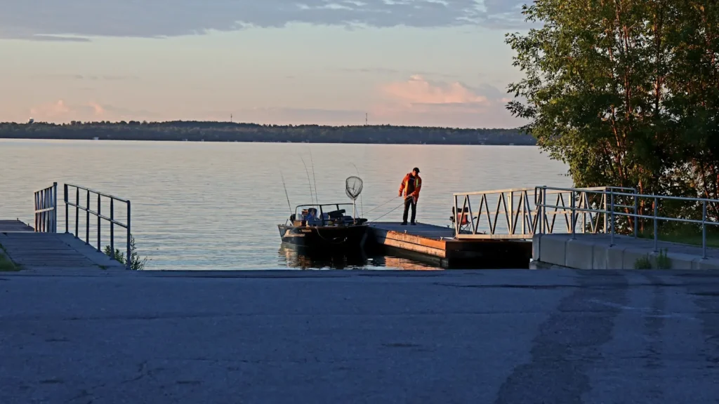
The photo at the top of this page is not Lake Lanier.
It is a regional stand-in, honestly captioned but generic — we will not put a name to a river we cannot prove. Send us a photograph you took here and it replaces the stand-in, with your credit on it.
Pioneer badgeUnclaimed
Add a photo of this water
Landscape, not fish — the water itself. Reviewed by hand before it appears. The first one published here earns the Pioneer badge.
Pool right now
1,062.70ft
- 24 hours-0.07 ft → steady
- For the dateA little below normal for the date
Reading taken 52 min ago at USGS 02334400, LAKE SIDNEY LANIER NEAR BUFORD, GA. Elevation is the surface of the lake above the survey datum, not depth. Source.
Fished this water? Add a photo
Reviewed by hand before it appears. Pick the water, not the spot — we never publish exact locations.
Access
Corps of Engineers parks: ramps spaced all around the lake, most with parking and restrooms.
Van Pugh and Little Hall Park: south end access near the dam and the deep water.
Bolding Mill and War Hill Park: north end ramps near the Chestatee and Chattahoochee arms.
Laurel Park and Longwood Park: Gainesville-side access, convenient and busy.
Marinas at Aqualand, Lanier Islands and Habersham: fuel, slips and guide services.
Buford Dam Park: bank access below and beside the dam.
Note: recreational traffic is very heavy from spring to autumn. Fish early.
Seasons
Winter: the best striper months, fish shallow and catchable on boards and free lines.
Spring: bass spawn in the pockets, stripers follow herring, and the lake is at its most generous.
Summer: stripers deep on downlines, spotted bass on offshore structure, early starts essential.
Fall: schooling fish on the main lake and the most enjoyable topwater of the year.
From the water
No logged trips yet. Be the first to put this water on your map.
Log this water
Fished it or cleaned it? Log in or create a free account to log a trip with photos and earn the waterway badge.
Questions
What species can you catch on the Lake Lanier?
Anglers target Black Crappie, Bluegill, Channel Catfish, Largemouth Bass, Spotted Bass, Striped Bass on the Lake Lanier in Georgia.
Are there fishing guides on the Lake Lanier?
GuidedFloats lists 1 guide and outfitters on the Lake Lanier. Claimed profiles accept booking requests; unclaimed profiles are built from public records and link to the business.
Where can you access the Lake Lanier?
Corps of Engineers parks: ramps spaced all around the lake, most with parking and restrooms. Van Pugh and Little Hall Park: south end access near the dam and the deep water. Bolding Mill and War Hill Park: north end ramps near the Chestatee and Chattahoochee arms. Laurel Park and Longwood Park: Gainesville-side access, convenient and busy. Marinas at Aqualand, Lanier Islands and Habersham: fuel, slips and guide services. Buford Dam Park: bank access below and beside the dam. Note: recreational traffic is very heavy from spring to autumn. Fish early.
When is the best time to fish the Lake Lanier?
Winter: the best striper months, fish shallow and catchable on boards and free lines. Spring: bass spawn in the pockets, stripers follow herring, and the lake is at its most generous. Summer: stripers deep on downlines, spotted bass on offshore structure, early starts essential. Fall: schooling fish on the main lake and the most enjoyable topwater of the year.
Where are the fishing regulations for the Lake Lanier?
Regulations change by season and section. Read the current rules on the Georgia agency site: https://georgiawildlife.com/fishing-regulations