Fishes Allagash River
River · Northern Maine, Aroostook County, the Allagash Wilderness Waterway running north to the St. John · Maine
Allagash River Fishing Guides
The Allagash Wilderness Waterway through northern Maine, a remote canoe river fished for wild brook trout and landlocked salmon.
Map of the Allagash River
59 numbered points: 6 access points, 41 campsites, 2 outfitters, 2 bridges, 1 park or conservation area, 1 agency office, 1 regulation section limit, 4 hazards, 1 USGS gauge. Tap a marker for details. Reviewed Sep 25, 2026.
- Access / boat ramp (6)
- Campsite (41)
- Outfitter / canoe rental (2)
- Bridge crossing (2)
- Park / conservation area (1)
- Agency / conservation office (1)
- Regulation section limit (1)
- Dam / hazard (4)
- USGS gauge (1)
Map data © OpenStreetMap contributors. Points are curated from OpenStreetMap and state agency sources; confirm access and hours before you go.
Print it. Bag it. Bring it.Phones die, screens crack, and most of this water has no signal. Print this map, fold it into a zip-top bag or dry bag with your license, and you have a backup your electronics can’t give you. Every marker is numbered so you can say exactly where you are.
Open the printable mapAll 59 points on this map
| # | Point | Type | Lat, Lon | Notes |
|---|---|---|---|---|
| 1 | Churchill Dam Boat Ramp AWW - head of Chase Rapids | Access / boat ramp | 46.49345, -69.28871 | Top of the Allagash Wilderness Waterway canoe run; the Chase Rapids shuttle starts here. |
| 2 | Churchill Dam AWW dam and gatehouse | Dam / hazard | 46.49290, -69.28813 | Release into Chase Rapids is controlled at the dam. |
| 3 | Churchill Dam Campsite AWW campsite - 4 sites | Campsite | 46.49437, -69.28686 | |
| 4 | Bissonette Bridge Access Point AWW - Bissonette Bridge | Access / boat ramp | 46.53630, -69.31525 | Foot of Chase Rapids; the shuttle drop-off. |
| 5 | Meadows AWW campsite - 1 site | Campsite | 46.56336, -69.33956 | OSM spells this Medows. |
| 6 | Allagash Wilderness Waterway Maine Bureau of Parks and Lands | Park / conservation area | 46.57734, -69.33769 | State-managed corridor either side of the river for its whole length. |
| 7 | Reach boundary - red markers at Chisholm Brook MDIFW reach boundary | Regulation section limit | 46.57235, -69.34605 | Boundary of a reach listed under this river in the MDIFW special fishing laws. The rules themselves are not restated here - check the current law book. |
| 8 | Chisholm Brook AWW campsite - 2 sites | Campsite | 46.57269, -69.34568 | |
| 9 | Ferry Landing AWW campsite - 1 site | Campsite | 46.59339, -69.35646 | |
| 10 | Ledges AWW campsite - 2 sites | Campsite | 46.59791, -69.38350 | |
| 11 | Sandy Point AWW campsite | Campsite | 46.61166, -69.39439 | |
| 12 | Umsaskis Thoroughfare Canoe Landing AWW canoe landing | Access / boat ramp | 46.61407, -69.39355 | |
| 13 | Realty Road Woods-road crossing at Umsaskis Thoroughfare | Bridge crossing | 46.61469, -69.39231 | One of only three road crossings on the waterway. |
| 14 | Pine AWW campsite - 1 site | Campsite | 46.61849, -69.38970 | |
| 15 | Cedar Springs AWW campsite - 1 site | Campsite | 46.63569, -69.37315 | |
| 16 | Grey Brook AWW campsite - 1 site | Campsite | 46.63652, -69.38115 | |
| 17 | Jalbert AWW campsite - 1 site | Campsite | 46.65402, -69.37534 | |
| 18 | Sam's AWW campsite - 1 site | Campsite | 46.65902, -69.38313 | |
| 19 | McNally Camps and Guide Service Sporting camp and guide service | Outfitter / canoe rental | 46.68717, -69.40656 | About 1.9 km off the river. |
| 20 | Lost Popple AWW campsite - 1 site | Campsite | 46.70092, -69.38596 | |
| 21 | Long Lake Dam Old log-driving dam | Dam / hazard | 46.71455, -69.37956 | Rips run through the old crib dam at the foot of Long Lake - scout the line. |
| 22 | Long Lake Dam AWW campsite - 2 sites | Campsite | 46.71430, -69.37887 | |
| 23 | Cunliffe Island AWW campsite | Campsite | 46.72483, -69.36877 | |
| 24 | Sweeny Brook AWW campsite | Campsite | 46.74005, -69.36998 | |
| 25 | Henderson Bridge Road Access Point AWW - Henderson Bridge | Access / boat ramp | 46.76352, -69.30531 | Road crossing and access at the head of Round Pond. |
| 26 | Back Channel AWW campsite | Campsite | 46.75584, -69.26939 | |
| 27 | Inlet AWW campsite | Campsite | 46.76978, -69.27196 | |
| 28 | Tower Trail AWW campsite - 1 site | Campsite | 46.77301, -69.26101 | |
| 29 | Outlet AWW campsite - 1 site | Campsite | 46.77809, -69.27091 | |
| 30 | Round Pond Rips AWW campsite - 1 site | Campsite | 46.78075, -69.27009 | |
| 31 | Turk Island AWW campsite | Campsite | 46.78843, -69.27605 | |
| 32 | Croque Brook AWW campsite - 2 sites | Campsite | 46.81778, -69.26489 | |
| 33 | Hosea B AWW campsite - 1 site | Campsite | 46.84544, -69.25291 | |
| 34 | Five Finger Brook West AWW campsite - 1 site | Campsite | 46.85826, -69.24795 | |
| 35 | Five Finger Brook South AWW campsite - 1 site | Campsite | 46.86002, -69.24595 | |
| 36 | Five Finger Brook North AWW campsite - 1 site | Campsite | 46.86407, -69.24484 | |
| 37 | Dead Water South AWW campsite - 1 site | Campsite | 46.90261, -69.22503 | |
| 38 | Dead Water North AWW campsite - 1 site | Campsite | 46.90295, -69.22328 | |
| 39 | Bass Brook AWW campsite - 1 site | Campsite | 46.90750, -69.21224 | |
| 40 | Cunliffe AWW campsite - 1 site | Campsite | 46.92409, -69.19551 | |
| 41 | Cunliffe Depot AWW campsite - 1 site | Campsite | 46.92453, -69.19362 | |
| 42 | Ramsay Ledge AWW campsite - 3 sites | Campsite | 46.93264, -69.19434 | |
| 43 | Michaud Farm AWW campsite - 1 site | Campsite | 46.95226, -69.19675 | |
| 44 | Michaud Farm Ranger Station Maine BPL - AWW ranger station | Agency / conservation office | 46.95213, -69.19508 | Staffed station near the foot of the waterway. |
| 45 | Finley Bogan Access Point AWW access | Access / boat ramp | 46.95453, -69.17927 | |
| 46 | Taylor Landing AWW campsite - 1 site | Campsite | 46.94967, -69.17484 | |
| 47 | Allagash Falls AWW campsite - 4 sites | Campsite | 46.94918, -69.13412 | Sites at the head of the carry around the falls. |
| 48 | Allagash Falls Falls - portage | Dam / hazard | 46.95017, -69.13443 | A marked carry trail leaves the right bank above the falls. |
| 49 | Falls Bank AWW campsite - 1 site | Campsite | 46.94983, -69.12895 | Below the falls. |
| 50 | McKeen Brook AWW campsite - 2 sites | Campsite | 46.96044, -69.10836 | |
| 51 | Big Brook South AWW campsite - 1 site | Campsite | 46.97226, -69.08578 | |
| 52 | Big Brook North AWW campsite - 1 site | Campsite | 46.97466, -69.08302 | |
| 53 | Big Brook East AWW campsite - 1 site | Campsite | 46.97548, -69.08003 | |
| 54 | Spring Bank Rapids Rapids | Dam / hazard | 46.99974, -69.08930 | |
| 55 | East Twin Brook AWW campsite | Campsite | 47.01683, -69.08189 | |
| 56 | Twin Brook Access Point AWW access | Access / boat ramp | 47.03243, -69.07996 | |
| 57 | USGS gauge 01011000 - Allagash River near Allagash Live stage and discharge | USGS gauge | 47.06972, -69.07944 | |
| 58 | Tylor Kelly's Camps Canoe rental and shuttle, Allagash | Outfitter / canoe rental | 47.08934, -69.05016 | |
| 59 | Dickey Road Crossing at Allagash village | Bridge crossing | 47.08345, -69.04598 | Last crossing above the St. John confluence. |
Guides on the Allagash River
Claimed profiles take booking requests. Unclaimed profiles are built from public records so the river is never empty; the guide can claim or remove one any time.
Order on this page: premium and outfitter plans first (labelled Premium placement), then claimed free profiles, then unclaimed — one published price, no bidding for position. How placement works
About the Allagash River
The Allagash runs north through the largest block of undeveloped forest in the eastern United States, from the chain of lakes in northern Piscataquis County to its meeting with the St. John River at the village of Allagash. Ninety-two miles of it are protected as the Allagash Wilderness Waterway, a state-administered corridor established in 1966 and the first state-designated component of the national Wild and Scenic Rivers System.
It is a canoe river before it is anything else. The standard trip runs a week or more from Telos or Chamberlain Lake down through Eagle, Churchill and Umsaskis, past Allagash Falls, to the take-out near the confluence. Between the lakes the river is quick and shallow over cobble, with long quiet stretches through spruce and fir, and the only structures of any kind are the remains of old logging works. There is no road access through most of it and no cell service at all.
Brook trout are the fish that define the water and northern Maine holds the strongest wild brook trout populations remaining in the country. They are found through the river and concentrate around the cold tributary mouths and the spring holes in summer. Landlocked salmon are present, particularly in the lake sections and the connecting thoroughfares, and lake trout hold in the deeper lakes. Whitefish, chain pickerel, burbot and white sucker round out the community.
Planning is the real work here. Permits, campsite registration, a long shuttle and genuine remoteness all need arranging in advance, and the gauge at Allagash reports water temperature as well as flow, which helps judge both trout conditions and whether the shallow reaches will float a loaded canoe. Guided trips are common and for a first visit they are worth the cost, because the guides who work this river know where the cold water is in August and how to read the shallow reaches with a loaded boat. Black flies peak in June and taper through July.
This water needs a real photo
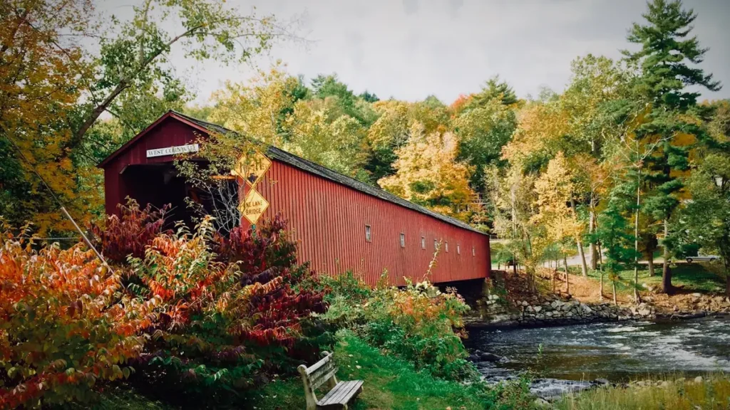
The photo at the top of this page is not Allagash River.
It is a regional stand-in, honestly captioned but generic — we will not put a name to a river we cannot prove. Send us a photograph you took here and it replaces the stand-in, with your credit on it.
Pioneer badgeUnclaimed
Add a photo of this water
Landscape, not fish — the water itself. Reviewed by hand before it appears. The first one published here earns the Pioneer badge.
Fished this water? Add a photo
Reviewed by hand before it appears. Pick the water, not the spot — we never publish exact locations.
Access
Allagash village - the gauge reach and the downstream take-out near the St. John.
Chamberlain Lake and Telos - the usual put-in at the head of the waterway.
Churchill Dam - the access controlling flow into the Chase Rapids reach.
Umsaskis and Long Lake - mid-trip lake access on the waterway.
Michaud Farm - the last ranger station above Allagash Falls.
Allagash Falls carry - the mandatory portage on the lower river.
North Maine Woods checkpoints - the gated access controlling entry to the region.
Seasons
Spring: high cold water and the best brook trout fishing, though ice-out comes late this far north.
Summer: the main canoe season, with trout holding at cold tributary mouths and spring holes.
Fall: excellent fishing and no crowds, but weather turns hard and the season closes early.
Winter: the region is snowbound and the waterway is effectively closed to fishing.
From the water
No logged trips yet. Be the first to put this water on your map.
Log this water
Fished it or cleaned it? Log in or create a free account to log a trip with photos and earn the waterway badge.
Questions
What is the current flow on the Allagash River?
As of Nov 2, 6:00 am, the USGS gauge Allagash River near Allagash, Maine reads 246 cfs. Conditions update every 15 minutes.
What species can you catch on the Allagash River?
Anglers target Brook Trout, Burbot, Chain Pickerel, Lake Trout, Lake Whitefish, Landlocked Salmon, White Sucker on the Allagash River in Maine.
Are there fishing guides on the Allagash River?
GuidedFloats lists 2 guides and outfitters on the Allagash River. Claimed profiles accept booking requests; unclaimed profiles are built from public records and link to the business.
Where can you access the Allagash River?
Allagash village - the gauge reach and the downstream take-out near the St. John. Chamberlain Lake and Telos - the usual put-in at the head of the waterway. Churchill Dam - the access controlling flow into the Chase Rapids reach. Umsaskis and Long Lake - mid-trip lake access on the waterway. Michaud Farm - the last ranger station above Allagash Falls. Allagash Falls carry - the mandatory portage on the lower river. North Maine Woods checkpoints - the gated access controlling entry to the region.
When is the best time to fish the Allagash River?
Spring: high cold water and the best brook trout fishing, though ice-out comes late this far north. Summer: the main canoe season, with trout holding at cold tributary mouths and spring holes. Fall: excellent fishing and no crowds, but weather turns hard and the season closes early. Winter: the region is snowbound and the waterway is effectively closed to fishing.
Where are the fishing regulations for the Allagash River?
Regulations change by season and section. Read the current rules on the Maine agency site: https://www.maine.gov/ifw/fishing-boating/fishing/laws-rules/index.html