Grand River Fishing Guides
The headwater reach of Michigan's longest river at Jackson, a warmwater smallmouth and pike fishery far upstream of the Grand Rapids salmon and steelhead water.
Map of the Grand River
89 numbered points: 26 access points, 3 campsites, 4 outfitters, 25 bridges, 17 parks and conservation areas, 1 agency office, 1 USGS gauge, 12 points of interest. Tap a marker for details. Reviewed Oct 23, 2026.
- Access / boat ramp (26)
- Campsite (3)
- Outfitter / canoe rental (4)
- Bridge crossing (25)
- Park / conservation area (17)
- Agency / conservation office (1)
- USGS gauge (1)
- Point of interest (12)
Print it. Bag it. Bring it.Phones die, screens crack, and most of this water has no signal. Print this map, fold it into a zip-top bag or dry bag with your license, and you have a backup your electronics can’t give you. Every marker is numbered so you can say exactly where you are.
Open the printable mapAll 89 points on this map
| # | Point | Type | Lat, Lon | Notes |
|---|---|---|---|---|
| 1 | South Meridian Road (US 127) Liberty Township | Bridge crossing | 42.14147, -84.36440 | Uppermost mapped crossing on the chained relation. |
| 2 | Brooklyn Road (M 50) Jackson | Bridge crossing | 42.21377, -84.37445 | |
| 3 | South Cooper Street Jackson | Bridge crossing | 42.24726, -84.40046 | |
| 4 | West Louis Glick Highway Jackson | Bridge crossing | 42.24933, -84.40664 | |
| 5 | Jackson County Conservation District Jackson | Agency / conservation office | 42.25448, -84.40972 | The only river or conservation agency office OSM places near this river. |
| 6 | Lions Park City of Jackson | Park / conservation area | 42.26252, -84.41074 | |
| 7 | USGS streamgauge Live stage and discharge | USGS gauge | 42.28365, -84.40885 | Roster coordinate; USGS 04109000, Grand River at Jackson. |
| 8 | East Parnall Road Jackson | Bridge crossing | 42.29110, -84.40564 | |
| 9 | Maple Grove Bridge Access Site Michigan DNR boating access site, Jackson County | Access / boat ramp | 42.34248, -84.40296 | |
| 10 | Lansing Avenue Jackson County | Bridge crossing | 42.39590, -84.41377 | |
| 11 | Rives Eaton Road Jackson County | Bridge crossing | 42.40376, -84.48582 | |
| 12 | Trestle Bridge Access Site Michigan DNR boating access site, Eaton County | Access / boat ramp | 42.39649, -84.48908 | |
| 13 | Tompkins Bridge Jackson County, state game area launch | Access / boat ramp | 42.39127, -84.54186 | Recovered by the second-pass refill of the band Overpass lost on the first try. |
| 14 | Gale Road Access Site Eaton County | Access / boat ramp | 42.48247, -84.58143 | |
| 15 | Gale Road Grand River State Game Area Michigan DNR | Park / conservation area | 42.48528, -84.58996 | |
| 16 | Smithville Dam Eaton County | Point of interest | 42.49967, -84.62918 | Mapped as a weir in OSM; a low-head dam and a portage. |
| 17 | McArthur Park Launch Eaton Rapids | Access / boat ramp | 42.50484, -84.64867 | |
| 18 | State Street Dam Eaton Rapids | Point of interest | 42.50895, -84.65505 | Mapped as a weir in OSM; a low-head dam and a portage. |
| 19 | Eaton Rapids Outdoor Recreation Center Eaton Rapids | Outfitter / canoe rental | 42.51360, -84.65445 | Livery on the Eaton Rapids reach. |
| 20 | East Sanitary Dam Eaton Rapids | Point of interest | 42.51474, -84.65305 | Mapped as a weir in OSM; a low-head dam and a portage. |
| 21 | Bunker Road Canoe Landing Ingham County Parks | Access / boat ramp | 42.55248, -84.62084 | |
| 22 | North Michigan Road (M 99) Dimondale | Bridge crossing | 42.63100, -84.62271 | |
| 23 | Danford Island Park Village of Dimondale | Park / conservation area | 42.64748, -84.65033 | OSM mis-spells the operator as Village of Diamondale. |
| 24 | Dimondale Canoe & Kayak Dimondale | Outfitter / canoe rental | 42.67126, -84.64294 | Livery on the reach above Lansing. |
| 25 | Grand Pointe Marina Dimondale | Access / boat ramp | 42.67064, -84.64154 | |
| 26 | South Waverly Road Lansing | Bridge crossing | 42.70922, -84.60305 | |
| 27 | Grand River Park City of Lansing | Access / boat ramp | 42.72030, -84.58762 | |
| 28 | South Martin Luther King Jr Boulevard (M 99) Lansing | Bridge crossing | 42.72099, -84.56901 | |
| 29 | Moores Park Dam Lansing | Point of interest | 42.71829, -84.56088 | Mapped as a weir in OSM; a low-head dam and a portage. |
| 30 | Moores Park City of Lansing | Park / conservation area | 42.71705, -84.55927 | |
| 31 | River Point Park Lansing, at the Red Cedar confluence | Park / conservation area | 42.72395, -84.54987 | |
| 32 | Sweeney's Landing City of Lansing, no fee | Access / boat ramp | 42.72651, -84.54588 | |
| 33 | River Town Adventures Lansing | Outfitter / canoe rental | 42.72751, -84.54730 | Livery on the Lansing river trail reach. |
| 34 | East Michigan Avenue Lansing | Bridge crossing | 42.73358, -84.54972 | |
| 35 | The Power of Water Lansing | Outfitter / canoe rental | 42.74047, -84.54714 | Paddling shop; OSM tags it shop=boat. |
| 36 | East Saginaw Street (M 43) Lansing | Bridge crossing | 42.74084, -84.54942 | |
| 37 | North Lansing Dam Lansing | Point of interest | 42.74570, -84.55003 | Mapped as a weir in OSM; a low-head dam and a portage. |
| 38 | Turner-Dodge Park Lansing | Park / conservation area | 42.75119, -84.55244 | |
| 39 | North Waverly Road Lansing | Bridge crossing | 42.75328, -84.60285 | |
| 40 | Willow Canoe Launch Delta Township | Access / boat ramp | 42.75622, -84.71040 | |
| 41 | South Bridge Street (M 100) Grand Ledge | Bridge crossing | 42.75457, -84.74406 | |
| 42 | Tyler Lee Murphy Memorial Fishing Dock Grand Ledge Riverwalk | Point of interest | 42.75524, -84.74514 | A fishing dock, not a launch. |
| 43 | Island Park City of Grand Ledge | Park / conservation area | 42.75607, -84.74839 | A second island park is mapped nearby; only this one is kept. |
| 44 | Grand Ledge Dam Grand Ledge | Point of interest | 42.76321, -84.76256 | Mapped as a weir in OSM; a low-head dam and a portage. |
| 45 | Kruger Memorial Landing Clinton County | Access / boat ramp | 42.86719, -84.90978 | |
| 46 | Portland Dam Portage Portland | Access / boat ramp | 42.88851, -84.93013 | Signed portage around the municipal dam. |
| 47 | Portland Municipal Dam Portland | Point of interest | 42.88870, -84.93093 | Mapped twice in OSM, as a dam and as a weir; collapsed to one point. A portage. |
| 48 | Webber Dam Boat Access Site Michigan DNR, Ionia County | Access / boat ramp | 42.95386, -84.90480 | OSM writes the name Boad Access Site and the operator Departement; corrected here. |
| 49 | Webber Dam Portage Ionia County | Access / boat ramp | 42.95214, -84.90159 | Signed portage around the dam. |
| 50 | Webber Dam Consumers Energy, Ionia County | Point of interest | 42.95318, -84.90282 | OSM names this Weber Dam; it is Webber Dam. |
| 51 | Wagar Dam Ionia County | Point of interest | 42.96588, -84.91385 | Mapped as a weir in OSM; a low-head dam and a portage. |
| 52 | Green View Point Park Ionia County Parks | Park / conservation area | 42.98639, -84.92007 | |
| 53 | Lyons Village Boat Launch Lyons, no fee | Access / boat ramp | 42.97753, -84.94163 | |
| 54 | Public Fishing Access Village of Lyons | Access / boat ramp | 42.98141, -84.94884 | |
| 55 | South State Road (M 66) Ionia | Bridge crossing | 42.97207, -85.06931 | |
| 56 | Saranac Riverwalk Park Village of Saranac | Park / conservation area | 42.93257, -85.21152 | |
| 57 | Boat Launch Park Village of Saranac | Access / boat ramp | 42.93229, -85.21443 | Named Boat Launch Park in OSM and tagged as a park; it is the village launch. |
| 58 | South Hudson Street Lowell | Bridge crossing | 42.92523, -85.34292 | |
| 59 | Grand River Fulton Street Preserve Ada Township | Park / conservation area | 42.95432, -85.47282 | |
| 60 | Fulton Street East (M 21) Ada | Bridge crossing | 42.95533, -85.47554 | |
| 61 | Ada Boating Access Site Michigan DNR | Access / boat ramp | 42.95630, -85.47782 | |
| 62 | Woodrick Memorial Wetland Observation Deck Ada | Point of interest | 42.98401, -85.53184 | |
| 63 | Roselle Park Ada | Park / conservation area | 42.98764, -85.53364 | |
| 64 | Knapp Street Bridge Boating Access Site Michigan DNR, Grand Rapids | Access / boat ramp | 43.00473, -85.54154 | |
| 65 | Northland Drive Northeast (M 44) Grand Rapids | Bridge crossing | 43.06358, -85.57990 | |
| 66 | Rogue River Mouth Boat Launch Grand Rapids, at the Rogue confluence | Access / boat ramp | 43.06302, -85.58505 | |
| 67 | Donald J. Lamoreaux Park Grand Rapids | Park / conservation area | 43.05007, -85.64262 | |
| 68 | Riverside Park Boat Launch Grand Rapids | Access / boat ramp | 42.99951, -85.67186 | |
| 69 | Canal Street Park Grand Rapids, above the Sixth Street Dam | Park / conservation area | 42.98062, -85.67239 | |
| 70 | Sixth Street Dam Grand Rapids | Point of interest | 42.97444, -85.67453 | Mapped as a weir in OSM; the head of navigation and a portage. |
| 71 | Sixth Street Dam Boat Launch Grand Rapids | Access / boat ramp | 42.97438, -85.67352 | |
| 72 | Bridge Street Northwest Grand Rapids | Bridge crossing | 42.97043, -85.67486 | |
| 73 | Lyon Square Grand Rapids riverfront | Park / conservation area | 42.96724, -85.67434 | |
| 74 | Fulton Street West Grand Rapids | Bridge crossing | 42.96326, -85.67615 | |
| 75 | Gerald R Ford Freeway (I 196) Grand Rapids | Bridge crossing | 42.94764, -85.71041 | |
| 76 | Johnson Park Boat Launch Michigan DNR, Walker | Access / boat ramp | 42.93021, -85.75629 | |
| 77 | Wilson Avenue Southwest (M 11) Grandville | Bridge crossing | 42.91502, -85.76678 | |
| 78 | Steamboat Park Campground Grandville | Campsite | 42.93703, -85.80024 | Private caravan park on the bank. |
| 79 | Grand River Park Boat Launch Ottawa County | Access / boat ramp | 42.94452, -85.85466 | |
| 80 | Lake Michigan Drive (M 45) Ottawa County | Bridge crossing | 42.97200, -85.87658 | |
| 81 | Deer Creek Park Boat Launch Ottawa County | Access / boat ramp | 43.01076, -85.93635 | |
| 82 | 68th Avenue Ottawa County | Bridge crossing | 43.01529, -85.95560 | |
| 83 | Burr Oak Landing West Open Space Area Ottawa County | Park / conservation area | 43.02102, -86.01740 | |
| 84 | Conestoga Grand River Campground Coopersville | Campsite | 43.03056, -86.03389 | Private caravan park. |
| 85 | Robinson Boat Launch Ottawa County | Access / boat ramp | 43.03982, -86.08391 | The Robinson site is mapped twice, as a launch node and a DNR access-site way; collapsed to one point. |
| 86 | Eastpointe RV Resort Ottawa County, fee | Campsite | 43.06421, -86.20428 | Private caravan park. |
| 87 | North Beacon Boulevard (US 31) Grand Haven | Bridge crossing | 43.07529, -86.21788 | The last crossing above the harbour. |
| 88 | Bicentennial Park Grand Haven | Park / conservation area | 43.06345, -86.23554 | |
| 89 | Fishermens Park Grand Haven | Park / conservation area | 43.05880, -86.25247 |
Guides on the Grand River
Claimed profiles take booking requests. Unclaimed profiles are built from public records so the river is never empty; the guide can claim or remove one any time.
Order on this page: premium and outfitter plans first (labelled Premium placement), then claimed free profiles, then unclaimed — one published price, no bidding for position. How placement works
About the Grand River
The Grand is Michigan’s longest river, running about two hundred and sixty miles from Jackson County northwest through Lansing and Grand Rapids to Lake Michigan at Grand Haven. Most anglers who know the name know the lower river, where salmon and steelhead run up to the Sixth Street dam at Grand Rapids and where the guided fishery is concentrated. This gauge is at Jackson, near the very top of the system, and the water it reads is a completely different river – small, warm, agricultural and entirely warmwater in character.
That upper reach is genuinely worth fishing and almost nobody does. Smallmouth bass are the main quarry through the summer, holding in the riffles and around woody structure in a river narrow enough to wade in many places. Largemouth occupy the slower pools and the impounded stretches, northern pike hold in the weedy backwaters, and rock bass are everywhere. Channel catfish are abundant, common carp reach substantial sizes and are increasingly fished on purpose with fly gear, and walleye are present in the deeper water downstream toward Eaton Rapids.
Dam removal has changed this reach over the past decade, with restoration work in and above Jackson reopening river habitat that had been impounded for a century. The result is more riffle, more gravel and better smallmouth water than the upper Grand had a generation ago. Anglers should still expect an urban and agricultural river with variable clarity, and should give it a few days after heavy rain. This gauge at Jackson reports turbidity, discharge and stage but no water temperature, and the turbidity series is the useful one for judging whether the river has cleared after a storm. Anglers heading for salmon or steelhead want a gauge two hundred miles downstream, not this one.
This water needs a real photo
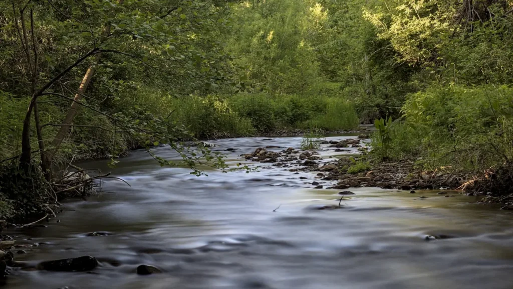
The photo at the top of this page is not Grand River.
It is a regional stand-in, honestly captioned but generic — we will not put a name to a river we cannot prove. Send us a photograph you took here and it replaces the stand-in, with your credit on it.
Add a photo of this water
Landscape, not fish — the water itself. Reviewed by hand before it appears. The first one published here earns the Pioneer badge.
Fished this water? Add a photo
Reviewed by hand before it appears. Pick the water, not the spot — we never publish exact locations.
Access
Jackson riverfront and the Grand River Trail - in-town bank access closest to the gauge.
Blackman Park in Jackson - parking and shoreline access on the upper river.
Sharp Park and the restored reach through Jackson - wadeable riffle water opened by dam removal.
Eaton Rapids river access - downstream access with a ramp and bank fishing.
Onondaga Road crossings - rural roadside access between Jackson and Eaton Rapids.
Grand River County Park in Ingham County - developed access with parking and a launch.
Portage River confluence above Jackson - tributary access and an alternative when the mainstem is high.
Seasons
Spring: high, coloured water from snowmelt and spring rain, with pike active early in the backwaters.
Summer: the main season, with smallmouth in the riffles and carp on the flats in low, clear water.
Fall: cooling water, aggressive smallmouth and very little competition on the upper river.
Winter: low and often iced in the slow reaches, with almost no angling activity above Eaton Rapids.
From the water
No logged trips yet. Be the first to put this water on your map.
Log this water
Fished it or cleaned it? Log in or create a free account to log a trip with photos and earn the waterway badge.
Questions
What is the current flow on the Grand River?
As of Nov 2, 6:30 am, the USGS gauge GRAND RIVER AT JACKSON, MI reads 69 cfs. Conditions update every 15 minutes.
What species can you catch on the Grand River?
Anglers target Channel Catfish, Common Carp, Largemouth Bass, Northern Pike, Rock Bass, Smallmouth Bass, Walleye on the Grand River in Michigan.
Are there fishing guides on the Grand River?
GuidedFloats lists 2 guides and outfitters on the Grand River. Claimed profiles accept booking requests; unclaimed profiles are built from public records and link to the business.
Where can you access the Grand River?
Jackson riverfront and the Grand River Trail - in-town bank access closest to the gauge. Blackman Park in Jackson - parking and shoreline access on the upper river. Sharp Park and the restored reach through Jackson - wadeable riffle water opened by dam removal. Eaton Rapids river access - downstream access with a ramp and bank fishing. Onondaga Road crossings - rural roadside access between Jackson and Eaton Rapids. Grand River County Park in Ingham County - developed access with parking and a launch. Portage River confluence above Jackson - tributary access and an alternative when the mainste...
When is the best time to fish the Grand River?
Spring: high, coloured water from snowmelt and spring rain, with pike active early in the backwaters. Summer: the main season, with smallmouth in the riffles and carp on the flats in low, clear water. Fall: cooling water, aggressive smallmouth and very little competition on the upper river. Winter: low and often iced in the slow reaches, with almost no angling activity above Eaton Rapids.
Where are the fishing regulations for the Grand River?
Regulations change by season and section. Read the current rules on the Michigan agency site: https://www.michigan.gov/dnr/things-to-do/fishing/fishing-regulations