Fishes Au Sable River
River · Great Lakes · Michigan
Au Sable River Fishing Guides
Michigan's flagship trout river, with fly-only Holy Waters near Grayling and the larger Mio and McKinley reaches floated by Au Sable riverboat for browns, rainbows and brook trout.
Map of the Au Sable River
37 numbered points: 10 access points, 12 campsites, 1 bait & fly shop, 2 outfitters, 3 agency offices, 2 regulation section limits, 6 hazards, 1 USGS gauge. Tap a marker for details. Reviewed Sep 25, 2026.
- Access / boat ramp (10)
- Campsite (12)
- Bait, tackle & fly shop (1)
- Outfitter / canoe rental (2)
- Agency / conservation office (3)
- Regulation section limit (2)
- Dam / hazard (6)
- USGS gauge (1)
Map data © OpenStreetMap contributors. Points are curated from OpenStreetMap and state agency sources; confirm access and hours before you go.
Print it. Bag it. Bring it.Phones die, screens crack, and most of this water has no signal. Print this map, fold it into a zip-top bag or dry bag with your license, and you have a backup your electronics can’t give you. Every marker is numbered so you can say exactly where you are.
Open the printable mapAll 37 points on this map
| # | Point | Type | Lat, Lon | Notes |
|---|---|---|---|---|
| 1 | Michigan DNR Grayling Field Office Michigan Department of Natural Resources | Agency / conservation office | 44.71320, -84.70391 | DNR field office north of Grayling covering the upper river; 4.3 km from the water. |
| 2 | Skip's Sports Shop Sporting-goods shop · Grayling | Bait, tackle & fly shop | 44.65926, -84.72370 | The one shop tagged in OSM on the river in Grayling; tagged as a sports shop rather than a fly shop, so check before relying on it for tackle. |
| 3 | Borchers Canoe & Kayak Canoe and kayak livery · Grayling | Outfitter / canoe rental | 44.66124, -84.70871 | Livery on the river in Grayling and the usual shuttle for the upper floats. |
| 4 | Au Sable River State Forest Campground and Canoe Camp Michigan DNR state forest campground | Campsite | 44.66556, -84.65885 | First state forest campground and canoe camp below Grayling. |
| 5 | Burton's Landing State Forest Campground Michigan DNR state forest campground | Campsite | 44.66179, -84.64561 | State forest campground at Burton's Landing, at the top of the Holy Waters. |
| 6 | Holy Waters - upper limit at Burton's Landing Designated special-regulation reach | Regulation section limit | 44.66312, -84.64597 | Upstream end of the nine-mile Holy Waters, which runs from Burton's Landing down to Wakeley Bridge. Read the current rules on the Michigan DNR's own pages; this sheet marks the boundary only. |
| 7 | Keystone Landing State Forest Campground Michigan DNR state forest campground | Campsite | 44.66478, -84.62274 | State forest campground inside the Holy Waters. |
| 8 | Stephan Bridge Boating Access Site Michigan DNR boating access site | Access / boat ramp | 44.67889, -84.57498 | The best-known access on the Holy Waters and the mid-point of the reach. Tagged as a park in OSM, which also spells it 'Stephans'; the South Stephan Bridge Road crossing is 190 m away and is not shown separately. |
| 9 | Au Sable River Access (Trout Unlimited) Trout Unlimited river access | Access / boat ramp | 44.67723, -84.56212 | Small walk-in access held by Trout Unlimited, inside the Holy Waters. Tagged as a park in OSM; it is an access. |
| 10 | Wakeley Bridge Landing Michigan DNR landing | Access / boat ramp | 44.65880, -84.50459 | Landing at Wakeley Bridge and the bottom of the Holy Waters. A second polygon tags the same site as a park. |
| 11 | Holy Waters - lower limit at Wakeley Bridge Designated special-regulation reach | Regulation section limit | 44.65998, -84.50725 | Downstream end of the nine-mile Holy Waters that starts at Burton's Landing. Read the current rules on the Michigan DNR's own pages; this sheet marks the boundary only. The source spells the bridge both 'Wakeley' and 'Wakely'. |
| 12 | White Pine Canoe Campground Michigan DNR canoe campground | Campsite | 44.65652, -84.47529 | Canoe-in state forest campground below Wakeley Bridge. |
| 13 | Connors Flats Michigan DNR access | Access / boat ramp | 44.66844, -84.43910 | Access on the flats reach above Rainbow Bend; sits on the centreline. |
| 14 | Lower Rainbow Bend Campground Michigan DNR state forest campground | Campsite | 44.67035, -84.41749 | State forest campground at Rainbow Bend. |
| 15 | McMasters Bridge Landing Michigan DNR landing | Access / boat ramp | 44.66451, -84.39712 | Landing at the McMasters Bridge crossing, which sits 85 m away and is not shown separately. Tagged as a park in OSM; it is a landing. |
| 16 | Parmalee Bridge State Forest Campground Michigan DNR state forest campground | Campsite | 44.67670, -84.29364 | State forest campground at the Parmalee Bridge crossing, on the long reach above Mio. |
| 17 | Camp Ten Bridge Boat Launch Michigan DNR boating access site | Access / boat ramp | 44.66918, -84.17826 | Launch at the Camp Ten Road crossing, the last access above Mio Pond. A boating-access-site polygon tags the same spot. |
| 18 | Mio Dam Consumers Energy hydro dam | Dam / hazard | 44.65997, -84.13299 | First dam on the river. Mio Pond backs up above it; take out at Camp Ten Bridge or at the pond launches rather than approaching the dam. |
| 19 | Au Sable River Outfitters Outfitter and guide service · Mio | Outfitter / canoe rental | 44.65370, -84.13218 | Outfitter on the river at Mio, just below the dam. |
| 20 | Huron National Forest Visitor Center United States Forest Service | Agency / conservation office | 44.66543, -84.12685 | Forest Service visitor centre and ranger station at Mio, for the national forest land the river runs through. |
| 21 | Au Sable Loop Campground National forest campground | Campsite | 44.65199, -84.10049 | Forest Service campground on the reach below Mio. |
| 22 | River Dune Campground National forest campground | Campsite | 44.64968, -84.09714 | Forest Service campground on the river below Mio. |
| 23 | Meadow Springs Campground National forest campground | Campsite | 44.65578, -84.07538 | Forest Service campground on the middle river. |
| 24 | Comins Flats Boat Access River access | Access / boat ramp | 44.65387, -84.04342 | Access on the Comins Flats reach. |
| 25 | Cathedral Pines Campground National forest campground | Campsite | 44.65519, -84.00460 | Forest Service campground in the pines on the middle river. |
| 26 | Buttercup Campground National forest campground | Campsite | 44.64117, -83.91353 | Forest Service campground above the Alcona backwater. |
| 27 | Gabions Campground National forest campground | Campsite | 44.62128, -83.84727 | Forest Service campground at the gabions, just above the river gauge. |
| 28 | USGS 04136900 - Au Sable River near Curtisville Real-time stage and discharge | USGS gauge | 44.61278, -83.83766 | The gauge float levels on this river are read from, on the reach above Alcona Pond. |
| 29 | Alcona Dam Consumers Energy hydro dam | Dam / hazard | 44.56260, -83.80226 | Second dam on the river, at the foot of Alcona Pond. |
| 30 | Loud Dam Consumers Energy hydro dam | Dam / hazard | 44.46431, -83.72121 | Third dam, at the foot of Loud Pond. |
| 31 | Five Channels Dam Consumers Energy hydro dam | Dam / hazard | 44.45511, -83.67713 | Fourth dam, at the foot of Five Channels Pond. |
| 32 | Cooke Dam Consumers Energy hydro dam | Dam / hazard | 44.47319, -83.57186 | Fifth dam, at the foot of Cooke Pond. |
| 33 | Foote Dam Consumers Energy hydro dam | Dam / hazard | 44.43614, -83.44114 | Last dam on the river; the free-flowing water below it to Oscoda is the steelhead and salmon reach. |
| 34 | Whirlpool River Access River access below Foote Dam | Access / boat ramp | 44.43233, -83.39111 | Access on the free-flowing water below Foote Dam. Two nodes and two ways tag this same site. |
| 35 | Huron Shores Ranger Station United States Forest Service | Agency / conservation office | 44.44742, -83.34828 | Ranger station for the lower river, 1.6 km north of the water at Oscoda. |
| 36 | Harbor Street Boat Ramp Boat ramp · Oscoda | Access / boat ramp | 44.40850, -83.32810 | Ramp on the lower river in Oscoda. |
| 37 | Au Sable River Mouth Boat Launch Michigan DNR boating access site | Access / boat ramp | 44.40643, -83.32257 | Lowest launch on the river, at the mouth on Lake Huron; an access-site polygon 120 m away tags the same place. |
Guides on the Au Sable River
Claimed profiles take booking requests. Unclaimed profiles are built from public records so the river is never empty; the guide can claim or remove one any time.
About the Au Sable River
Michigan's flagship trout river, with fly-only Holy Waters near Grayling and the larger Mio and McKinley reaches floated by Au Sable riverboat for browns, rainbows and brook trout.
This water needs a real photo
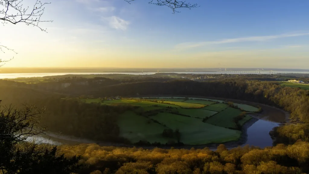
The photo at the top of this page is not Au Sable River.
It is a regional stand-in, honestly captioned but generic — we will not put a name to a river we cannot prove. Send us a photograph you took here and it replaces the stand-in, with your credit on it.
Pioneer badgeUnclaimed
Add a photo of this water
Landscape, not fish — the water itself. Reviewed by hand before it appears. The first one published here earns the Pioneer badge.
Fished this water? Add a photo
Reviewed by hand before it appears. Pick the water, not the spot — we never publish exact locations.
From the water
No logged trips yet. Be the first to put this water on your map.
Log this water
Fished it or cleaned it? Log in or create a free account to log a trip with photos and earn the waterway badge.
Questions
What is the current flow on the Au Sable River?
As of Oct 18, 4:30 pm, the USGS gauge AU SABLE RIVER NEAR MC KINLEY, MI reads 1,290 cfs, the 76th percentile for this date, with water temperature 52.2 F. Conditions update every 15 minutes.
What species can you catch on the Au Sable River?
Anglers target Brook Trout, Brown Trout, Rainbow Trout on the Au Sable River in Michigan.
Are there fishing guides on the Au Sable River?
GuidedFloats lists 5 guides and outfitters on the Au Sable River. Claimed profiles accept booking requests; unclaimed profiles are built from public records and link to the business.
Where are the fishing regulations for the Au Sable River?
Regulations change by season and section. Read the current rules on the Michigan agency site: https://www.michigan.gov/dnr/things-to-do/fishing/fishing-regulations