Muskegon River Fishing Guides
The big tailwater below Croton Dam, a year-round steelhead and trout river wide enough to row all day and close enough to Grand Rapids to fish after work.
Map of the Muskegon River
62 numbered points: 18 access points, 15 campsites, 2 bait & fly shops, 2 outfitters, 11 bridges, 8 parks and conservation areas, 2 agency offices, 3 hazards, 1 USGS gauge. Tap a marker for details. Reviewed Sep 25, 2026.
- Access / boat ramp (18)
- Campsite (15)
- Bait, tackle & fly shop (2)
- Outfitter / canoe rental (2)
- Bridge crossing (11)
- Park / conservation area (8)
- Agency / conservation office (2)
- Dam / hazard (3)
- USGS gauge (1)
Print it. Bag it. Bring it.Phones die, screens crack, and most of this water has no signal. Print this map, fold it into a zip-top bag or dry bag with your license, and you have a backup your electronics can’t give you. Every marker is numbered so you can say exactly where you are.
Open the printable mapAll 62 points on this map
| # | Point | Type | Lat, Lon | Notes |
|---|---|---|---|---|
| 1 | Reedsburg Dam First dam below Houghton Lake | Dam / hazard | 44.35577, -84.85983 | Holds back the Reedsburg flooding at the head of the river. Portage; no through route over the structure. |
| 2 | Reedsburg Dam State Forest Campground Michigan DNR state forest campground | Campsite | 44.35833, -84.85825 | Rustic sites on the flooding immediately above the dam, at the top of the float. |
| 3 | Houghton Lake Field Office Michigan DNR · 5.1 km from the river | Agency / conservation office | 44.33303, -84.79432 | DNR field office for this stretch. Well off the water — listed for contact, not as an access. |
| 4 | Launch at East Houghton Lake Road Unnamed slipway in OSM, at the road crossing | Access / boat ramp | 44.33546, -84.88931 | Carried in OSM as an unnamed slipway beside the East Houghton Lake Road bridge; not in the DNR boating-access layer, so treat as informal. |
| 5 | South Paradise Road Road crossing | Bridge crossing | 44.26304, -84.89651 | |
| 6 | East Cadillac Road Road crossing | Bridge crossing | 44.24865, -84.89644 | |
| 7 | South Dolph Road Road crossing | Bridge crossing | 44.22541, -84.87524 | |
| 8 | Canoe Camp Riverside camp | Campsite | 44.21368, -84.84739 | Tagged in OSM simply as "Canoe Camp"; a paddlers’ camp on the upper river. |
| 9 | Jonesville Road Road crossing | Bridge crossing | 44.15390, -84.86020 | |
| 10 | Muskegon Road Road crossing | Bridge crossing | 44.13885, -84.89838 | |
| 11 | Pine Road Road crossing | Bridge crossing | 44.08190, -85.01311 | |
| 12 | Duggan's Canoe Livery & Campground Canoe livery and campground | Outfitter / canoe rental | 44.03727, -85.03281 | Livery and riverside campground at the Temple Drive crossing, which sits directly beside it. |
| 13 | Great Lakes Central Railroad Railroad crossing | Bridge crossing | 44.03090, -85.03843 | |
| 14 | The Old Log Resort Private campground / resort | Campsite | 43.98825, -85.09086 | |
| 15 | River Country Campground Campground and canoe trips | Outfitter / canoe rental | 43.93288, -85.20771 | Campground that also runs canoe trips on this reach; typed here as an outfitter for that reason. |
| 16 | Riverside Park West City of Evart | Park / conservation area | 43.89736, -85.25672 | Riverside park on the west bank at Evart; Riverside Park East sits opposite. |
| 17 | Evart riverside launch Unnamed slipway in OSM, at Riverside Park | Access / boat ramp | 43.89567, -85.25748 | Carried in OSM as an unnamed slipway inside the Evart riverside parks, below the South Main Street bridge. |
| 18 | Crawford Park Michigan DNR · 1 lane, 5 trailer spaces | Access / boat ramp | 43.94684, -85.14963 | DNR boating access site; OSM carries the ramp as an unnamed slipway at the 30th Avenue crossing. |
| 19 | 135th Street Road crossing | Bridge crossing | 43.87257, -85.35725 | |
| 20 | Blodgett Landing Riverside campground and landing | Campsite | 43.84888, -85.43534 | |
| 21 | White Pine Valley Recreation Area Mecosta County · 0.8 km off the river | Park / conservation area | 43.78969, -85.48529 | County recreation area above Paris; the river frontage is a walk from the main area. |
| 22 | Paris Park Mecosta County park | Park / conservation area | 43.79038, -85.50104 | |
| 23 | Paris Park Campground Mecosta County campground | Campsite | 43.78647, -85.50106 | |
| 24 | Hoover Road Road crossing | Bridge crossing | 43.77878, -85.50018 | |
| 25 | Tube launch, Big Rapids OSM name: "tube launch" · at Baldwin Street | Access / boat ramp | 43.70840, -85.48115 | Small launch on the Big Rapids riverwalk beside the Baldwin Street bridge. Named exactly this in OSM. |
| 26 | Osceola Park Big Rapids riverside park | Park / conservation area | 43.70604, -85.48173 | |
| 27 | Centennial Park Big Rapids riverside park | Park / conservation area | 43.69360, -85.47214 | |
| 28 | River Bend Bluffs Michigan DNR · carry-in, 1 parking space | Access / boat ramp | 43.64223, -85.44275 | DNR boating access site. Very small: no ramp lanes recorded, one parking space. |
| 29 | 131 Bridge State-agency site · 1 lane, 10 trailer spaces, 1 pier | Access / boat ramp | 43.60765, -85.49348 | Boating access site at the US-131 crossing; OSM carries the ramp unnamed. |
| 30 | Rogers Dam Pond Boat Launch On the Rogers Dam impoundment | Access / boat ramp | 43.62310, -85.47309 | Launch on the pond above Rogers Dam; the pond shore, not the free-flowing river. |
| 31 | Rogers Dam Hydro dam | Dam / hazard | 43.61335, -85.47864 | Portage. The pond above is flat water; the river resumes below. |
| 32 | Northland Drive Road crossing | Bridge crossing | 43.60765, -85.48070 | |
| 33 | 8 Mile Road Road crossing | Bridge crossing | 43.58393, -85.52645 | Public launch at this crossing is the "131 Bridge" DNR site listed above. |
| 34 | River Ridge Resort & Marina Private resort and marina | Campsite | 43.58173, -85.52944 | |
| 35 | Brower Park Campground Mecosta County campground | Campsite | 43.56136, -85.54883 | Sits on the Hardy Dam impoundment; an unnamed launch is tagged at the same point. |
| 36 | Newaygo State Park campground Michigan DNR · Oak and Poplar loops | Campsite | 43.50374, -85.58483 | Two named loops, Oak and Poplar, on the Hardy Dam impoundment; one marker stands for both. |
| 37 | Big Bend Township Park Big Prairie Township · 0.76 km from the water | Campsite | 43.51348, -85.58031 | |
| 38 | Oxbow Park Hardy Dam impoundment · 0.95 km from the water | Campsite | 43.50448, -85.60832 | Measured to the chained centreline, which runs down the middle of the impoundment. |
| 39 | Sandy Beach County Park Hardy Dam impoundment · 0.90 km from the water | Campsite | 43.49709, -85.63073 | Measured to the chained centreline, which runs down the middle of the impoundment. |
| 40 | Hardy Dam Reservoir Park On the Hardy Dam impoundment | Park / conservation area | 43.48548, -85.62618 | Hardy Dam itself is not tagged as a dam in OSM anywhere on this reach and carries no marker on this sheet. |
| 41 | Croton Dam Hydro dam | Dam / hazard | 43.43711, -85.66411 | Portage. The tailwater below is the head of the well-known Croton-to-Newaygo float. |
| 42 | Charles Besemer Muskegon River Park Boat Launch Township park launch below Croton Dam | Access / boat ramp | 43.43481, -85.66574 | First launch below the dam, beside the Croton Drive crossing. |
| 43 | Pine Street Michigan DNR · 1 lane, 30 trailer spaces | Access / boat ramp | 43.42343, -85.67545 | |
| 44 | High Rollway Michigan DNR · 3 lanes, 30 trailer spaces | Access / boat ramp | 43.41493, -85.71906 | DNR name is High Rollway; OSM labels the same ramp "Thornapple Public Boat Launch". |
| 45 | High Rollway Roadside Park Michigan DOT roadside park | Park / conservation area | 43.40594, -85.72106 | Overlook above the river, separate from the boat launch of the same name. |
| 46 | Ed H. Henning Campground Newaygo County park campground | Campsite | 43.42122, -85.78767 | |
| 47 | Henning Park County · 2 lanes, 40 trailer spaces | Access / boat ramp | 43.41886, -85.78999 | |
| 48 | Riverside Park, Newaygo Village riverside park | Park / conservation area | 43.42215, -85.80002 | |
| 49 | Parsley's Sport Shop Tagged shop=fishing in OSM | Bait, tackle & fly shop | 43.41884, -85.80083 | The one tackle shop on the river corridor that OSM records as a fishing shop. |
| 50 | 37 North Tagged shop=outdoor in OSM | Bait, tackle & fly shop | 43.41967, -85.80016 | An outdoor shop rather than a tagged fly or bait shop; check before relying on it for tackle. |
| 51 | New Bridge Michigan DNR · 1 lane, 10 trailer spaces | Access / boat ramp | 43.41512, -85.81133 | |
| 52 | Anderson Flats Michigan DNR · 3 lanes, 15 trailer spaces | Access / boat ramp | 43.38877, -85.82839 | |
| 53 | Salmon Run Campground Private campground | Campsite | 43.38959, -85.83716 | |
| 54 | Mystery Creek Campground Private campground | Campsite | 43.38063, -85.87097 | Run with Chinook Campground downstream. |
| 55 | Marl Pit Creek Boat Launch Public launch | Access / boat ramp | 43.36269, -85.91673 | |
| 56 | Chinook Campground Private campground | Campsite | 43.34754, -85.93619 | |
| 57 | Bridgeton Township Park Municipal · 1 lane, 12 trailer spaces, carry-down | Access / boat ramp | 43.34672, -85.94005 | Township park launch at the Warner Avenue crossing. |
| 58 | Maple Island Michigan DNR · 2 lanes, 25 trailer spaces | Access / boat ramp | 43.31838, -86.03347 | |
| 59 | Muskegon DNR Wildlife Office Michigan DNR · 1.4 km from the river | Agency / conservation office | 43.29254, -86.05742 | |
| 60 | Walleye Pond Michigan DNR Wildlife · 1 lane, 6 trailer spaces | Access / boat ramp | 43.29781, -86.07919 | DNR name is Walleye Pond; OSM labels the same ramp "Holton-Duck Lake Road Boat Launch". |
| 61 | Mill Iron Boat Launch Public launch near the mouth | Access / boat ramp | 43.26864, -86.15073 | Last launch before the river opens into Muskegon Lake. |
| 62 | USGS 04121970 — Muskegon River near Croton Live stage and discharge | USGS gauge | 43.43475, -85.66532 | Placed on the roster gauge coordinate, which falls on the centreline just below Croton Dam. |
Guides on the Muskegon River
Claimed profiles take booking requests. Unclaimed profiles are built from public records so the river is never empty; the guide can claim or remove one any time.
Order on this page: premium and outfitter plans first (labelled Premium placement), then claimed free profiles, then unclaimed — one published price, no bidding for position. How placement works
About the Muskegon River
The Muskegon below Croton Dam is West Michigan’s workhorse. Cold releases hold trout through the summer, the steelhead run is long and dependable, and the river is big enough that a guide can row a full day without repeating water. From Croton down through Newaygo and Bridgeton to Muskegon Lake it is a wide, gravel-and-run river with excellent spawning habitat and a genuinely strong wild steelhead component alongside the stocked fish.
Steelhead define the calendar. Fish enter in the fall behind the salmon, hold through the winter, and the run peaks from March into April when boats line up in the classic gravel reaches. Between runs the river fishes well for resident browns and rainbows, with a heavy hex hatch in June and good streamer water all year. Summer brings smallmouth and walleye into the mix on the lower reaches, and the whole river gets recreational tubing traffic on hot weekends.
The Croton gauge is the release number. Something in the 1,200 to 2,500 cfs range is normal working water; higher releases in spring make the wading reaches unfishable and push the boats to the banks, while low, clear summer flows concentrate fish and make long leaders necessary. Consumers Energy changes releases seasonally, so check the current reading the morning of a float rather than assuming last week’s number.
Newaygo is the river town, with shops, ramps and guides, and Grand Rapids is forty-five minutes away, which is why this river gets fished so hard on weekday evenings. The reach immediately below Croton is the most popular and the most crowded in steelhead season.
This water needs a real photo
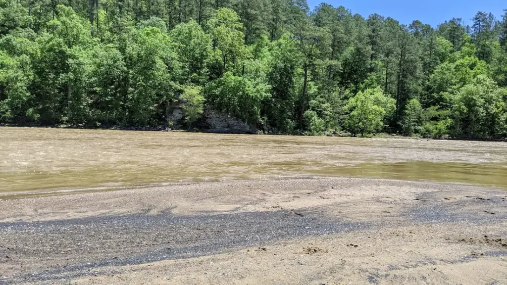
The photo at the top of this page is not Muskegon River.
It is a regional stand-in, honestly captioned but generic — we will not put a name to a river we cannot prove. Send us a photograph you took here and it replaces the stand-in, with your credit on it.
Add a photo of this water
Landscape, not fish — the water itself. Reviewed by hand before it appears. The first one published here earns the Pioneer badge.
Fished this water? Add a photo
Reviewed by hand before it appears. Pick the water, not the spot — we never publish exact locations.
Access
Croton Dam: the top of the tailwater, parking and the first ramp.
Pine Street and Thornapple: upper tailwater access points below the dam.
Newaygo boat launch and Henning Park: the main mid-river ramps.
Anderson Flats and Bridgeton: lower river launches with long float options.
Maple Island: the bottom of the standard guided water.
Muskegon Lake and the mouth: for run timing and lower-river fishing.
Summer tubing traffic is heavy between Croton and Newaygo on warm weekends.
Seasons
Year-round tailwater; it does not freeze off below the dam.
March and April: peak spring steelhead, the busiest and best-known weeks.
May through August: resident trout, the June hex hatch, smallmouth and walleye downstream.
September through December: salmon first, then fresh fall steelhead and quiet water after the leaves drop.
From the water
No logged trips yet. Be the first to put this water on your map.
Log this water
Fished it or cleaned it? Log in or create a free account to log a trip with photos and earn the waterway badge.
Questions
What is the current flow on the Muskegon River?
As of Nov 2, 6:45 am, the USGS gauge MUSKEGON RIVER NEAR CROTON, MI reads 1,230 cfs, the 24th percentile for this date, with water temperature 57.6 F. Conditions update every 15 minutes.
What species can you catch on the Muskegon River?
Anglers target Brown Trout, Chinook Salmon, Rainbow Trout, Smallmouth Bass, Steelhead, Walleye on the Muskegon River in Michigan.
Are there fishing guides on the Muskegon River?
GuidedFloats lists 2 guides and outfitters on the Muskegon River. Claimed profiles accept booking requests; unclaimed profiles are built from public records and link to the business.
Where can you access the Muskegon River?
Croton Dam: the top of the tailwater, parking and the first ramp. Pine Street and Thornapple: upper tailwater access points below the dam. Newaygo boat launch and Henning Park: the main mid-river ramps. Anderson Flats and Bridgeton: lower river launches with long float options. Maple Island: the bottom of the standard guided water. Muskegon Lake and the mouth: for run timing and lower-river fishing. Summer tubing traffic is heavy between Croton and Newaygo on warm weekends.
When is the best time to fish the Muskegon River?
Year-round tailwater; it does not freeze off below the dam. March and April: peak spring steelhead, the busiest and best-known weeks. May through August: resident trout, the June hex hatch, smallmouth and walleye downstream. September through December: salmon first, then fresh fall steelhead and quiet water after the leaves drop.
Where are the fishing regulations for the Muskegon River?
Regulations change by season and section. Read the current rules on the Michigan agency site: https://www.michigan.gov/dnr/things-to-do/fishing/fishing-regulations