Fishes Big Piney River
River · Ozarks · Missouri
Big Piney River Fishing Guides
Remote, slow-moving Ozark smallmouth stream with long pools and gravel bars, floated by canoe and kayak from Slabtown to the Gasconade confluence, with goggle-eye and largemouth bass in the deeper holes.
Map of the Big Piney River
32 numbered points: 10 access points, 2 campsites, 9 bridges, 3 parks and conservation areas, 7 springs, 1 USGS gauge. Tap a marker for details. Reviewed Sep 7, 2026.
- Access / boat ramp (10)
- Campsite (2)
- Bridge crossing (9)
- Park / conservation area (3)
- Spring (7)
- USGS gauge (1)
Map data © OpenStreetMap contributors. Points are curated from OpenStreetMap and state agency sources; confirm access and hours before you go.
Print it. Bag it. Bring it.Phones die, screens crack, and most of this water has no signal. Print this map, fold it into a zip-top bag or dry bag with your license, and you have a backup your electronics can’t give you. Every marker is numbered so you can say exactly where you are.
Open the printable mapAll 32 points on this map
| # | Point | Type | Lat, Lon | Notes |
|---|---|---|---|---|
| 1 | Highway 63 bridge at Houston US 63 | Bridge crossing | 37.19498, -92.03901 | Upper crossing at Houston; small water above here. |
| 2 | Big Piney Access (Houston) Public | Access / boat ramp | 37.19509, -92.03919 | Landing at the Highway 63 bridge. |
| 3 | Baptist Camp Access MDC | Access / boat ramp | 37.25796, -92.01758 | Public access north of Houston; a common upper put-in. |
| 4 | Dripping Spring | Spring | 37.26876, -92.02701 | Spring below Baptist Camp. |
| 5 | Highway Z bridge MO Z | Bridge crossing | 37.31734, -92.00433 | Crossing above the Piney River Narrows. |
| 6 | Piney River Narrows Natural Area Missouri Department of Conservation | Park / conservation area | 37.32193, -92.00985 | Narrow rock ridge between two bends of the river; conservation area on both banks. |
| 7 | Highway 17 bridge MO 17 | Bridge crossing | 37.32660, -92.00313 | Crossing at Dogs Bluff. |
| 8 | Dogs Bluff Access MDC | Access / boat ramp | 37.32726, -92.00213 | Public access at the Highway 17 bridge; start of the popular Dogs Bluff–Boiling Spring float. |
| 9 | Horseshoe Bend Natural Area Missouri Department of Conservation | Park / conservation area | 37.36030, -91.97814 | Natural area on the big bend below Dogs Bluff. |
| 10 | Mineral Springs boat ramp Public | Access / boat ramp | 37.36315, -91.96972 | Ramp at Mineral Springs. |
| 11 | Boiling Spring | Spring | 37.45945, -91.98925 | The Big Piney's Boiling Spring, a large spring on river left at the Boiling Springs access. |
| 12 | Boiling Springs Access Public · floater parking | Access / boat ramp | 37.46166, -91.98775 | Access and parking at the spring; resort camping nearby. |
| 13 | Burnett Spring | Spring | 37.48318, -91.96901 | Spring below Boiling Springs. |
| 14 | Highway 32 bridge (Mason Bridge) MO 32 | Bridge crossing | 37.49913, -91.98840 | Crossing between Licking and Roby. |
| 15 | Mason Bridge Access Public | Access / boat ramp | 37.50581, -91.98319 | Landing at the Highway 32 bridge. |
| 16 | Falling Springs | Spring | 37.52542, -92.00227 | Spring on the reach above Slabtown. |
| 17 | Hazelton Spring | Spring | 37.52477, -92.02381 | Spring across from Falling Springs. |
| 18 | Slabtown Landing Mark Twain National Forest | Access / boat ramp | 37.56097, -92.03249 | Forest Service landing and camping area at Slabtown. |
| 19 | Slabtown Camping Area Mark Twain National Forest | Campsite | 37.56208, -92.03231 | Primitive camping beside the landing. |
| 20 | Slabtown Road bridge County road | Bridge crossing | 37.56655, -92.02639 | Crossing at Slabtown with a landing beside it. |
| 21 | Peter A. Eck Conservation Area Missouri Department of Conservation | Park / conservation area | 37.58440, -92.02428 | MDC area below Slabtown. |
| 22 | Six Crossing Access Mark Twain National Forest | Access / boat ramp | 37.64262, -92.04367 | Forest Service access above Ross Bridge. |
| 23 | Ross Bridge County road | Bridge crossing | 37.66375, -92.05203 | Crossing at Ross Access. |
| 24 | USGS 06930000 Big Piney River near Big Piney | USGS gauge | 37.66564, -92.04992 | The gauge behind the live flow on this page, at Ross Bridge. |
| 25 | Ross Access MDC · canoe launch | Access / boat ramp | 37.66943, -92.04899 | Public access below Ross Bridge; the usual take-out for the Slabtown float. |
| 26 | Stone Mill Spring Fort Leonard Wood · trout area | Spring | 37.74005, -92.04126 | Spring branch stocked with trout by MDC; on the Fort Leonard Wood side of the river. |
| 27 | Eastgate Access Fort Leonard Wood · FLW 10 bridge | Access / boat ramp | 37.76020, -92.05813 | Access at the fort's east gate road crossing. |
| 28 | Shanghai Spring | Spring | 37.83040, -92.08885 | Spring above Devils Elbow. |
| 29 | Devils Elbow Campground Private · camping | Campsite | 37.84606, -92.05968 | Campground at Devils Elbow on the old Route 66. |
| 30 | Devils Elbow Bridge (Historic Route 66) US Historic 66 · Teardrop Road | Bridge crossing | 37.84821, -92.06227 | The 1923 steel truss bridge at Devils Elbow. |
| 31 | Highway Z bridge at Devils Elbow MO Z | Bridge crossing | 37.85012, -92.07122 | Crossing just below the old bridge. |
| 32 | Interstate 44 bridge I-44 | Bridge crossing | 37.85343, -92.07631 | The interstate crossing; the Big Piney meets the Gasconade a few miles below. |
Guides on the Big Piney River
Claimed profiles take booking requests. Unclaimed profiles are built from public records so the river is never empty; the guide can claim or remove one any time.
About the Big Piney River
The Big Piney is a smallmouth river through and through. It runs north out of Texas County past Houston and through Fort Leonard Wood to join the Gasconade near Jerome, and it is one of the streams designated by the Missouri Department of Conservation for special smallmouth management. It is a Smallmouth Slam stream and a classic Ozark float: gravel bars, root wads, bluff pools, and enough gradient to keep the water moving.
The upper river from Dogs Bluff and Slabtown down through Boiling Spring is the best-known guided water. Boiling Spring itself adds a shot of cold water and creates a deep pool that holds fish year-round. Below the spring the floats continue past Ross Bridge and Mason Bridge to Sand Shoals and the Fort Leonard Wood boundary. The lower river inside the fort requires a post pass but rewards it with less pressure.
The gauge near Big Piney, in the middle of the river, is a good indicator for the whole float section. Around 200 to 500 cfs is ideal for a canoe or a light raft with a fly rod; under 150 the river is low and you will drag through riffles; above 900 the river is high and fast. Smallmouth fishing is best on falling water after a rise, and the Big Piney clears faster than the Gasconade.
Licking and Houston are the supply towns. There are canoe liveries and a few cabins near Slabtown and Boiling Spring, and primitive camping on the National Forest gravel bars, which makes the Big Piney a natural choice for an overnight float with a guide who cooks. It is also the river where the Missouri Smallmouth Alliance has done some of its longest-running habitat and angler survey work, so the fishery is better documented than most.
This water needs a real photo
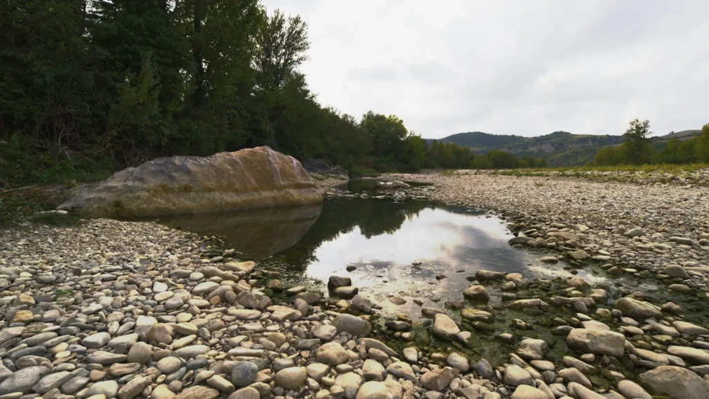
The photo at the top of this page is not Big Piney River.
It is a regional stand-in, honestly captioned but generic — we will not put a name to a river we cannot prove. Send us a photograph you took here and it replaces the stand-in, with your credit on it.
Pioneer badgeUnclaimed
Add a photo of this water
Landscape, not fish — the water itself. Reviewed by hand before it appears. The first one published here earns the Pioneer badge.
Fished this water? Add a photo
Reviewed by hand before it appears. Pick the water, not the spot — we never publish exact locations.
Access
Dogs Bluff Access (Highway 17 near Houston): MDC access at the top of the popular floats.
Slabtown Access: Forest Service access and campground, 10 miles below Dogs Bluff.
Boiling Spring Access: Forest Service access near the spring, a common takeout for a one-day float.
Ross Bridge and Mason Bridge: MDC accesses on the middle river.
Sand Shoals Access: MDC access above Fort Leonard Wood; accesses inside the fort require a post permit.
Seasons
April and May: pre-spawn and spawn, the biggest smallmouth of the year on jigs and streamers, best flows.
June through August: topwater season, low clear water by late summer, early and late in the day.
September and October: cooling water and aggressive fish, low flows, wading and short floats.
Winter: smallmouth stack in the deep bluff pools; slow, deep presentations for the few who go.
From the water
No logged trips yet. Be the first to put this water on your map.
Log this water
Fished it or cleaned it? Log in or create a free account to log a trip with photos and earn the waterway badge.
Questions
What is the current flow on the Big Piney River?
As of Oct 18, 5:00 pm, the USGS gauge Big Piney River near Big Piney, MO reads 125 cfs, the 20th percentile for this date. Conditions update every 15 minutes.
What species can you catch on the Big Piney River?
Anglers target Channel Catfish, Largemouth Bass, Rock Bass, Smallmouth Bass on the Big Piney River in Missouri.
Are there fishing guides on the Big Piney River?
GuidedFloats lists 1 guide and outfitters on the Big Piney River. Claimed profiles accept booking requests; unclaimed profiles are built from public records and link to the business.
Where can you access the Big Piney River?
Dogs Bluff Access (Highway 17 near Houston): MDC access at the top of the popular floats. Slabtown Access: Forest Service access and campground, 10 miles below Dogs Bluff. Boiling Spring Access: Forest Service access near the spring, a common takeout for a one-day float. Ross Bridge and Mason Bridge: MDC accesses on the middle river. Sand Shoals Access: MDC access above Fort Leonard Wood; accesses inside the fort require a post permit.
When is the best time to fish the Big Piney River?
April and May: pre-spawn and spawn, the biggest smallmouth of the year on jigs and streamers, best flows. June through August: topwater season, low clear water by late summer, early and late in the day. September and October: cooling water and aggressive fish, low flows, wading and short floats. Winter: smallmouth stack in the deep bluff pools; slow, deep presentations for the few who go.
Where are the fishing regulations for the Big Piney River?
Regulations change by season and section. Read the current rules on the Missouri agency site: https://mdc.mo.gov/fishing/regulations