Pearl River Fishing Guides
South Mississippi's big sand-and-sandbar river below Columbia - a long, sweeping coastal-plain float for bass, catfish and crappie with alligator gar in the deep bends.
Guides on the Pearl River
Claimed profiles take booking requests. Unclaimed profiles are built from public records so the river is never empty; the guide can claim or remove one any time.
No guides listed yet
Guide or outfit this water? Create your profile. Listing is free, the commission is 10% or 7% with a premium profile, and premium profiles list first on this water.
About the Pearl River
The Pearl runs roughly four hundred and forty miles from east-central Mississippi to the Gulf, and the USGS gauge near Columbia watches about five thousand seven hundred square miles of it in the lower-middle basin. The gauge reports discharge and stage and carries no temperature series. This is coastal-plain river country: wide sand bars, cut banks, cypress and willow, long sweeping bends and a channel that moves sand around every high water.
Below Columbia the Pearl is a genuine float river. It is big enough for outboard johnboats through most of the reach and it carries the fish mix that goes with a warm southern river. Largemouth and spotted bass hold on wood and around the bar edges, blue, flathead and channel catfish work the deep outside bends, white and black crappie stack in the sloughs and oxbows, and bluegill and longear sunfish fill the shallow margins. Alligator gar are present in the deeper holes and are managed under Mississippi’s specific gar regulations, which are worth reading before targeting them.
The river above this reach is impounded by the Ross Barnett Reservoir at Jackson, and reservoir operation along with tributary rainfall shapes what the lower river does. Sand bars make good camps and take-outs at moderate flow and disappear at high water, so the gauge is read here mostly as a bar-and-bank instrument: whether the sand is exposed, whether the wood is fishable, and whether the river is pushing too hard to hold a boat in the bends.
The lower Pearl below this point splits into the West and East Pearl through the Bogue Chitto and Pearl River wildlife management areas before reaching the Gulf near the Louisiana line, and the whole corridor carries substantial public land. It is an under-fished river relative to its size.
This water needs a real photo
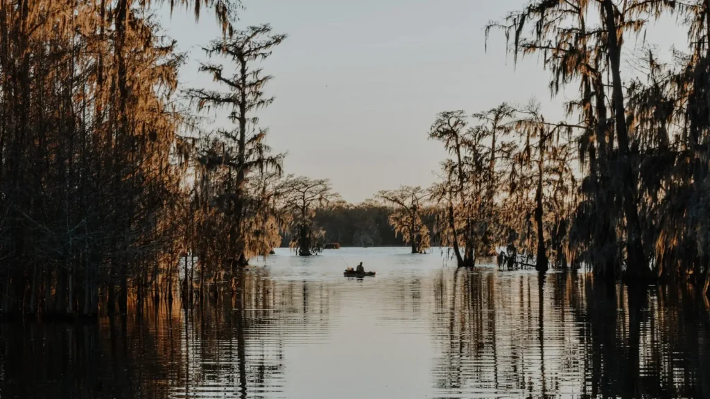
The photo at the top of this page is not Pearl River.
It is a regional stand-in, honestly captioned but generic — we will not put a name to a river we cannot prove. Send us a photograph you took here and it replaces the stand-in, with your credit on it.
Add a photo of this water
Landscape, not fish — the water itself. Reviewed by hand before it appears. The first one published here earns the Pioneer badge.
Fished this water? Add a photo
Reviewed by hand before it appears. Pick the water, not the spot — we never publish exact locations.
Access
Columbia riverfront and gauge - the flow reference and the standard upper access.
Marion County boat ramps - trailer access above and below town.
Bogue Chitto confluence area - major tributary junction that concentrates fish.
Monticello area landing - upstream access for a longer float.
Pearl River Wildlife Management Area - extensive public frontage downstream.
Sand bar camps below Columbia - gravel and sand landings usable at moderate flow.
Bogue Chitto Water Park area - developed access with ramps and camping.
Seasons
Spring: high and often muddy with strong current; crappie move into the sloughs.
Summer: low and clear with exposed sand bars - the best float and wade-the-bars season.
Fall: steady low flows and excellent bass and catfish action on the bends.
Winter: cool and variable; catfish and crappie continue in the deeper holes between rises.
From the water
No logged trips yet. Be the first to put this water on your map.
Log this water
Fished it or cleaned it? Log in or create a free account to log a trip with photos and earn the waterway badge.
Questions
What is the current flow on the Pearl River?
As of Oct 21, 10:45 pm, the USGS gauge PEARL RIVER NR COLUMBIA, MS reads 903 cfs. Conditions update every 15 minutes.
What species can you catch on the Pearl River?
Anglers target Alligator Gar, Black Crappie, Blue Catfish, Bluegill, Channel Catfish, Flathead Catfish, Largemouth Bass, Longear Sunfish, Spotted Bass, White Crappie on the Pearl River in Mississippi.
Where can you access the Pearl River?
Columbia riverfront and gauge - the flow reference and the standard upper access. Marion County boat ramps - trailer access above and below town. Bogue Chitto confluence area - major tributary junction that concentrates fish. Monticello area landing - upstream access for a longer float. Pearl River Wildlife Management Area - extensive public frontage downstream. Sand bar camps below Columbia - gravel and sand landings usable at moderate flow. Bogue Chitto Water Park area - developed access with ramps and camping.
When is the best time to fish the Pearl River?
Spring: high and often muddy with strong current; crappie move into the sloughs. Summer: low and clear with exposed sand bars - the best float and wade-the-bars season. Fall: steady low flows and excellent bass and catfish action on the bends. Winter: cool and variable; catfish and crappie continue in the deeper holes between rises.
Where are the fishing regulations for the Pearl River?
Regulations change by season and section. Read the current rules on the Mississippi agency site: https://www.mdwfp.com/enforcement-education/general-fishing-rules-regulations