Fishes Nantahala River
River · Blue Ridge · North Carolina
Nantahala River Fishing Guides
A cold Nantahala National Forest river with wild trout and delayed harvest water on the upper reach, and the powerhouse-fed whitewater gorge below Nantahala Lake.
Map of the Nantahala River
28 numbered points: 6 access points, 4 campsites, 3 outfitters, 8 bridges, 1 park or conservation area, 3 regulation section limits, 1 hazard, 2 USGS gauges. Tap a marker for details. Reviewed Sep 25, 2026.
- Access / boat ramp (6)
- Campsite (4)
- Outfitter / canoe rental (3)
- Bridge crossing (8)
- Park / conservation area (1)
- Regulation section limit (3)
- Dam / hazard (1)
- USGS gauge (2)
Map data © OpenStreetMap contributors. Points are curated from OpenStreetMap and state agency sources; confirm access and hours before you go.
Print it. Bag it. Bring it.Phones die, screens crack, and most of this water has no signal. Print this map, fold it into a zip-top bag or dry bag with your license, and you have a backup your electronics can’t give you. Every marker is numbered so you can say exactly where you are.
Open the printable mapAll 28 points on this map
| # | Point | Type | Lat, Lon | Notes |
|---|---|---|---|---|
| 1 | Hurricane Creek Horse & Primitive Campground Nantahala National Forest - primitive, horse camp | Campsite | 35.05527, -83.51013 | Upper river, about mile 3. First mapped campground on the Nantahala, 165 m off the channel. |
| 2 | Standing Indian Road bridge (FS 424) Forest Service road 424 | Bridge crossing | 35.07457, -83.52980 | Crossing at the head of the Standing Indian recreation area, about mile 5. |
| 3 | Standing Indian Campground Store Standing Indian Campground, Nantahala National Forest | Campsite | 35.07734, -83.52978 | Camp store node for the Standing Indian campground, 189 m off the river at about mile 5.4. The campground's numbered pitches are mapped separately and are not listed. |
| 4 | Winding Stair Campground Nantahala National Forest | Campsite | 35.09821, -83.54500 | About mile 7.8, 192 m off the channel. |
| 5 | US 64 bridge (Murphy Road) US 64 | Bridge crossing | 35.09422, -83.56029 | The upper river's main highway crossing, about mile 9. |
| 6 | USGS 03504000 - Nantahala River near Rainbow Springs USGS streamgage - upper river | USGS gauge | 35.12750, -83.61861 | About mile 14.5, above Nantahala Lake. Coordinates confirmed against the USGS NWIS expanded site record. |
| 7 | Tate Cove Road bridge Tate Cove Road | Bridge crossing | 35.12987, -83.62462 | Crossing beside the Rainbow Springs gauge, about mile 14.9. |
| 8 | Nantahala Dam Impounds Nantahala Lake | Dam / hazard | 35.19951, -83.65334 | About mile 25. The river above this point is lake; the tailrace below runs to the powerhouse at the head of the gorge. |
| 9 | Hatchery Supported Trout Waters (upper) - Dicks Creek NCWRC, Macon County - upper boundary | Regulation section limit | 35.22209, -83.66000 | Dicks Creek confluence, about mile 27.8. NCWRC lists Nantahala River (upper) as Hatchery Supported Trout Waters from Dicks Creek to Whiteoak Creek. The Junaluska Road bridge crosses here. |
| 10 | Delayed Harvest Trout Waters - Whiteoak Creek NCWRC, Macon County - upper boundary | Regulation section limit | 35.25006, -83.64078 | Whiteoak Creek confluence, about mile 31. NCWRC lists the Delayed Harvest reach as Whiteoak Creek to the Nantahala hydropower discharge canal. The Old River Road bridge crosses here. |
| 11 | Wayah Road bridge (Delayed Harvest reach) Wayah Road | Bridge crossing | 35.24687, -83.65368 | About mile 31.8. Wayah Road follows the Delayed Harvest water and crosses it four times; the two most useful spans are on this sheet. |
| 12 | Wayah Road bridge at the head of the gorge Wayah Road, Beechertown | Bridge crossing | 35.26923, -83.67489 | About mile 34.6, immediately above the commercial put-in ramps. |
| 13 | Nantahala Gorge put-in ramp, Wayah Road Unnamed in OpenStreetMap - tagged whitewater put-in | Access / boat ramp | 35.27030, -83.67596 | Beechertown, Macon County, about mile 34.8. Forest Service gravel parking 56 m away. Uppermost of the three ramps at the head of the gorge. |
| 14 | Nantahala Gorge ramp, Nantahala Bikeway (upper) Unnamed in OpenStreetMap - tagged whitewater put-in | Access / boat ramp | 35.27346, -83.67813 | Beechertown, about mile 35.1. Duke Energy permissive parking 180 m away. |
| 15 | Nantahala Gorge ramp, Nantahala Bikeway (lower) Unnamed in OpenStreetMap - tagged whitewater put-in | Access / boat ramp | 35.27463, -83.68093 | Beechertown, about mile 35.3. Forest Service sealed parking 120 m away. Lowest of the three head-of-gorge ramps. |
| 16 | Swain County Hatchery Supported Trout Waters - county line NCWRC, Swain County - upper boundary | Regulation section limit | 35.28244, -83.67310 | Macon / Swain county line, about mile 36.1, located to within 35 m along the centreline. NCWRC lists the Swain County reach from the Macon County line to existing Fontana Reservoir water level. |
| 17 | US 19/US 74 bridge above Ferebee US 19 / US 74 | Bridge crossing | 35.30154, -83.65390 | About mile 38. The highway runs the length of the gorge below this crossing. |
| 18 | Ferebee Memorial Picnic Area river access Ramp unnamed in OpenStreetMap; picnic area 110 m away | Access / boat ramp | 35.30259, -83.65391 | About mile 38, Swain County. Standard gorge take-out and put-in; the slipway and the named picnic area are one signed place and ship as one point. |
| 19 | USGS 03505550 - Nantahala River near Hewitt USGS streamgage - gorge reach | USGS gauge | 35.30500, -83.65222 | About mile 38.2, in the gorge below the powerhouse. Coordinates confirmed against the USGS NWIS expanded site record. |
| 20 | Nantahala Gorge ramp, US 19/74 at Talc Mountain Unnamed in OpenStreetMap | Access / boat ramp | 35.33290, -83.62790 | About mile 40.9, Swain County, 14 m off the channel on the highway side. |
| 21 | Endless River Adventures Paddling outfitter and instruction | Outfitter / canoe rental | 35.33152, -83.60817 | US 19/74 in the lower gorge, about mile 42.2, 93 m off the river. |
| 22 | Nantahala Gorge ramp above the Outdoor Center Unnamed in OpenStreetMap | Access / boat ramp | 35.33333, -83.59753 | About mile 42.9, roughly half a mile above the Nantahala Outdoor Center. |
| 23 | Nantahala Outdoor Center Adventure centre and outfitter's store, US 19/74 | Outfitter / canoe rental | 35.33199, -83.59277 | About mile 43.2, at the foot of the gorge. The adventure centre and the outfitter's store are mapped separately 100 m apart and ship as one point. |
| 24 | Appalachian Trail footbridge at the Outdoor Center Appalachian Trail | Bridge crossing | 35.33168, -83.59216 | The AT crosses the Nantahala here, about mile 43.2. |
| 25 | US 19/US 74 bridge at the Outdoor Center US 19 / US 74 | Bridge crossing | 35.33147, -83.59124 | About mile 43.3, the last highway crossing above Fontana. |
| 26 | Carolina Outfitters Rafting outfitter, US 19/74 | Outfitter / canoe rental | 35.32854, -83.58025 | About mile 43.6, 1.0 km off the river below the Outdoor Center. |
| 27 | Turkey Creek Campground Lower river above Fontana Reservoir | Campsite | 35.37796, -83.57418 | About mile 47.7, 880 m off the channel. |
| 28 | Swain County Park Swain County | Park / conservation area | 35.37593, -83.56266 | About mile 47.8, at the head of Fontana Reservoir where the river ends. |
Guides on the Nantahala River
Claimed profiles take booking requests. Unclaimed profiles are built from public records so the river is never empty; the guide can claim or remove one any time.
About the Nantahala River
The Nantahala runs north through the national forest that shares its name, into Nantahala Lake, and then down the gorge to Fontana. The name means land of the noonday sun, which is what the gorge earns: the walls are steep enough that sunlight reaches the water for only a few hours a day, and the river stays cold year-round.
The upper river above the lake, around Rainbow Springs and Standing Indian, is the wild trout water. It is small, tight, forested stream fishing for wild rainbows and browns with brook trout in the headwater feeders, and it is best fished on foot with a short rod. Below the upper reach the state manages delayed harvest water that gets heavy stocking and heavy pressure in spring and fall.
The gorge below the powerhouse is a different animal. Water diverted from Nantahala Lake comes out of the powerhouse cold and hard on a scheduled release, and that release is what runs the rafting industry through the Nantahala Outdoor Center. Trout live in it, and anglers fish it, but the schedule dominates: on a release day the river is high, cold and busy with boats, and on a non-release day it drops to a thin trickle that fishes very differently.
This gauge sits high on the river near Rainbow Springs, above the lake, so it reads the free-flowing headwaters rather than the powerhouse release. Small numbers are normal. Storm response is fast and the river clears quickly.
Franklin, Bryson City and the outdoor center area cover lodging and outfitters. Combine a day here with the Tuckasegee or with a park stream.
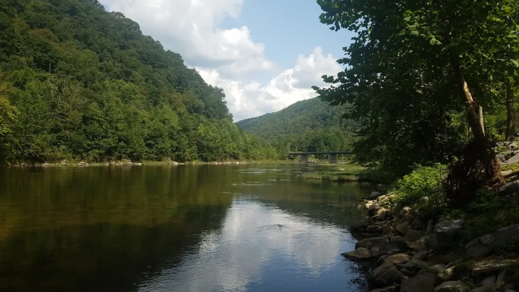
This water needs a real photo
The photo at the top of this page is not Nantahala River.
It is a regional stand-in, honestly captioned but generic — we will not put a name to a river we cannot prove. Send us a photograph you took here and it replaces the stand-in, with your credit on it.
Pioneer badgeUnclaimed
Add a photo of this water
Landscape, not fish — the water itself. Reviewed by hand before it appears. The first one published here earns the Pioneer badge.
Fished this water? Add a photo
Reviewed by hand before it appears. Pick the water, not the spot — we never publish exact locations.
Access
Standing Indian Campground: headwater access in the Nantahala National Forest.
Rainbow Springs and the upper Nantahala Road: wade access near the gauge.
White Oak and the delayed harvest sections: marked state access points on the upper river.
Nantahala Lake: the impoundment separating the upper river from the gorge.
Nantahala Powerhouse: the top of the gorge release reach.
Nantahala Outdoor Center and Highway 19/74: gorge access, parking and shuttles.
Seasons
October through early June: delayed harvest regulations on the marked sections.
March through May: stocking, hatches and the best fishing on the upper river.
June through August: cold water year-round; the gorge is busy with rafts on release days.
September through November: wild trout on the headwaters, quiet water, fall color in the forest.
From the water
No logged trips yet. Be the first to put this water on your map.
Log this water
Fished it or cleaned it? Log in or create a free account to log a trip with photos and earn the waterway badge.
Questions
What is the current flow on the Nantahala River?
As of Oct 19, 3:30 am, the USGS gauge NANTAHALA RIVER NEAR RAINBOW SPRINGS, NC reads 85 cfs, the 47th percentile for this date. Conditions update every 15 minutes.
What species can you catch on the Nantahala River?
Anglers target Brook Trout, Brown Trout, Rainbow Trout, Smallmouth Bass on the Nantahala River in North Carolina.
Are there fishing guides on the Nantahala River?
GuidedFloats lists 1 guide and outfitters on the Nantahala River. Claimed profiles accept booking requests; unclaimed profiles are built from public records and link to the business.
Where can you access the Nantahala River?
Standing Indian Campground: headwater access in the Nantahala National Forest. Rainbow Springs and the upper Nantahala Road: wade access near the gauge. White Oak and the delayed harvest sections: marked state access points on the upper river. Nantahala Lake: the impoundment separating the upper river from the gorge. Nantahala Powerhouse: the top of the gorge release reach. Nantahala Outdoor Center and Highway 19/74: gorge access, parking and shuttles.
When is the best time to fish the Nantahala River?
October through early June: delayed harvest regulations on the marked sections. March through May: stocking, hatches and the best fishing on the upper river. June through August: cold water year-round; the gorge is busy with rafts on release days. September through November: wild trout on the headwaters, quiet water, fall color in the forest.
Where are the fishing regulations for the Nantahala River?
Regulations change by season and section. Read the current rules on the North Carolina agency site: https://www.ncwildlife.gov/fishing/regulations