Fishes Ausable River
River · Adirondacks · New York
Ausable River Fishing Guides
The Adirondack pocket-water classic, dropping out of Lake Placid through Wilmington Notch and the Flume to the forks, with wild browns in every boulder seam.
Map of the Ausable River
38 numbered points: 9 access points, 4 campsites, 2 bait & fly shops, 9 bridges, 3 parks and conservation areas, 4 regulation section limits, 6 hazards, 1 USGS gauge. Tap a marker for details. Reviewed Sep 21, 2026.
- Access / boat ramp (9)
- Campsite (4)
- Bait, tackle & fly shop (2)
- Bridge crossing (9)
- Park / conservation area (3)
- Regulation section limit (4)
- Dam / hazard (6)
- USGS gauge (1)
Map data © OpenStreetMap contributors. Points are curated from OpenStreetMap and state agency sources; confirm access and hours before you go.
Print it. Bag it. Bring it.Phones die, screens crack, and most of this water has no signal. Print this map, fold it into a zip-top bag or dry bag with your license, and you have a backup your electronics can’t give you. Every marker is numbered so you can say exactly where you are.
Open the printable mapAll 38 points on this map
| # | Point | Type | Lat, Lon | Notes |
|---|---|---|---|---|
| 1 | Adirondack Loj Road bridge Headwaters below the High Peaks | Bridge crossing | 44.19080, -73.95675 | Top of the West Branch above Lake Placid. Small, brushy wild brook-trout water here; foot access off the Loj road. |
| 2 | NY 73 bridge (Cascade Road) NY 73 between Lake Placid and Keene | Bridge crossing | 44.25715, -73.96210 | The West Branch crosses Route 73 above Lake Placid. Still a small stream at this crossing. |
| 3 | High Peaks Cyclery 2733 Main Street, Lake Placid · outfitter | Bait, tackle & fly shop | 44.28107, -73.98153 | Lake Placid outfitter stocking fly and spin tackle and running guided trips. 2.4 km off the river and the nearest shop to the upper West Branch. |
| 4 | Public fishing rights parking — River Road NYS DEC · Lake Placid | Access / boat ramp | 44.28665, -73.93253 | First of three DEC public-fishing-rights parking areas on River Road between here and the Route 86 bridge. The state publishes the locations and no names. |
| 5 | Public fishing rights parking — NY 86 above Monument Falls NYS DEC · first of seven roadside lots | Access / boat ramp | 44.30026, -73.93042 | Seven DEC fishing-rights lots line Route 86 from here down to Monument Falls. All are unnamed in the state's own data; park on the shoulder side. |
| 6 | Monument Falls parking area NYS DEC · NY 86 · Whiteface viewpoint | Access / boat ramp | 44.31053, -73.91565 | The classic Whiteface viewpoint pull-off, and a DEC fishing-rights lot. Monument Falls itself is 110 m upstream and is DEC's reference point for the section limit downstream. |
| 7 | NY 86 bridge, Wilmington Notch NY 86 | Bridge crossing | 44.32327, -73.91236 | Route 86 crosses the river in the notch. Pocket water above and below, and a fishing-rights lot at each end. |
| 8 | Public fishing rights parking — NY 86, Wilmington Notch NYS DEC · one of five lots | Access / boat ramp | 44.32711, -73.91014 | Middle of a run of five DEC fishing-rights lots between the notch bridge and the section limit downstream. |
| 9 | Catch-and-release limit — DEC sign 2.2 mi below Monument Falls West Branch · boundary of two DEC reaches | Regulation section limit | 44.33761, -73.89680 | DEC posts this limit as a sign 2.2 river miles below Monument Falls; measured along the mapped channel that distance lands 130 m from this lot. Catch-and-release water runs upstream from here to Holcomb Pond Outlet, which is unmapped. |
| 10 | Public fishing rights parking — NY 86 below the notch NYS DEC · one of two lots | Access / boat ramp | 44.34077, -73.88950 | Two DEC fishing-rights lots on Route 86 between the section limit and High Falls Gorge. |
| 11 | High Falls High Falls Gorge · four named drops | Dam / hazard | 44.34829, -73.87476 | A staircase of falls in a privately operated, ticketed gorge with footbridges. OSM names four drops here. Not wadeable, and dangerous water at any flow. |
| 12 | Public fishing rights parking — NY 86 at High Falls Gorge NYS DEC · NY 86 | Access / boat ramp | 44.34805, -73.87005 | Roadside DEC lot opposite the gorge, 0.21 km back from the water — the furthest of the twenty-six from the channel. |
| 13 | Wilmington Notch Campground NYS DEC · 54 sites · reservation required | Campsite | 44.35080, -73.86035 | State campground on the river between High Falls Gorge and the ski centre. Showers, dump station, wheelchair-accessible sites. |
| 14 | Whiteface Ski Center bridge — reach boundary West Branch · top of the catch-and-release water | Regulation section limit | 44.35388, -73.86018 | DEC uses this bridge as a boundary: catch-and-release water runs downstream from here to the Route 86 bridge at the Flume. OSM carries the bridge unnamed; the ski centre lies 140 m along the line. |
| 15 | Hungry Trout Fly Shop 5239 NYS Route 86, Wilmington | Bait, tackle & fly shop | 44.36512, -73.84172 | The only fly shop on the river itself — full-service shop and guide service on the West Branch bank just above the Flume. |
| 16 | Catch-and-release limit — NY 86 bridge at the Flume West Branch · foot of the catch-and-release water | Regulation section limit | 44.36606, -73.84095 | The Route 86 bridge at the Flume is DEC's boundary: catch-and-release water upstream to the Whiteface Ski Center bridge, stocked-extended water downstream to the forks. Two DEC lots at the bridge. |
| 17 | The Flume Flume Falls · ledge drops under NY 86 | Dam / hazard | 44.36647, -73.84038 | A short gorge of ledge drops right under the Route 86 bridge. OSM names two falls here. Worth looking at, not worth wading. |
| 18 | Lake Placid / Whiteface Mtn. KOA Holiday 5591 NYS Route 86, Wilmington · private | Campsite | 44.38521, -73.83327 | Private campground on Route 86 between the Flume and Wilmington village. |
| 19 | Lake Everest Boat Launch Town of Wilmington · concrete · no fee | Access / boat ramp | 44.38466, -73.82231 | Small concrete ramp for canoes, kayaks and small motors on Lake Everest, the impoundment behind the Wilmington weir. |
| 20 | NY 86 bridge, Wilmington village NY 86 · at the dam | Bridge crossing | 44.38902, -73.81748 | The village crossing, immediately above the weir, the beach and the boat launch. |
| 21 | Wilmington Dam Weir · foot of Lake Everest | Dam / hazard | 44.38942, -73.81667 | The weir that forms Lake Everest through Wilmington village. Portage it; do not wade the sill. |
| 22 | Wilmington Heritage Park Town of Wilmington | Park / conservation area | 44.38882, -73.81611 | Village park at the dam, beside the town beach and the Lake Everest launch. |
| 23 | Wilmington Wild Forest NYS DEC · Wild Forest | Park / conservation area | 44.39059, -73.81428 | State Wild Forest land along the river below Wilmington, open to fishing and primitive camping under DEC rules. |
| 24 | Public fishing rights parking — Preston Road, Haselton NYS DEC · Haselton | Access / boat ramp | 44.40471, -73.79454 | The lowest DEC fishing-rights lot on the West Branch, below Wilmington in the hamlet of Haselton. |
| 25 | Hazelton Road bridge (CR 19) Essex CR 19 | Bridge crossing | 44.40358, -73.78226 | County road crossing below Haselton, on the last West Branch reach above the forks. |
| 26 | Stocked-extended limit — confluence with the East Branch Au Sable Forks · foot of the regulated water | Regulation section limit | 44.44072, -73.67469 | DEC's West Branch reaches end where the two branches meet. Below here the river is the main-stem Ausable and carries no special trout reach. The NY 9N bridge is 90 m upstream. |
| 27 | USGS 04275500 — Ausable River near Au Sable Forks USGS gauge · main stem below the forks | USGS gauge | 44.45172, -73.64339 | The gauge this water page reads for flow. It sits on the main stem below the junction, so it carries both branches. |
| 28 | Lower Road bridge Town of Black Brook / Au Sable | Bridge crossing | 44.46450, -73.57522 | Quiet crossing on the main stem between the forks and the Northway. |
| 29 | I-87 Adirondack Northway I 87 | Bridge crossing | 44.49092, -73.49445 | The Northway crossing, the easiest landmark on the lower river. |
| 30 | Front Street bridge, Keeseville US 9 / NY 22 | Bridge crossing | 44.50703, -73.47932 | Keeseville village crossing, at the head of the dam-and-chasm reach. |
| 31 | Alice Falls Dam Hydro dam · Keeseville | Dam / hazard | 44.51944, -73.46480 | First of three dams and falls between Keeseville and Ausable Chasm. The river is not navigable through this reach. |
| 32 | Rainbow Falls Dam Hydro dam at the head of the chasm | Dam / hazard | 44.52273, -73.45943 | Dam at the head of Ausable Chasm, with Rainbow Falls dropping immediately below it. |
| 33 | Horseshoe Falls Inside Ausable Chasm | Dam / hazard | 44.52464, -73.46276 | Sheer walls, no bank access and no fishing through the chasm itself. The chasm is a ticketed attraction. |
| 34 | US 9 bridge at Ausable Chasm US 9 | Bridge crossing | 44.52494, -73.46296 | The chasm crossing; the walkway network starts here. |
| 35 | Ausable Chasm Campground Private · at the chasm | Campsite | 44.52778, -73.45548 | Private campground beside the chasm, the only camping on the lower river above Lake Champlain. |
| 36 | Ausable Marsh Wildlife Management Area NYS DEC · game land | Park / conservation area | 44.56647, -73.43398 | The delta marsh where the Ausable enters Lake Champlain. Landlocked salmon, northern pike and bass water, and the best bank walking on the lower river. |
| 37 | Ausable Point Campground NYS DEC · Lake Champlain | Campsite | 44.57084, -73.42830 | State campground on the point at the river mouth, with the car-top launch inside it. |
| 38 | Ausable Point Campground car-top boat launch NYSDEC · canoe / car-top | Access / boat ramp | 44.56730, -73.42436 | Car-top launch at the mouth, inside the state campground — the only mapped launch on the whole lower river. |
Guides on the Ausable River
Claimed profiles take booking requests. Unclaimed profiles are built from public records so the river is never empty; the guide can claim or remove one any time.
About the Ausable River
The West Branch of the Ausable is the most famous trout stream in New York and one of the hardest to wade in the Northeast. It leaves Lake Placid, drops through Wilmington Notch past Whiteface Mountain, and runs a boulder-strewn course through the Flume, the Wilmington catch-and-release water and the village pools before joining the East Branch at Au Sable Forks. The rock is slick, the current is fast, and studded boots and a staff are not optional.
What the difficulty buys is wild brown trout in beautiful water. The trophy section below Wilmington Dam and the two-mile catch-and-release stretch above the village hold the best fish, and the whole river fishes on a classic Northeastern hatch calendar: Hendricksons in May, caddis and sulphurs through June, terrestrials and tricos in high summer, and blue-winged olives into October. This is short-line, high-stick water more than it is long-drift water.
The gauge at Au Sable Forks reads the West and East branches combined below their junction, so treat it as a basin trend rather than a section-specific number. Roughly 200 to 600 cfs there corresponds to comfortable wading up on the West Branch; readings well above a thousand mean high, pushy water where the pocket seams disappear; late-summer lows leave the river clear, warm and technical, and anglers should watch water temperatures and fish early on hot weeks.
Wilmington and Lake Placid are the base towns, with fly shops, guides and everything an Olympic village accumulated. The East Branch through Keene and Jay is worth a day of its own, and both branches sit inside the Adirondack Park, which keeps the corridor undeveloped.
This water needs a real photo
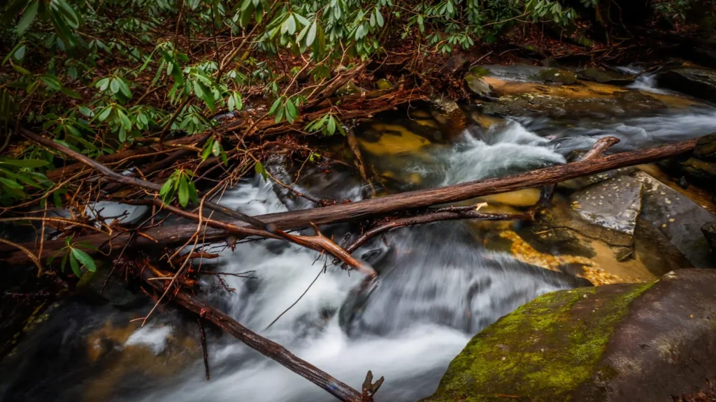
The photo at the top of this page is not Ausable River.
It is a regional stand-in, honestly captioned but generic — we will not put a name to a river we cannot prove. Send us a photograph you took here and it replaces the stand-in, with your credit on it.
Pioneer badgeUnclaimed
Add a photo of this water
Landscape, not fish — the water itself. Reviewed by hand before it appears. The first one published here earns the Pioneer badge.
Fished this water? Add a photo
Reviewed by hand before it appears. Pick the water, not the spot — we never publish exact locations.
Access
Lake Placid outlet and the Monument Falls area: upper West Branch access on Route 86.
Wilmington Notch Campground: state campground with river frontage in the canyon.
The Flume and Whiteface area pullouts: roadside access to the classic pocket water.
Wilmington catch-and-release section: marked two-mile reach above the village.
Trophy section below Wilmington Dam: special-regulation water, walk-in access.
Au Sable Forks: access near the gauge at the junction of the two branches.
Route 9N through Jay and Keene: East Branch access points.
Seasons
April: opening-day water, high and cold, streamers and nymphs.
May and June: the main hatch season, Hendricksons then caddis and sulphurs.
July and August: low clear water, terrestrials and early mornings; watch water temperature on hot spells.
September and October: fall browns, blue-winged olives, foliage and few anglers; winter is closed water on much of the river.
From the water
No logged trips yet. Be the first to put this water on your map.
Log this water
Fished it or cleaned it? Log in or create a free account to log a trip with photos and earn the waterway badge.
Questions
What is the current flow on the Ausable River?
As of Oct 19, 2:15 am, the USGS gauge AUSABLE RIVER NEAR AU SABLE FORKS NY reads 600 cfs, the 72nd percentile for this date. Conditions update every 15 minutes.
What species can you catch on the Ausable River?
Anglers target Brook Trout, Brown Trout, Landlocked Atlantic Salmon, Rainbow Trout on the Ausable River in New York.
Are there fishing guides on the Ausable River?
GuidedFloats lists 1 guide and outfitters on the Ausable River. Claimed profiles accept booking requests; unclaimed profiles are built from public records and link to the business.
Where can you access the Ausable River?
Lake Placid outlet and the Monument Falls area: upper West Branch access on Route 86. Wilmington Notch Campground: state campground with river frontage in the canyon. The Flume and Whiteface area pullouts: roadside access to the classic pocket water. Wilmington catch-and-release section: marked two-mile reach above the village. Trophy section below Wilmington Dam: special-regulation water, walk-in access. Au Sable Forks: access near the gauge at the junction of the two branches. Route 9N through Jay and Keene: East Branch access points.
When is the best time to fish the Ausable River?
April: opening-day water, high and cold, streamers and nymphs. May and June: the main hatch season, Hendricksons then caddis and sulphurs. July and August: low clear water, terrestrials and early mornings; watch water temperature on hot spells. September and October: fall browns, blue-winged olives, foliage and few anglers; winter is closed water on much of the river.
Where are the fishing regulations for the Ausable River?
Regulations change by season and section. Read the current rules on the New York agency site: https://dec.ny.gov/things-to-do/freshwater-fishing/regulations