Fishes Lake George
Lake · Adirondacks · New York
Lake George Fishing Guides
Thirty-two miles of clear, deep Adirondack water between forested mountains, with a two-storey fishery: lake trout and salmon below, smallmouth on the rock above.
Map of the Lake George
21 numbered points: 5 access points, 4 campsites, 2 bait & fly shops, 4 outfitters, 4 parks and conservation areas, 1 agency office, 1 USGS gauge. Tap a marker for details. Reviewed Sep 22, 2026.
- Access / boat ramp (5)
- Campsite (4)
- Bait, tackle & fly shop (2)
- Outfitter / canoe rental (4)
- Park / conservation area (4)
- Agency / conservation office (1)
- USGS gauge (1)
Map data © OpenStreetMap contributors. Points are curated from OpenStreetMap and state agency sources; confirm access and hours before you go.
Print it. Bag it. Bring it.Phones die, screens crack, and most of this water has no signal. Print this map, fold it into a zip-top bag or dry bag with your license, and you have a backup your electronics can’t give you. Every marker is numbered so you can say exactly where you are.
Open the printable mapAll 21 points on this map
| # | Point | Type | Lat, Lon | Notes |
|---|---|---|---|---|
| 1 | FISH307 814 Goggins Road, Lake George · off Northway exit 21 | Bait, tackle & fly shop | 43.40068, -73.71579 | Walk-in tackle store and mail-order warehouse; its own site calls it a fishing tackle superstore trading since 1992. Tackle is itemised; live bait is not stated on the site. |
| 2 | Lake George Battleground Campground NYSDEC · 2224 State Route 9 · 68 sites | Campsite | 43.41506, -73.71178 | DEC drive-in campground a quarter mile south of Lake George village; swimming is at the Lake George Beach day-use facility next door. Coordinate is DEC's own published GPS. |
| 3 | Beach Road Bait & Tackle 2239 State Route 9, Lake George | Bait, tackle & fly shop | 43.41588, -73.71310 | Walk-in shop at the head of the lake. Its own site lists fishing and hunting licences, Lake George Park Commission boat permits and bike rentals; newest dated page is a January 2026 fishing report. |
| 4 | Lake George Beach (Million Dollar Beach) NYSDEC · hard-surface, two lanes · off Beach Road | Access / boat ramp | 43.41658, -73.70357 | The lake's main south-end launch, in Lake George village. Day-use fee Memorial Day to Columbus Day; DEC gives hours as 6am-8pm. An OSM slipway node 0.16 km away corroborates the ramp position. |
| 5 | Hearthstone Point Campground and Day Use Area NYSDEC · 3298 Lake Shore Drive · 243 sites | Campsite | 43.45520, -73.69601 | DEC drive-in campground on the west shore two miles north of the village, with a sand beach. No boat launch at this facility. Coordinate is DEC's own published GPS. |
| 6 | Castaway Marina East shore, Cleverdale | Outfitter / canoe rental | 43.46270, -73.63103 | Private marina on the east shore; mapped in OSM as a marina and harbour. Not a public launch. |
| 7 | Fischer's Marina East shore, Cleverdale | Outfitter / canoe rental | 43.47495, -73.62711 | Private marina on the east shore. OSM spells the name with a stray double quote; corrected here. |
| 8 | Lake George Islands — Long Island Group NYSDEC · boat access only · 90 sites | Campsite | 43.48377, -73.65490 | One of DEC's three island campground groups, at the south end of the lake. Sites are reachable by boat only and each has a dock. Point is placed on Long Island itself, the group's namesake. |
| 9 | Pilot Knob Marina East shore, Pilot Knob | Outfitter / canoe rental | 43.51780, -73.62893 | Private marina on the east shore below the Tongue Mountain narrows. |
| 10 | Water's Edge Marina West shore, Bolton Landing | Outfitter / canoe rental | 43.55857, -73.64999 | Private marina at Bolton Landing, the village nearest the Glen Island campground group. |
| 11 | Greene Island Maintenance Facility New York State · Bolton Landing | Agency / conservation office | 43.56176, -73.64650 | State-managed maintenance facility on the Bolton Landing shore, mapped in OSM as a government office on protected state land. |
| 12 | Northwest Bay Brook hand launch NYSDEC · hand launch · Route 9N | Access / boat ramp | 43.62640, -73.60795 | DEC hand launch on Route 9N about four miles north of Bolton Landing. It sits on Northwest Bay Brook rather than the lake shore — boats must be carried in and paddled down to Northwest Bay. |
| 13 | Leeming Jelliffe Preserve Nature reserve · east shore | Park / conservation area | 43.65521, -73.49059 | Shoreline nature reserve on the east side of the lake opposite the Tongue Mountain range. |
| 14 | Hague Town Beach Town of Hague · hard-surface ramp · fee/permit | Access / boat ramp | 43.74445, -73.49890 | Municipal hard-surface launch on the Hague waterfront. DEC lists parking as 3 car-and-trailer spaces plus 15 cars; a fee or permit is required. |
| 15 | Peggy's Point Town of Hague · lakeside park | Park / conservation area | 43.74490, -73.49700 | Small town park on the Hague waterfront, immediately north of the town beach and launch. |
| 16 | Rogers Rock Campground launch NYSDEC · hard-surface · Route 9N | Access / boat ramp | 43.79282, -73.47984 | The campground's own hard-surface launch, on Route 9N three miles north of Hague hamlet. DEC says it is open year round with a day-use fee in season. |
| 17 | Rogers Rock Campground and Day Use Area NYSDEC · 9894 Lake Shore Drive, Hague · 332 sites | Campsite | 43.79433, -73.48556 | DEC drive-in campground at the north end of the lake, six miles south of Ticonderoga, with a sand beach, mooring buoys and its own launch. Coordinate is DEC's own published GPS. |
| 18 | USGS 04278000 — Lake George at Rogers Rock USGS monitoring location | USGS gauge | 43.80814, -73.45789 | The lake's USGS gauge, off Rogers Rock near the north end. Lake level rather than a river discharge. |
| 19 | Cook Mountain Nature reserve · Ticonderoga | Park / conservation area | 43.81793, -73.43801 | Nature reserve on the northeast shore above the lake's outlet, overlooking Mossy Point. |
| 20 | Mossy Point State Boat Launch NYSDEC · hard-surface · Black Point Road | Access / boat ramp | 43.82142, -73.42639 | The lake's big north-end launch, two miles north of Ticonderoga village on the east shore. DEC gives 100 car-and-trailer spaces, accessible parking and a boat pumpout. |
| 21 | Lake George Forest Preserve New York State Forest Preserve | Park / conservation area | 43.83766, -73.42988 | State Forest Preserve land at the very north end of the lake, where it narrows toward the La Chute outlet at Ticonderoga. |
Guides on the Lake George
Claimed profiles take booking requests. Unclaimed profiles are built from public records so the river is never empty; the guide can claim or remove one any time.
Order on this page: premium and outfitter plans first (labelled Premium placement), then claimed free profiles, then unclaimed — one published price, no bidding for position. How placement works
About the Lake George
Lake George runs thirty-two miles north through the southeastern Adirondacks between steep forested mountains, and it is one of the clearest large lakes in the eastern United States. The clarity and the depth are the two facts that govern the fishing: it is a two-storey lake, with a coldwater fishery below the thermocline and a warmwater fishery above it.
Lake trout are the signature species, caught deep through the summer and nearer the surface in the weeks after ice-out and again in late autumn. Landlocked Atlantic salmon share that cold water and are the prize most anglers would rather catch. Both are pursued by trolling, and the lake has a long tradition of it.
Smallmouth bass on the rock, the drop-offs and the islands are excellent and heavily fished, and largemouth hold in the weedier bays at the southern end. Northern pike, yellow perch and crappie fill in the rest.
The lake is a major summer resort destination and the recreational traffic between the end of June and Labor Day is genuinely heavy. Fishing here in July is an early-morning activity or a deep-water one.
Winter brings ice fishing, which on a lake this deep and this large is a serious undertaking requiring local knowledge about where the ice is dependable.
The lake has also been the subject of an unusually long-running water quality effort, and the clarity anglers rely on is not an accident. Invasive species control, milfoil management and a boat inspection programme at the launches are all part of visiting here, and the few minutes they cost are the reason the fishing is what it is.
The gauge below reports lake elevation. Lake George is a natural lake with a controlled outlet at the north end, so the level moves slowly with the season rather than with an operator schedule.
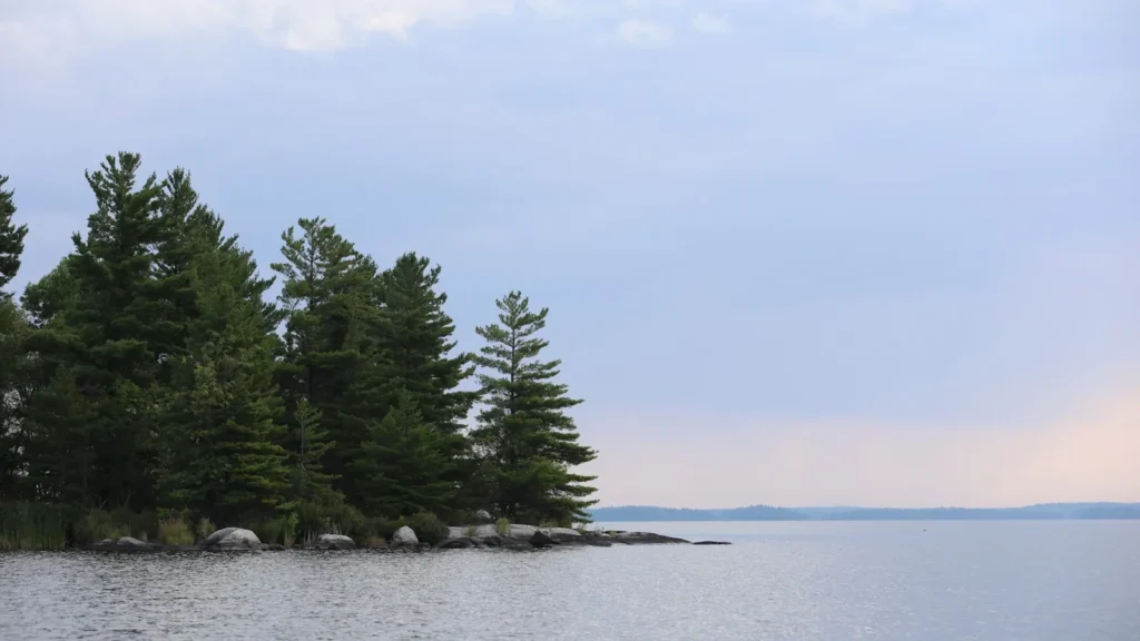
This water needs a real photo
The photo at the top of this page is not Lake George.
It is a regional stand-in, honestly captioned but generic — we will not put a name to a river we cannot prove. Send us a photograph you took here and it replaces the stand-in, with your credit on it.
Pioneer badgeUnclaimed
Add a photo of this water
Landscape, not fish — the water itself. Reviewed by hand before it appears. The first one published here earns the Pioneer badge.
Pool right now
318.84ft NAVD88
- 24 hours+0.01 ft → steady
Reading taken 2h ago at USGS 04278000, LAKE GEORGE AT ROGERS ROCK NY. Elevation is the surface of the lake above the survey datum, not depth. Source.
Fished this water? Add a photo
Reviewed by hand before it appears. Pick the water, not the spot — we never publish exact locations.
Access
Rogers Rock and Hearthstone Point: state campgrounds with ramps in the north.
Lake George Village and Bolton Landing: public ramps and marinas.
Mossy Point and Norowal: additional launches along the lake.
Island campsites are reachable by boat and permitted through the state.
Extensive shoreline is private, so boat access is the practical choice.
Ticonderoga and Lake George Village have services and guides.
Note: very heavy recreational traffic from late June to early September.
Seasons
Winter: ice fishing for lake trout and perch where the ice is dependable.
Spring: lake trout and salmon near the surface after ice-out, the best trolling weeks.
Summer: deep coldwater trolling, smallmouth on the rock, crowded afternoons.
Fall: trout and salmon shallow again and the lake almost empty of boats.
From the water
No logged trips yet. Be the first to put this water on your map.
Log this water
Fished it or cleaned it? Log in or create a free account to log a trip with photos and earn the waterway badge.
Questions
What species can you catch on the Lake George?
Anglers target Black Crappie, Lake Trout, Landlocked Salmon, Largemouth Bass, Northern Pike, Smallmouth Bass, Yellow Perch on the Lake George in New York.
Are there fishing guides on the Lake George?
GuidedFloats lists 1 guide and outfitters on the Lake George. Claimed profiles accept booking requests; unclaimed profiles are built from public records and link to the business.
Where can you access the Lake George?
Rogers Rock and Hearthstone Point: state campgrounds with ramps in the north. Lake George Village and Bolton Landing: public ramps and marinas. Mossy Point and Norowal: additional launches along the lake. Island campsites are reachable by boat and permitted through the state. Extensive shoreline is private, so boat access is the practical choice. Ticonderoga and Lake George Village have services and guides. Note: very heavy recreational traffic from late June to early September.
When is the best time to fish the Lake George?
Winter: ice fishing for lake trout and perch where the ice is dependable. Spring: lake trout and salmon near the surface after ice-out, the best trolling weeks. Summer: deep coldwater trolling, smallmouth on the rock, crowded afternoons. Fall: trout and salmon shallow again and the lake almost empty of boats.
Where are the fishing regulations for the Lake George?
Regulations change by season and section. Read the current rules on the New York agency site: https://dec.ny.gov/things-to-do/freshwater-fishing/regulations