Fishes Grande Ronde River
River · Northeast Oregon, from the Wallowa Mountains through the Grande Ronde canyon past Troy to the Snake River confluence in Washington · Oregon
Grande Ronde River Fishing Guides
Northeast Oregon canyon water with a genuine wild steelhead run, summer smallmouth and some of the emptiest river miles in the state.
Map of the Grande Ronde River
34 numbered points: 12 access points, 3 campsites, 5 parks and conservation areas, 1 agency office, 3 regulation section limits, 9 hazards, 1 USGS gauge. Tap a marker for details. Reviewed Sep 25, 2026.
- Access / boat ramp (12)
- Campsite (3)
- Park / conservation area (5)
- Agency / conservation office (1)
- Regulation section limit (3)
- Dam / hazard (9)
- USGS gauge (1)
Map data © OpenStreetMap contributors. Points are curated from OpenStreetMap and state agency sources; confirm access and hours before you go.
Print it. Bag it. Bring it.Phones die, screens crack, and most of this water has no signal. Print this map, fold it into a zip-top bag or dry bag with your license, and you have a backup your electronics can’t give you. Every marker is numbered so you can say exactly where you are.
Open the printable mapAll 34 points on this map
| # | Point | Type | Lat, Lon | Notes |
|---|---|---|---|---|
| 1 | Red Bridge State Wayside Day-use wayside on OR 244, upper Grande Ronde | Park / conservation area | 45.29092, -118.33270 | First public river frontage on the sheet, 6 km down the chained centreline. Day use and picnicking on a small upper-river reach; the water here is a mountain stream, not float water. |
| 2 | Upstream end of Hilgard State Park Upper limit of the ODFW Clark Creek Rd. section | Regulation section limit | 45.34172, -118.23385 | ODFW's Northeast Zone exceptions divide the Grande Ronde at two points. This is the upper one, taken from the upstream edge of the Hilgard Junction State Park polygon where it meets the river. Read the current rules before you fish. |
| 3 | Hilgard Junction State Park State park and campground at the I-84 crossing west of La Grande | Park / conservation area | 45.34141, -118.23203 | Camping, day use and the most used bank access on the upper river. Sits at the head of the ODFW section that runs down to Clark Creek Rd. |
| 4 | Riverside Park La Grande city park on the left bank | Park / conservation area | 45.34223, -118.08224 | The town park that actually fronts the river in La Grande. The other La Grande parks in OpenStreetMap sit blocks away from the water and were dropped. |
| 5 | La Grande Ranger Station Wallowa-Whitman National Forest, La Grande Ranger District | Agency / conservation office | 45.30632, -118.05775 | District office for the national forest land the upper river runs through. Road, camp and fire information for the Starkey and Hilgard country. About 4 km from the water, in town. |
| 6 | Ruckman Dam Low diversion structure, line-km 58.5 | Dam / hazard | 45.43321, -117.93612 | Mapped across the channel in the Imbler-Elgin valley reach. Scout before running anything here; diversion structures on this stretch change with irrigation season. |
| 7 | Bill Howell Dam Low diversion structure, line-km 62.6 | Dam / hazard | 45.45407, -117.95174 | Second of the two mapped valley diversions, 4 km below Ruckman. Same caution applies. |
| 8 | Clark Creek Road Shared limit of the two ODFW Grande Ronde sections | Regulation section limit | 45.56183, -117.90878 | Clark Creek Rd. below Elgin is the boundary between ODFW's State Line-to-Clark-Creek reach and its Clark-Creek-to-Hilgard reach. Pinned where the road comes within 30 m of the chained centreline. Read the current rules before you fish. |
| 9 | Andys Rapids Named rapid, line-km 89 | Dam / hazard | 45.61373, -117.89151 | First named whitewater on the sheet, in the reach below Elgin where the river leaves the valley. |
| 10 | Sheep Creek Rapids Named rapid in the canyon reach | Dam / hazard | 45.74787, -117.77412 | Inside the roadless canyon between Rondowa and Powwatka. There is no road access on either side here. |
| 11 | Grande Ronde Scenic Area Wild and Scenic corridor designation, canyon reach | Park / conservation area | 45.85376, -117.74687 | The named protected corridor through the canyon. Boundary mapped as a single point in OpenStreetMap, so treat this as a label for the reach rather than a site you can drive to. |
| 12 | Martin's Misery Rapids Named rapid, line-km 128.8 | Dam / hazard | 45.84791, -117.73313 | One of the recognised drops on the multi-day canyon run. Scout from the left. |
| 13 | Grey's Rapid Named rapid, line-km 137.4 | Dam / hazard | 45.87317, -117.65314 | Canyon reach, about 18 km above Powwatka Bridge. |
| 14 | Powwatka Bridge Access Road access where Troy Road crosses, line-km 155.8 | Access / boat ramp | 45.89869, -117.48346 | The first road you meet coming out of the canyon. Commonly used as a take-out for the upper canyon run and a put-in for the Troy water. |
| 15 | Mud Creek Access Bank access 1 km below Powwatka Bridge | Access / boat ramp | 45.89876, -117.47324 | Small access just downstream of the bridge; useful when the bridge ramp is busy. |
| 16 | Double Eddy Rapids Named rapid just above Troy | Dam / hazard | 45.93694, -117.44299 | Last named drop before the Troy gauge and launch. |
| 17 | Troy Boat Launch Main launch at Troy, line-km 167.5 | Access / boat ramp | 45.94548, -117.45023 | The hub of the lower river. Most Wild and Scenic trips take out or put in here, and the USGS gauge that everyone reads before launching is right beside it. |
| 18 | USGS gauge - Grande Ronde River at Troy Streamflow gauge, line-km 167.5 | USGS gauge | 45.94570, -117.45101 | The flow reference for the whole lower river. Coordinate taken from the site roster, not typed by hand; it lands 44 m from the chained centreline. |
| 19 | Grizzly Flats Campground Campground at Troy | Campsite | 45.94565, -117.45764 | Drive-in camping at the launch, half a kilometre back from the water. |
| 20 | Mallory Bridge Access Road access below Troy, line-km 170.5 | Access / boat ramp | 45.95707, -117.42376 | Short float from Troy. Redmond Grade Lane crosses here. |
| 21 | State Line Access Last Oregon access, line-km 177.6 | Access / boat ramp | 45.99107, -117.38456 | The bottom of the Oregon water in practice. Below here the river is in Washington and the rules change. |
| 22 | Oregon - Washington state line Downstream limit of ODFW's lower Grande Ronde section | Regulation section limit | 46.00003, -117.38010 | Measured where the chained centreline first crosses 46 deg N, not from a published coordinate. The river braids the border, crossing three times between line-km 178.7 and 181.8; State Line Access sits 1.1 km above. |
| 23 | Botts Boat Launch Washington bank launch, line-km 191.7 | Access / boat ramp | 46.03028, -117.31690 | First mapped launch below the state line, on the Grande Ronde Road side. |
| 24 | Bezona Water Access Site Washington water access site with camping | Campsite | 46.03515, -117.27300 | State access site on the lower river, about 2 km above Boggan's Oasis. |
| 25 | Boggan's Oasis Boat Launch Launch at the SR 129 bridge, line-km 198.6 | Access / boat ramp | 46.04169, -117.25305 | The well-known stop on the lower river where the highway crosses. Two mapped parking areas either side of the ramp were folded into this point rather than shipped separately. |
| 26 | Shumaker Access Bank access, line-km 212.2 | Access / boat ramp | 46.02478, -117.14561 | Road access on the lower canyon reach below Boggan's. |
| 27 | Snyder Bar Campground Riverside camping at Shumaker | Campsite | 46.02644, -117.14302 | Camping beside the Shumaker access, half a kilometre downstream. |
| 28 | Shumaker Grade Water Access Site Washington water access site, line-km 218.3 | Access / boat ramp | 46.04452, -117.10216 | Separate site from Shumaker Access 6 km upstream despite the shared name. |
| 29 | The Narrows Named constriction, line-km 233 | Dam / hazard | 46.05429, -117.01114 | The river pinches here in the last canyon above the Snake confluence. |
| 30 | Turkey Bend Water Access Site Washington water access site, line-km 235.9 | Access / boat ramp | 46.06974, -117.00859 | Access in the Chief Joseph Wildlife Area country near the Joseph Creek mouth. |
| 31 | Bridge Rapids Named rapid at the Joseph Creek Road crossing | Dam / hazard | 46.07029, -117.00663 | Last named rapid before the Snake. |
| 32 | Chief Joseph Wildlife Area Washington wildlife area, lower river | Park / conservation area | 46.07113, -117.00459 | Public land covering the last miles of canyon above the Snake confluence. Mapped in OpenStreetMap as an information point rather than a boundary, so this pin is the signed entrance area, not the area's centre. |
| 33 | Ebsen Boat Launch Launch at line-km 237.3 | Access / boat ramp | 46.06274, -116.99672 | Last launch above Heller Bar. Its own mapped water access site sits 70 m away and was folded in here. |
| 34 | Heller Bar Boat Ramp Take-out at the Snake River confluence, line-km 240.7 | Access / boat ramp | 46.08600, -116.98300 | The bottom of the river. Big concrete ramp on the Snake just below the mouth; almost every lower-river trip ends here. A mapped alternate ramp and a mapped water access site at the same bar were folded into this point. |
Guides on the Grande Ronde River
Claimed profiles take booking requests. Unclaimed profiles are built from public records so the river is never empty; the guide can claim or remove one any time.
Order on this page: premium and outfitter plans first (labelled Premium placement), then claimed free profiles, then unclaimed — one published price, no bidding for position. How placement works
About the Grande Ronde River
The Grande Ronde is the steelhead river that people who fish steelhead talk about quietly. It drains the Wallowa and Blue Mountains, cuts a long basalt canyon through the northeast corner of Oregon, and joins the Snake just over the Washington line. The canyon reach around Troy is remote by any standard – a gravel road, a few scattered cabins, and a river that runs cold and clear in the shoulder seasons and warm and bass-friendly in midsummer.
Autumn is the point. Summer-run steelhead move up through September, October and November, and the Grande Ronde has a deserved reputation as a swung-fly river: long even-grained runs, wadeable gravel, and fish that will come up for a skated or lightly dressed pattern in a way that Columbia system steelhead do not always do. Runs vary sharply year to year and hatchery and wild regulations change with them, so the current rule book matters more here than almost anywhere. Chinook and bull trout are present and protected, and mountain whitefish and resident rainbows fill the winter and spring.
Midsummer is a different river entirely. When flows drop and water temperatures climb, smallmouth bass take over the lower canyon and provide fast, unfussy fishing from a raft, which is how most people see this water. Multi-day float trips from Minam down through Troy to Heller Bar are a genuine wilderness experience and the standard way to cover the canyon.
Access outside the float corridor is limited to the Troy area, the Minam launch and a handful of forest road crossings. Guides and outfitters run both the autumn steelhead season and the summer bass floats out of Enterprise, Joseph and the Washington side.
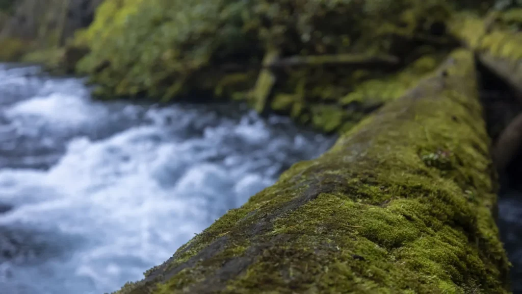
This water needs a real photo
The photo at the top of this page is not Grande Ronde River.
It is a regional stand-in, honestly captioned but generic — we will not put a name to a river we cannot prove. Send us a photograph you took here and it replaces the stand-in, with your credit on it.
Pioneer badgeUnclaimed
Add a photo of this water
Landscape, not fish — the water itself. Reviewed by hand before it appears. The first one published here earns the Pioneer badge.
Fished this water? Add a photo
Reviewed by hand before it appears. Pick the water, not the spot — we never publish exact locations.
Access
Minam - the standard upper launch for canyon float trips.
Wallowa - upper river road access above the canyon.
Troy - the gauge reach and the main road-accessible steelhead water.
Boggans Oasis - Washington-side access on the lower canyon.
Heller Bar - the Snake River confluence takeout.
Grande Ronde Road crossings - scattered bank access between Troy and the state line.
Elgin area - upper valley access above the canyon proper.
Seasons
Spring: high snowmelt flows, resident rainbows and whitefish, limited access.
Summer: warm low water, excellent smallmouth bass fishing and multi-day float season.
Fall: the summer steelhead run and the best swung-fly fishing of the year.
Winter: cold, quiet and largely unfished, with occasional late steelhead.
From the water
No logged trips yet. Be the first to put this water on your map.
Log this water
Fished it or cleaned it? Log in or create a free account to log a trip with photos and earn the waterway badge.
Questions
What is the current flow on the Grande Ronde River?
As of Nov 2, 6:00 am, the USGS gauge GRANDE RONDE RIVER AT TROY, OR reads 762 cfs. Conditions update every 15 minutes.
What species can you catch on the Grande Ronde River?
Anglers target Bull Trout, Chinook Salmon, Mountain Whitefish, Rainbow Trout, Smallmouth Bass, Steelhead, Westslope Cutthroat Trout on the Grande Ronde River in Oregon.
Are there fishing guides on the Grande Ronde River?
GuidedFloats lists 1 guide and outfitters on the Grande Ronde River. Claimed profiles accept booking requests; unclaimed profiles are built from public records and link to the business.
Where can you access the Grande Ronde River?
Minam - the standard upper launch for canyon float trips. Wallowa - upper river road access above the canyon. Troy - the gauge reach and the main road-accessible steelhead water. Boggans Oasis - Washington-side access on the lower canyon. Heller Bar - the Snake River confluence takeout. Grande Ronde Road crossings - scattered bank access between Troy and the state line. Elgin area - upper valley access above the canyon proper.
When is the best time to fish the Grande Ronde River?
Spring: high snowmelt flows, resident rainbows and whitefish, limited access. Summer: warm low water, excellent smallmouth bass fishing and multi-day float season. Fall: the summer steelhead run and the best swung-fly fishing of the year. Winter: cold, quiet and largely unfished, with occasional late steelhead.
Where are the fishing regulations for the Grande Ronde River?
Regulations change by season and section. Read the current rules on the Oregon agency site: https://myodfw.com/fishing/regulations