Fishes North Santiam River
River · Western Oregon in Marion and Linn counties, running west from the Cascades below Detroit Lake and Big Cliff Dam past Mill City, Gates and Mehama toward the Willamette River near Jefferson · Oregon
North Santiam River Fishing Guides
A clear, cold Cascade river below Detroit Lake with a strong summer steelhead run, a spring chinook fishery and some of the most reliable drift-boat water in the Willamette Valley.
Map of the North Santiam River
40 numbered points: 15 access points, 10 campsites, 1 bait & fly shop, 1 outfitter, 1 bridge, 2 parks and conservation areas, 3 agency offices, 2 regulation section limits, 4 hazards, 1 USGS gauge. Tap a marker for details. Reviewed Sep 25, 2026.
- Access / boat ramp (15)
- Campsite (10)
- Bait, tackle & fly shop (1)
- Outfitter / canoe rental (1)
- Bridge crossing (1)
- Park / conservation area (2)
- Agency / conservation office (3)
- Regulation section limit (2)
- Dam / hazard (4)
- USGS gauge (1)
Map data © OpenStreetMap contributors. Points are curated from OpenStreetMap and state agency sources; confirm access and hours before you go.
Print it. Bag it. Bring it.Phones die, screens crack, and most of this water has no signal. Print this map, fold it into a zip-top bag or dry bag with your license, and you have a backup your electronics can’t give you. Every marker is numbered so you can say exactly where you are.
Open the printable mapAll 40 points on this map
| # | Point | Type | Lat, Lon | Notes |
|---|---|---|---|---|
| 1 | Big Meadows Horse Camp Willamette National Forest | Campsite | 44.49398, -121.98394 | First developed camp on the river, in the headwater meadows below Santiam Lake. Stock-oriented but open to all; the channel here is a small meadow stream, not floatable. |
| 2 | Marion Forks Fish Hatchery ODFW · Hwy 22 at Marion Forks | Agency / conservation office | 44.61204, -121.94876 | ODFW hatchery on Marion Creek at the highway; rears the spring Chinook and summer steelhead smolts released into the North Santiam. |
| 3 | Marion Forks Campground Willamette National Forest | Campsite | 44.60896, -121.94590 | Small forest camp beside the highway at the Marion Creek confluence; the usual base for the upper river above Detroit Lake. |
| 4 | Riverside Campground Willamette National Forest | Campsite | 44.64244, -121.94597 | Riverside sites on the North Santiam about 5 miles below Marion Forks, on the Hwy 22 side. |
| 5 | Whispering Falls Campground Willamette National Forest | Campsite | 44.68782, -122.00923 | Forest Service camp on the river above the head of Detroit Lake; the last camp before the reservoir pool. |
| 6 | River Mountain RV Park Private · Hwy 22, Idanha | Campsite | 44.69826, -122.07321 | Private RV park on the river at Idanha, immediately above the Detroit Lake pool. |
| 7 | Santiam Flats Campground Willamette National Forest | Campsite | 44.71170, -122.11611 | Camp on the upper Detroit Lake pool where the river comes in; the pool draws down hard in autumn and the flats go dry. |
| 8 | Hoover Campground Willamette National Forest | Campsite | 44.71346, -122.12448 | Lakeside camp at the upper end of Detroit Lake, next to the Hoover ramp. The adjacent group loop is not listed separately here. |
| 9 | Hoover Boat Ramp Willamette National Forest · Detroit Lake | Access / boat ramp | 44.71496, -122.12334 | Uppermost ramp on Detroit Lake, at the head of the pool. Usable only at higher pool levels. |
| 10 | Detroit Lake Marina 115 Breitenbush Rd, Detroit | Outfitter / canoe rental | 44.73847, -122.15102 | Seasonal lakeside marina with moorage, boat rental and a store carrying tackle; season runs roughly May to Labor Day and depends on pool level. |
| 11 | Detroit Ranger Station Willamette National Forest · Hwy 22, Detroit | Agency / conservation office | 44.73126, -122.17473 | District office for the Detroit Ranger District; the place to ask about forest road status, the reservoir pool and upriver camp openings. |
| 12 | Piety Island Campground Willamette National Forest · boat-in | Campsite | 44.72142, -122.16040 | Boat-in only camp on the island in Detroit Lake; no road access. |
| 13 | Cove Creek Campground Willamette National Forest · south shore | Campsite | 44.71209, -122.15972 | Large south-shore camp on Detroit Lake above the Southshore ramp. |
| 14 | Southshore Boat Ramp Willamette National Forest · Detroit Lake | Access / boat ramp | 44.70784, -122.17393 | South-shore ramp on Detroit Lake, reached from Blowout Road. |
| 15 | Southshore Campground Willamette National Forest | Campsite | 44.70580, -122.17717 | South-shore camp beside the Southshore ramp. |
| 16 | Mongold Boat Ramp Detroit Lake State Recreation Area | Access / boat ramp | 44.71202, -122.19250 | The main Detroit Lake ramp, at the state park day-use area near the dam end of the pool. |
| 17 | Detroit Dam US Army Corps of Engineers | Dam / hazard | 44.72131, -122.25026 | 463-ft flood-control and power dam that forms Detroit Lake. No passage; the river below the dam is the Big Cliff pool. |
| 18 | Big Cliff Dam USACE · re-regulating dam | Dam / hazard | 44.75093, -122.28295 | Re-regulating dam 3 miles below Detroit. ODFW's open North Fork Santiam reaches run from the mouth up to this dam, and the water immediately below the dam face is closed — read the current rules before fishing here. |
| 19 | Big Cliff lower put-in Hand-carry · no trailer launch | Access / boat ramp | 44.75350, -122.29000 | Uppermost access below Big Cliff Dam, listed by the Oregon State Marine Board as hand-carry. No owning agency is recorded in the state database; treat it as an informal put-in. |
| 20 | Ed Rogers Wayside Marion County · Hwy 22 at Niagara | Park / conservation area | 44.75484, -122.33119 | Small highway wayside on the river at Niagara, just above Minto Dam; day use and bank access only. |
| 21 | Minto Dam Diversion structure · Niagara | Dam / hazard | 44.75540, -122.33591 | Low dam at Niagara with a falls immediately below it. ODFW's reach boundary between the Packsaddle–Minto water and the Minto–Big Cliff water sits here. |
| 22 | Minto Fish Facility ODFW · adult collection facility | Agency / conservation office | 44.75807, -122.36012 | ODFW trap-and-haul facility just above Packsaddle Park where returning spring Chinook and steelhead are collected and sorted. |
| 23 | Packsaddle County Park Marion County · 1-lane launch | Access / boat ramp | 44.75721, -122.36515 | The top put-in of the standard float. Marion County allows no motorised boats here, and the ODFW deadline markers that bound the reach above are posted at the park. |
| 24 | Riverview Street bridge, Gates CR 968A · Gates | Bridge crossing | 44.75273, -122.41145 | The Gates crossing, roughly halfway down the Packsaddle-to-Fishermen's Bend drift. Bank access only; no ramp here. |
| 25 | 7th Street Ramp City of Mill City · 1-lane launch | Access / boat ramp | 44.75443, -122.46805 | Mill City's upper ramp, immediately above Kimmel Park; the two sit about 130 m apart and may share one parking area. |
| 26 | Kimmel Park City of Mill City · 1-lane launch | Access / boat ramp | 44.75314, -122.46957 | City park and launch on the Mill City waterfront, just below the 7th Street ramp. |
| 27 | ODFW deadline markers, Mill City 1st Avenue bridge — reach boundary | Regulation section limit | 44.75489, -122.47753 | ODFW posts markers between the foot bridge and the 1st Avenue bridge here; the water from the markers up to the falls is a separate reach from the drift below. Read the current Willamette Zone rules for what applies. |
| 28 | Santiam Sports Center 250 NW 9th Ave, Mill City | Bait, tackle & fly shop | 44.75701, -122.48748 | The corridor's only general bait-and-tackle stop between Stayton and Detroit — a market and sporting-goods counter rather than a dedicated tackle shop. No website; call ahead for hours. |
| 29 | Hammond Park City of Mill City · hand-carry | Access / boat ramp | 44.75567, -122.47785 | Hand-carry launch at the lower end of the Mill City waterfront, below the deadline markers. |
| 30 | Fishermen's Bend Recreation Site BLM · 1-lane launch and campground | Access / boat ramp | 44.75341, -122.51416 | BLM campground and ramp 1.5 miles west of Mill City; the usual take-out for the Packsaddle drift and put-in for the run to Mehama. |
| 31 | North Santiam State Recreation Area Oregon Parks & Recreation | Access / boat ramp | 44.77289, -122.56732 | State park launch above Mehama. The Marine Board records no improved ramp lane here and shuttle operators describe the launch as rocky and awkward. |
| 32 | John Neal Memorial Park Linn County · Lyons, south bank | Access / boat ramp | 44.78358, -122.60795 | Linn County park at Lyons. The county's own page calls the launch paddle-craft only while the state database still codes it as trailered — check before hauling a drift boat here. |
| 33 | Lyons-Mehama Boat Ramp Linn County · under the Hwy 226 bridge | Access / boat ramp | 44.78857, -122.61806 | Non-motorised launch on the Lyons bank under the Lyons-Mehama bridge; the standard take-out for the Fishermen's Bend drift and put-in for the long run to Stayton. |
| 34 | USGS 14183000 — North Santiam River at Mehama Real-time stage and discharge | USGS gauge | 44.78925, -122.61881 | The river's index gauge, at the Lyons-Mehama bridge. Flow here is regulated by releases from Big Cliff, so it moves with the Corps' schedule as much as with rain. |
| 35 | Upper Bennett Dam Santiam Water Control District · boat slide | Dam / hazard | 44.78804, -122.74253 | Irrigation diversion dam that must be portaged on the Mehama-to-Stayton drift. A boat slide is built into the structure; scout it before committing to the chute. |
| 36 | Riverfront Park, Stayton City of Stayton | Park / conservation area | 44.79521, -122.78114 | City riverfront park and trail above the Stayton bridge; bank access and parking, no launch. |
| 37 | Stayton Bridge Linn County · non-motorised, 1 lane | Access / boat ramp | 44.79116, -122.79480 | Linn-bank ramp at the Stayton-Scio Bridge. The bridge itself is an ODFW reach boundary — the water below it to the mouth is regulated separately from the water above. |
| 38 | Buell Miller ODFW / Linn County · 40510 Hess Rd | Access / boat ramp | 44.75779, -122.86465 | Ramp at the old railroad right-of-way off Hess Road, five miles below Stayton; owned by ODFW and managed by Linn County. |
| 39 | Greens Bridge ODFW · gated in summer | Access / boat ramp | 44.70781, -122.97205 | The last ramp above the mouth. ODFW locks the gate from early June to late September — only licensed anglers holding a key from the South Willamette Watershed District office can drive in; everyone else walks. |
| 40 | Mouth — Santiam River confluence Lower limit of the North Fork reaches | Regulation section limit | 44.68800, -123.00762 | The North Santiam ends here at the South Santiam. ODFW's reach descriptions on this river all start from this mouth; below it the water is the Santiam mainstem and is listed separately. |
Guides on the North Santiam River
Claimed profiles take booking requests. Unclaimed profiles are built from public records so the river is never empty; the guide can claim or remove one any time.
Order on this page: premium and outfitter plans first (labelled Premium placement), then claimed free profiles, then unclaimed — one published price, no bidding for position. How placement works
About the North Santiam River
The North Santiam is the Willamette Valley’s most dependable summer steelhead river, and dependability is exactly what recommends it. Water is released from Detroit Lake through Big Cliff Dam, and that storage smooths out the winter rain spikes that make so many western Oregon rivers unfishable for days at a time. The result is a river that clears fast, holds a usable green tint and stays cold well into the summer while nearby freestone streams warm and drop.
Summer steelhead are the headline. Hatchery fish enter from spring and hold through the summer in the canyon runs between Mill City and Mehama, and this is classic swung-fly and side-drifting water with clean gravel and readable seams. Spring chinook run the same reach and draw a serious boat fishery from May into July. There are wild winter steelhead as well, though those are catch-and-release, and resident rainbows and cutthroat provide steady trout fishing through the middle of the year. Mountain whitefish are abundant and underappreciated.
The river is a drift-boat fishery more than a wading one. Most guided trips float the reaches between the Packsaddle, Mill City, Gates and Mehama accesses, with a few longer runs down toward Stayton. Wading is possible at the bigger gravel bars but the bed is slick and the current pushes harder than it looks. This gauge sits at Mehama and reports discharge, stage and water temperature, which makes it genuinely useful for steelhead timing rather than only for safety. The 2020 Beachie Creek Fire burned much of the upper watershed, and anglers should expect changed banks, new woody debris and access points that have shifted since older guidebooks were written. Check current launch conditions before committing to a long float.
This water needs a real photo
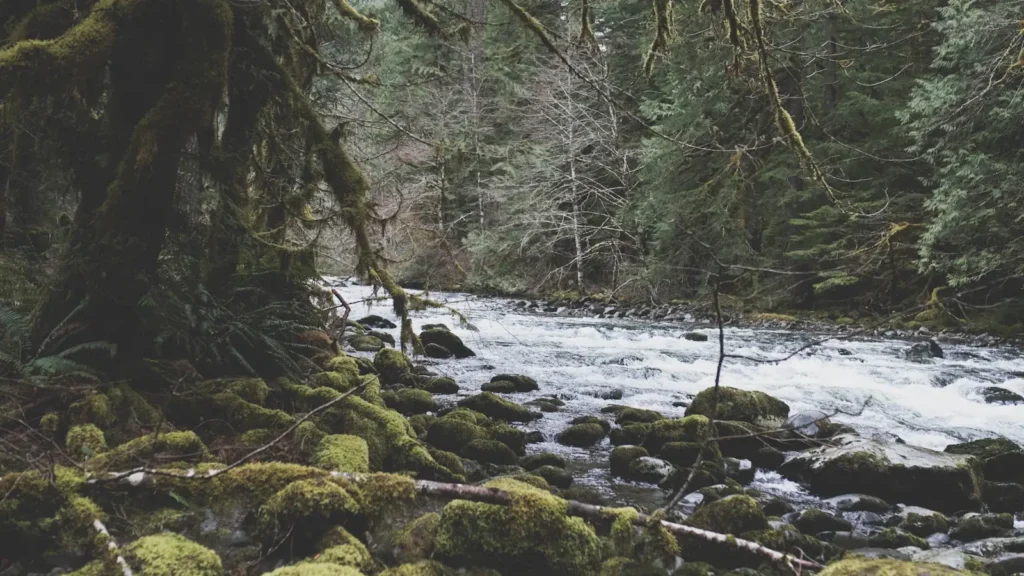
The photo at the top of this page is not North Santiam River.
It is a regional stand-in, honestly captioned but generic — we will not put a name to a river we cannot prove. Send us a photograph you took here and it replaces the stand-in, with your credit on it.
Pioneer badgeUnclaimed
Add a photo of this water
Landscape, not fish — the water itself. Reviewed by hand before it appears. The first one published here earns the Pioneer badge.
Fished this water? Add a photo
Reviewed by hand before it appears. Pick the water, not the spot — we never publish exact locations.
Access
Packsaddle County Park near Gates - upper-river boat launch and bank access.
Mill City bridge and Kimmel Park - the top of the most-floated canyon reach.
Fishermens Bend Recreation Site - BLM campground with a ramp and good bank water.
John Neal Park at Lyons - a common take-out on the middle river.
Mehama bridge on Highway 226 - the reach this gauge reads.
Stayton Bridge and the lower river - slower water and a longer float.
Greens Bridge near Jefferson - the lowest access before the Willamette confluence.
Seasons
Spring: spring chinook enter from May and the first summer steelhead show behind them.
Summer: the peak season, with steelhead holding in the canyon runs and steady, cold, clear flows.
Fall: falling reservoir releases, good trout fishing and quieter water after the summer crowd leaves.
Winter: wild winter steelhead on catch-and-release rules, with the river clearing faster than its neighbors.
From the water
No logged trips yet. Be the first to put this water on your map.
Log this water
Fished it or cleaned it? Log in or create a free account to log a trip with photos and earn the waterway badge.
Questions
What is the current flow on the North Santiam River?
As of Nov 2, 6:50 am, the USGS gauge NORTH SANTIAM RIVER AT MEHAMA, OR reads 1,490 cfs. Conditions update every 15 minutes.
What species can you catch on the North Santiam River?
Anglers target Chinook Salmon, Cutthroat Trout, Mountain Whitefish, Rainbow Trout, Smallmouth Bass, Steelhead on the North Santiam River in Oregon.
Are there fishing guides on the North Santiam River?
GuidedFloats lists 1 guide and outfitters on the North Santiam River. Claimed profiles accept booking requests; unclaimed profiles are built from public records and link to the business.
Where can you access the North Santiam River?
Packsaddle County Park near Gates - upper-river boat launch and bank access. Mill City bridge and Kimmel Park - the top of the most-floated canyon reach. Fishermens Bend Recreation Site - BLM campground with a ramp and good bank water. John Neal Park at Lyons - a common take-out on the middle river. Mehama bridge on Highway 226 - the reach this gauge reads. Stayton Bridge and the lower river - slower water and a longer float. Greens Bridge near Jefferson - the lowest access before the Willamette confluence.
When is the best time to fish the North Santiam River?
Spring: spring chinook enter from May and the first summer steelhead show behind them. Summer: the peak season, with steelhead holding in the canyon runs and steady, cold, clear flows. Fall: falling reservoir releases, good trout fishing and quieter water after the summer crowd leaves. Winter: wild winter steelhead on catch-and-release rules, with the river clearing faster than its neighbors.
Where are the fishing regulations for the North Santiam River?
Regulations change by season and section. Read the current rules on the Oregon agency site: https://myodfw.com/fishing/regulations