Blackstone River Fishing Guides
The river that powered American industry, now a recovering urban fishery running from Worcester through Woonsocket to the Providence tidewater.
Map of the Blackstone River
53 numbered points: 3 access points, 22 bridges, 13 parks and conservation areas, 14 hazards, 1 USGS gauge. Tap a marker for details. Reviewed Sep 26, 2026.
- Access / boat ramp (3)
- Bridge crossing (22)
- Park / conservation area (13)
- Dam / hazard (14)
- USGS gauge (1)
Print it. Bag it. Bring it.Phones die, screens crack, and most of this water has no signal. Print this map, fold it into a zip-top bag or dry bag with your license, and you have a backup your electronics can’t give you. Every marker is numbered so you can say exactly where you are.
Open the printable mapAll 53 points on this map
| # | Point | Type | Lat, Lon | Notes |
|---|---|---|---|---|
| 1 | Riverdale Dam Northbridge MA - NID MA00942 | Dam / hazard | 42.13889, -71.63979 | Highest dam on the mapped reach. The river above it is the Northbridge mill pond. |
| 2 | Church Street Northbridge MA | Bridge crossing | 42.12946, -71.63643 | |
| 3 | West Hill Wildlife Management Area MassWildlife | Park / conservation area | 42.10937, -71.61241 | State shooting and wildlife ground on the east bank, about 700 m off the river. |
| 4 | Blackstone River and Canal Heritage State Park Massachusetts DCR | Park / conservation area | 42.10491, -71.62774 | Runs with the river through most of the Massachusetts reach; the canal towpath is the practical shuttle and portage route. |
| 5 | Hartford Avenue East Uxbridge MA - at the Rice City Pond outlet | Bridge crossing | 42.09794, -71.62304 | |
| 6 | Rice City Pond Dam Uxbridge MA - NID MA00935 | Dam / hazard | 42.09843, -71.62238 | Head of the Rice City Pond impoundment. OSM does not tag the pond as river, so the sheet carries a 1.9 km gap here and no point is placed inside it. |
| 7 | Mendon Street MA 16 - Uxbridge MA | Bridge crossing | 42.07978, -71.61965 | |
| 8 | Blackstone River and Canal Heritage State Park - Uxbridge unit Massachusetts DCR - River Bend Farm | Park / conservation area | 42.07687, -71.62792 | Visitor centre and towpath access for the Uxbridge reach. |
| 9 | Blackstone and West River Access Conservation land at the West River mouth | Access / boat ramp | 42.06229, -71.61029 | The only OSM feature on the reach actually named as an access; carry-in from the conservation parcel. |
| 10 | Millville Road MA 122 - Millville MA | Bridge crossing | 42.05494, -71.61632 | |
| 11 | Skull Rock Lock Trailhead Blackstone Canal towpath | Park / conservation area | 42.05459, -71.61528 | Towpath trailhead at the Millville lock, the best foot access to this stretch. |
| 12 | River Road Millville MA | Bridge crossing | 42.02990, -71.60322 | |
| 13 | Tucker Cove Conservation land - Blackstone MA | Park / conservation area | 42.02890, -71.58471 | |
| 14 | Central Street Blackstone MA | Bridge crossing | 42.02613, -71.58164 | |
| 15 | Stone Diversion Dam Blackstone MA - NID MA00096 | Dam / hazard | 42.01532, -71.55356 | Sits at the head of the gorge reach; scout before committing below it. |
| 16 | High Rocks Gorge Blackstone MA - also mapped as Blackstone Gorge | Park / conservation area | 42.01246, -71.55176 | The gorge below the diversion dam, the one stretch of the river with real gradient. |
| 17 | Blackstone Dam Blackstone MA - NID RI83001 | Dam / hazard | 42.01464, -71.54456 | |
| 18 | Canal Street Blackstone MA | Bridge crossing | 42.01672, -71.53844 | |
| 19 | Blackstone River Saranac Dam at Canal Street Blackstone MA - NID MA01164 | Dam / hazard | 42.01702, -71.53803 | |
| 20 | Saint Paul Street Blackstone MA | Bridge crossing | 42.01841, -71.53304 | |
| 21 | Meadows Recreation Area Blackstone MA - Mammoth Mill site | Park / conservation area | 42.01354, -71.53087 | |
| 22 | Slipway at Cold Spring Park Woonsocket RI - unnamed in OpenStreetMap | Access / boat ramp | 42.00759, -71.52501 | Carry-in slipway inside Cold Spring Park, above Woonsocket Falls Dam. |
| 23 | River Street Woonsocket RI | Bridge crossing | 42.00523, -71.52480 | |
| 24 | Woonsocket Falls Dam Woonsocket RI - NID RI03902 | Dam / hazard | 41.99948, -71.51798 | The South Main Street bridge (RI 104) crosses within 60 m of the dam. |
| 25 | River Island Park Woonsocket RI - also mapped as River Island Art Park | Park / conservation area | 41.99798, -71.51550 | Riverfront park immediately below Woonsocket Falls Dam. |
| 26 | Court Street RI 122 - Woonsocket RI | Bridge crossing | 42.00259, -71.51196 | |
| 27 | World War II Veterans Memorial State Park Woonsocket RI | Park / conservation area | 42.00929, -71.50776 | |
| 28 | USGS 01112500 Blackstone River at Woonsocket, RI USGS streamgauge | USGS gauge | 42.00649, -71.50256 | The reference gauge for the whole river; coordinates taken from the site record, not placed by hand. |
| 29 | Hamlet Avenue RI 122 and RI 126 - Woonsocket RI | Bridge crossing | 42.00308, -71.49841 | |
| 30 | Slipway below Woonsocket Unnamed in OpenStreetMap | Access / boat ramp | 41.99694, -71.49425 | Service-road slipway on the reach between Woonsocket Falls Dam and Manville Dam. |
| 31 | Woonsocket Industrial Highway RI 99 - Woonsocket RI | Bridge crossing | 41.97818, -71.48507 | |
| 32 | Manville Dam Manville RI - NID RI00809 | Dam / hazard | 41.97146, -71.47067 | Main Street Manville crosses within 70 m of the dam. |
| 33 | New River Road Lincoln RI | Bridge crossing | 41.95710, -71.46294 | |
| 34 | Albion Dam Albion RI - NID RI00808 | Dam / hazard | 41.95423, -71.45355 | |
| 35 | School Street Albion RI - also mapped as Albion Road | Bridge crossing | 41.95306, -71.45240 | |
| 36 | Ashton Dam Ashton RI - NID RI00807 | Dam / hazard | 41.94039, -71.43581 | |
| 37 | George Washington Highway RI 116 - Ashton Viaduct, Lincoln RI | Bridge crossing | 41.93825, -71.43389 | |
| 38 | Martin Street Albion RI - Blackstone River Bikeway crossing here too | Bridge crossing | 41.92701, -71.43092 | |
| 39 | Lonsdale Park Lincoln RI - Lonsdale Marsh | Park / conservation area | 41.90835, -71.41855 | Marsh and park on the east bank, about 1 km off the centreline. |
| 40 | Pratt Dam Lincoln RI - NID RI01705 | Dam / hazard | 41.91320, -71.40870 | |
| 41 | Lonsdale Avenue RI 122 - Lincoln RI | Bridge crossing | 41.91117, -71.40294 | |
| 42 | John Street RI 123 - Cumberland RI | Bridge crossing | 41.90643, -71.39994 | |
| 43 | Valley Falls Dam Valley Falls RI - NID RI00401 | Dam / hazard | 41.89945, -71.38966 | The Broad Street bridge (RI 114) crosses within 40 m of the dam. |
| 44 | Valley Falls Heritage Park Central Falls RI | Park / conservation area | 41.90001, -71.38940 | |
| 45 | River Island Park Central Falls RI - not the Woonsocket park of the same name | Park / conservation area | 41.89865, -71.38682 | |
| 46 | Mill Street Central Falls RI | Bridge crossing | 41.90076, -71.38564 | |
| 47 | Roosevelt Avenue Central Falls RI | Bridge crossing | 41.88866, -71.38174 | |
| 48 | Central Falls Dam Central Falls RI - NID RI00402 | Dam / hazard | 41.88758, -71.38031 | |
| 49 | Central Avenue Pawtucket RI - Cross Street crosses alongside | Bridge crossing | 41.88591, -71.38068 | |
| 50 | Exchange Street RI 15 and RI 114 - Pawtucket RI | Bridge crossing | 41.87985, -71.38147 | |
| 51 | Pawtucket Upper Dam Pawtucket RI - NID RI04270 | Dam / hazard | 41.87713, -71.38221 | |
| 52 | Slater Mill Site Pawtucket RI | Park / conservation area | 41.87735, -71.38262 | The mill site between the two Pawtucket dams; the Main Street bridge (RI 114) is at the lower dam. |
| 53 | Pawtucket Lower Dam Pawtucket RI - NID RI04271 | Dam / hazard | 41.87654, -71.38328 | Foot of the mapped reach. Below here the river is tidal and becomes the Seekonk. |
Guides on the Blackstone River
Claimed profiles take booking requests. Unclaimed profiles are built from public records so the river is never empty; the guide can claim or remove one any time.
No guides listed yet
Guide or outfit this water? Create your profile. Listing is free, the commission is 10% or 7% with a premium profile, and premium profiles list first on this water.
About the Blackstone River
The Blackstone River runs from Worcester, Massachusetts, southeast through the Blackstone River Valley to Pawtucket and the Providence River tidewater in Rhode Island. It is the river where American industrialization began, and for most of the twentieth century that history made it one of the most degraded rivers in New England. The last three decades have changed that substantially: dam removals, improved treatment and sustained restoration work through the Blackstone River Valley National Historical Park have brought the fishery back. The USGS gauge at Woonsocket reports discharge and stage.
Smallmouth bass are the strongest and most consistent fishery, holding on the rock and ledge below the remaining dams and through the faster runs. Largemouth bass, black crappie and bluegill fill the impounded stretches, northern pike and chain pickerel work the weedy backwaters, and channel catfish are common in the deeper holes. Rhode Island stocks brown and rainbow trout in designated reaches in the spring, and American eel have returned in numbers as fish passage has improved through the lower river.
Fishing here is bank, wade and paddle work rather than boat work — the river is broken by dams and narrow through much of its length. The Blackstone River Bikeway parallels long stretches and makes access unusually easy for an urban river, and kayak fishing on the impoundments has grown quickly. Guided trips here tend to be as much about the valley’s mill history as the fish, and the contrast between granite mill walls and a good smallmouth run is the whole character of the place.
Access is straightforward through state parks, the bikeway and municipal park land in Woonsocket, Lincoln and Cumberland. Rhode Island fishing licenses are required, with a separate trout conservation stamp for stocked waters, and anglers moving upstream should note that Massachusetts rules apply above the state line. The RIDEM link below carries current stocking schedules and limits, and some reaches still carry consumption advisories worth reading before keeping fish.
This water needs a real photo
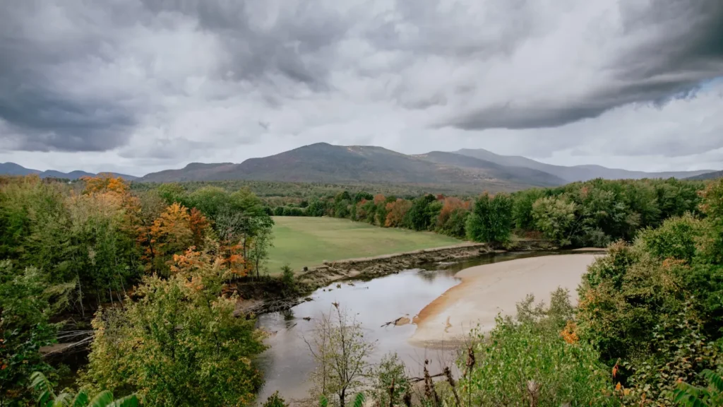
The photo at the top of this page is not Blackstone River.
It is a regional stand-in, honestly captioned but generic — we will not put a name to a river we cannot prove. Send us a photograph you took here and it replaces the stand-in, with your credit on it.
Add a photo of this water
Landscape, not fish — the water itself. Reviewed by hand before it appears. The first one published here earns the Pioneer badge.
Fished this water? Add a photo
Reviewed by hand before it appears. Pick the water, not the spot — we never publish exact locations.
Access
Woonsocket riverfront access — bank and wade access at the USGS gauge.
Blackstone River State Park, Lincoln — the main developed access with parking and trails.
Blackstone River Bikeway — continuous walk-in access along much of the Rhode Island reach.
Manville and Albion dam areas — tailout access below the remaining dams.
Ashton and Pratt Dam accesses — paddle put-ins on the impounded reaches.
Central Falls and Valley Falls parks — lower river urban bank access.
Slater Mill, Pawtucket — bottom-end access at the head of tidewater.
Seasons
Spring: high water early, trout stocking in the designated reaches, and pike active in the backwaters.
Summer: prime smallmouth season on the ledges and runs, with early and late the best hours.
Fall: settled flows and the strongest smallmouth fishing of the year through October.
Winter: limited open-water fishing on the faster reaches; most activity pauses until spring.
From the water
No logged trips yet. Be the first to put this water on your map.
Log this water
Fished it or cleaned it? Log in or create a free account to log a trip with photos and earn the waterway badge.
Questions
What is the current flow on the Blackstone River?
As of Nov 2, 6:30 am, the USGS gauge BLACKSTONE RIVER AT WOONSOCKET, RI reads 368 cfs. Conditions update every 15 minutes.
What species can you catch on the Blackstone River?
Anglers target American Eel, Black Crappie, Bluegill, Brown Trout, Chain Pickerel, Channel Catfish, Largemouth Bass, Northern Pike, Rainbow Trout, Smallmouth Bass on the Blackstone River in Rhode Island.
Where can you access the Blackstone River?
Woonsocket riverfront access — bank and wade access at the USGS gauge. Blackstone River State Park, Lincoln — the main developed access with parking and trails. Blackstone River Bikeway — continuous walk-in access along much of the Rhode Island reach. Manville and Albion dam areas — tailout access below the remaining dams. Ashton and Pratt Dam accesses — paddle put-ins on the impounded reaches. Central Falls and Valley Falls parks — lower river urban bank access. Slater Mill, Pawtucket — bottom-end access at the head of tidewater.
When is the best time to fish the Blackstone River?
Spring: high water early, trout stocking in the designated reaches, and pike active in the backwaters. Summer: prime smallmouth season on the ledges and runs, with early and late the best hours. Fall: settled flows and the strongest smallmouth fishing of the year through October. Winter: limited open-water fishing on the faster reaches; most activity pauses until spring.
Where are the fishing regulations for the Blackstone River?
Regulations change by season and section. Read the current rules on the Rhode Island agency site: https://dem.ri.gov/natural-resources-bureau/fish-wildlife/freshwater-fishing/rules-regulations