Fishes Clinch River, French Broad River
River · East Tennessee and the Great Smoky Mountains Foothills · Tennessee
French Broad River Fishing Guides
One of the oldest rivers in the world, running north out of North Carolina past Newport to meet the Holston and form the Tennessee, with a serious smallmouth and musky fishery.
Map of the French Broad River
45 numbered points: 6 access points, 6 campsites, 14 bridges, 2 parks and conservation areas, 2 regulation section limits, 11 hazards, 1 USGS gauge, 3 points of interest. Tap a marker for details. Reviewed Oct 23, 2026.
- Access / boat ramp (6)
- Campsite (6)
- Bridge crossing (14)
- Park / conservation area (2)
- Regulation section limit (2)
- Dam / hazard (11)
- USGS gauge (1)
- Point of interest (3)
Map data © OpenStreetMap contributors. Points are curated from OpenStreetMap and state agency sources; confirm access and hours before you go.
Print it. Bag it. Bring it.Phones die, screens crack, and most of this water has no signal. Print this map, fold it into a zip-top bag or dry bag with your license, and you have a backup your electronics can’t give you. Every marker is numbered so you can say exactly where you are.
Open the printable mapAll 45 points on this map
| # | Point | Type | Lat, Lon | Notes |
|---|---|---|---|---|
| 1 | Paint Creek Road FS 41, at the state line | Bridge crossing | 35.94529, -82.89836 | |
| 2 | Paint Rock River Access Paint Rock - US Forest Service | Access / boat ramp | 35.94482, -82.89904 | Uppermost access on the Tennessee reach, just below the North Carolina line. OSM maps it three times; the other two objects are the parking area and the footpath. |
| 3 | Dixie Highway US 25 / US 70 | Bridge crossing | 35.92073, -82.95915 | |
| 4 | French Broad Recreation Site US Forest Service | Park / conservation area | 35.92210, -82.96202 | |
| 5 | SR 107 Del Rio | Bridge crossing | 35.92491, -83.02134 | OSM tags this span with a ref and no name. |
| 6 | French Broad River Access About 2 km below the SR 107 bridge | Access / boat ramp | 35.91869, -83.04000 | OSM gives it no name beyond "French Broad River Access"; it is the slipway downstream of the Del Rio crossing. |
| 7 | Dixie Highway US 25 / US 70 above Newport | Bridge crossing | 35.95475, -83.11124 | |
| 8 | USGS streamgauge Live stage and discharge | USGS gauge | 35.98151, -83.16121 | Roster coordinate; USGS 03455000, French Broad River near Newport. |
| 9 | US 321 Newport | Bridge crossing | 35.98248, -83.16088 | Also the upstream limit of the TWRA section below. |
| 10 | Newport to the state line section US 321 bridge at Newport upstream to the North Carolina line | Regulation section limit | 35.98248, -83.16088 | TWRA names this reach in its statewide fishing exceptions. Check the current TWRA regulations for what applies before you fish it. |
| 11 | Holt Town Road | Bridge crossing | 36.05074, -83.20998 | |
| 12 | Rankin Bridge Rankin Bottoms | Bridge crossing | 36.05347, -83.21147 | |
| 13 | US 25E | Bridge crossing | 36.04493, -83.25698 | |
| 14 | Nina Ferry Landing Douglas Lake at Nina | Access / boat ramp | 36.02668, -83.27258 | OSM carries the name only, with no ramp or surface tag, so its condition is unconfirmed. It is the one mapped landing in 20 km of lake. |
| 15 | I 40 | Bridge crossing | 36.04152, -83.33623 | OSM maps the two carriageways separately; this is one of the pair. |
| 16 | US 25W / US 70 | Bridge crossing | 36.03945, -83.33768 | |
| 17 | The Point RV Park Douglas Lake near Dandridge | Campsite | 36.00939, -83.40866 | |
| 18 | Chestnut Hill Road SR 92 | Bridge crossing | 36.01218, -83.41310 | |
| 19 | Crosslake Landing Douglas Lake, 1.7 km off the mid-lake line | Access / boat ramp | 35.98731, -83.46055 | Name-only in OSM like Nina Ferry Landing, and kept for the same reason: nothing else is mapped on the mid-lake reach. |
| 20 | Douglas Headwater Campground TVA, above the dam | Campsite | 35.95820, -83.53513 | |
| 21 | Douglas Dam Tennessee Valley Authority | Point of interest | 35.96125, -83.53860 | Head of the 52 km tailwater float down to the Holston confluence; the impoundment above it is Douglas Lake. |
| 22 | Mountain Cove Marina Douglas Lake, above Douglas Dam | Access / boat ramp | 35.95209, -83.53702 | Marina sharing an operator with the campground of the same name; the last mapped launch above the dam. |
| 23 | Old State Hwy 66 SR 338, just below Douglas Dam | Bridge crossing | 35.95787, -83.54692 | |
| 24 | Douglas Tailwater Campground TVA, below the dam | Campsite | 35.95617, -83.54968 | First camp on the tailwater float. |
| 25 | Mountain Cove Campground Douglas Lake, with the marina | Campsite | 35.94687, -83.53505 | |
| 26 | Winfield Dunn Parkway SR 66, Sevierville | Bridge crossing | 35.93789, -83.58331 | OSM maps the two carriageways separately; this is one of the pair. |
| 27 | Coleman Camping-gear outlet, Sevierville | Point of interest | 35.93317, -83.58526 | Outlet store 325 m off the river, tagged shop=outdoor in OSM. Gear, not bait or tackle. |
| 28 | Two Rivers Landing RV Resort Sevierville, on the river | Campsite | 35.93412, -83.58811 | OSM tags it tourism=camp_site; typed camp here rather than access. |
| 29 | Riverside RV Park & Resort Sevierville | Campsite | 35.92933, -83.58843 | |
| 30 | Bryant Shoals Named shoal, Douglas tailwater | Dam / hazard | 35.93259, -83.60489 | |
| 31 | Davis Shoals Named shoal, Douglas tailwater | Dam / hazard | 35.92676, -83.63406 | |
| 32 | Hanging Rock Shoals Named shoal, Douglas tailwater | Dam / hazard | 35.92842, -83.64156 | |
| 33 | The Gallops Named shoal, Douglas tailwater | Dam / hazard | 35.94342, -83.64851 | |
| 34 | Wild Bull Shoals Named shoal, Douglas tailwater | Dam / hazard | 35.94648, -83.66240 | |
| 35 | Bass Pro Shops Kodak, about 4 km off the river | Point of interest | 35.98506, -83.61217 | Kept despite the distance because OSM maps no bait or fly shop anywhere on the Tennessee reach. |
| 36 | Seven Mile Eddy Named eddy, not a rapid | Dam / hazard | 35.94537, -83.68601 | OSM tags it waterway=rapids; the name and the local usage are for the eddy. |
| 37 | Cruze Landing Knox County river landing | Access / boat ramp | 35.96046, -83.73732 | Lowest mapped landing above the Holston confluence. |
| 38 | Pattys Shoals Named shoal, Douglas tailwater | Dam / hazard | 35.95620, -83.79768 | |
| 39 | East Governor John Sevier Highway SR 168 | Bridge crossing | 35.95287, -83.80990 | Also the downstream limit of the TWRA section below. |
| 40 | Hwy 168 to Douglas Dam section Hwy 168 bridge upstream to Douglas Dam | Regulation section limit | 35.95287, -83.80990 | TWRA names this reach in its statewide fishing exceptions. Check the current TWRA regulations for what applies before you fish it. |
| 41 | Paint Rock Shoals Named shoal, Douglas tailwater | Dam / hazard | 35.94925, -83.81240 | Not the Paint Rock at the North Carolina line, which is 156 km upstream. |
| 42 | Pennyroyal Shoals Named shoal, Douglas tailwater | Dam / hazard | 35.94231, -83.81601 | |
| 43 | Mill Shoals Named shoal, Douglas tailwater | Dam / hazard | 35.94314, -83.84185 | |
| 44 | Forks of the River Wildlife Management Area TWRA, at the mouth | Park / conservation area | 35.94865, -83.84851 | End of the float: the French Broad meets the Holston here and the two form the Tennessee River. |
| 45 | Jumping Moses Shoal Named shoal, Douglas tailwater | Dam / hazard | 35.95342, -83.84463 | Last named shoal before the Holston confluence. |
Guides on the French Broad River
Claimed profiles take booking requests. Unclaimed profiles are built from public records so the river is never empty; the guide can claim or remove one any time.
Order on this page: premium and outfitter plans first (labelled Premium placement), then claimed free profiles, then unclaimed — one published price, no bidding for position. How placement works
About the French Broad River
The French Broad is among the oldest rivers on the continent, older than the mountains it cuts through, and it is one of the few major American rivers that flows north. It rises in western North Carolina, gathers the Pigeon and the Nolichucky on the Tennessee side, and joins the Holston just above Knoxville to form the Tennessee River. The USGS gauge near Newport watches about eighteen hundred and sixty square miles and reports discharge and stage; there is no active temperature series on this gauge, so flow is the number that drives a float.
Below Newport the river settles into long, wide pools broken by ledge and shoal complexes, with limestone influence that keeps productivity high. This is float-fishing water in the truest sense, and the drift-boat and raft trade out of the Newport and Sevierville area treats it as a smallmouth river first. Smallmouth hold on the ledges, current seams and rock the entire length, and fish in the four to five pound class are a realistic target rather than a story.
The other headline is muskellunge. Tennessee’s musky fishery on the upper French Broad and its tributaries is among the southernmost in the country, and dedicated guides fish it hard through the cold months. Beyond those two, the river carries rock bass, redbreast sunfish, largemouth, walleye, big flathead and channel catfish, and striped bass that push up out of Douglas Lake.
The lower end backs into Douglas Lake, so the bottom reach behaves like reservoir water and its level follows TVA drawdown rather than rainfall. Above that, the river responds normally to rain, and the gauge at Newport is the practical read on whether the shoals are floatable and how stained the water will be.
This water needs a real photo
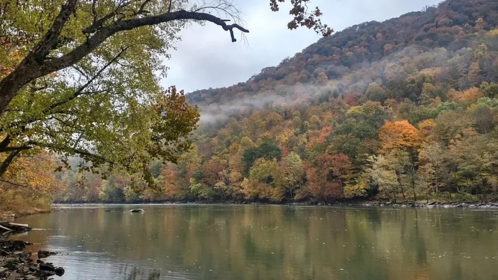
The photo at the top of this page is not French Broad River.
It is a regional stand-in, honestly captioned but generic — we will not put a name to a river we cannot prove. Send us a photograph you took here and it replaces the stand-in, with your credit on it.
Pioneer badgeUnclaimed
Add a photo of this water
Landscape, not fish — the water itself. Reviewed by hand before it appears. The first one published here earns the Pioneer badge.
Fished this water? Add a photo
Reviewed by hand before it appears. Pick the water, not the spot — we never publish exact locations.
Access
Newport river access and the gauge site - the flow reference and a standard put-in.
Riverside and Highway 25 bridge accesses near Newport - road-supported launches.
House Mountain and Seven Islands area - lower-river float access above the Holston junction.
Seven Islands State Birding Park - walk-in bank access and shoal water.
Pigeon River confluence - tributary mouth and a productive current seam.
Douglas Lake headwaters near Dandridge - where the river becomes reservoir.
Kodak and Highway 66 crossing - popular middle-river put-in and takeout.
Seasons
Spring: high and often stained; strong smallmouth pre-spawn fishing when the river drops.
Summer: the main float season, with low clear water and steady topwater smallmouth fishing.
Fall: cooling water, aggressive smallmouth and the start of the serious musky season.
Winter: cold and higher after rain; the prime window for musky and big flathead.
From the water
No logged trips yet. Be the first to put this water on your map.
Log this water
Fished it or cleaned it? Log in or create a free account to log a trip with photos and earn the waterway badge.
Questions
What is the current flow on the French Broad River?
As of Nov 2, 6:45 am, the USGS gauge FRENCH BROAD RIVER NEAR NEWPORT, TN reads 831 cfs. Conditions update every 15 minutes.
What species can you catch on the French Broad River?
Anglers target Black Crappie, Channel Catfish, Flathead Catfish, Largemouth Bass, Muskellunge, Redbreast Sunfish, Rock Bass, Smallmouth Bass, Striped Bass, Walleye on the French Broad River in Tennessee.
Are there fishing guides on the French Broad River?
GuidedFloats lists 1 guide and outfitters on the French Broad River. Claimed profiles accept booking requests; unclaimed profiles are built from public records and link to the business.
Where can you access the French Broad River?
Newport river access and the gauge site - the flow reference and a standard put-in. Riverside and Highway 25 bridge accesses near Newport - road-supported launches. House Mountain and Seven Islands area - lower-river float access above the Holston junction. Seven Islands State Birding Park - walk-in bank access and shoal water. Pigeon River confluence - tributary mouth and a productive current seam. Douglas Lake headwaters near Dandridge - where the river becomes reservoir. Kodak and Highway 66 crossing - popular middle-river put-in and takeout.
When is the best time to fish the French Broad River?
Spring: high and often stained; strong smallmouth pre-spawn fishing when the river drops. Summer: the main float season, with low clear water and steady topwater smallmouth fishing. Fall: cooling water, aggressive smallmouth and the start of the serious musky season. Winter: cold and higher after rain; the prime window for musky and big flathead.
Where are the fishing regulations for the French Broad River?
Regulations change by season and section. Read the current rules on the Tennessee agency site: https://www.tn.gov/twra/fishing-regs.html