Bear Lake Fishing Guides
The Caribbean of the Rockies on the Utah and Idaho line, a turquoise limestone lake holding four fish species found nowhere else, including the cisco anglers net through the ice.
Map of the Bear Lake
17 numbered points: 8 access points, 4 campsites, 2 outfitters, 1 agency office, 1 regulation section limit, 1 USGS gauge. Tap a marker for details. Reviewed Sep 24, 2026.
- Access / boat ramp (8)
- Campsite (4)
- Outfitter / canoe rental (2)
- Agency / conservation office (1)
- Regulation section limit (1)
- USGS gauge (1)
Print it. Bag it. Bring it.Phones die, screens crack, and most of this water has no signal. Print this map, fold it into a zip-top bag or dry bag with your license, and you have a backup your electronics can’t give you. Every marker is numbered so you can say exactly where you are.
Open the printable mapAll 17 points on this map
| # | Point | Type | Lat, Lon | Notes |
|---|---|---|---|---|
| 1 | North Beach (Bear Lake State Park, Idaho) Idaho State Parks · two boat ramps · day use only | Access / boat ramp | 42.11960, -111.29815 | Idaho's north-end unit: over a mile of sand, two ramps, life-jacket loaner station, picnic tables and restrooms. Day use 7am-10pm; a parking day pass is sold separately. Ramp position is the mapped slipway. |
| 2 | North Beach Rentals Boat and PWC rental · 535 Eastshore Rd, St Charles ID | Outfitter / canoe rental | 42.10908, -111.26574 | Bear Lake Fun's Idaho-shore rental base, on site at the north-east corner. Boats, Sea-Doos and non-motorised craft; no bait or tackle advertised. Trading per the operator's own 2026 locations page. |
| 3 | Mountain Fawn Campground (Bear Lake State Park, Idaho) Idaho State Parks · 5687 Eastshore Rd, St Charles | Campsite | 42.03165, -111.25827 | Lakeshore camping on the Idaho east shore: restrooms, picnic tables, fire rings, dump station and group sites; reservation only. The park's own pages still call this stretch East Beach in places. |
| 4 | Mountain Fawn Day Use Area ramp (Idaho) Idaho State Parks · small boat ramp · day use 7am-10pm | Access / boat ramp | 42.02733, -111.25925 | The day-use half of the Mountain Fawn (East Beach) unit: beach access, a small boat ramp, life-jacket loaner station, restrooms and three reservable group shelters. Shares its entrance with the campground. |
| 5 | Sage Springs Beach (Bear Lake State Park, Idaho) Idaho State Parks · 6419 Eastshore Rd · no ramp | Access / boat ramp | 42.01852, -111.25968 | Day-use beach with two large parking areas, north and south, and restrooms at both. Shore access only - Idaho State Parks names no ramp here. Primitive campsites sit just south at 7031 Eastshore Rd. |
| 6 | North Eden Campground (Bear Lake State Park, Utah) Utah State Parks · 9705 N Cisco Rd, Laketown · approx. May-Oct | Campsite | 41.99948, -111.26171 | The northernmost Utah eastside unit, about 13 miles up Cisco Road from SR-30. Utah State Parks says the rebuilt campground will be renamed Border Campground; check the park page before relying on the site count. |
| 7 | Rainbow Cove launch ramp (Bear Lake State Park, Utah) Utah State Parks · 7739 N Cisco Rd · ramp open year round | Access / boat ramp | 41.96852, -111.27226 | Eastside launch ramp with primitive campsites above it. Under a phased rebuild: new access road, expanded trailer parking and a new day-use beach; the ramp itself stays open year round. Ramp position is the mapped slipway. |
| 8 | Cisco Beach (Bear Lake State Park, Utah) Utah State Parks · 7175 N Cisco Rd · low-water ramp | Access / boat ramp | 41.95420, -111.27720 | Rocky beach-front camping with a low-water ramp at the south end of the campground; vault toilets, no hook-ups, first-come in summer. The January Bonneville cisco dip-netting happens off this shore. Coordinate is the park's own. |
| 9 | South Eden Campground (Bear Lake State Park, Utah) Utah State Parks · 5829 N Cisco Rd · approx. May-Oct | Campsite | 41.93167, -111.28323 | Twenty individual sites with power and water plus two group sites, about 8 miles north of the SR-30 junction on Cisco Road. The park's pages name no launch ramp here. |
| 10 | First Point (Bear Lake State Park, Utah) Utah State Parks · 2815 N Cisco Rd · four-lane ramp | Access / boat ramp | 41.87530, -111.29550 | Day-use launching area at the south end of the eastside road, about 4 miles up Cisco Road: four-lane ramp and a small picnic area south of it, no overnight facilities. Open year round. Coordinate is the park's own. |
| 11 | Rendezvous Beach campgrounds (Bear Lake State Park, Utah) Utah State Parks · 1220 N Bear Lake Blvd, Laketown | Campsite | 41.84320, -111.34900 | Four campgrounds behind the south beach - Birch and Big Creek full hook-up, Cottonwood tent-only, Willow group-only - plus the day-use beach. Usually open late April to late October. Coordinate is the park's own for the whole unit. |
| 12 | Rendezvous Beach Rentals Bear Lake Fun concession · inside Rendezvous Beach | Outfitter / canoe rental | 41.84796, -111.35224 | On-site boat, Sea-Doo and non-motorised rental plus fast food and camping cabins, inside the state park at the south end. No street number is published - the operator gives the location as 2 miles west of Laketown. |
| 13 | Rendezvous Beach launch ramp (Bear Lake State Park, Utah) Utah State Parks · 2 miles NW of Laketown on SR-30 | Access / boat ramp | 41.84812, -111.35223 | The south-shore ramp, beside the concession. Utah's 2009 statewide boat-ramp inventory records a Rendezvous Beach ramp 0.8 km east of this mapped slipway; the park's current pages describe the beach but name no ramp, so check status. |
| 14 | Bear Lake State Park office (Utah) Utah State Parks · 940 N Bear Lake Blvd, Garden City | Agency / conservation office | 41.96370, -111.39930 | Park headquarters for all three Utah areas - Marina, Rendezvous Beach and the Eastside - at the marina. Phone 435-946-3343. Coordinate is the park's own. |
| 15 | USGS 10055000 - Bear Lake at State Park Marina USGS lake-level gauge · near Garden City, UT | USGS gauge | 41.96592, -111.39818 | The lake-elevation record the water page reads. Site type LK; identity and position confirmed against the USGS site service, and the coordinate is the roster's own rather than a hand-typed one. |
| 16 | Bear Lake State Park Marina (Utah) Utah State Parks · 940 N Bear Lake Blvd, Garden City · seven-lane ramp | Access / boat ramp | 41.96519, -111.39846 | The lake's main launch: seven lanes, open year round, gates 6am-11pm, with 361 leased slips and 21 nightly rental slips. Concession rentals, fuel and food on site. The marina is under a phased expansion. Ramp position is the mapped slipway. |
| 17 | Swan Creek mouth — Utah tributary-mouth area Utah DWR special-regulation area · Bear Lake tributaries, Rich County | Regulation section limit | 41.98469, -111.40761 | Utah's Bear Lake tributaries entry bounds an area of the lake itself here: 'that area extending from the mouth out into the lake 1,000 feet, or as buoyed'. Seasonal; this site does not restate regulations - read the Utah guidebook. |
Guides on the Bear Lake
Claimed profiles take booking requests. Unclaimed profiles are built from public records so the river is never empty; the guide can claim or remove one any time.
No guides listed yet
Guide or outfit this water? Create your profile. Listing is free, the commission is 10% or 7% with a premium profile, and premium profiles list first on this water.
About the Bear Lake
Bear Lake straddles the Utah and Idaho border, a large natural lake sitting at over five thousand nine hundred feet in a high valley. Suspended limestone particles give it a striking turquoise colour that has earned it the nickname the Caribbean of the Rockies, and it looks nothing like any other water in the region.
The lake is biologically unusual. It was isolated long enough to develop several endemic fish found nowhere else on earth, the best known being the Bonneville cisco, a small silvery fish that spawns in enormous numbers along the rocky eastern shore in January. Anglers wade in with dip nets to take them during a short, tightly regulated season, and it is one of the strangest and most enjoyable fishing events in the West.
For rod and line anglers the main quarry is lake trout, which grow large here, and Bear Lake cutthroat trout, an adapted strain that feeds on the cisco. Both are fished by trolling and jigging, with the cold months the most productive.
The lake is shared between two states with separate regulations and a reciprocal arrangement in places, so it is worth confirming what applies where you intend to fish.
The cutthroat here deserve a note of their own. The Bear Lake strain evolved to hunt cisco in open water rather than to hold in a river, and they behave accordingly, cruising and chasing rather than sitting on structure. Anglers who fish them like stream trout tend to struggle.
The gauge below reports lake elevation. Bear Lake is used for irrigation storage as well as being a natural lake, and its level moves substantially between wet and dry cycles, which changes beach access and how far the marinas reach.
This water needs a real photo
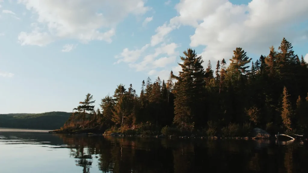
The photo at the top of this page is not Bear Lake.
It is a regional stand-in, honestly captioned but generic — we will not put a name to a river we cannot prove. Send us a photograph you took here and it replaces the stand-in, with your credit on it.
Add a photo of this water
Landscape, not fish — the water itself. Reviewed by hand before it appears. The first one published here earns the Pioneer badge.
Pool right now
- 24 hours+0.05 ft → steady
- For the dateLow for the date
Reading taken 44 min ago at USGS 10055000, BEAR LAKE AT STATE PARK MARINA NR GARDEN CITY, UT. Elevation is the surface of the lake above the survey datum, not depth. Source.
Fished this water? Add a photo
Reviewed by hand before it appears. Pick the water, not the spot — we never publish exact locations.
Access
Bear Lake State Park Marina at Garden City: the main Utah access.
Rendezvous Beach on the south shore: camping and launching.
Cisco Beach on the east shore: the rocky shoreline and the January cisco run.
Idaho state park access at North Beach and East Beach.
Garden City and Laketown have services and rentals.
The lake is shared between two states with separate regulations.
Note: high elevation and open water. Weather changes quickly here.
Seasons
Winter: the cisco run in January and the best lake trout fishing of the year.
Spring: cutthroat and lake trout accessible as the water warms.
Summer: deep lake trout, warm weather and heavy recreational traffic.
Fall: cooling water, feeding trout and the lake quiet again.
From the water
No logged trips yet. Be the first to put this water on your map.
Log this water
Fished it or cleaned it? Log in or create a free account to log a trip with photos and earn the waterway badge.
Questions
What species can you catch on the Bear Lake?
Anglers target Bonneville Cisco, Bonneville Whitefish, Cutthroat Trout, Lake Trout on the Bear Lake in Utah.
Where can you access the Bear Lake?
Bear Lake State Park Marina at Garden City: the main Utah access. Rendezvous Beach on the south shore: camping and launching. Cisco Beach on the east shore: the rocky shoreline and the January cisco run. Idaho state park access at North Beach and East Beach. Garden City and Laketown have services and rentals. The lake is shared between two states with separate regulations. Note: high elevation and open water. Weather changes quickly here.
When is the best time to fish the Bear Lake?
Winter: the cisco run in January and the best lake trout fishing of the year. Spring: cutthroat and lake trout accessible as the water warms. Summer: deep lake trout, warm weather and heavy recreational traffic. Fall: cooling water, feeding trout and the lake quiet again.
Where are the fishing regulations for the Bear Lake?
Regulations change by season and section. Read the current rules on the Utah agency site: https://wildlife.utah.gov/guidebooks.html