Fishes Bois Brule River
River · Lake Superior · Wisconsin
Bois Brule River Fishing Guides
Wisconsin's river of presidents, a spring-fed Lake Superior tributary with resident brook and brown trout up top and migratory steelhead and salmon in the lower canyon.
Map of the Bois Brule River
19 numbered points: 9 access points, 3 campsites, 1 outfitter, 3 bridges, 1 park or conservation area, 1 agency office, 1 USGS gauge. Tap a marker for details. Reviewed Sep 25, 2026.
- Access / boat ramp (9)
- Campsite (3)
- Outfitter / canoe rental (1)
- Bridge crossing (3)
- Park / conservation area (1)
- Agency / conservation office (1)
- USGS gauge (1)
Map data © OpenStreetMap contributors. Points are curated from OpenStreetMap and state agency sources; confirm access and hours before you go.
Print it. Bag it. Bring it.Phones die, screens crack, and most of this water has no signal. Print this map, fold it into a zip-top bag or dry bag with your license, and you have a backup your electronics can’t give you. Every marker is numbered so you can say exactly where you are.
Open the printable mapAll 19 points on this map
| # | Point | Type | Lat, Lon | Notes |
|---|---|---|---|---|
| 1 | Stone Chimney Canoe Launch WI DNR carry-in · Brule River State Forest | Access / boat ramp | 46.41691, -91.71201 | Uppermost public launch on the river, in the bog reach above Stones Bridge. Carry-in only, unimproved. |
| 2 | Stones Bridge Canoe Launch WI DNR carry-in · County Road S | Access / boat ramp | 46.43423, -91.67488 | The traditional top-of-the-river put-in at the County Road S crossing. Gravel carry-in. |
| 3 | Cedar Island Road crossing | Bridge crossing | 46.46327, -91.61352 | Crossing at the Cedar Island reach, the private estate stretch between Stones Bridge and Winneboujou. |
| 4 | Winneboujou Canoe Launch WI DNR carry-in · County Road B | Access / boat ramp | 46.51653, -91.60358 | Gravel carry-in at Winneboujou. Bottom of the classic upper float and top of the Winneboujou-to-Highway-2 run. |
| 5 | Brule River State Forest Headquarters Wisconsin DNR · 0.06 km from the river | Agency / conservation office | 46.53657, -91.59470 | State forest headquarters beside the river at Brule. Listed for contact and information, not as an access. |
| 6 | USGS 04025500 · Bois Brule River at Brule Live stage and discharge | USGS gauge | 46.53778, -91.59528 | Placed on the roster gauge coordinate, which falls on the centreline at Brule, 0.05 km off the line. |
| 7 | Bois Brule Canoe Landing WI DNR carry-in · Brule River State Forest | Access / boat ramp | 46.53896, -91.59425 | Gravel carry-in at Brule, beside the state forest campground. |
| 8 | Bois Brule Campground Wisconsin DNR · Brule River State Forest | Campsite | 46.53955, -91.59161 | State forest campground on the east bank at Brule, immediately above the landing. |
| 9 | Highway 2 Canoe Landing WI DNR carry-in · US Highway 2 | Access / boat ramp | 46.55054, -91.58906 | Unimproved carry-in at the US 2 crossing. Common take-out for the upper river and put-in for the lower. |
| 10 | River Adventures Tagged amenity=boat_rental in OSM | Outfitter / canoe rental | 46.55019, -91.58147 | Canoe and kayak rental at the Highway 2 crossing, 0.44 km off the centreline. |
| 11 | Copper Range Campground Canoe Launch WI DNR carry-in · Brule River State Forest | Access / boat ramp | 46.61032, -91.58364 | Gravel carry-in at Copper Range, top of the lower-river ledge water. |
| 12 | Copper Range Campground Wisconsin DNR · Brule River State Forest | Campsite | 46.61011, -91.58105 | State forest campground at the launch of the same name. |
| 13 | Pine Tree Canoe Landing WI DNR carry-in · Brule River State Forest | Access / boat ramp | 46.61549, -91.58170 | Gravel carry-in just below Copper Range. |
| 14 | County Road FF Road crossing | Bridge crossing | 46.63292, -91.59758 | Lower-river crossing between Pine Tree and the Highway 13 landing. |
| 15 | Brule River State Forest (hike-in) Wisconsin DNR · hike-in site | Campsite | 46.67566, -91.59395 | Walk-in campsite in the state forest on the lower river. |
| 16 | Highway 13 Canoe Landing WI DNR carry-in · State Highway 13 | Access / boat ramp | 46.67796, -91.59536 | Gravel carry-in at the State Highway 13 crossing, last road-side landing above the ledges. |
| 17 | McNeils Landing Road Road crossing | Bridge crossing | 46.70530, -91.60385 | Crossing on the lowest reach; the road name records a former landing here. |
| 18 | Brule River Boreal Forest State Natural Area Wisconsin DNR state natural area | Park / conservation area | 46.71944, -91.60222 | Boreal forest along the lowest river, above the Lake Superior mouth. |
| 19 | Bois Brule River Mouth Access WI DNR gravel ramp · Brule River State Forest | Access / boat ramp | 46.74777, -91.61033 | Ramp at the Lake Superior mouth. Bottom take-out for the whole river; recorded by the DNR under Lake Superior. |
Guides on the Bois Brule River
Claimed profiles take booking requests. Unclaimed profiles are built from public records so the river is never empty; the guide can claim or remove one any time.
About the Bois Brule River
The Bois Brule rises in a bog south of Highway 2 and runs north forty-four miles through the Brule River State Forest to Lake Superior. Five presidents fished it, which is how it got its nickname, and it remains one of the most carefully managed and most beautiful trout rivers in the Midwest.
The river has two halves. Above Highway 2 it is a spring-fed, slow, cedar-lined stream with a stable, cold flow and resident brook trout and browns, fished by canoe and on foot, and it is the reach the fly fishing tradition here was built on. Below Highway 2 the gradient steepens through a series of ledges and rapids in a red clay canyon, and that lower reach is the migratory water, with steelhead running in spring and fall and coho and chinook salmon in the fall.
Wisconsin manages the Brule intensively, with reach-by-reach regulations, seasonal closures and gear restrictions that differ substantially between the upper and lower river. It is one of the rivers where reading the current rules for the specific section really matters.
The Brule gauge reads a spring-fed system, and its most distinctive feature is stability: the flow varies far less than on a typical freestone river because so much of it comes from groundwater. That is why the upper river stays cold in August and clear after rain, and it is also why the fishing here is comparatively reliable. The lower canyon still colors up after heavy rain because of the clay.
The village of Brule and the towns along Highway 2 provide lodging and canoe rental; Superior and Duluth are less than an hour away.
This water needs a real photo
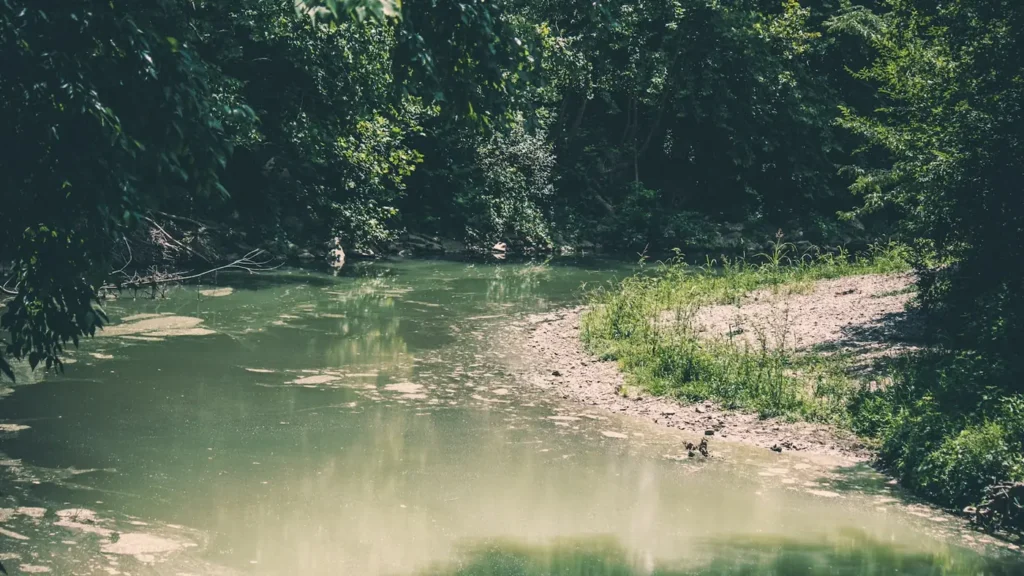
The photo at the top of this page is not Bois Brule River.
It is a regional stand-in, honestly captioned but generic — we will not put a name to a river we cannot prove. Send us a photograph you took here and it replaces the stand-in, with your credit on it.
Pioneer badgeUnclaimed
Add a photo of this water
Landscape, not fish — the water itself. Reviewed by hand before it appears. The first one published here earns the Pioneer badge.
Fished this water? Add a photo
Reviewed by hand before it appears. Pick the water, not the spot — we never publish exact locations.
Access
Stones Bridge: the top of the fly water on the upper river, canoe launch.
Winneboujou: upper river access and the classic canoe stretch.
Brule River State Forest campground and Highway 2: the dividing line between the upper and lower river.
Pine Tree Landing and Highway 13: lower river accesses in the migratory water.
McNeil's Landing and the lower canyon: steelhead and salmon access.
The mouth at Lake Superior: access through the state forest.
Seasons
Late March through May: spring steelhead in the lower river, high water from snowmelt.
May through August: the resident trout season on the upper river, hendricksons through terrestrials.
September through November: fall salmon and steelhead in the lower canyon.
Winter: closed on most reaches; check current Wisconsin rules for the Brule specifically.
From the water
No logged trips yet. Be the first to put this water on your map.
Log this water
Fished it or cleaned it? Log in or create a free account to log a trip with photos and earn the waterway badge.
Questions
What is the current flow on the Bois Brule River?
As of Oct 19, 3:00 am, the USGS gauge BOIS BRULE RIVER AT BRULE, WI reads 112 cfs, the 9th percentile for this date. Conditions update every 15 minutes.
What species can you catch on the Bois Brule River?
Anglers target Brook Trout, Brown Trout, Chinook Salmon, Coho Salmon, Rainbow Trout, Steelhead on the Bois Brule River in Wisconsin.
Are there fishing guides on the Bois Brule River?
GuidedFloats lists 1 guide and outfitters on the Bois Brule River. Claimed profiles accept booking requests; unclaimed profiles are built from public records and link to the business.
Where can you access the Bois Brule River?
Stones Bridge: the top of the fly water on the upper river, canoe launch. Winneboujou: upper river access and the classic canoe stretch. Brule River State Forest campground and Highway 2: the dividing line between the upper and lower river. Pine Tree Landing and Highway 13: lower river accesses in the migratory water. McNeil's Landing and the lower canyon: steelhead and salmon access. The mouth at Lake Superior: access through the state forest.
When is the best time to fish the Bois Brule River?
Late March through May: spring steelhead in the lower river, high water from snowmelt. May through August: the resident trout season on the upper river, hendricksons through terrestrials. September through November: fall salmon and steelhead in the lower canyon. Winter: closed on most reaches; check current Wisconsin rules for the Brule specifically.
Where are the fishing regulations for the Bois Brule River?
Regulations change by season and section. Read the current rules on the Wisconsin agency site: https://dnr.wisconsin.gov/topic/fishing/regulations