Fishes Wind River
River · Wind River Country · Wyoming
Wind River Fishing Guides
The upper Wind above Dubois, a fast freestone dropping out of the Absaroka and Wind River ranges, with wild browns and cutthroat and far fewer boats than the Jackson side of the pass.
Map of the Wind River
38 numbered points: 8 access points, 4 campsites, 3 bait & fly shops, 1 outfitter, 15 bridges, 2 parks and conservation areas, 4 hazards, 1 USGS gauge. Tap a marker for details. Reviewed Sep 16, 2026.
- Access / boat ramp (8)
- Campsite (4)
- Bait, tackle & fly shop (3)
- Outfitter / canoe rental (1)
- Bridge crossing (15)
- Park / conservation area (2)
- Dam / hazard (4)
- USGS gauge (1)
Map data © OpenStreetMap contributors. Points are curated from OpenStreetMap and state agency sources; confirm access and hours before you go.
Print it. Bag it. Bring it.Phones die, screens crack, and most of this water has no signal. Print this map, fold it into a zip-top bag or dry bag with your license, and you have a backup your electronics can’t give you. Every marker is numbered so you can say exactly where you are.
Open the printable mapAll 38 points on this map
| # | Point | Type | Lat, Lon | Notes |
|---|---|---|---|---|
| 1 | Wind River Picnic Site USFS Shoshone NF · Wind River RD | Park / conservation area | 43.74770, -110.05890 | |
| 2 | Moccasin Basin Road Bridge Forest road crossing | Bridge crossing | 43.71773, -110.01316 | |
| 3 | Falls Campground USFS Shoshone NF | Campsite | 43.70482, -109.96988 | Forest Service campground on the upper river below Brooks Lake. |
| 4 | Warm Springs Creek Road Bridge County road crossing | Bridge crossing | 43.64206, -109.91968 | |
| 5 | Wind River Drive Bridge County road crossing | Bridge crossing | 43.60538, -109.80114 | |
| 6 | Wind River — Dunoir WGFD public access area | Access / boat ramp | 43.59033, -109.77478 | The largest of the Dubois-area walk-in accesses, about 15 acres. Point is the centroid of the agency's parcel. |
| 7 | Stoney Point Road Bridge County road crossing | Bridge crossing | 43.57760, -109.74370 | |
| 8 | Old Airport Road Bridge County road crossing above Dubois | Bridge crossing | 43.55202, -109.68246 | |
| 9 | Rhoads Street Bridge Dubois | Bridge crossing | 43.53968, -109.65487 | |
| 10 | Wind River Flyfitter 412 West Ramshorn Street, Dubois | Bait, tackle & fly shop | 43.53404, -109.63734 | |
| 11 | Dubois KOA Private · on the river in town | Campsite | 43.53180, -109.63560 | |
| 12 | 3rd Street Bridge Dubois | Bridge crossing | 43.53126, -109.63438 | |
| 13 | Cutthroat Fly Shop & Adventures 202 East Ramshorn Street, Dubois | Bait, tackle & fly shop | 43.53371, -109.63066 | |
| 14 | Wind River — Sawmill WGFD public access area | Access / boat ramp | 43.52545, -109.61703 | Two small parcels here; the upper one is listed. Point is the centroid of the agency's parcel. |
| 15 | Kingfisher Road Bridge County road crossing below Dubois | Bridge crossing | 43.51694, -109.59459 | |
| 16 | Wind River — Jakey's Fork WGFD public access area | Access / boat ramp | 43.51384, -109.57040 | |
| 17 | Wind River — Painted Hills WGFD public access area · Red Hills Road | Access / boat ramp | 43.49849, -109.53152 | At the Red Hills Road crossing; the parcel centroid and the OSM bridge are 50 m apart. |
| 18 | Wind River — Landen WGFD public access area | Access / boat ramp | 43.48918, -109.51438 | |
| 19 | Wind River — North Parker WGFD public access area | Access / boat ramp | 43.48044, -109.49882 | |
| 20 | Wind River — South Parker WGFD public access area | Access / boat ramp | 43.46937, -109.48782 | The last state access before the river enters the Wind River Indian Reservation. |
| 21 | USGS gauge — Wind River near Dubois Station 06220800 | USGS gauge | 43.44162, -109.45876 | |
| 22 | West Dinwoody Lake Road Bridge Reservation road crossing | Bridge crossing | 43.43432, -109.36093 | |
| 23 | Burris–Lenore Road Bridge Reservation road crossing | Bridge crossing | 43.35337, -109.18872 | |
| 24 | Wind River Diversion Dam Bureau of Reclamation | Dam / hazard | 43.22433, -108.95581 | OSM carries two nodes 180 m apart for this dam; one is listed. |
| 25 | Diversion Dam Park Day-use park at the dam | Park / conservation area | 43.22496, -108.95124 | |
| 26 | Bighorn Road Bridge County road crossing | Bridge crossing | 43.21394, -108.86910 | |
| 27 | Blue Sky Highway Bridge US 26 / Blue Sky Highway | Bridge crossing | 43.14312, -108.70851 | |
| 28 | LeClair Diversion Dam Irrigation diversion | Dam / hazard | 43.10813, -108.66474 | |
| 29 | Riverton Valley Canal Diversion Irrigation diversion | Dam / hazard | 43.02637, -108.50568 | |
| 30 | Country Club Drive Bridge Riverton | Bridge crossing | 43.01927, -108.45293 | |
| 31 | High Country Sporting Goods 2125 East Monroe Avenue, Riverton | Bait, tackle & fly shop | 43.01944, -108.36450 | |
| 32 | Wyoming Heritage Trail Bridge Rail-trail crossing below Riverton | Bridge crossing | 43.09410, -108.30851 | |
| 33 | Boysen Dam Bureau of Reclamation | Dam / hazard | 43.41710, -108.17913 | Below the dam the river turns into the Wind River Canyon. |
| 34 | BNSF Casper Subdivision Bridge Railroad crossing in the canyon | Bridge crossing | 43.42467, -108.17896 | |
| 35 | Upper Wind River Campground Wyoming State Parks · Boysen | Campsite | 43.43144, -108.17875 | |
| 36 | Lower Wind River Campground Wyoming State Parks · Boysen | Campsite | 43.44095, -108.17259 | |
| 37 | Wedding of the Waters WGFD public access area | Access / boat ramp | 43.58801, -108.21410 | The bottom of the Wind: below this point the same river is called the Bighorn, and WGFD files the access under that name. |
| 38 | Wind River Canyon Whitewater & Fly Fishing 731 Shoshoni Street, Thermopolis | Outfitter / canoe rental | 43.63809, -108.21516 | The canyon outfitter, about 6 km below the take-out in Thermopolis. |
Guides on the Wind River
Claimed profiles take booking requests. Unclaimed profiles are built from public records so the river is never empty; the guide can claim or remove one any time.
About the Wind River
Cross Togwotee Pass east from Jackson and the Wind River is the first real trout water you meet. It is a working freestone: fast, cobbled, cold, and lined with willows and cottonwoods, running southeast from the Absarokas past Dubois and on toward Riverton and Boysen Reservoir. The upper river above and around Dubois is the part guides fish, and it is genuinely different from the Snake, smaller, wadeable in most places, and far less crowded.
Above Dubois the Wind holds wild brown trout, rainbows, cutthroat and brook trout in the tributaries. The bigger browns hold in the deep, dark corners and under the log jams, and the river rewards short accurate casts and heavy tippet rather than long drifts. Below Dubois the valley opens, the river slows, and irrigation withdrawal begins to matter; further down, the Wind River Canyon below Boysen Reservoir is a separate tailwater fishery that becomes the Bighorn at Wedding of the Waters.
This gauge sits above Red Creek near Dubois, high in the drainage, so it reads the mountain water rather than the diverted valley water. Modest numbers here mean a clear, wadeable river; a big number in late May or June means runoff, and the Wind blows out hard and stays off-color longer than a tailwater would. Late summer and fall bring the clearest, easiest conditions.
Dubois is a small, friendly ranching and outfitting town with lodging and a couple of shops. Much of the valley floor is private, so many guided days here are wade trips on public easements and forest tributaries rather than long floats. Book accordingly and ask your guide where the access actually is.
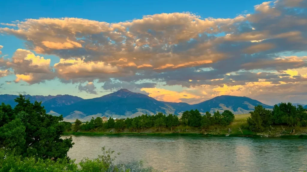
This water needs a real photo
The photo at the top of this page is not Wind River.
It is a regional stand-in, honestly captioned but generic — we will not put a name to a river we cannot prove. Send us a photograph you took here and it replaces the stand-in, with your credit on it.
Pioneer badgeUnclaimed
Add a photo of this water
Landscape, not fish — the water itself. Reviewed by hand before it appears. The first one published here earns the Pioneer badge.
Fished this water? Add a photo
Reviewed by hand before it appears. Pick the water, not the spot — we never publish exact locations.
Access
Upper Wind and tributaries in the Shoshone National Forest: wade access above Dubois.
Dubois town accesses and the Highway 26 corridor: pullouts and public easements along the upper river.
Torrey Creek and Trail Lake Road: tributary and lake access into the Wind River Range.
Wind River Wild and Scenic corridor east of Dubois: public reaches interspersed with private ranch land.
Boysen State Park and the Wind River Canyon: reservoir and tailwater access far downstream.
Portions of the river cross the Wind River Reservation, where a tribal permit is required.
Seasons
April and May: early season on the lower reaches, then runoff.
June: high and off-color on the freestone; tributaries and the canyon tailwater fish better.
July through September: the main season, clear water, terrestrials and attractors, easy wading.
October: brown trout on streamers, cold nights, the valley at its best; winter access is limited by snow.
From the water
No logged trips yet. Be the first to put this water on your map.
Log this water
Fished it or cleaned it? Log in or create a free account to log a trip with photos and earn the waterway badge.
Questions
What is the current flow on the Wind River?
As of Oct 19, 2:45 am, the USGS gauge WIND RIVER ABOVE RED CREEK, NEAR DUBOIS, WY reads 422 cfs, the 76th percentile for this date. Conditions update every 15 minutes.
What species can you catch on the Wind River?
Anglers target Brook Trout, Brown Trout, Cutthroat Trout, Mountain Whitefish, Rainbow Trout on the Wind River in Wyoming.
Are there fishing guides on the Wind River?
GuidedFloats lists 1 guide and outfitters on the Wind River. Claimed profiles accept booking requests; unclaimed profiles are built from public records and link to the business.
Where can you access the Wind River?
Upper Wind and tributaries in the Shoshone National Forest: wade access above Dubois. Dubois town accesses and the Highway 26 corridor: pullouts and public easements along the upper river. Torrey Creek and Trail Lake Road: tributary and lake access into the Wind River Range. Wind River Wild and Scenic corridor east of Dubois: public reaches interspersed with private ranch land. Boysen State Park and the Wind River Canyon: reservoir and tailwater access far downstream. Portions of the river cross the Wind River Reservation, where a tribal permit is required.
When is the best time to fish the Wind River?
April and May: early season on the lower reaches, then runoff. June: high and off-color on the freestone; tributaries and the canyon tailwater fish better. July through September: the main season, clear water, terrestrials and attractors, easy wading. October: brown trout on streamers, cold nights, the valley at its best; winter access is limited by snow.
Where are the fishing regulations for the Wind River?
Regulations change by season and section. Read the current rules on the Wyoming agency site: https://wgfd.wyo.gov/Regulations/Fish/Fishing-Regulation